Earth
ID: 2637
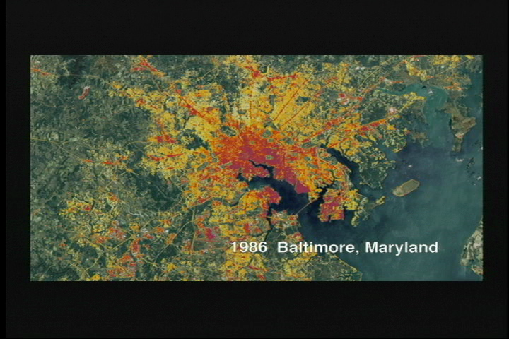
Here we see an image of the Baltimore Maryland area taken with the Landsat satellite. Dates ranging from 1986, 1990, 1996, 2000. For over 26 years, Landsat images have been used to help urban planners understand where growth is taking place and help geographers evaluate how different urban planning programs effect population growth and land use.
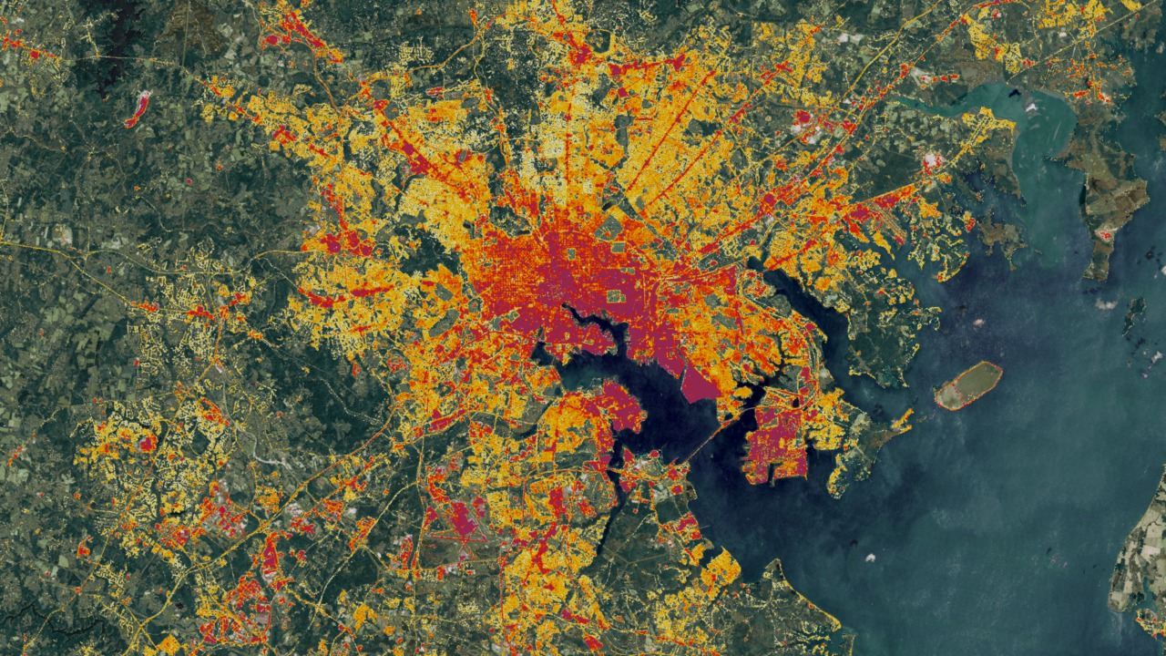
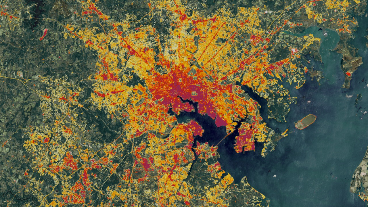
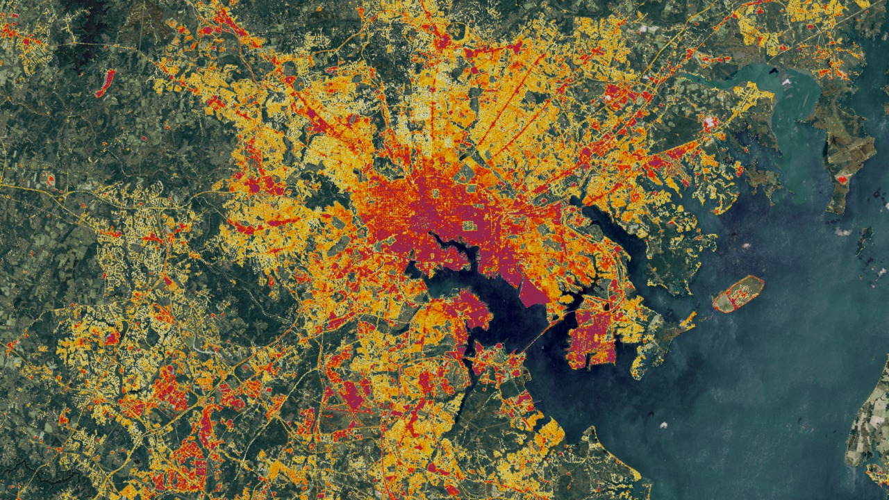
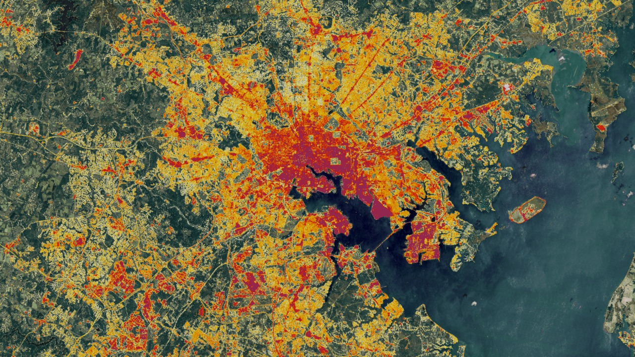
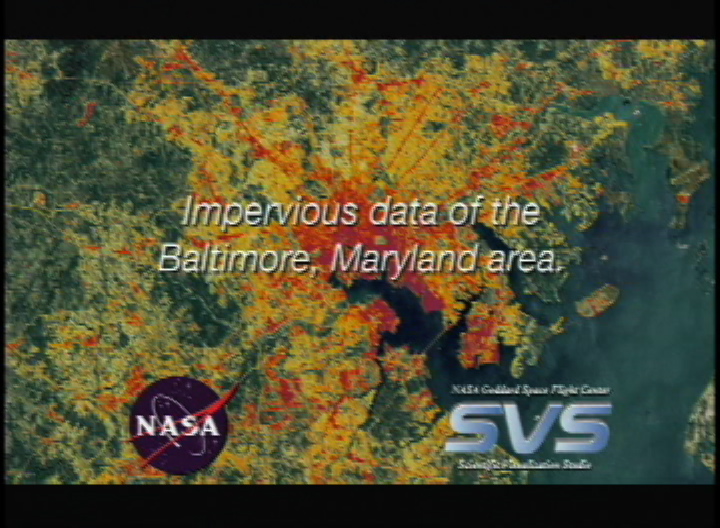
Impervious Data of the Baltimore Area
Visualization Credits
Please give credit for this item to:
NASA/Goddard Space Flight Center Scientific Visualization Studio
NASA/Goddard Space Flight Center Scientific Visualization Studio
Short URL to share this page:
https://svs.gsfc.nasa.gov/2637
Mission:
Landsat
Data Used:
Note: While we identify the data sets used in these visualizations, we do not store any further details nor the data sets themselves on our site.
This item is part of this series:
NASM2002
Goddard TV Tape:
G2008-034HD -- NASAs HD Chesapeake Bay Resource Tape
Keywords:
DLESE >> Human geography
SVS >> Impervious
SVS >> Land use
DLESE >> Physical geography
SVS >> Population growth
GCMD >> Earth Science >> Human Dimensions >> Environmental Impacts >> Urbanization
NASA Science >> Earth
GCMD keywords can be found on the Internet with the following citation: Olsen, L.M., G. Major, K. Shein, J. Scialdone, S. Ritz, T. Stevens, M. Morahan, A. Aleman, R. Vogel, S. Leicester, H. Weir, M. Meaux, S. Grebas, C.Solomon, M. Holland, T. Northcutt, R. A. Restrepo, R. Bilodeau, 2013. NASA/Global Change Master Directory (GCMD) Earth Science Keywords. Version 8.0.0.0.0
https://svs.gsfc.nasa.gov/2637
Mission:
Landsat
Data Used:
Landsat-7/ETM+/Impervious Surface Cover
1986, 1990, 1996, 2000This item is part of this series:
NASM2002
Goddard TV Tape:
G2008-034HD -- NASAs HD Chesapeake Bay Resource Tape
Keywords:
DLESE >> Human geography
SVS >> Impervious
SVS >> Land use
DLESE >> Physical geography
SVS >> Population growth
GCMD >> Earth Science >> Human Dimensions >> Environmental Impacts >> Urbanization
NASA Science >> Earth
GCMD keywords can be found on the Internet with the following citation: Olsen, L.M., G. Major, K. Shein, J. Scialdone, S. Ritz, T. Stevens, M. Morahan, A. Aleman, R. Vogel, S. Leicester, H. Weir, M. Meaux, S. Grebas, C.Solomon, M. Holland, T. Northcutt, R. A. Restrepo, R. Bilodeau, 2013. NASA/Global Change Master Directory (GCMD) Earth Science Keywords. Version 8.0.0.0.0


