Earth
ID: 2570
A Risk Map depicts which geographic regions are at greater or lesser risk for some specific event or condition. This image represents a sample risk map for the West Nile Virus in North America.
This image was created in support of a story describing how NASA is assisting the CDC and EPA in tracking the spread of West Nile Virus.
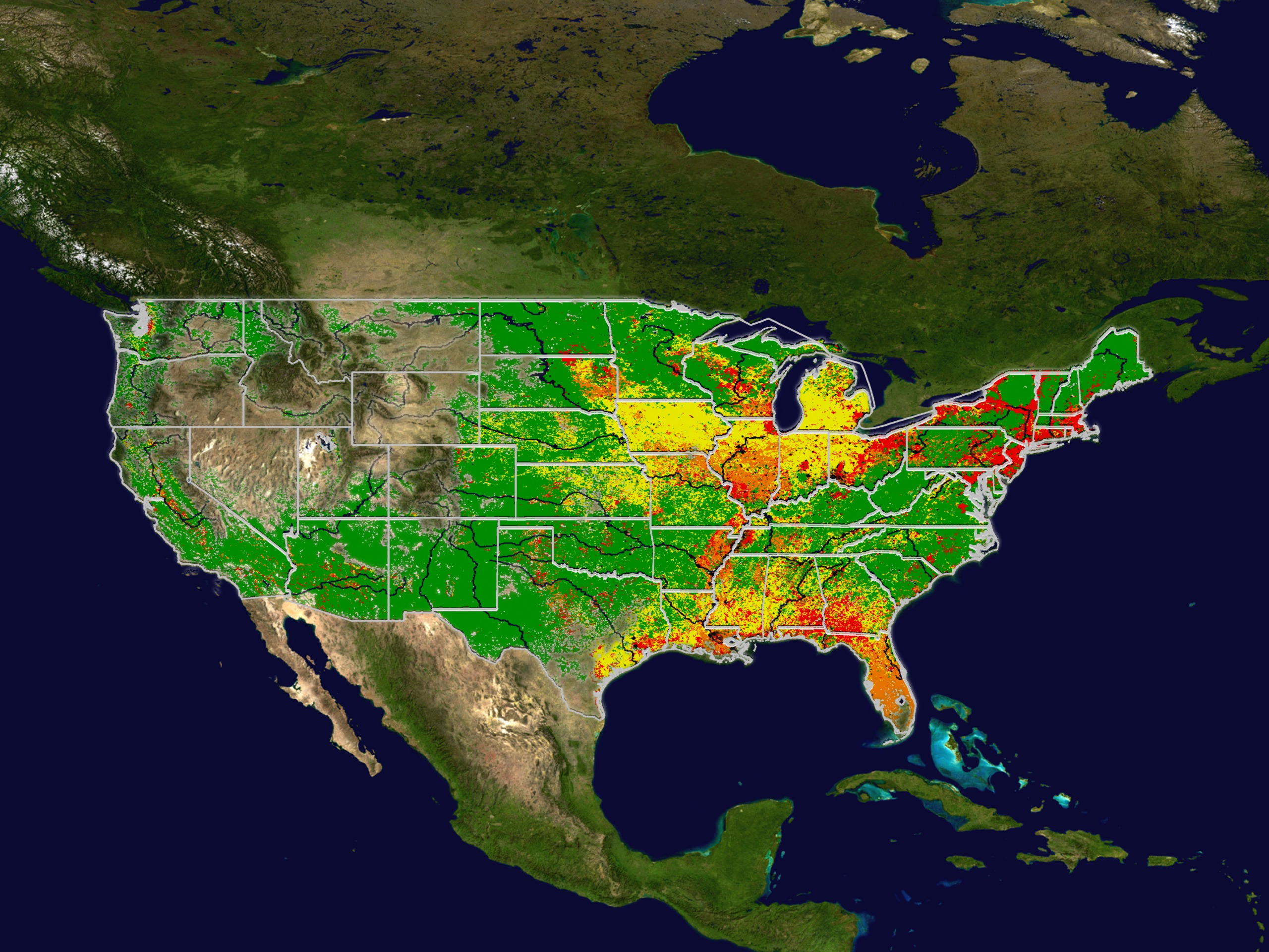
Sample Risk Map: Continental United States
This image was created in support of a story describing how NASA is assisting the CDC and EPA in tracking the spread of West Nile Virus.
Visualization Credits
Please give credit for this item to:
NASA/Goddard Space Flight Center Scientific Visualization Studio
NASA/Goddard Space Flight Center Scientific Visualization Studio
Short URL to share this page:
https://svs.gsfc.nasa.gov/2570
This item is part of this series:
West Nile Virus
Goddard TV Tape:
G2002-077
Keywords:
SVS >> CDC
SVS >> EPA
SVS >> Risk Map
SVS >> West Nile Virus
NASA Science >> Earth
https://svs.gsfc.nasa.gov/2570
This item is part of this series:
West Nile Virus
Goddard TV Tape:
G2002-077
Keywords:
SVS >> CDC
SVS >> EPA
SVS >> Risk Map
SVS >> West Nile Virus
NASA Science >> Earth


