Earth
ID: 2489
New satellite-derived images of vegetation confirm extremely dry conditions exist that are ripe for fires in the western United States, according to a data collaboration between NASA and the USDA Foreign Agricultural Service.
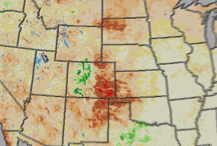
NDVI for the United States as of May, 2002
For More Information
Visualization Credits
Please give credit for this item to:
NASA/Goddard Space Flight Center Scientific Visualization Studio
NASA/Goddard Space Flight Center Scientific Visualization Studio
Short URL to share this page:
https://svs.gsfc.nasa.gov/2489
Data Used:
Note: While we identify the data sets used in these visualizations, we do not store any further details nor the data sets themselves on our site.
Keywords:
DLESE >> Climatology
SVS >> Drought
DLESE >> Hydrology
SVS >> NDVI
DLESE >> Natural hazards
DLESE >> Soil science
NASA Science >> Earth
https://svs.gsfc.nasa.gov/2489
Data Used:
SPOT-4/VGT-S10/NDVI
May, 2002Keywords:
DLESE >> Climatology
SVS >> Drought
DLESE >> Hydrology
SVS >> NDVI
DLESE >> Natural hazards
DLESE >> Soil science
NASA Science >> Earth


