Earth
ID: 2344
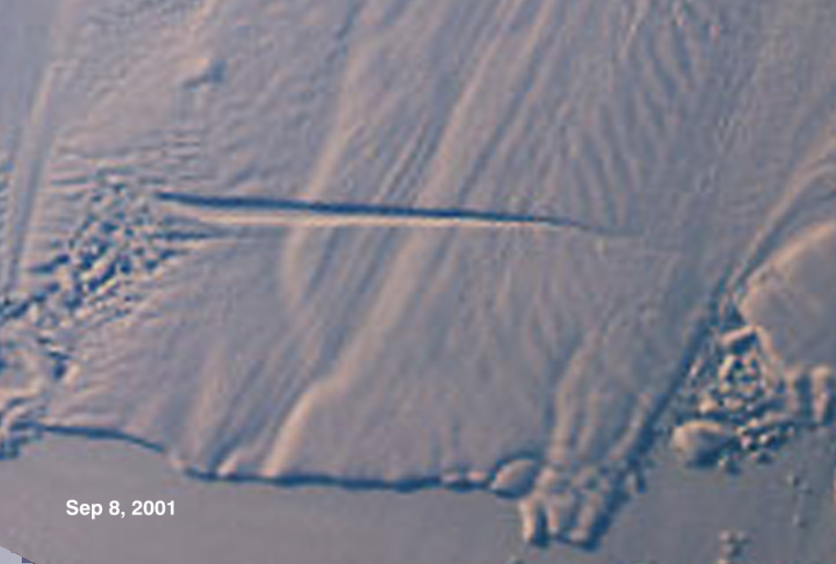
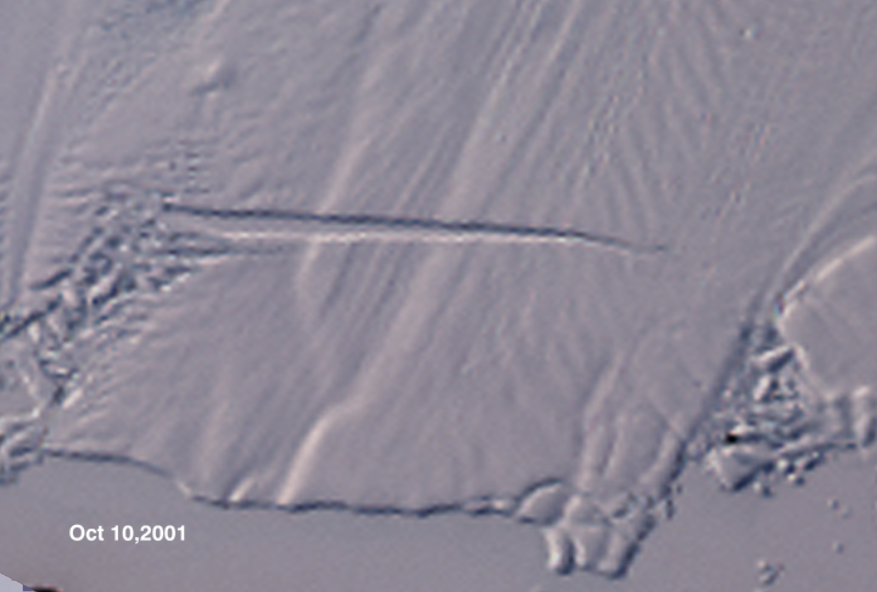
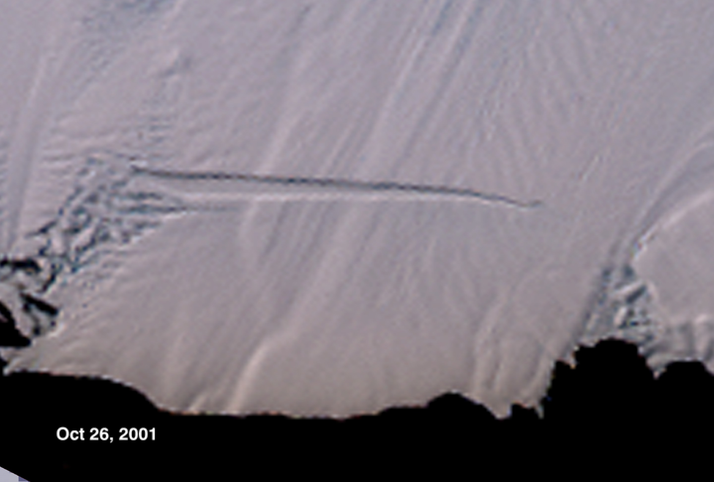
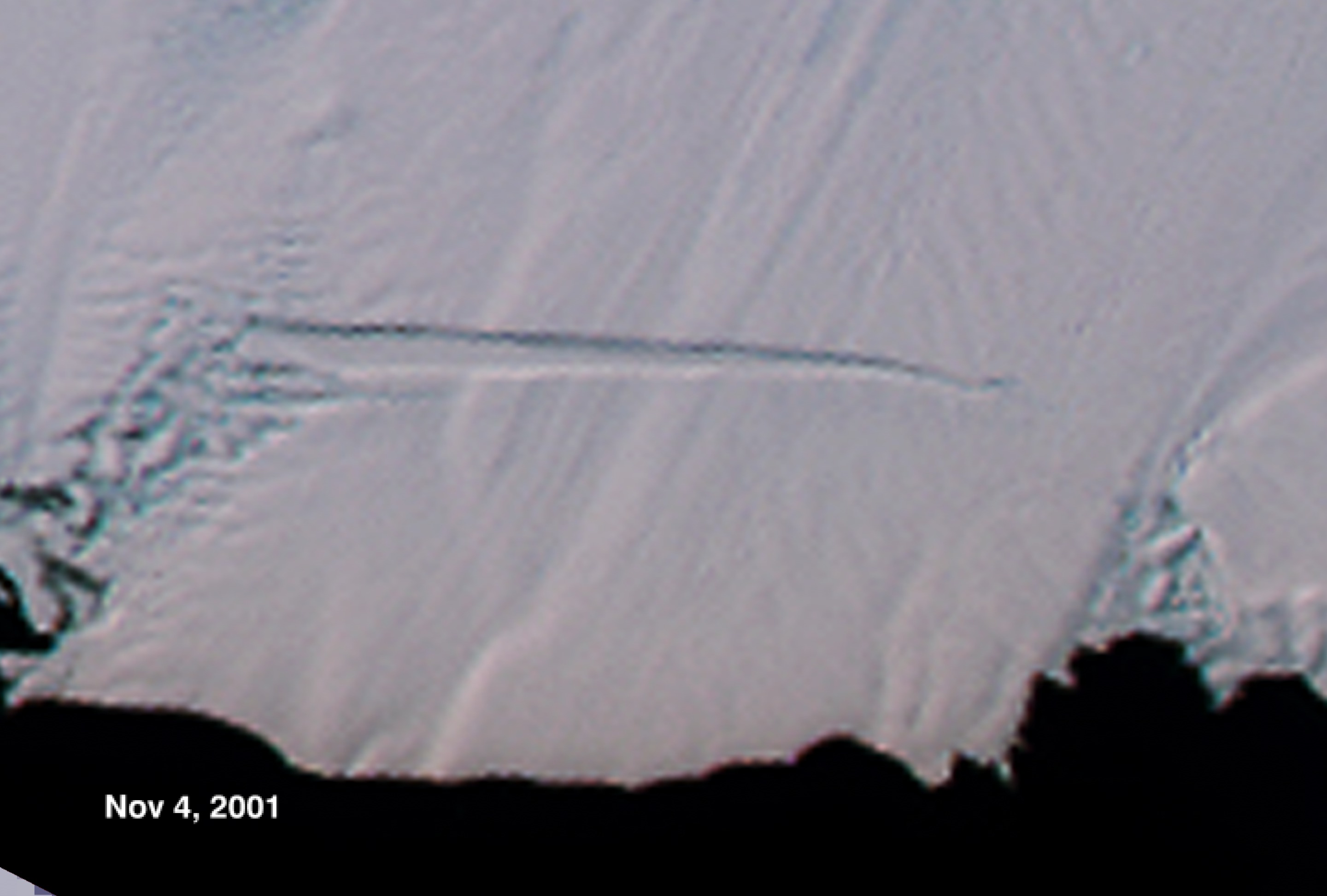
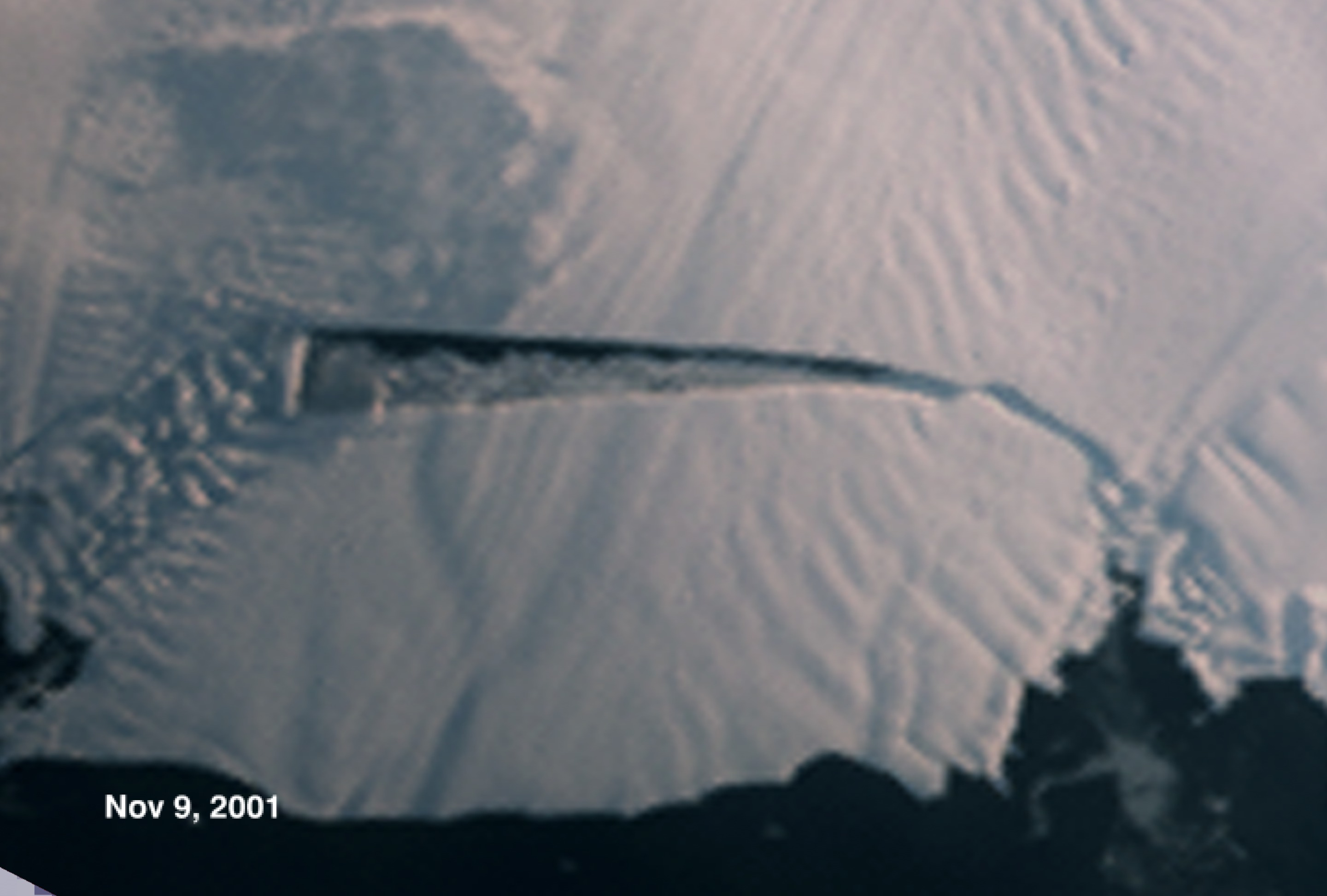
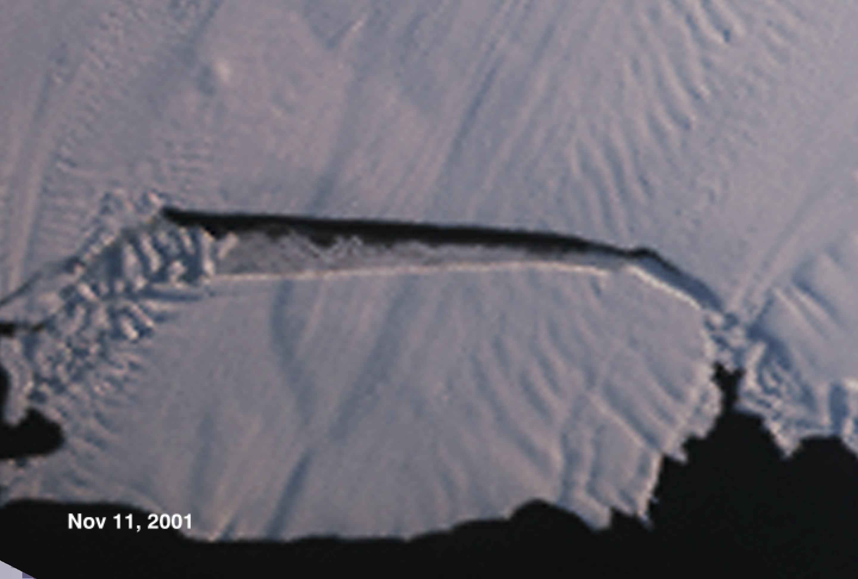
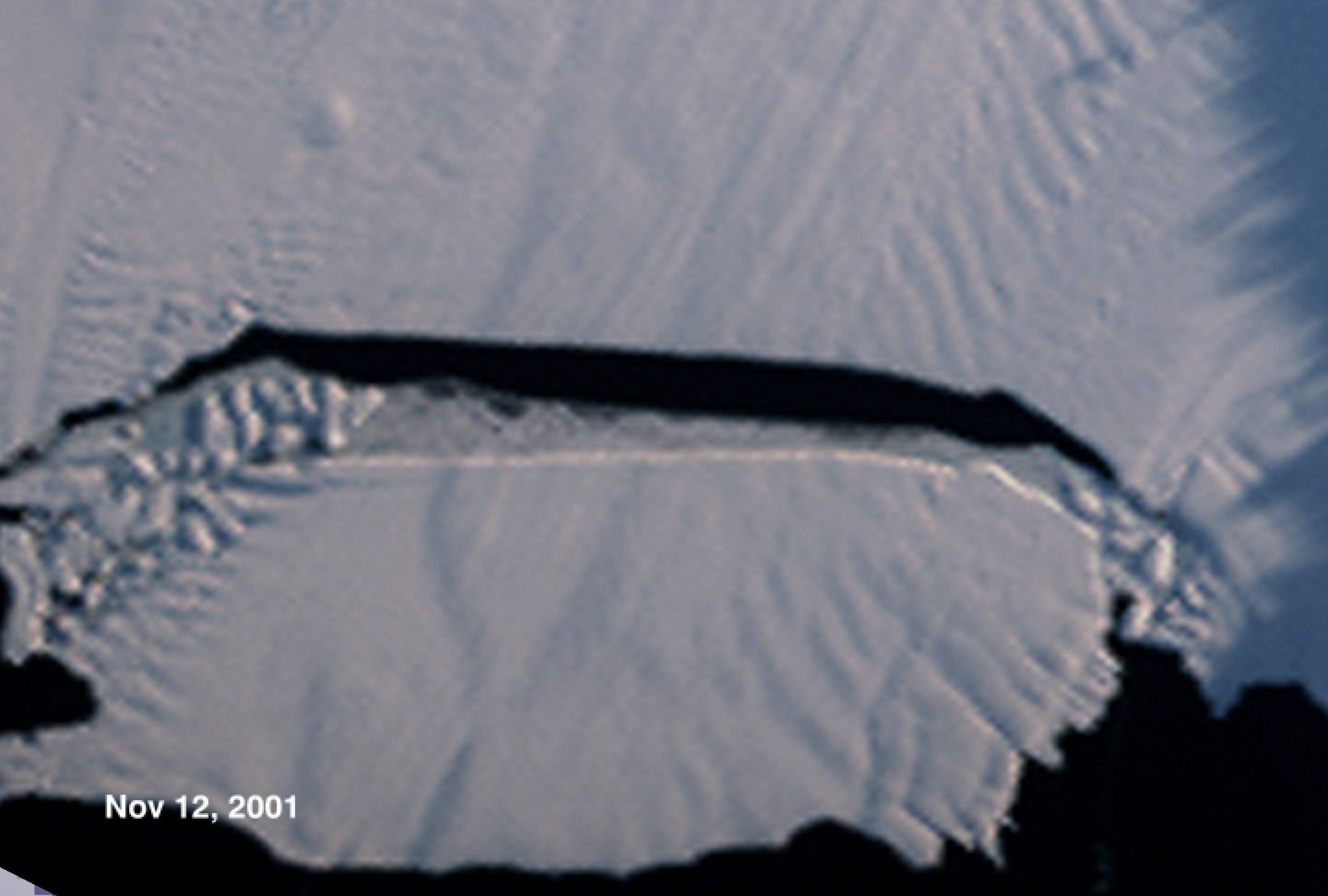
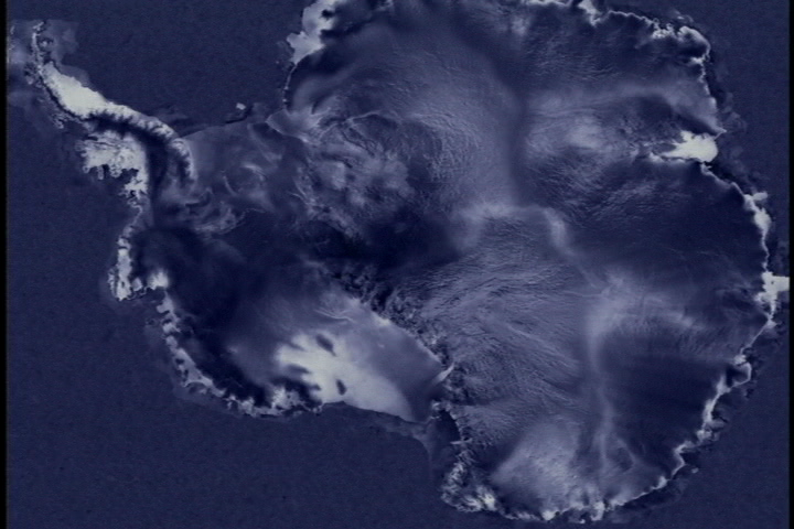
This animation is a sequence showing the formation of the Pine Island iceberg and the glacial seaward flow upstream from the crack. It is a series of MISR images from the Terra satellite on top of the continental Radarsat view of Antarctica. The Pine Island Glacier is the largest discharger of ice in Antarctica and the continent's fastest moving glacier. Even so, when a large crack formed across the glacier in mid 2000, it was surprising how fast the crack expanded, 15 meters per day, and how soon the resulting iceberg broke off, mid-November, 2001. This iceberg, called B-21, is 42 kilometers by 17 kilometers and contains seven years of glacier outflow released to the sea in a single event.
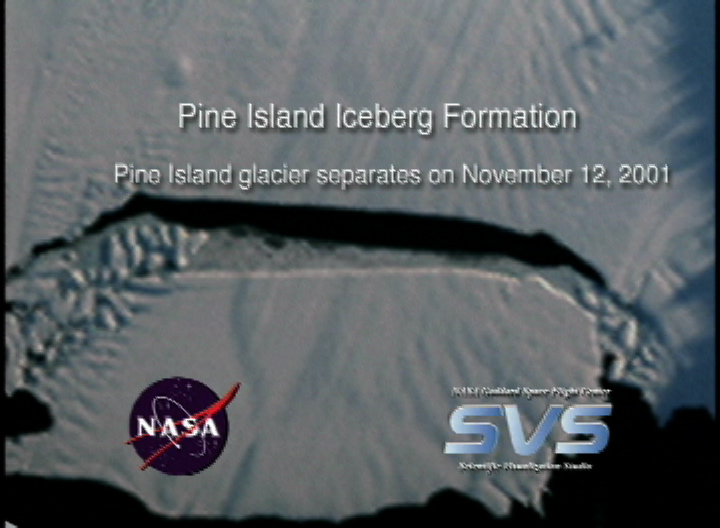
Pine Island Iceberg Formation
Visualization Credits
Lori Perkins (NASA/GSFC): Lead Animator
Bob Bindschadler (NASA/GSFC): Scientist
Dave Diner (NASA/JPL CalTech): Scientist
Bob Bindschadler (NASA/GSFC): Scientist
Dave Diner (NASA/JPL CalTech): Scientist
Please give credit for this item to:
NASA/Goddard Space Flight Center Scientific Visualization Studio
NASA/Goddard Space Flight Center Scientific Visualization Studio
Short URL to share this page:
https://svs.gsfc.nasa.gov/2344
Mission:
Terra
Data Used:
Note: While we identify the data sets used in these visualizations, we do not store any further details nor the data sets themselves on our site.
This item is part of this series:
Antarctica
Keywords:
DLESE >> Cryology
SVS >> Iceberg
SVS >> Sea Ice
NASA Science >> Earth
https://svs.gsfc.nasa.gov/2344
Mission:
Terra
Data Used:
RADARSAT-1/SAR
1997/09/26-1997/11/04
Credit:
Additional credit goes to Canadian Space Agency, RADARSAT International Inc.
Additional credit goes to Canadian Space Agency, RADARSAT International Inc.
Terra/MISR
2001/09/08-2001/11/12This item is part of this series:
Antarctica
Keywords:
DLESE >> Cryology
SVS >> Iceberg
SVS >> Sea Ice
NASA Science >> Earth


