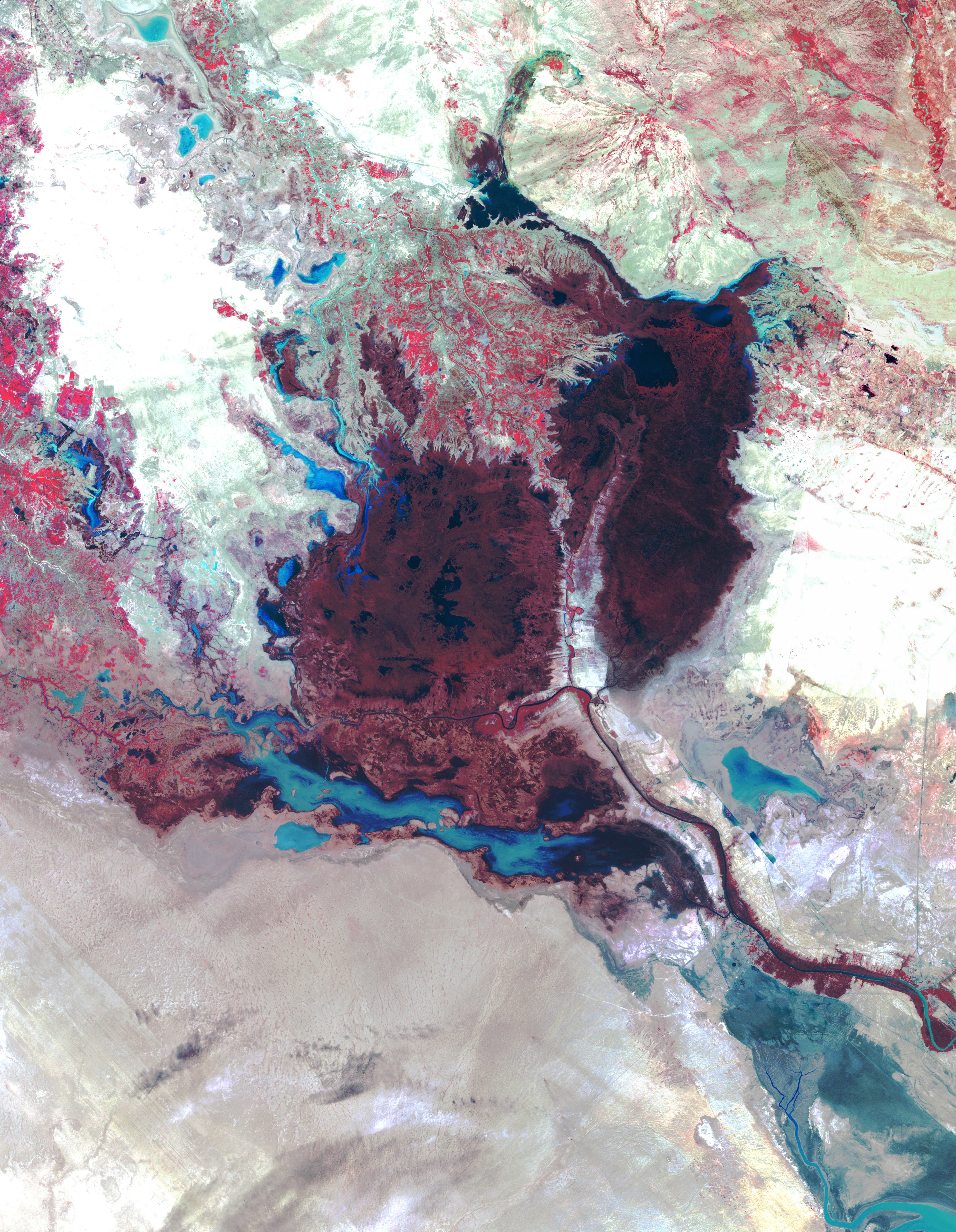
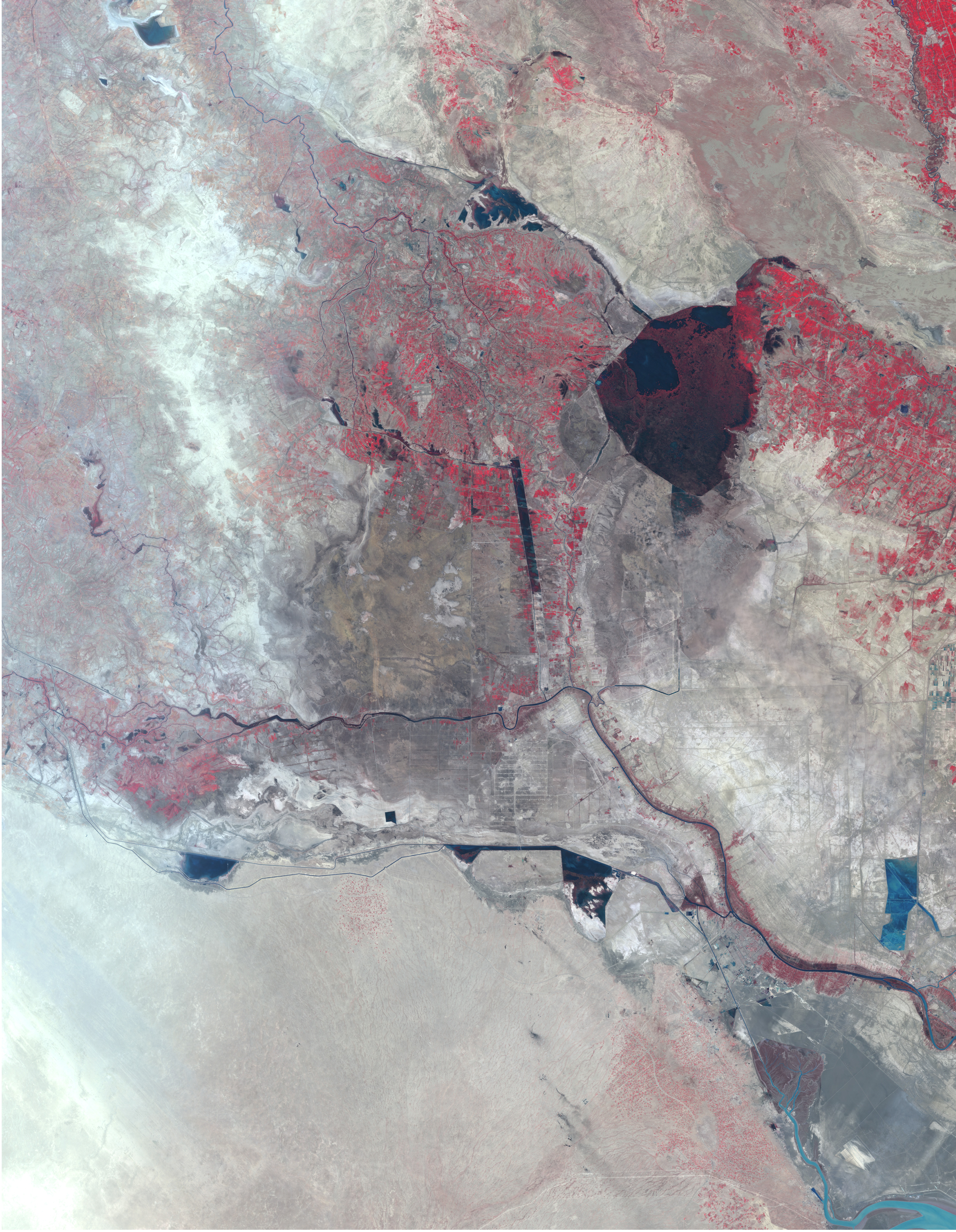
Landsat Witnesses the Destruction of Mesopotamian Ecosystem
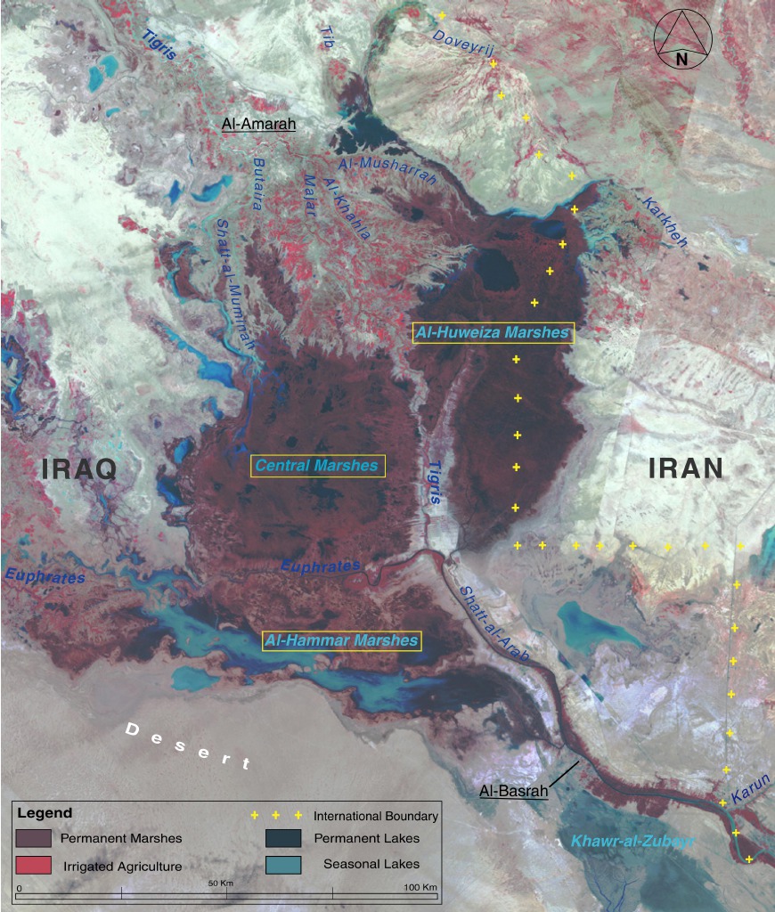
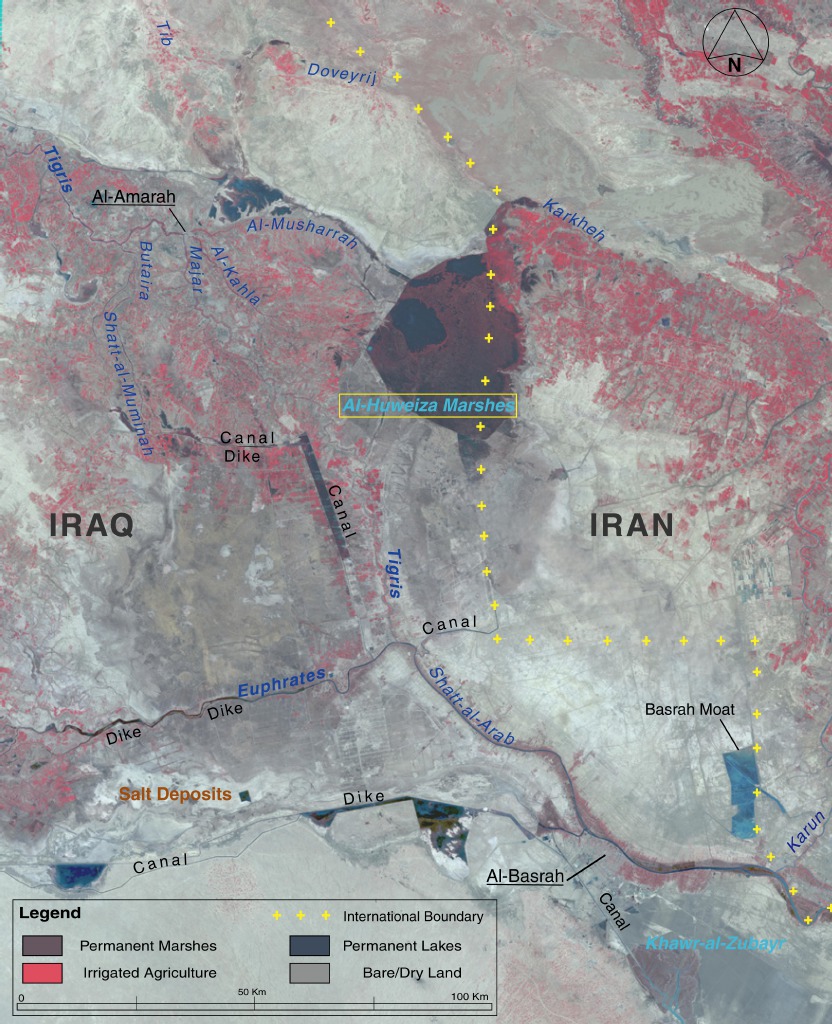
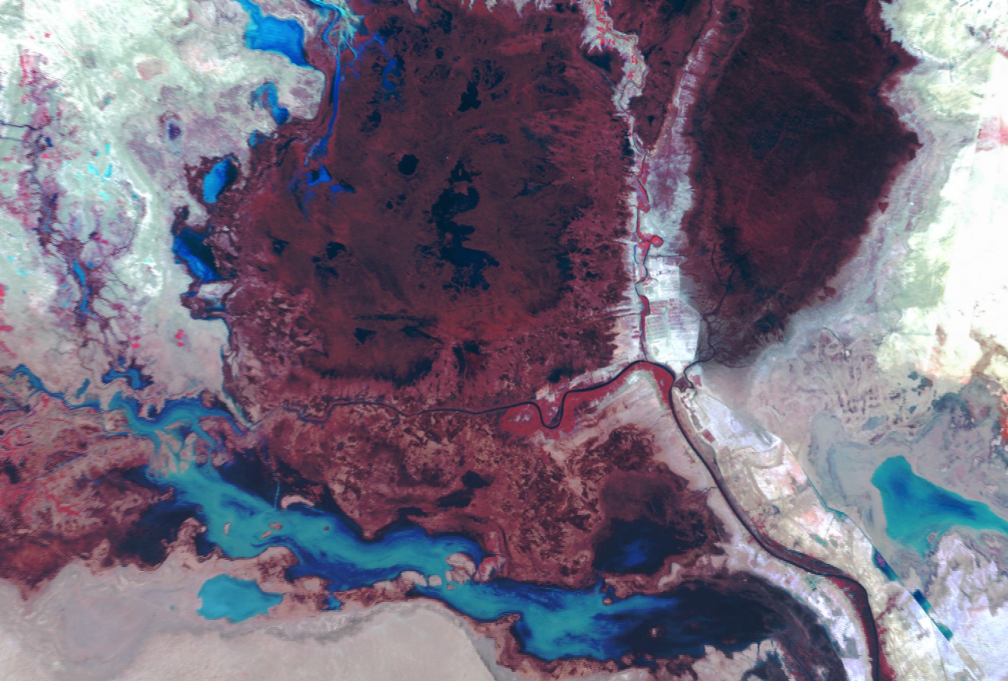
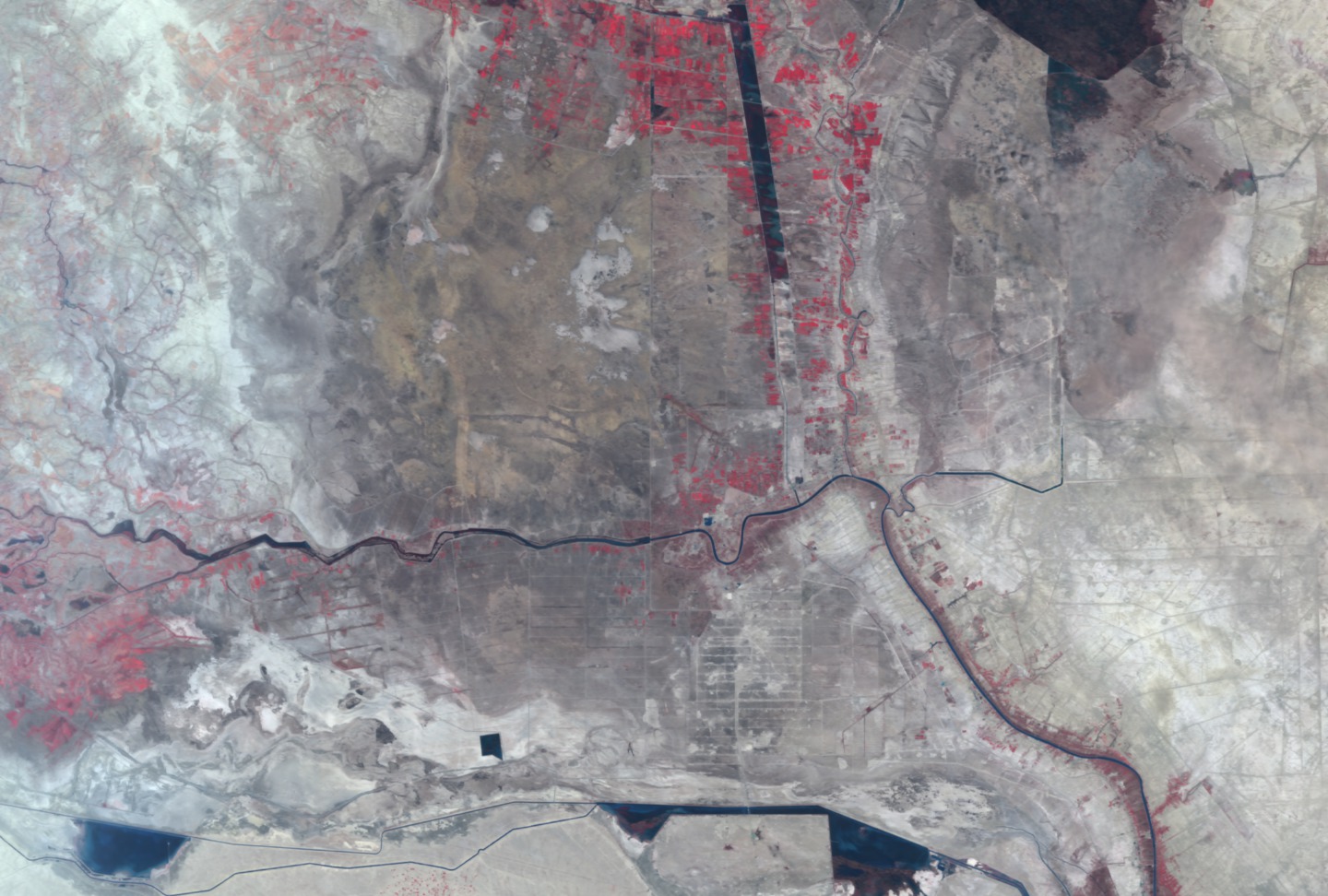
Landsat satellite imagery reveals that in the last 10 years, wetlands that once covered as much as 20,000 square km in parts of Iraq and Iran have been reduced to a small fraction of their original size. The authors of a new report released by the United Nations Environment Programme (UNEP) at the 11th Stockholm Water Symposium on August 13, 2001, warn that the marshlands could completely disappear within the next 3-5 years unless dramatic steps are taken immediately to reverse the damage being done.
The UNEP Executive Director described the wetlands' condition as 'a major environmental catastrophe that will be remembered as one of humanity's worst engineered disasters.' He noted that 'the tragic loss of this rare wetland has occurred in approximately the same period since world leaders pledged to safeguard the environment at the United Nations Conference on Environment and Development (the Earth Summit) held in Rio de Janeiro in 1992.' Regarded by historians as one of the cradles of civilization, the Mesopotamian Fertile Crescent has supported Marsh Arab society for millennia. But through the damming and siphoning off of waters from the Tigris and Euphrates Rivers, the countries of Iran, Iraq, Turkey, and Syria have decimated the ecosystem and, with it, a culture rooted in the dawn of human history (dating back to ancient Sumeria about 5,000 years ago).
For More Information
Related Documentation
Visualization Credits
NASA/Goddard Space Flight Center Scientific Visualization Studio
mesopotamia.pdf
Short URL to share this page:
https://svs.gsfc.nasa.gov/2210
Mission:
Landsat
Data Used:
Landsat-1/MSS
May 1973Landsat-7/ETM+
March 2000, May 2000Political Boundaries(GNV00019)
Database - World Boundary DatabankKeywords:
DLESE >> Ecology
SVS >> Ecosystem
DLESE >> Human geography
DLESE >> Hydrology
SVS >> Marsh
SVS >> Marshland
SVS >> Mesopotamia
GCMD >> Earth Science >> Human Dimensions >> Habitat Conversion/Fragmentation >> Desertification
GCMD >> Location >> Iran
GCMD >> Location >> Iraq
GCMD >> Location >> Syria
GCMD >> Location >> Turkey
NASA Science >> Earth
GCMD keywords can be found on the Internet with the following citation: Olsen, L.M., G. Major, K. Shein, J. Scialdone, S. Ritz, T. Stevens, M. Morahan, A. Aleman, R. Vogel, S. Leicester, H. Weir, M. Meaux, S. Grebas, C.Solomon, M. Holland, T. Northcutt, R. A. Restrepo, R. Bilodeau, 2013. NASA/Global Change Master Directory (GCMD) Earth Science Keywords. Version 8.0.0.0.0


