Earth
ID: 2183
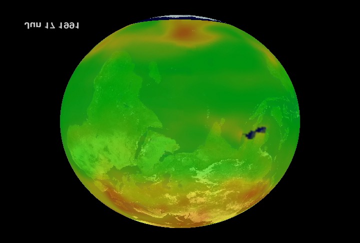
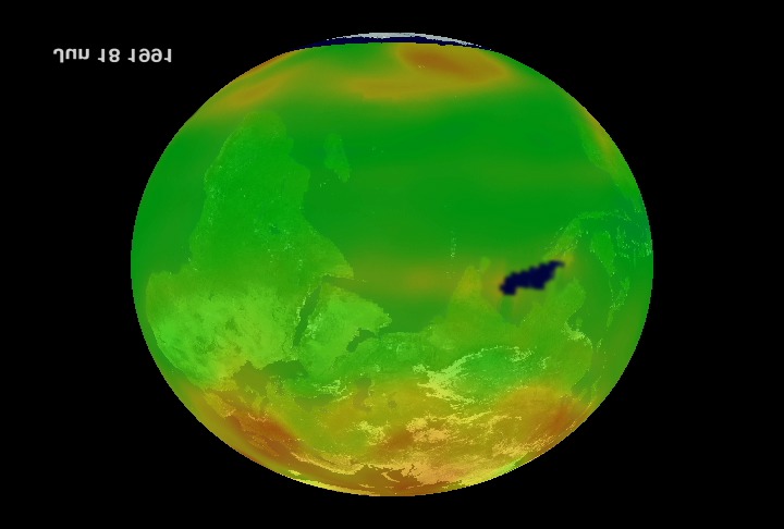
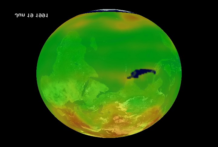
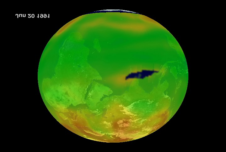
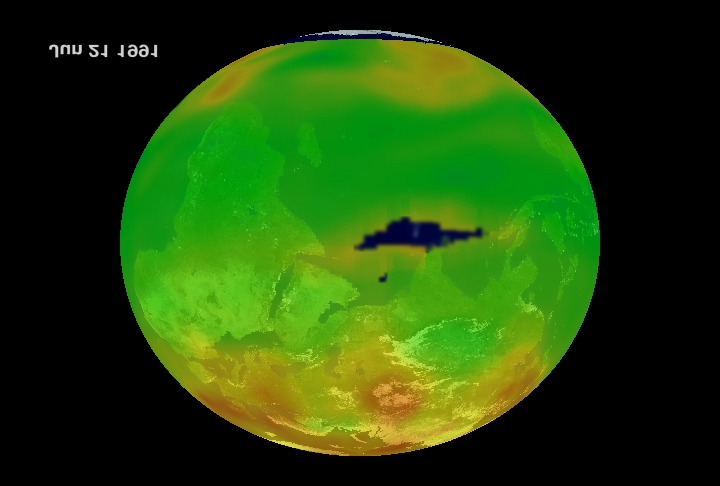
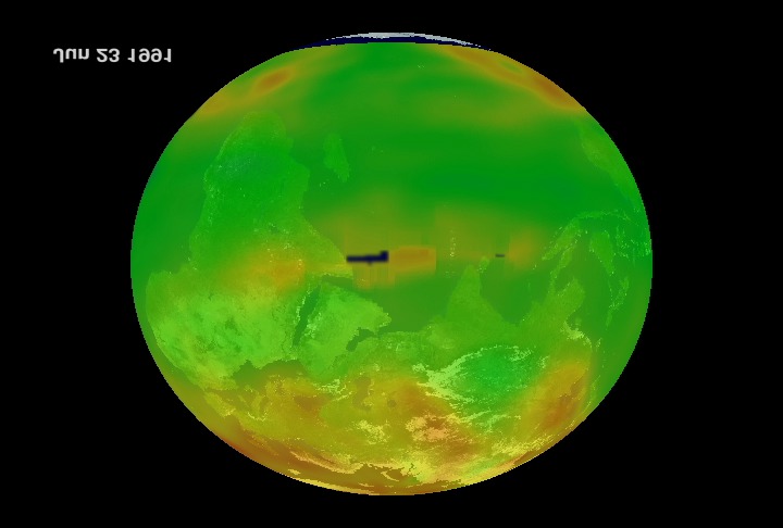
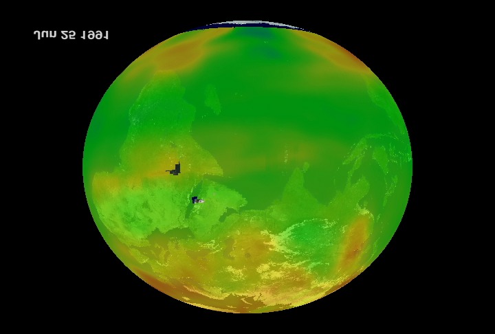
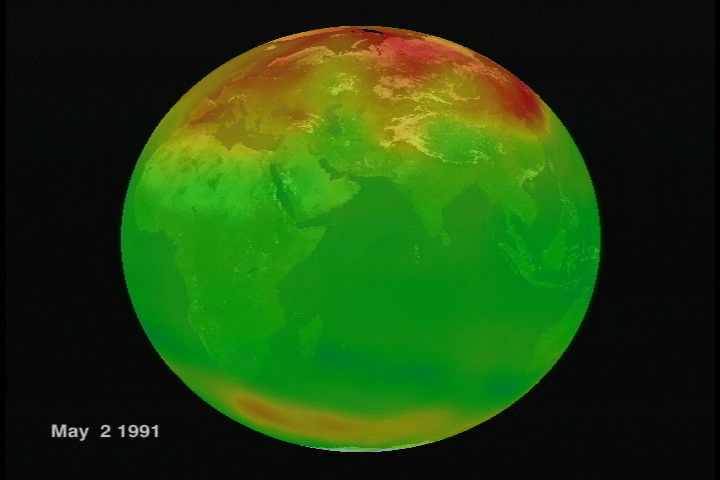
The second-largest volcanic eruption of the 20th century, and by far the largest eruption to affect a densely populated area, occurred at Mount Pinatubo in the Philippines on June 15, 1991. The eruption produced high-speed avalanches of hot ash and gas, giant mudflows, and a cloud of volcanic ash hundreds of miles across. This animation shows the ozone measurements around Mt Pinatubo reacting to the eruption. That "hole" in the days immediately following the eruption of Pinatubo is due to interference by sulfur dioxide with the retrieval algorithm. There are high amounts of volcanic SO2 in the initial plume from the eruption. These measurements make it look like there was an ozone hole when there was not. Ozone really did decrease in the equatorial zone after the volcanic cloud spread throughout the equatorial zone over the next year or so. Plots of global average ozone show a clear minimum in the two years after the eruption. But that "hole" on June 20th for instance is sulfur dioxide, not an ozone hole.


Mt. Pinatubo Eruption on June 15, 1991
Visualization Credits
Lori Perkins (NASA/GSFC): Lead Animator
Richard McPeters (NASA/GSFC): Scientist
Jay Herman (NASA/GSFC): Scientist
Richard McPeters (NASA/GSFC): Scientist
Jay Herman (NASA/GSFC): Scientist
Please give credit for this item to:
NASA/Goddard Space Flight Center Scientific Visualization Studio
NASA/Goddard Space Flight Center Scientific Visualization Studio
Short URL to share this page:
https://svs.gsfc.nasa.gov/2183
Data Used:
Note: While we identify the data sets used in these visualizations, we do not store any further details nor the data sets themselves on our site.
Dates of Data Used:
1991/06/16 - 1991/06/30
This item is part of this series:
Mt. Pinatubo
Keywords:
DLESE >> Atmospheric science
SVS >> Mt. Pinatubo
DLESE >> Natural hazards
SVS >> Volcano
GCMD >> Earth Science >> Atmosphere >> Atmospheric Chemistry/Oxygen Compounds >> Ozone
NASA Science >> Earth
GCMD keywords can be found on the Internet with the following citation: Olsen, L.M., G. Major, K. Shein, J. Scialdone, S. Ritz, T. Stevens, M. Morahan, A. Aleman, R. Vogel, S. Leicester, H. Weir, M. Meaux, S. Grebas, C.Solomon, M. Holland, T. Northcutt, R. A. Restrepo, R. Bilodeau, 2013. NASA/Global Change Master Directory (GCMD) Earth Science Keywords. Version 8.0.0.0.0
https://svs.gsfc.nasa.gov/2183
Data Used:
Nimbus-7/TOMS/Ozone
1991/06/16 - 1991/06/30Dates of Data Used:
1991/06/16 - 1991/06/30
This item is part of this series:
Mt. Pinatubo
Keywords:
DLESE >> Atmospheric science
SVS >> Mt. Pinatubo
DLESE >> Natural hazards
SVS >> Volcano
GCMD >> Earth Science >> Atmosphere >> Atmospheric Chemistry/Oxygen Compounds >> Ozone
NASA Science >> Earth
GCMD keywords can be found on the Internet with the following citation: Olsen, L.M., G. Major, K. Shein, J. Scialdone, S. Ritz, T. Stevens, M. Morahan, A. Aleman, R. Vogel, S. Leicester, H. Weir, M. Meaux, S. Grebas, C.Solomon, M. Holland, T. Northcutt, R. A. Restrepo, R. Bilodeau, 2013. NASA/Global Change Master Directory (GCMD) Earth Science Keywords. Version 8.0.0.0.0


