Earth
ID: 2176
A special algorithm has been applied to the Landsat 7 image to illuminate the changes in low-density residential land use which exemplify sprawl.
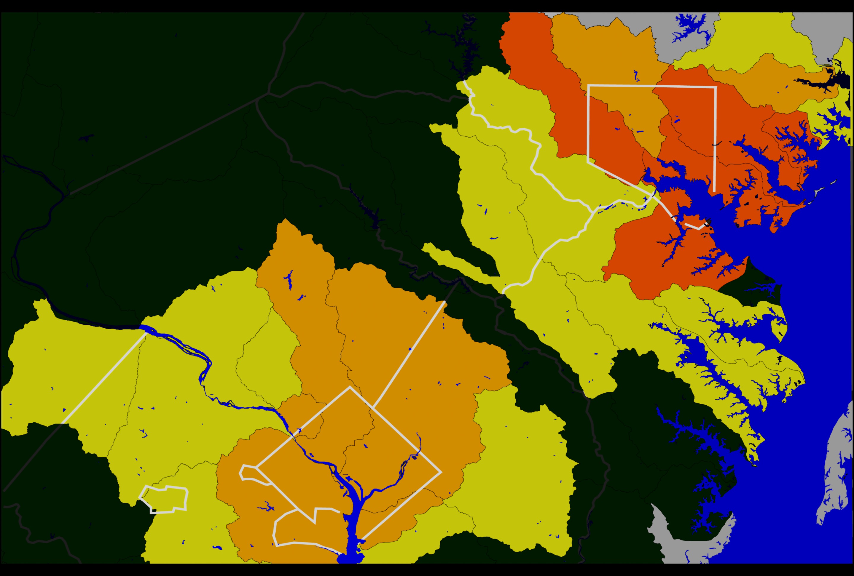
There is a link between impervious surfaces within a watershed, (here we see a subset of the Chesapeake Bay watershed area) and the water quality within the watershed. In general, once 10-15 % of an area is covered by impervious surfaces, increased sediments and chemical pollutants in runoff have a measurable effect on water quality. When 15-25% of a watershed is paved or impervious to drainage, increased runoff leads to reduced oxygen levels and impaired stream life. When more then 25% of surfaces are paved, many types of stream life die from the concentrated runoff and sediments.
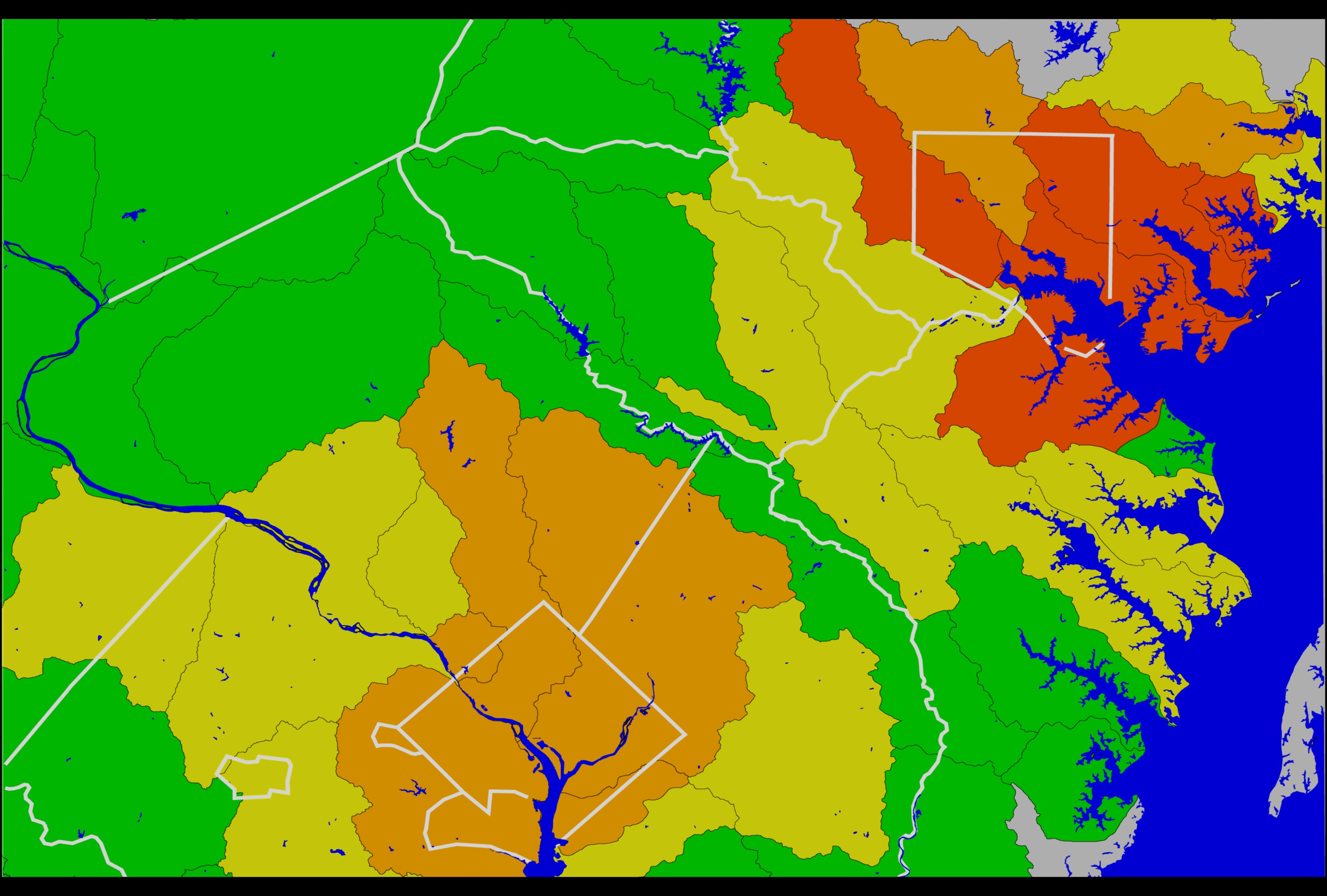
Impervious Surface Cover: Paved Areas in DC and Baltimore
There is a link between impervious surfaces within a watershed, (here we see a subset of the Chesapeake Bay watershed area) and the water quality within the watershed. In general, once 10-15 % of an area is covered by impervious surfaces, increased sediments and chemical pollutants in runoff have a measurable effect on water quality. When 15-25% of a watershed is paved or impervious to drainage, increased runoff leads to reduced oxygen levels and impaired stream life. When more then 25% of surfaces are paved, many types of stream life die from the concentrated runoff and sediments.
For More Information
Visualization Credits
Please give credit for this item to:
NASA/Goddard Space Flight Center Scientific Visualization Studio
NASA/Goddard Space Flight Center Scientific Visualization Studio
Short URL to share this page:
https://svs.gsfc.nasa.gov/2176
Mission:
Landsat
Data Used:
Note: While we identify the data sets used in these visualizations, we do not store any further details nor the data sets themselves on our site.
This item is part of this series:
Urban Surface Cover
Keywords:
SVS >> Baltimore
DLESE >> Ecology
DLESE >> Environmental science
DLESE >> Human geography
SVS >> Washington DC
SVS >> Watershed
NASA Science >> Earth
GCMD >> Earth Science >> Human Dimensions >> Habitat Conversion/fragmentation >> Urbanization/urban Sprawl
GCMD keywords can be found on the Internet with the following citation: Olsen, L.M., G. Major, K. Shein, J. Scialdone, S. Ritz, T. Stevens, M. Morahan, A. Aleman, R. Vogel, S. Leicester, H. Weir, M. Meaux, S. Grebas, C.Solomon, M. Holland, T. Northcutt, R. A. Restrepo, R. Bilodeau, 2013. NASA/Global Change Master Directory (GCMD) Earth Science Keywords. Version 8.0.0.0.0
https://svs.gsfc.nasa.gov/2176
Mission:
Landsat
Data Used:
Landsat-7/ETM+/Impervious Surface Cover
1998/03/27This item is part of this series:
Urban Surface Cover
Keywords:
SVS >> Baltimore
DLESE >> Ecology
DLESE >> Environmental science
DLESE >> Human geography
SVS >> Washington DC
SVS >> Watershed
NASA Science >> Earth
GCMD >> Earth Science >> Human Dimensions >> Habitat Conversion/fragmentation >> Urbanization/urban Sprawl
GCMD keywords can be found on the Internet with the following citation: Olsen, L.M., G. Major, K. Shein, J. Scialdone, S. Ritz, T. Stevens, M. Morahan, A. Aleman, R. Vogel, S. Leicester, H. Weir, M. Meaux, S. Grebas, C.Solomon, M. Holland, T. Northcutt, R. A. Restrepo, R. Bilodeau, 2013. NASA/Global Change Master Directory (GCMD) Earth Science Keywords. Version 8.0.0.0.0


