Earth
ID: 2145
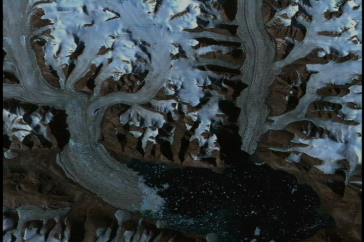
ASTER images are being used in an ambitious international project to map the extent of the world's glaciers and the rate at which they are changing. High-resolution ASTER images make it possible to distinguish and track small features on glacier surfaces. Images presented by Rick Wessels from Arizona State University showing details of snow and ice of glaciers are contributing to the Global Land Ice Measurements from Space (GLIMS) project, a global consortium led by the U.S. Geological Survey.
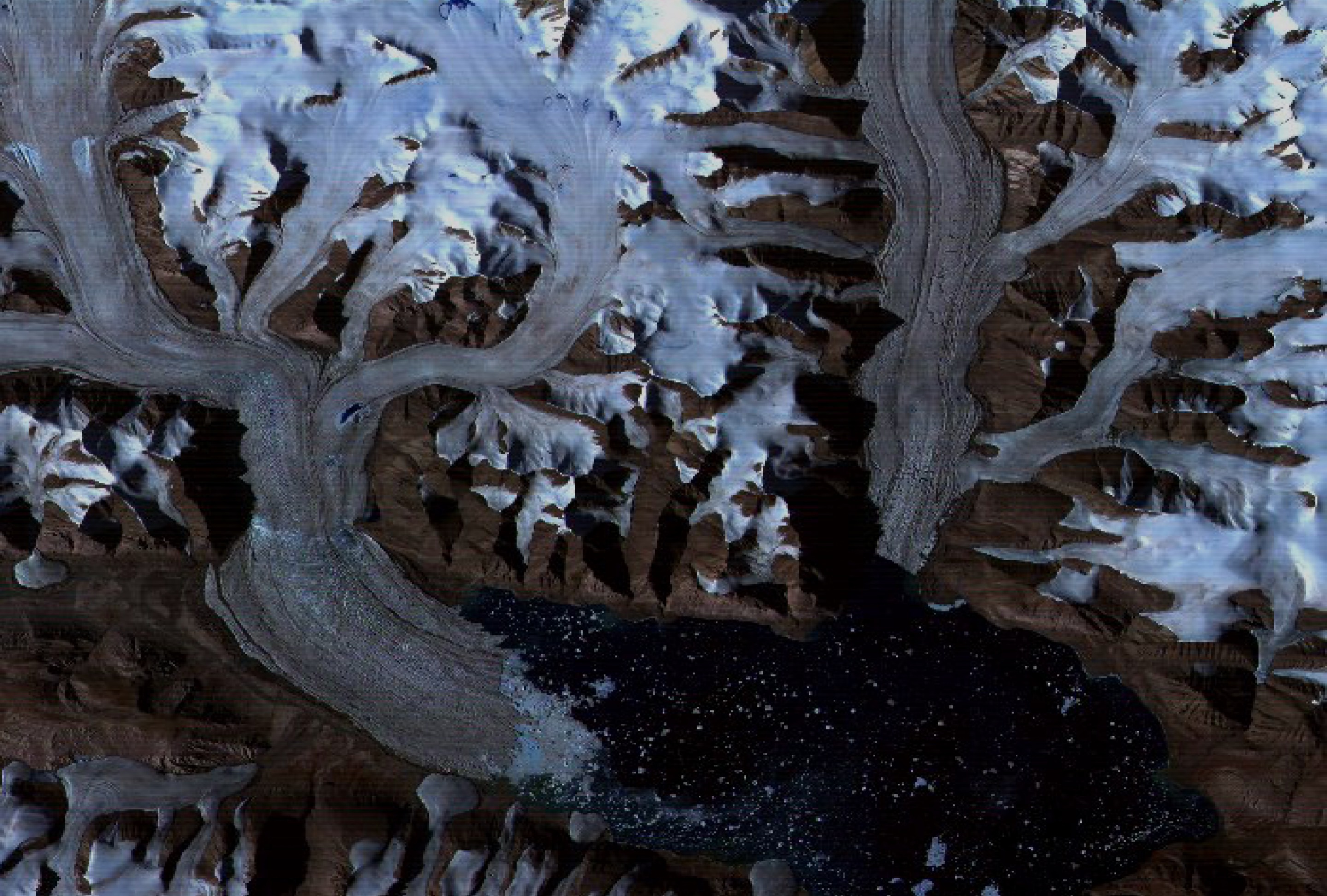
AGU Press Briefing May 29th: Global Land Ice Measurements from Space (Dobbin Glacier Zoom)
Visualization Credits
Please give credit for this item to:
NASA/Goddard Space Flight Center Scientific Visualization Studio
NASA/Goddard Space Flight Center Scientific Visualization Studio
Short URL to share this page:
https://svs.gsfc.nasa.gov/2145
Mission:
Terra
Data Used:
Note: While we identify the data sets used in these visualizations, we do not store any further details nor the data sets themselves on our site.
This item is part of this series:
GLIMS
Keywords:
DLESE >> Cryology
SVS >> Dobbin Glacier
DLESE >> Hydrology
GCMD >> Location >> Alaska
NASA Science >> Earth
GCMD keywords can be found on the Internet with the following citation: Olsen, L.M., G. Major, K. Shein, J. Scialdone, S. Ritz, T. Stevens, M. Morahan, A. Aleman, R. Vogel, S. Leicester, H. Weir, M. Meaux, S. Grebas, C.Solomon, M. Holland, T. Northcutt, R. A. Restrepo, R. Bilodeau, 2013. NASA/Global Change Master Directory (GCMD) Earth Science Keywords. Version 8.0.0.0.0
https://svs.gsfc.nasa.gov/2145
Mission:
Terra
Data Used:
This item is part of this series:
GLIMS
Keywords:
DLESE >> Cryology
SVS >> Dobbin Glacier
DLESE >> Hydrology
GCMD >> Location >> Alaska
NASA Science >> Earth
GCMD keywords can be found on the Internet with the following citation: Olsen, L.M., G. Major, K. Shein, J. Scialdone, S. Ritz, T. Stevens, M. Morahan, A. Aleman, R. Vogel, S. Leicester, H. Weir, M. Meaux, S. Grebas, C.Solomon, M. Holland, T. Northcutt, R. A. Restrepo, R. Bilodeau, 2013. NASA/Global Change Master Directory (GCMD) Earth Science Keywords. Version 8.0.0.0.0


