Earth
ID: 2096
The Landsat Project was started to study the land and land processes. The program is now working on Landsat 7.
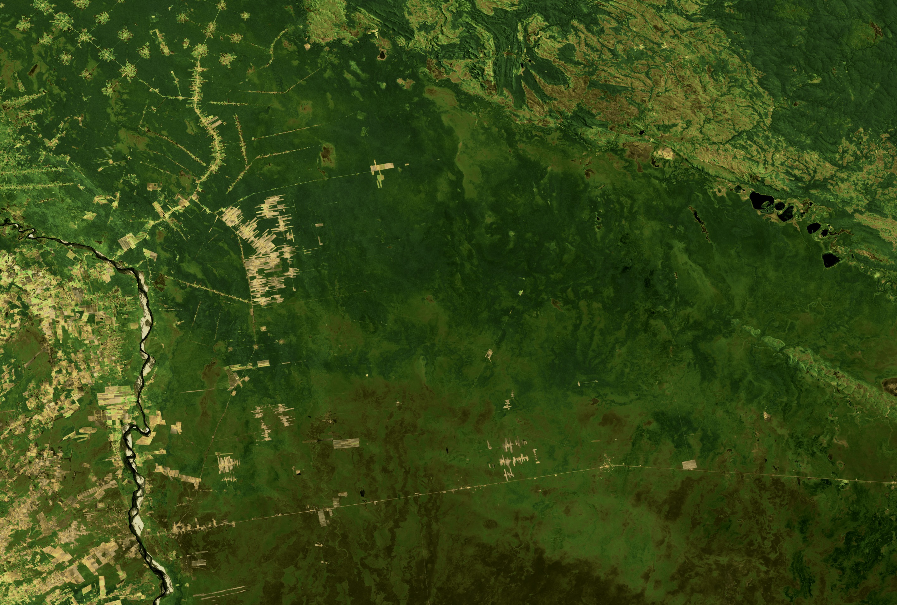
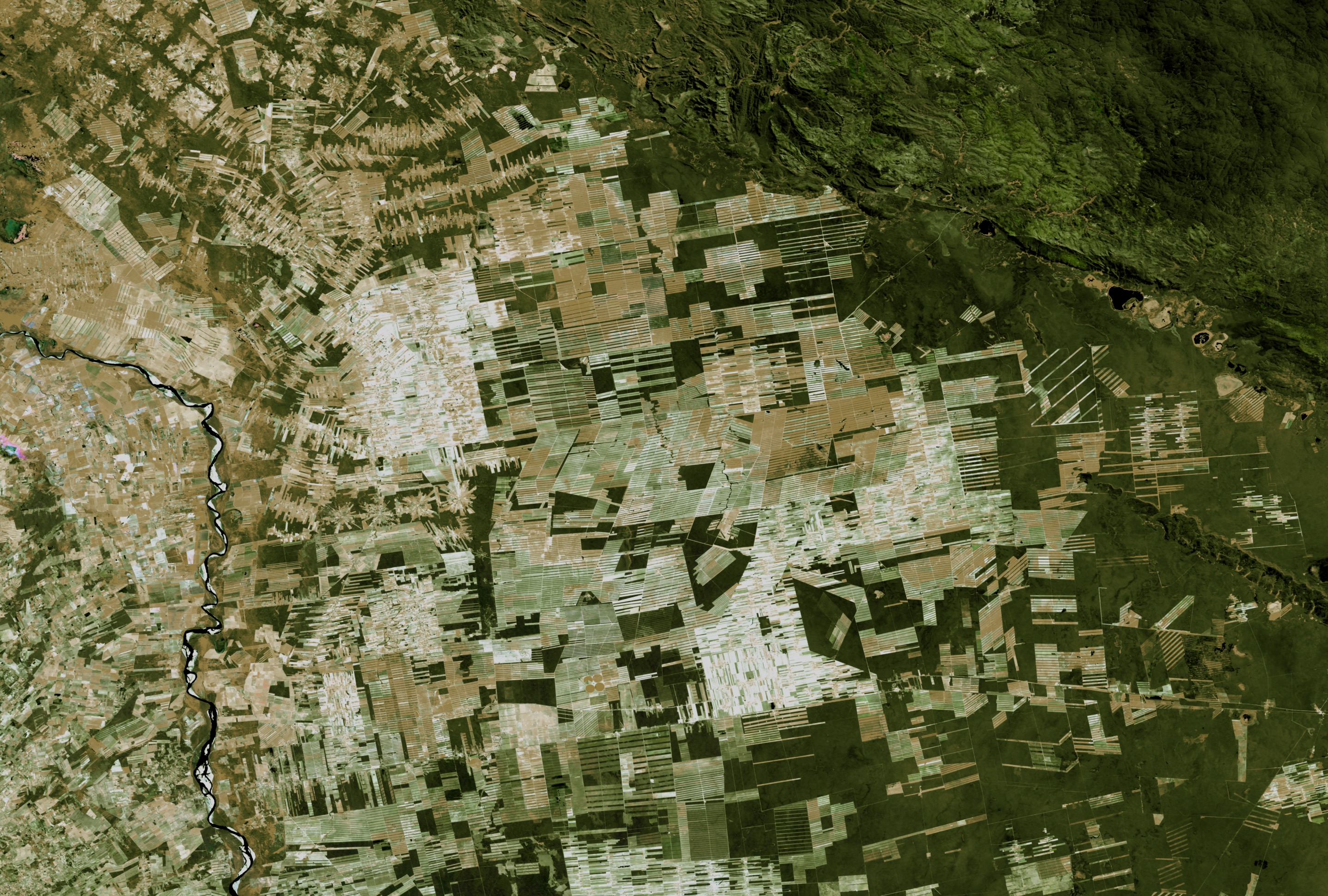
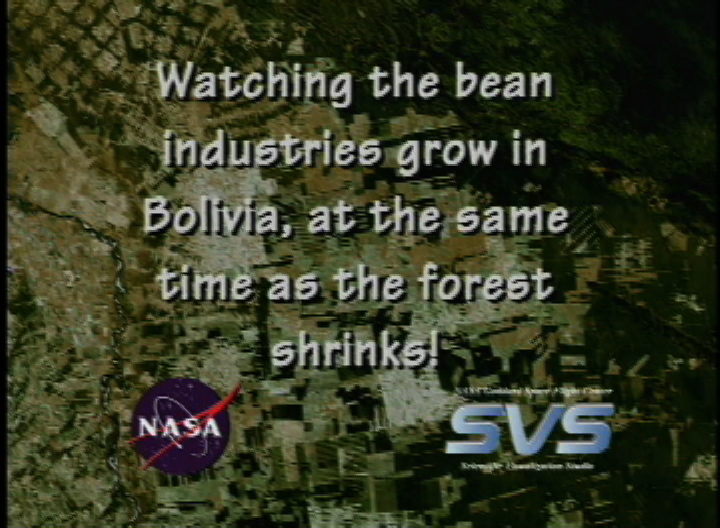
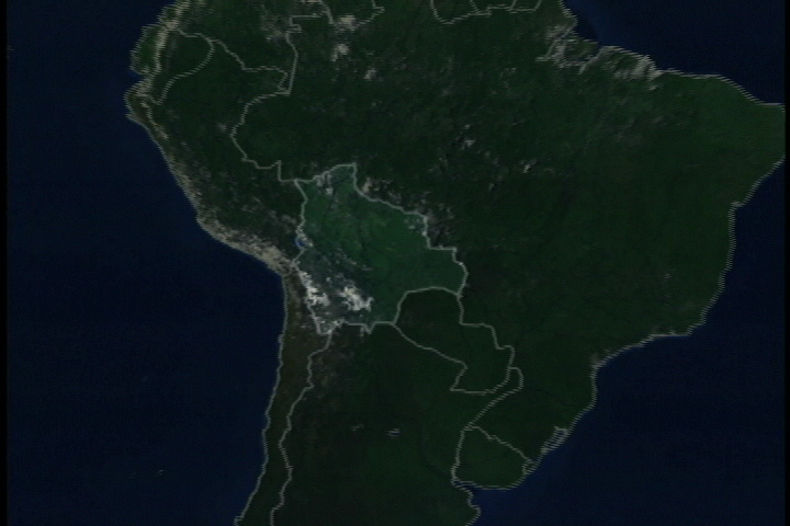
Bolivian Deforestation from 1984 to 2000
We are able to compare older data sets to newer ones. Using a Landsat images of Bolivia taken in 1984 and 2000, we can see the dramatic deforestation of the Bolivian rainforest.
Visualization Credits
Please give credit for this item to:
NASA/Goddard Space Flight Center Scientific Visualization Studio
NASA/Goddard Space Flight Center Scientific Visualization Studio
Science Paper:
Darrel Williams (NASA/GSFC)
Short URL to share this page:
https://svs.gsfc.nasa.gov/2096
Mission:
Landsat
Data Used:
Note: While we identify the data sets used in these visualizations, we do not store any further details nor the data sets themselves on our site.
This item is part of this series:
Bolivian Deforestation
Keywords:
DLESE >> Forestry
DLESE >> Human geography
GCMD >> Earth Science >> Human Dimensions >> Habitat Conversion/Fragmentation >> Deforestation
GCMD >> Location >> Bolivia
NASA Science >> Earth
GCMD keywords can be found on the Internet with the following citation: Olsen, L.M., G. Major, K. Shein, J. Scialdone, S. Ritz, T. Stevens, M. Morahan, A. Aleman, R. Vogel, S. Leicester, H. Weir, M. Meaux, S. Grebas, C.Solomon, M. Holland, T. Northcutt, R. A. Restrepo, R. Bilodeau, 2013. NASA/Global Change Master Directory (GCMD) Earth Science Keywords. Version 8.0.0.0.0
Darrel Williams (NASA/GSFC)
Short URL to share this page:
https://svs.gsfc.nasa.gov/2096
Mission:
Landsat
Data Used:
Landsat-5/TM
1984This item is part of this series:
Bolivian Deforestation
Keywords:
DLESE >> Forestry
DLESE >> Human geography
GCMD >> Earth Science >> Human Dimensions >> Habitat Conversion/Fragmentation >> Deforestation
GCMD >> Location >> Bolivia
NASA Science >> Earth
GCMD keywords can be found on the Internet with the following citation: Olsen, L.M., G. Major, K. Shein, J. Scialdone, S. Ritz, T. Stevens, M. Morahan, A. Aleman, R. Vogel, S. Leicester, H. Weir, M. Meaux, S. Grebas, C.Solomon, M. Holland, T. Northcutt, R. A. Restrepo, R. Bilodeau, 2013. NASA/Global Change Master Directory (GCMD) Earth Science Keywords. Version 8.0.0.0.0


