Earth
ID: 2094
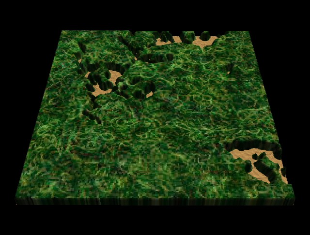
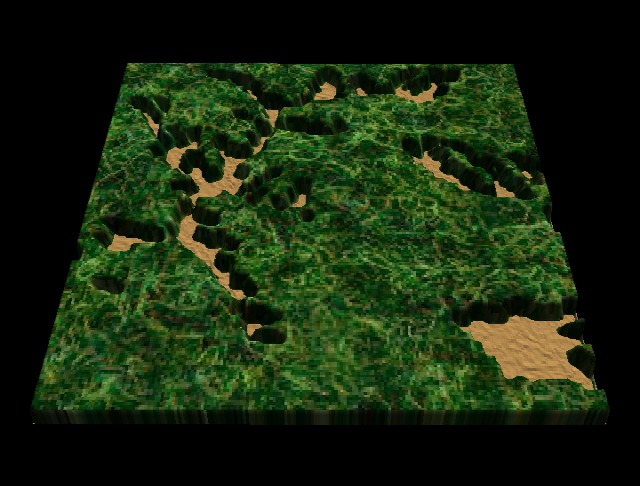
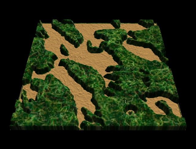
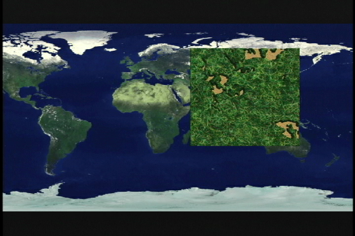
This animation uses a Landsat texture, USGS DEM data for elevation, and the Michigan State data for deforestation. Dissolve between 1965, 1974, and 1997 deforestation data sets.
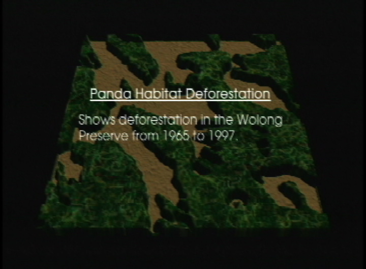
Panda Habitat Deforestation: Data
Visualization Credits
Alex Kekesi (Global Science and Technology, Inc.): Lead Animator
Lori Perkins (NASA/GSFC): Animator
Marc Linderman (Michigan State University): Scientist
Lori Perkins (NASA/GSFC): Animator
Marc Linderman (Michigan State University): Scientist
Please give credit for this item to:
NASA/Goddard Space Flight Center Scientific Visualization Studio
NASA/Goddard Space Flight Center Scientific Visualization Studio
Short URL to share this page:
https://svs.gsfc.nasa.gov/2094
Mission:
Landsat
Data Used:
Note: While we identify the data sets used in these visualizations, we do not store any further details nor the data sets themselves on our site.
This item is part of this series:
Panda Habitat Deforestation
Keywords:
SVS >> Habitat
SVS >> Landsat
SVS >> Panda
SVS >> Wolong
GCMD >> Earth Science >> Human Dimensions >> Habitat Conversion/Fragmentation >> Deforestation
NASA Science >> Earth
GCMD keywords can be found on the Internet with the following citation: Olsen, L.M., G. Major, K. Shein, J. Scialdone, S. Ritz, T. Stevens, M. Morahan, A. Aleman, R. Vogel, S. Leicester, H. Weir, M. Meaux, S. Grebas, C.Solomon, M. Holland, T. Northcutt, R. A. Restrepo, R. Bilodeau, 2013. NASA/Global Change Master Directory (GCMD) Earth Science Keywords. Version 8.0.0.0.0
https://svs.gsfc.nasa.gov/2094
Mission:
Landsat
Data Used:
CORONA/Panoramic Camera
1/20/1965Landsat-5/TM
9/27/1997Landsat-1/MSS
1/3/19747.5-Minute DEM
Model - USGSThis item is part of this series:
Panda Habitat Deforestation
Keywords:
SVS >> Habitat
SVS >> Landsat
SVS >> Panda
SVS >> Wolong
GCMD >> Earth Science >> Human Dimensions >> Habitat Conversion/Fragmentation >> Deforestation
NASA Science >> Earth
GCMD keywords can be found on the Internet with the following citation: Olsen, L.M., G. Major, K. Shein, J. Scialdone, S. Ritz, T. Stevens, M. Morahan, A. Aleman, R. Vogel, S. Leicester, H. Weir, M. Meaux, S. Grebas, C.Solomon, M. Holland, T. Northcutt, R. A. Restrepo, R. Bilodeau, 2013. NASA/Global Change Master Directory (GCMD) Earth Science Keywords. Version 8.0.0.0.0


