Earth
ID: 1350
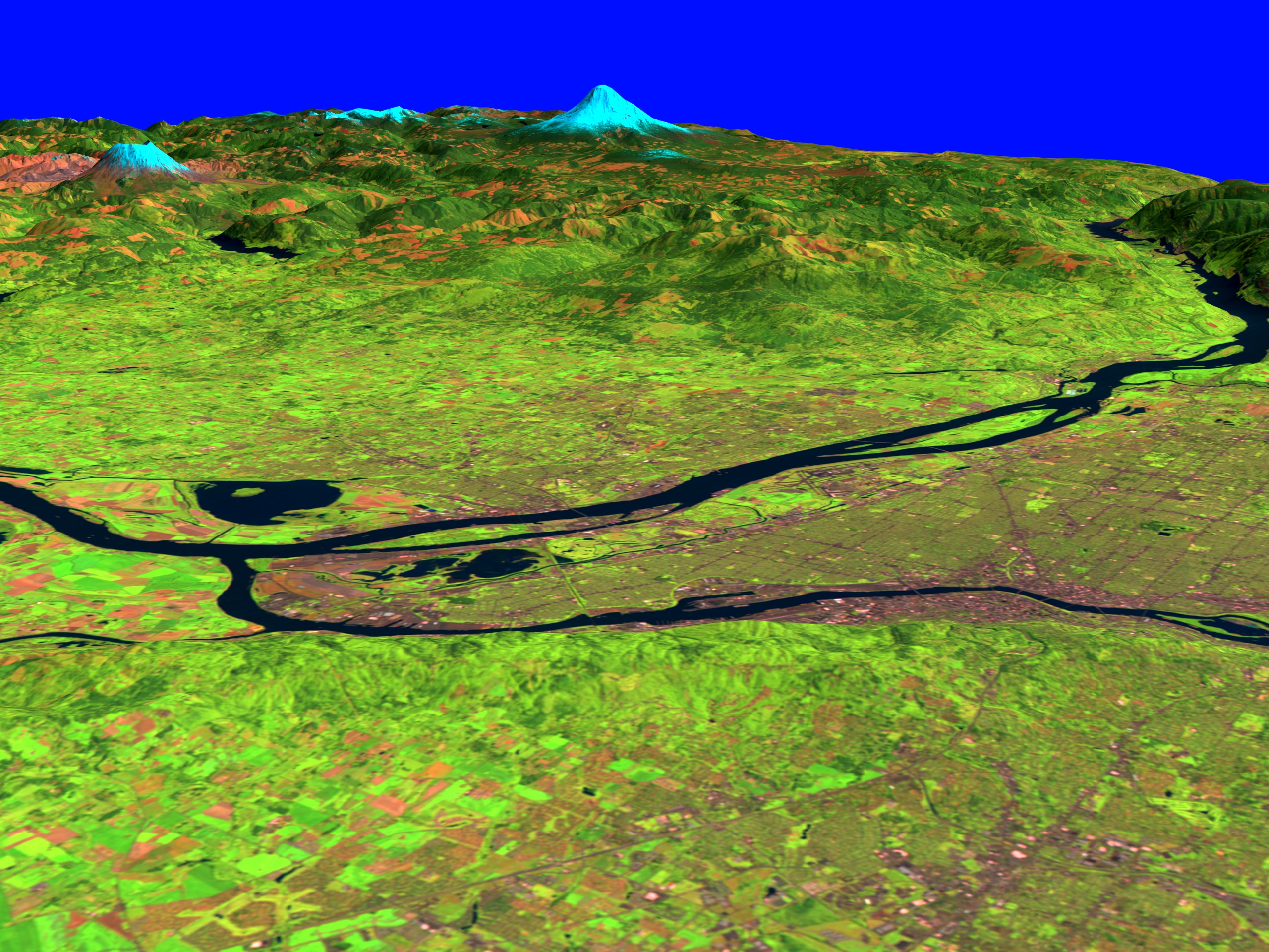
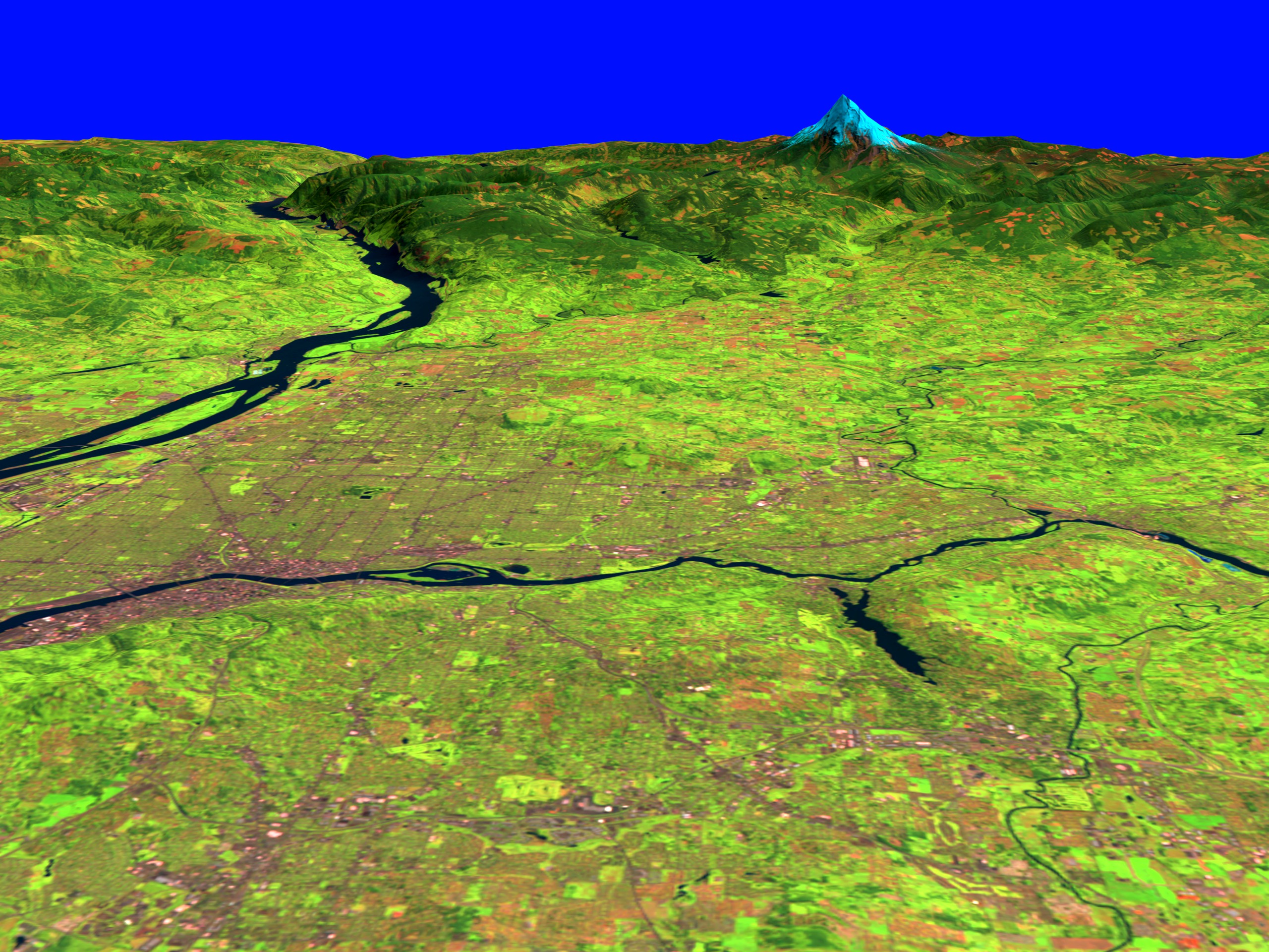
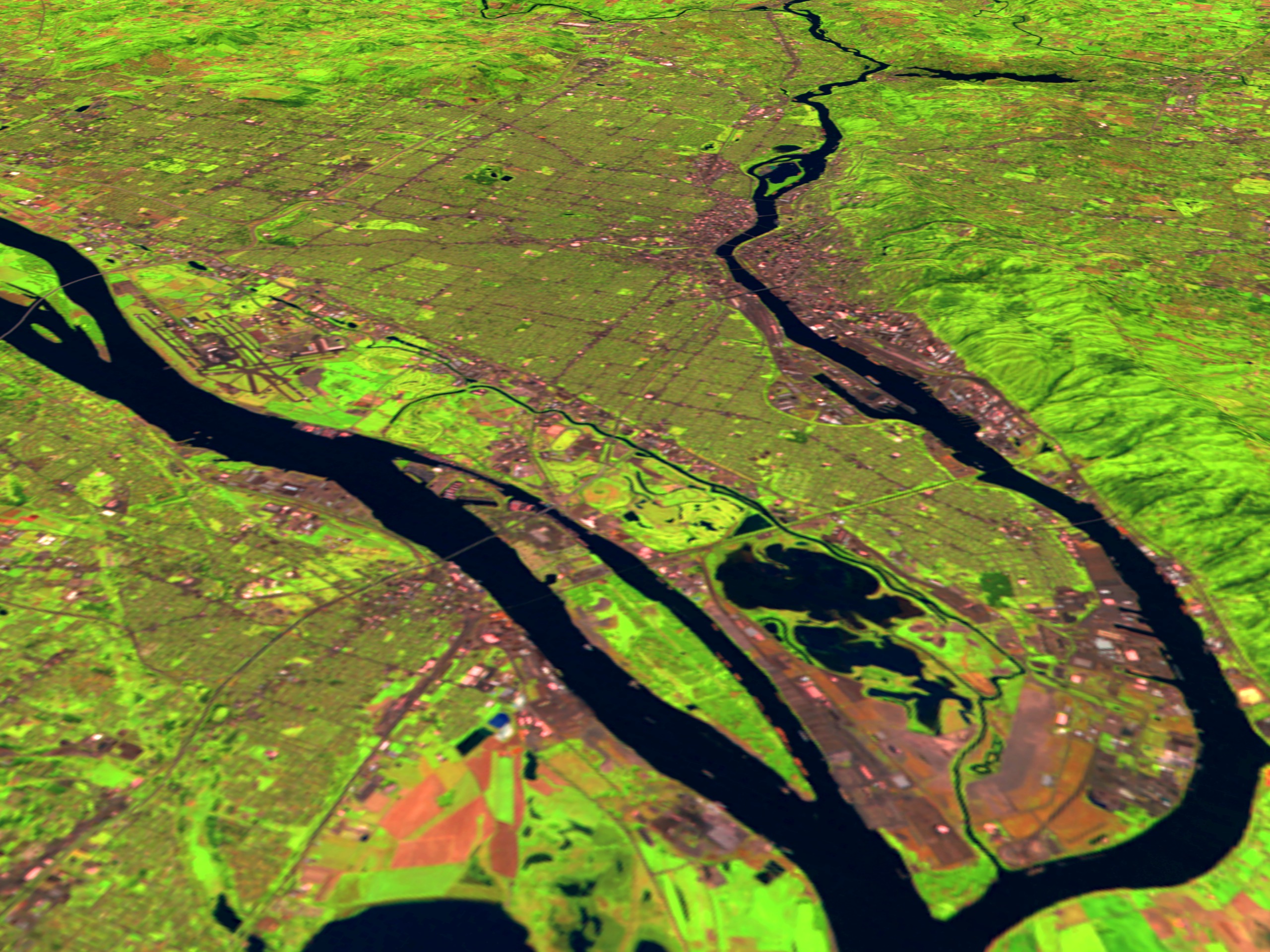
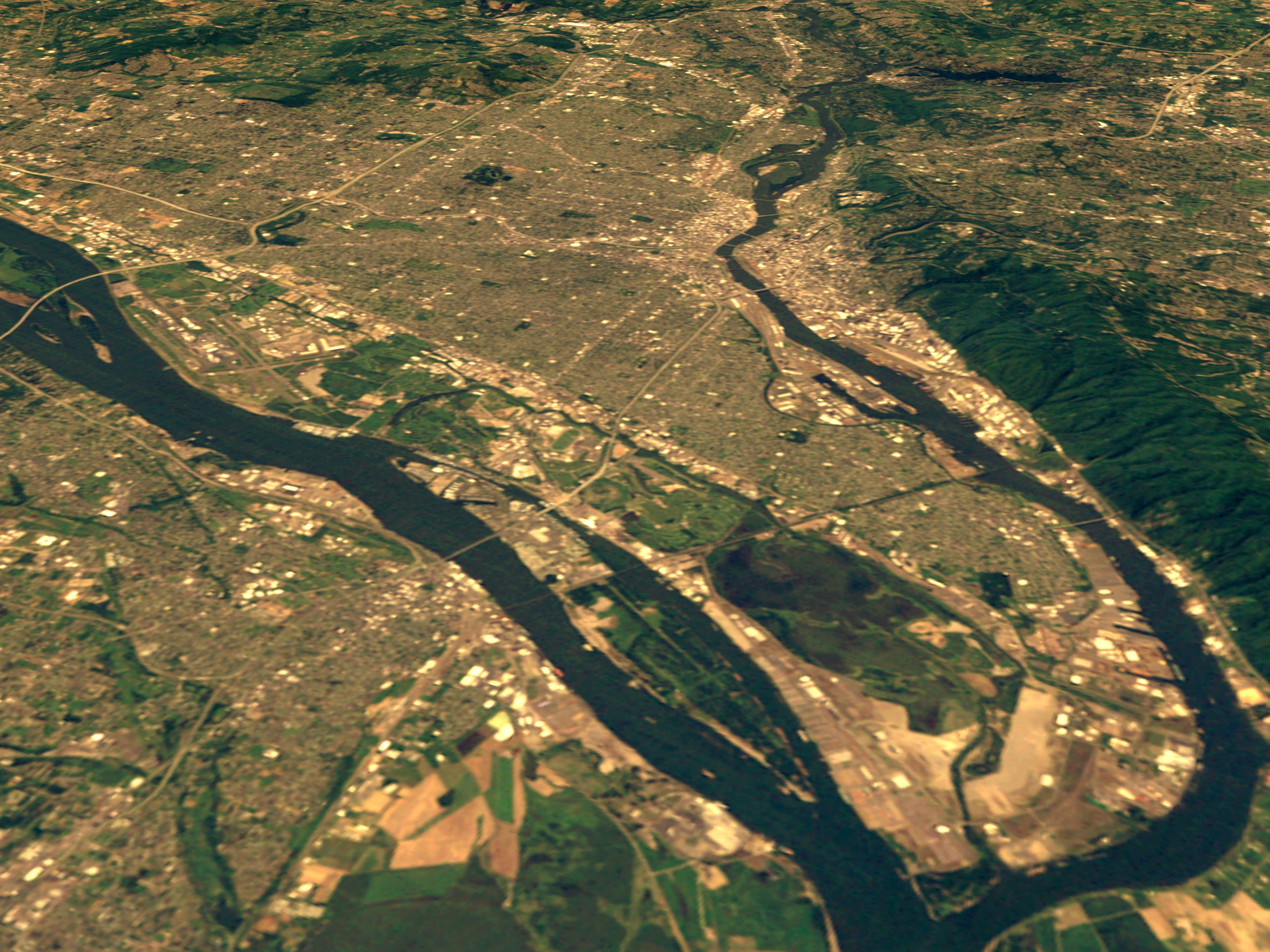
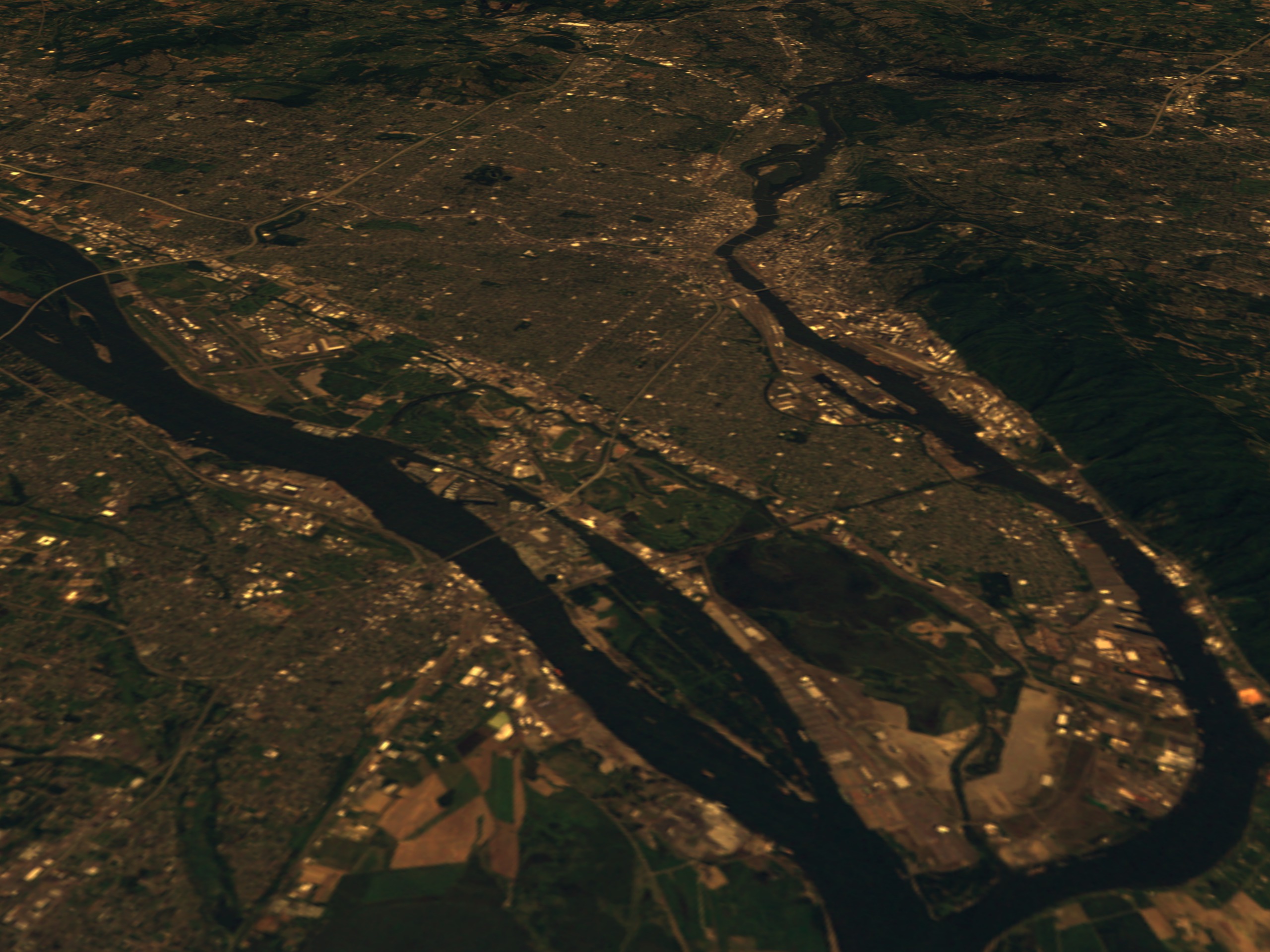
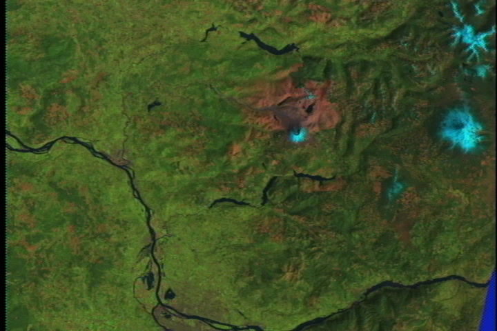
These scenes show Portland, Oregon and the countryside around it as seen by the Landsat Thematic Mapper (TM) instrument. Portland sits on the Willamette River south of its confluence with the Columbia River. The city sits very close to several mountains in the Cascade Range, including Mt. Hood, Mt. Adams, and Mt. St. Helens. The terrain of the area is also shown exaggerated by a factor of two to emphasis terrain features such as the mountains and the Columbia Gorge just north of Mt. Hood and south of Mt. Adams.
The shortwave infrared (TM band 5), infrared (TM band 4), and visible green (TM band 2) channels are displayed in the images as red, green, and blue respectively. In this combination, barren and/or recently cultivated land appears red to pink, vegetation appears green, water is dark blue, and artificial structures of concrete and asphalt appear dark gray or black. The natural color images combine TM bands 3, 2, and 1 and map them to red, green, and blue, respectively.


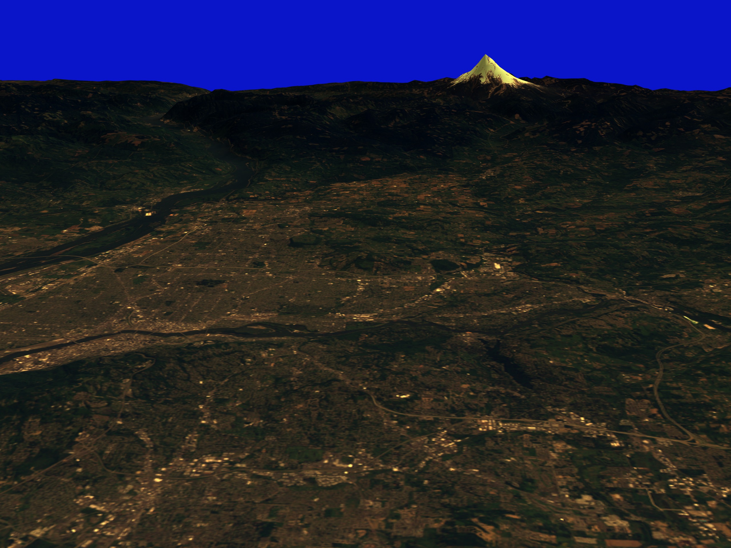
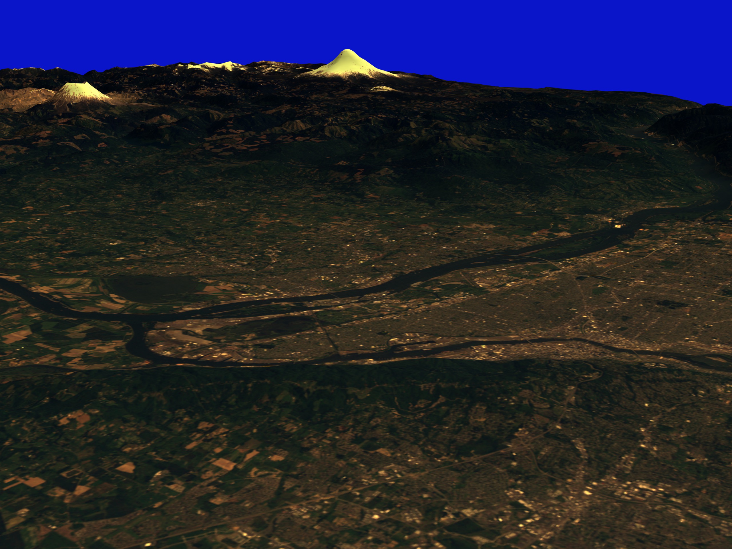
Portland: Correct Lighting, x2 Vertical Exaggeration
The shortwave infrared (TM band 5), infrared (TM band 4), and visible green (TM band 2) channels are displayed in the images as red, green, and blue respectively. In this combination, barren and/or recently cultivated land appears red to pink, vegetation appears green, water is dark blue, and artificial structures of concrete and asphalt appear dark gray or black. The natural color images combine TM bands 3, 2, and 1 and map them to red, green, and blue, respectively.
For More Information
Visualization Credits
Please give credit for this item to:
NASA/Goddard Space Flight Center Scientific Visualization Studio
NASA/Goddard Space Flight Center Scientific Visualization Studio
Short URL to share this page:
https://svs.gsfc.nasa.gov/1350
Mission:
Landsat
Data Used:
Note: While we identify the data sets used in these visualizations, we do not store any further details nor the data sets themselves on our site.
This item is part of this series:
USCities
Keywords:
DLESE >> Human geography
SVS >> Mt. Hood
DLESE >> Physical geography
SVS >> Portland
NASA Science >> Earth
https://svs.gsfc.nasa.gov/1350
Mission:
Landsat
Data Used:
Landsat-5/TM
1992/05/06DTED Level 1 (3 arc second)
Model - USGSThis item is part of this series:
USCities
Keywords:
DLESE >> Human geography
SVS >> Mt. Hood
DLESE >> Physical geography
SVS >> Portland
NASA Science >> Earth


