Earth
ID: 12193
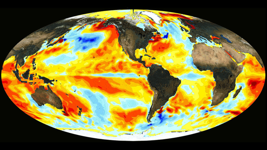
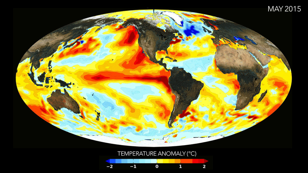
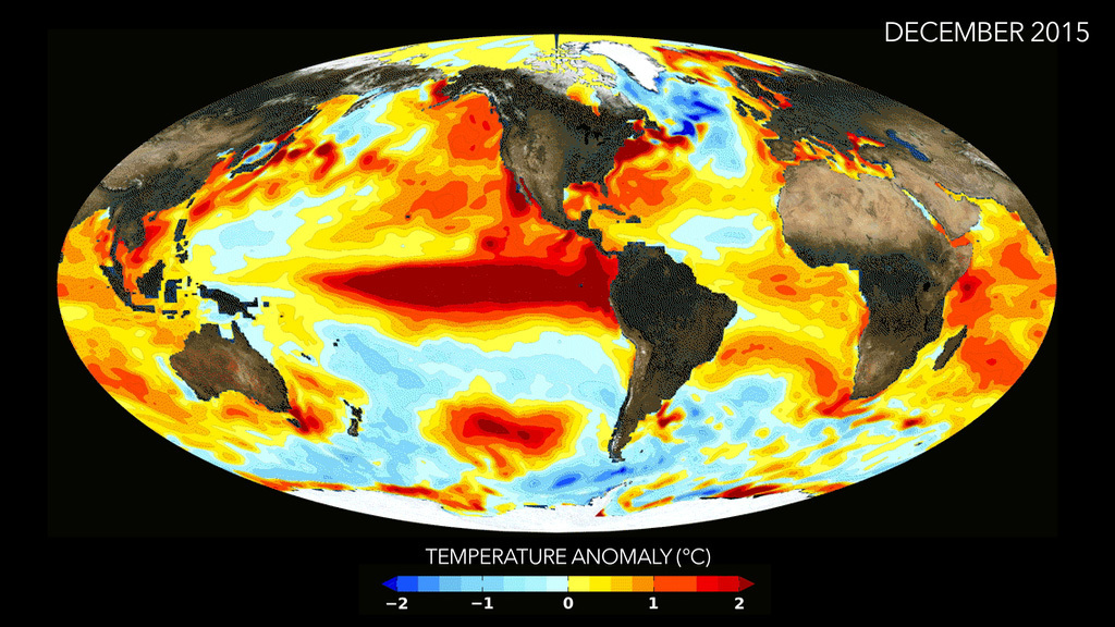
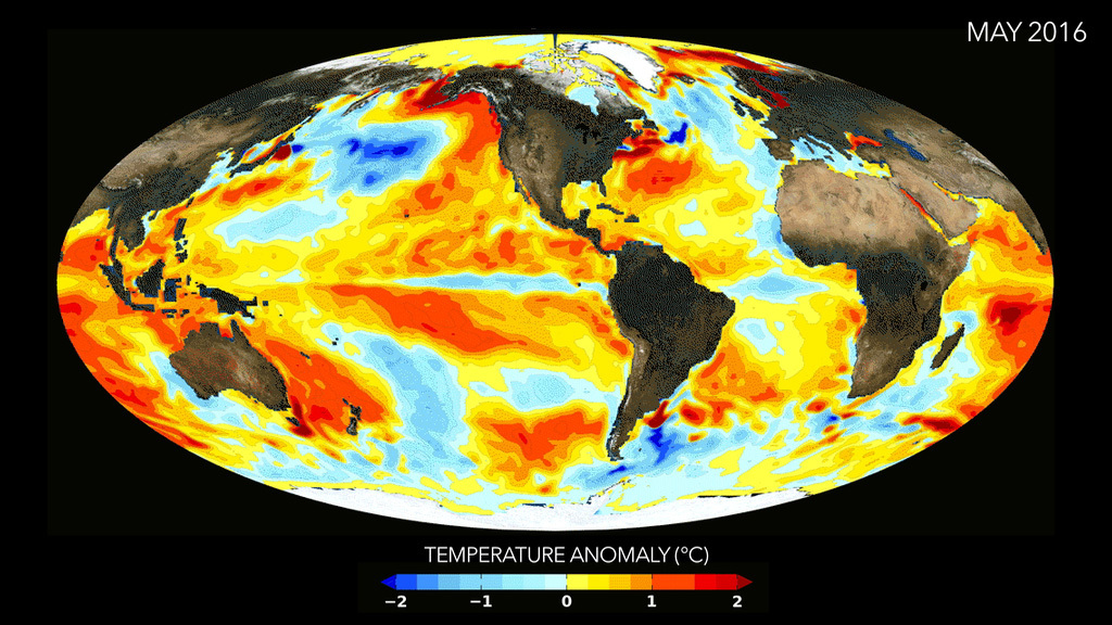
The winter of 2015-2016 saw an extremely strong El Niño event, in which warmer-than-normal water sloshed toward the eastern Pacific Ocean. Historically, some of the larger El Niño events are followed by a La Niña event, in which deep, colder-than-normal water surfaces in the eastern Pacific Ocean, off the coast of South America. But NASA researchers say that’s unlikely to happen this year. The latest forecast from climate models show water temperatures in the equatorial Pacific Ocean should be just around normal for the rest of 2016. The forecast is generated from models run on supercomputers at the NASA Center for Climate Simulation. By feeding satellite data and other information into the models, scientists can predict what ocean conditions will be like nine months into the future. Recent observations from satellites, ships and ocean buoys show temperatures in the equatorial Pacific Ocean are, in fact, getting cooler, as the models predicted they would. Scientists are currently working to further improve the model forecasts by bringing in new types of satellite observations. Watch the video for a look at how ocean temperatures changed leading up to and after the recent El Niño.


What's Next After El Niño?
For More Information
Story Credits
Lead Visualizer/Animator:
Robin Kovach (SSAI)
Scientist:
Robin Kovach (SSAI)
Lead Writer:
Kate Ramsayer (Telophase)
Robin Kovach (SSAI)
Scientist:
Robin Kovach (SSAI)
Lead Writer:
Kate Ramsayer (Telophase)
Please give credit for this item to:
NASA's Goddard Space Flight Center
Video and images courtesy of NASA/GSFC/GMAO/R. Kovach
NASA's Goddard Space Flight Center
Video and images courtesy of NASA/GSFC/GMAO/R. Kovach
Short URL to share this page:
https://svs.gsfc.nasa.gov/12193
Keywords:
SVS >> App
NASA Science >> Earth
https://svs.gsfc.nasa.gov/12193
Keywords:
SVS >> App
NASA Science >> Earth

