Earth
ID: 11734
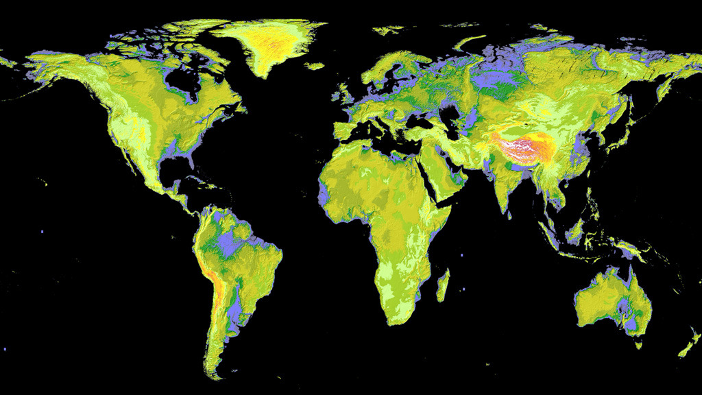
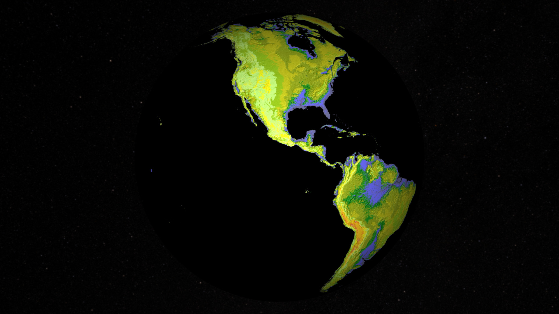
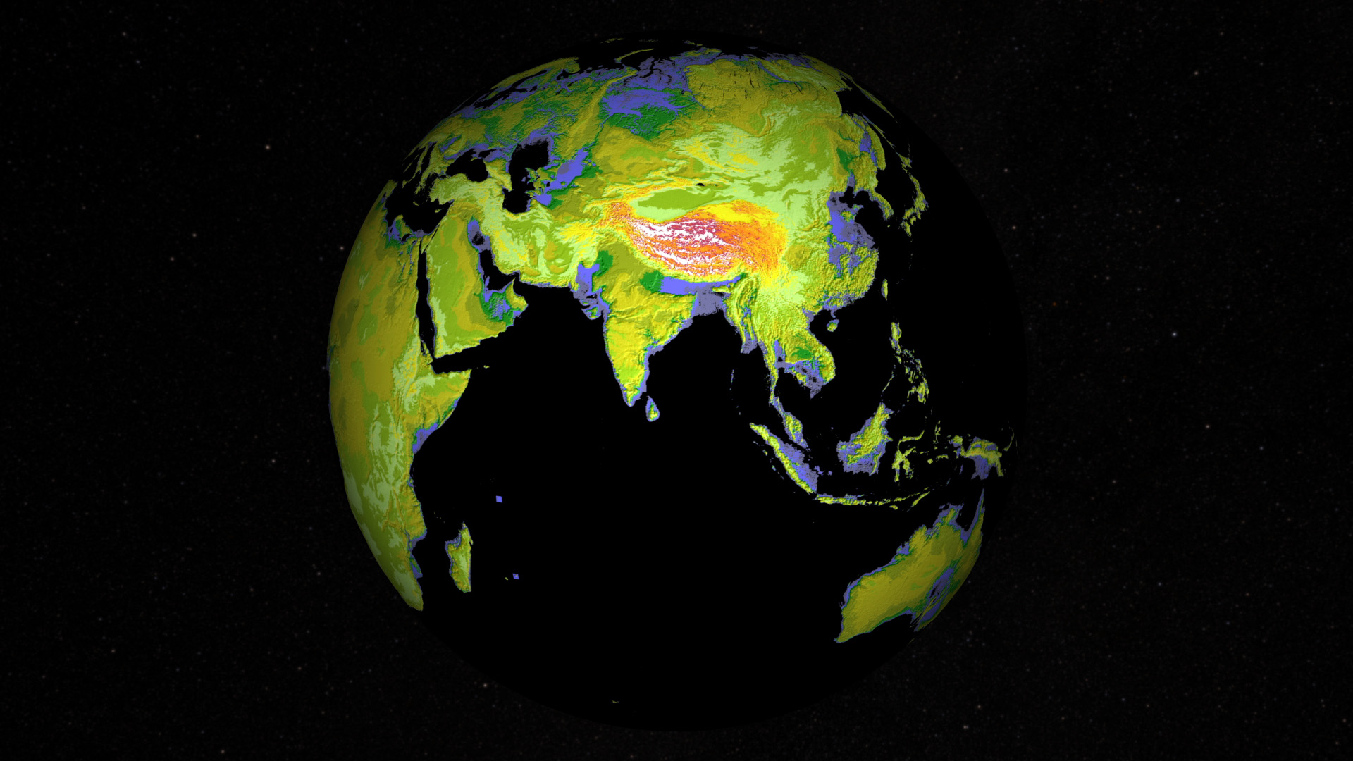
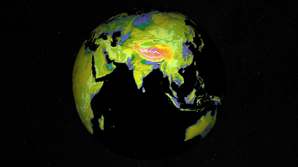
Explorers have long gone forth and charted the terrain of unknown territory, producing detailed topographic maps of mountains, rivers, hills and plains. But in 2009, scientists using data collected by the Advanced Spaceborne Thermal Emission and Reflection Radiometer, or ASTER, instrument aboard NASA's Terra satellite took things to a whole new level. More than 1 million scenes of the land surface imaged from space were stitched together to create the highest resolution global elevation map available to the public. The color-coded map covers 90 percent of Earth’s surface and stretches nearly pole to pole. Scientists use elevation data to better understand how land changes over time, especially from natural disasters like landslides, earthquakes, floods and tsunamis. Watch the video for a tour of the map.

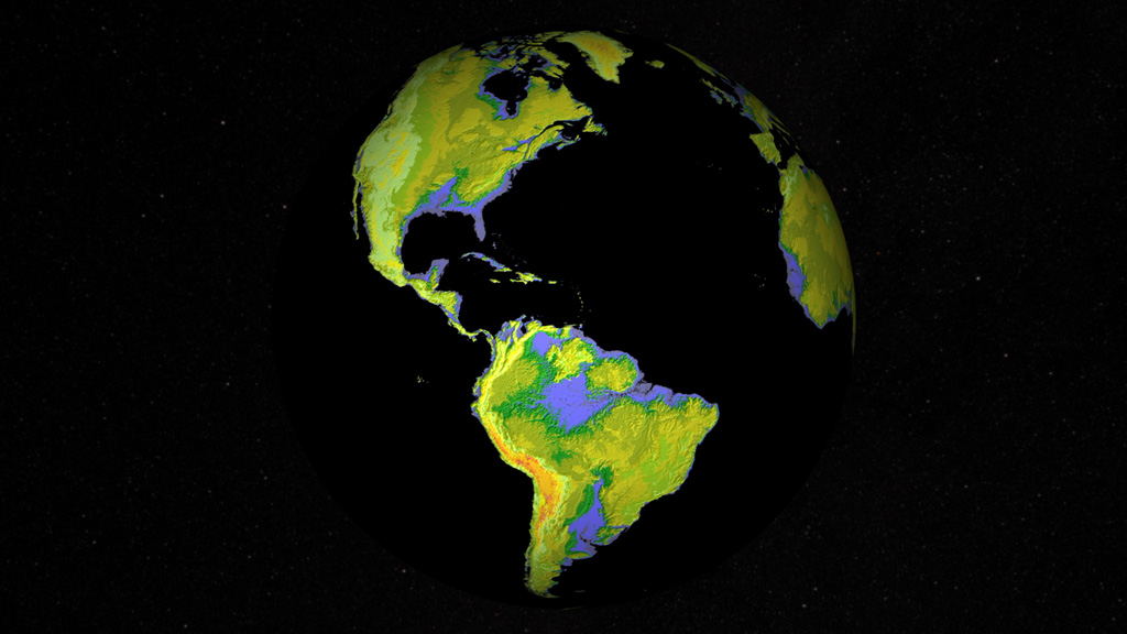

Visualizing Elevation
Story Credits
Please give credit for this item to:
NASA's Goddard Space Flight Center
Images courtesy of NASA/JPL/METI/ASTER Team
NASA's Goddard Space Flight Center
Images courtesy of NASA/JPL/METI/ASTER Team
Short URL to share this page:
https://svs.gsfc.nasa.gov/11734
Keywords:
SVS >> App
NASA Science >> Earth
https://svs.gsfc.nasa.gov/11734
Keywords:
SVS >> App
NASA Science >> Earth


