Earth
ID: 11269

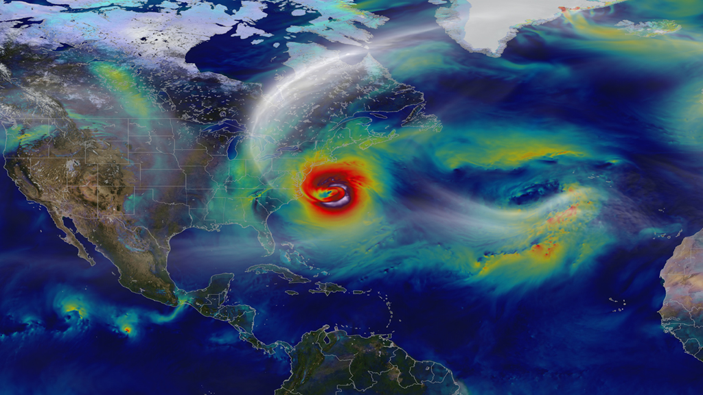
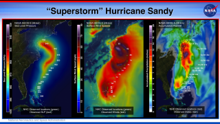
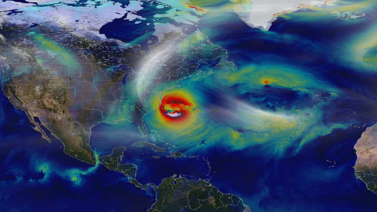
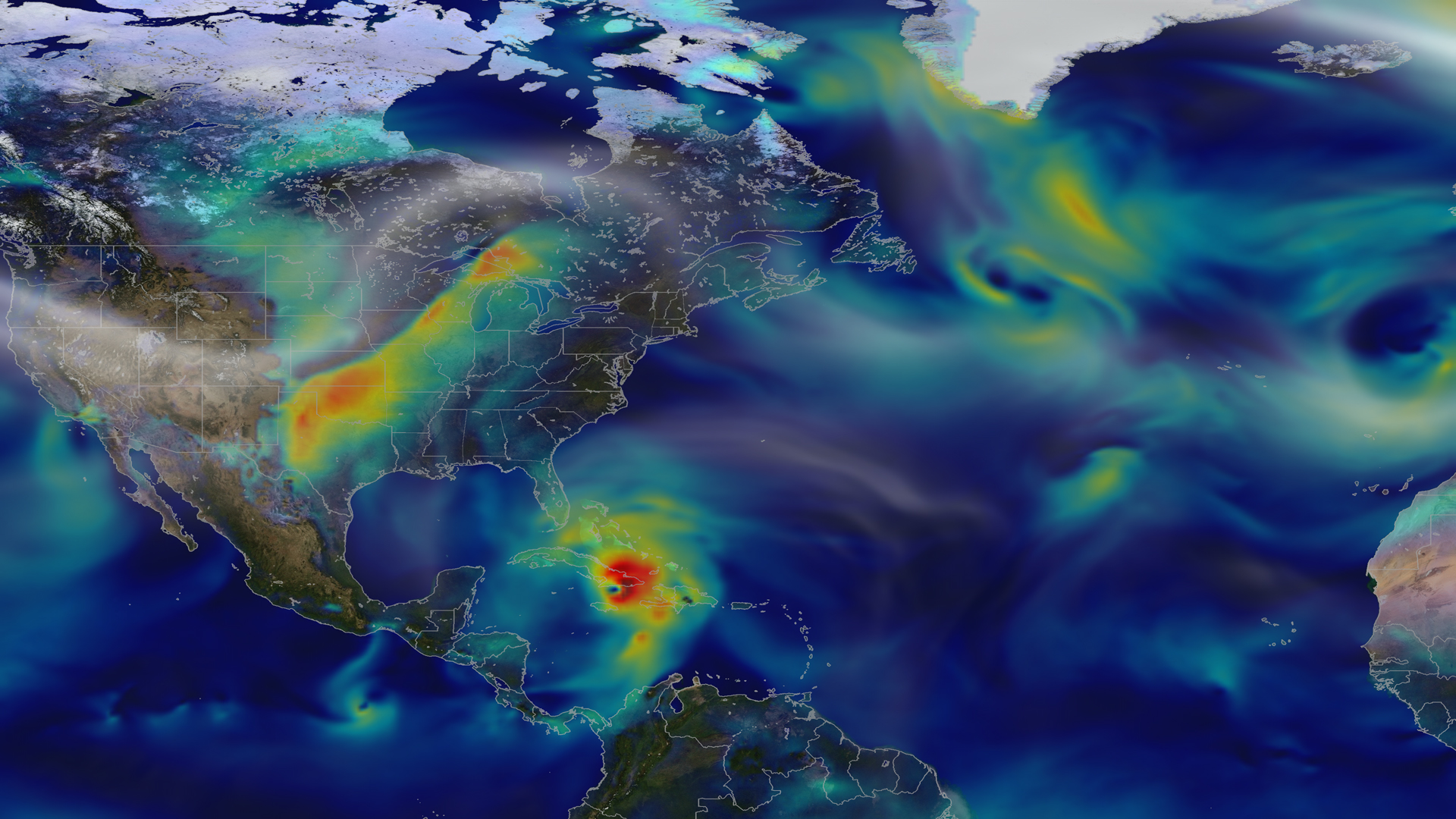
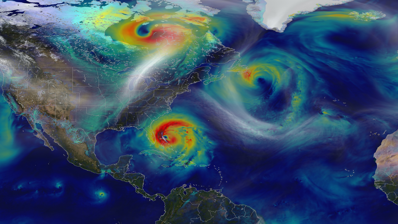
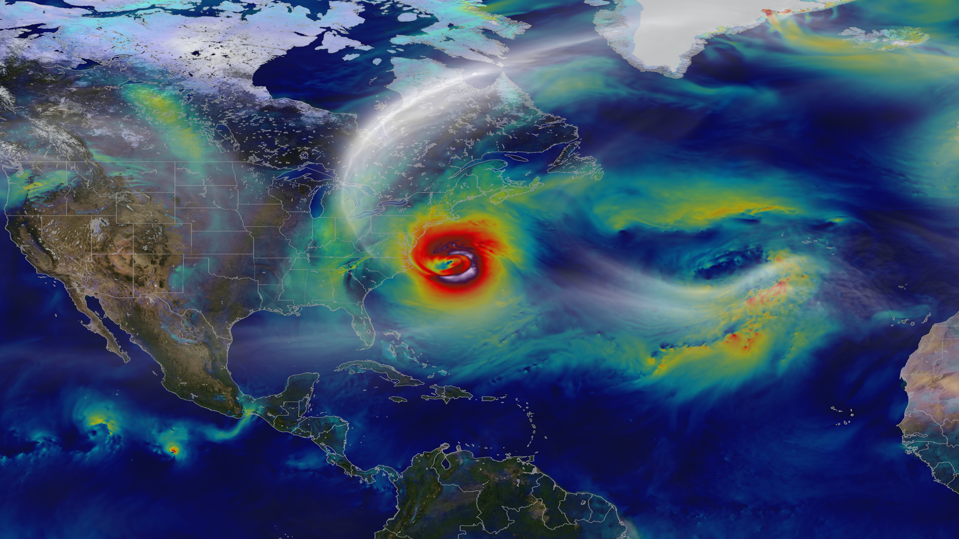
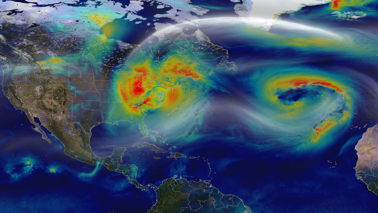
Hurricane Sandy pummeled the East Coast late in 2012’s Atlantic hurricane season, causing 159 deaths and $70 billion in damages. Days before landfall, forecasts of its trajectory were still being made. Some computer models showed that a trough in the jet stream would kick the monster storm away from land and out to sea. Among the earliest to predict its true course was NASA’s GEOS-5 global atmosphere model. The model works by dividing Earth’s atmosphere into a virtual grid of stacked boxes. A supercomputer then solves mathematical equations inside each box to create a weather forecast predicting Sandy’s structure, path and other traits. The NASA model not only produced an accurate track of Sandy, but also captured fine-scale details of the storm’s changing intensity and winds. Watch the video to see it for yourself.


Tracking A Superstorm
Related Story
For More Information
Story Credits
Visualizer/Animator:
William Putman (NASA/GSFC)
Video Editor:
Kayvon Sharghi (USRA)
Lead Scientist:
William Putman (NASA/GSFC)
Lead Writer:
Jarrett Cohen (GST)
William Putman (NASA/GSFC)
Video Editor:
Kayvon Sharghi (USRA)
Lead Scientist:
William Putman (NASA/GSFC)
Lead Writer:
Jarrett Cohen (GST)
Please give credit for this item to:
NASA's Goddard Space Flight Center and NASA Center for Climate Simulation
Video and images courtesy of NASA/GSFC/William Putman
NASA's Goddard Space Flight Center and NASA Center for Climate Simulation
Video and images courtesy of NASA/GSFC/William Putman
Short URL to share this page:
https://svs.gsfc.nasa.gov/11269
Keywords:
SVS >> App
NASA Science >> Earth
https://svs.gsfc.nasa.gov/11269
Keywords:
SVS >> App
NASA Science >> Earth


