Earth
ID: 11267

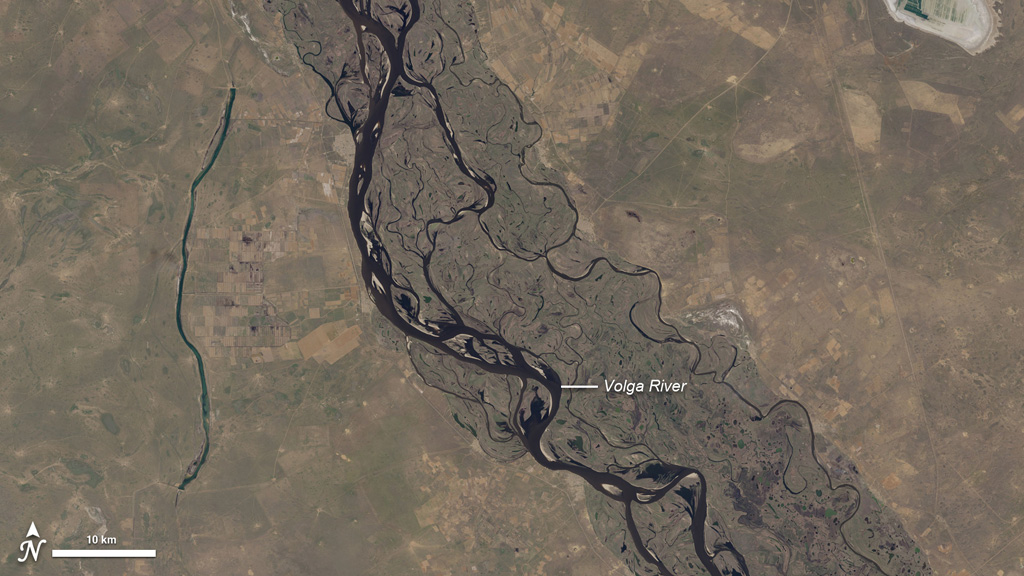
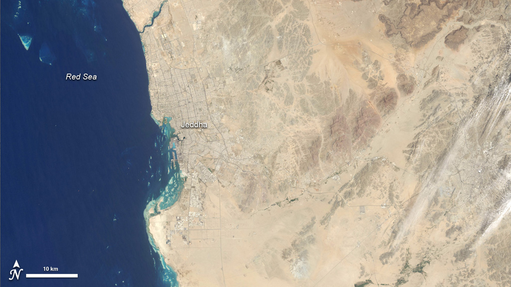
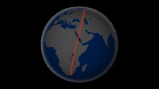
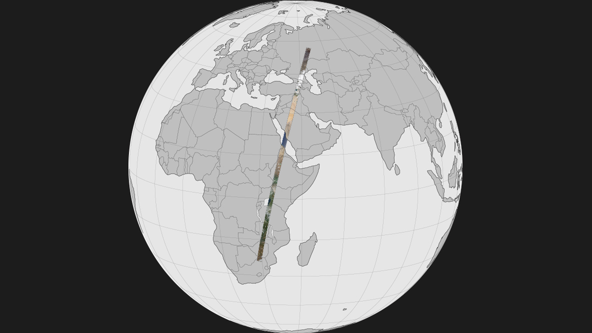
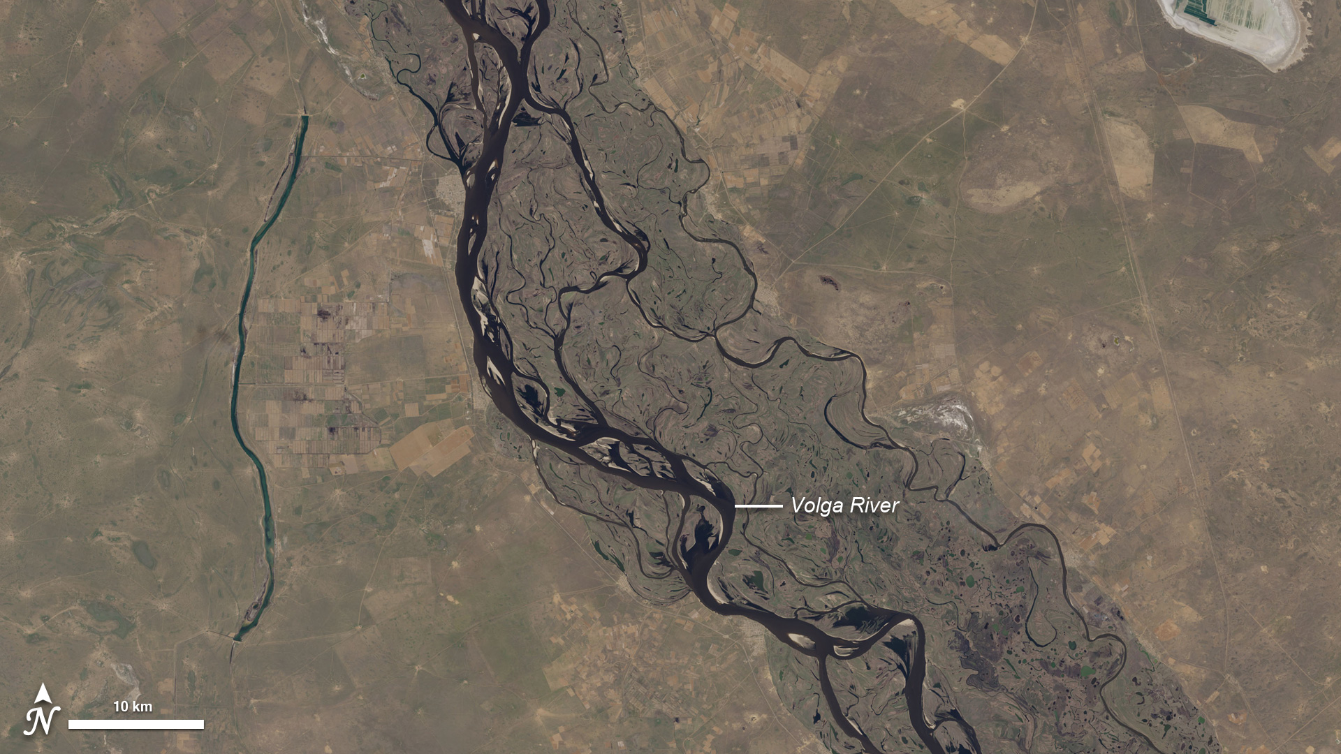
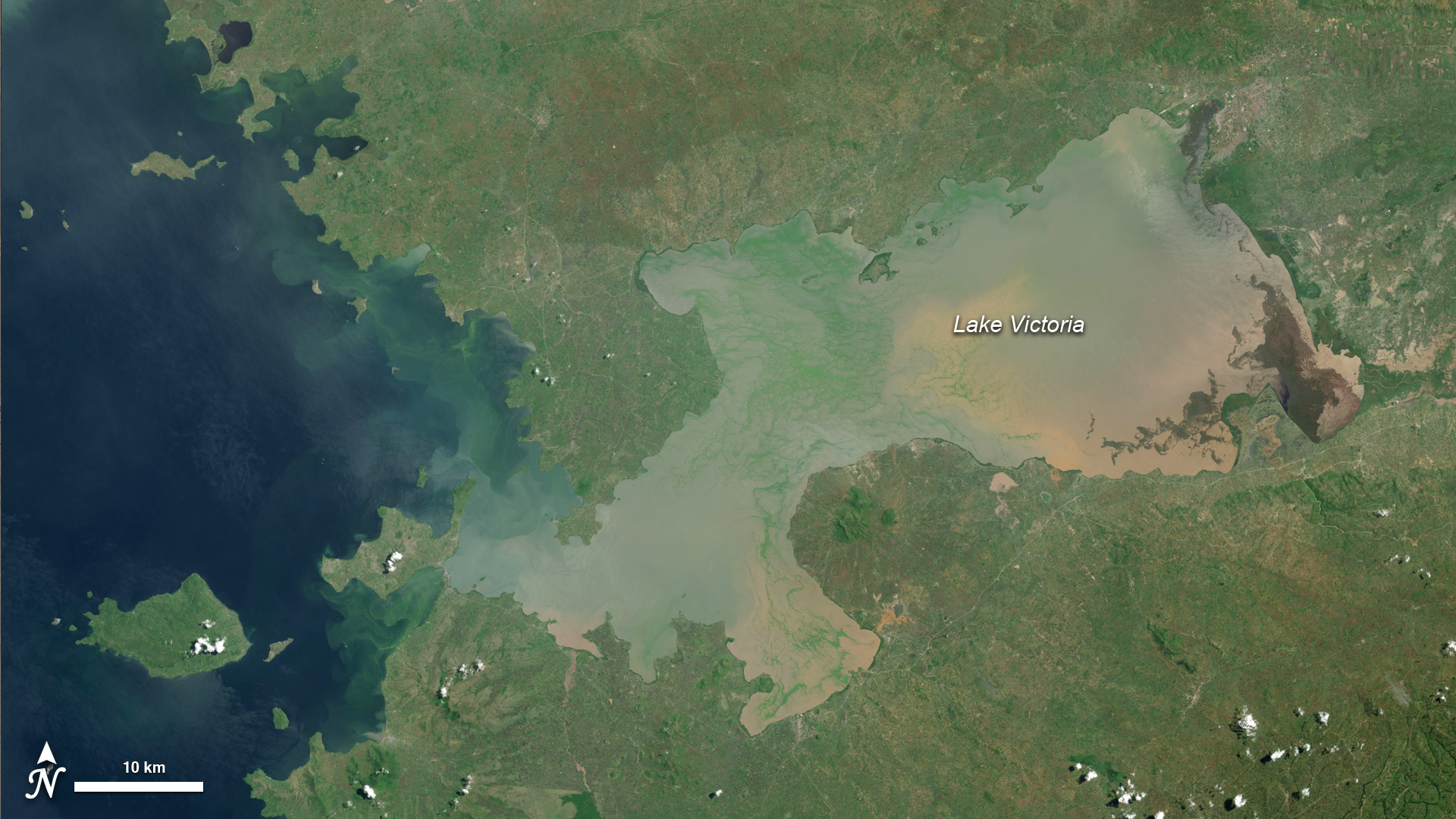
Have you ever wondered what it would be like to soar like a satellite, watching the world pass beneath you? The dream is elusive (except for astronauts), but through imagery from the Landsat Data Continuity Mission (LDCM), we can take a vicarious flight. In mid-April 2013, the newest satellite in the Landsat family scanned a 120-mile-wide swath of land from northern Russia to South Africa. That flight path afforded us a chance to assemble a flyover view of what LDCM's Operational Land Imager saw, including clouds, haze, and varying angles of sunlight. The full mosaic and animation stretches more than 6,000 miles and includes 56 adjoining, natural-color scenes stitched together into a seamless swath. Watch the videos to see highlights from the animation.

Come Fly With Me
Related Story
For More Information
Story Credits
Visualizers/Animators:
Robert Simmon (Sigma Space Corporation)
Jesse Allen (Sigma Space Corporation)
Alex Kekesi (Global Science and Technology, Inc.)
Video Editor:
Matthew R. Radcliff (USRA)
Producer:
Matthew R. Radcliff (USRA)
Lead Scientist:
James R. Irons (NASA/GSFC)
Lead Writers:
Mike Carlowicz (Sigma Space Corporation)
Holli Riebeek (Sigma Space Corporation)
Please give credit for this item to:
NASA's Earth Observatory
NASA's Earth Observatory
Short URL to share this page:
https://svs.gsfc.nasa.gov/11267
Keywords:
NASA Science >> Earth
SVS >> App
https://svs.gsfc.nasa.gov/11267
Keywords:
NASA Science >> Earth
SVS >> App


