Earth
ID: 11243
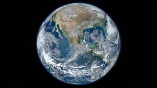
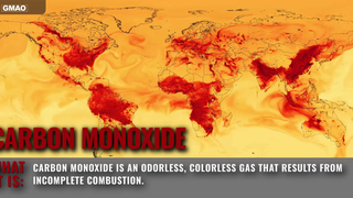
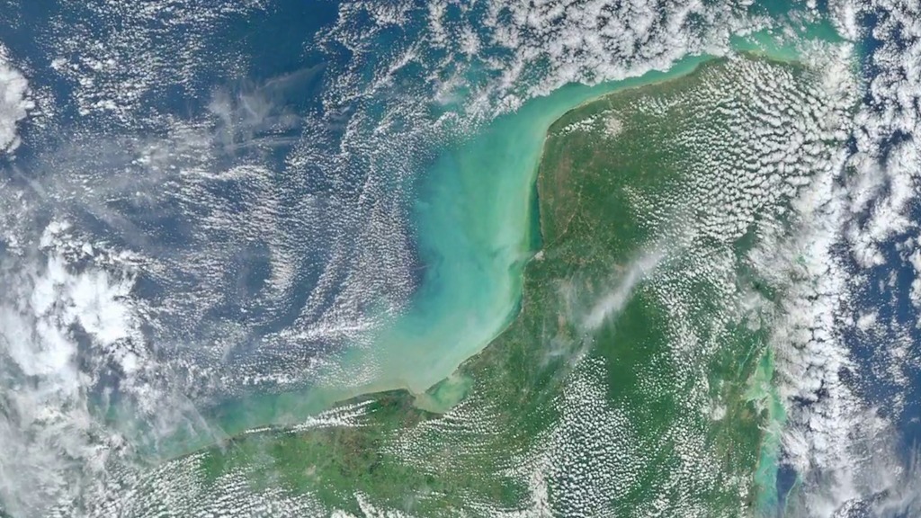
NASA's fleet of Earth-observing satellites constantly circle the globe, completing their orbits every 90 minutes. They give us invaluable information about everything from our weather and climate, to the way we use our land, to the air we breathe. This video highlights some of the newest satellites in the fleet, including the versatile Suomi National Polar-orbiting (NPP) satellite, a partnership between NASA and the National Oceanic and Atmospheric Administration, and Aquarius, which measures sea surface salinity and is a joint project between NASA and the Space Agency of Argentina. While many of the images are "true color" or photorealistic in nature, this video also includes data visualizations, which help scientists see data in useful new ways, and computer models, which help us understand interconnected Earth systems and make projections into the future.
Earth from Orbit 2012
Curious about what images we used in this video? A full list can be found at www.nasa.gov/topics/earth/earthmonth/earth-from-orbit-2012.html
Related
Credits
Jefferson Beck (USRA): Producer
Please give credit for this item to:
NASA's Goddard Space Flight Center
NASA's Goddard Space Flight Center
Short URL to share this page:
https://svs.gsfc.nasa.gov/11243
Missions:
Aquarius
NPP
Goddard TV Tape:
G2013-037 -- Earth from Orbit 2012
Keywords:
SVS >> Earth
SVS >> HDTV
SVS >> Satellite
SVS >> Model Data
SVS >> Aquarius
SVS >> NPP
NASA Science >> Earth
https://svs.gsfc.nasa.gov/11243
Missions:
Aquarius
NPP
Goddard TV Tape:
G2013-037 -- Earth from Orbit 2012
Keywords:
SVS >> Earth
SVS >> HDTV
SVS >> Satellite
SVS >> Model Data
SVS >> Aquarius
SVS >> NPP
NASA Science >> Earth


