Earth
ID: 11079

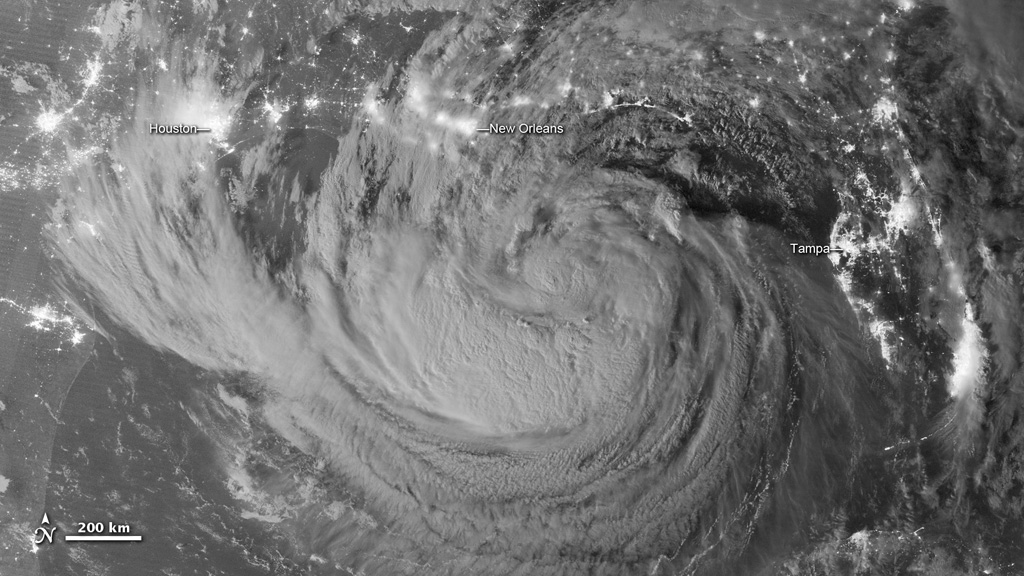
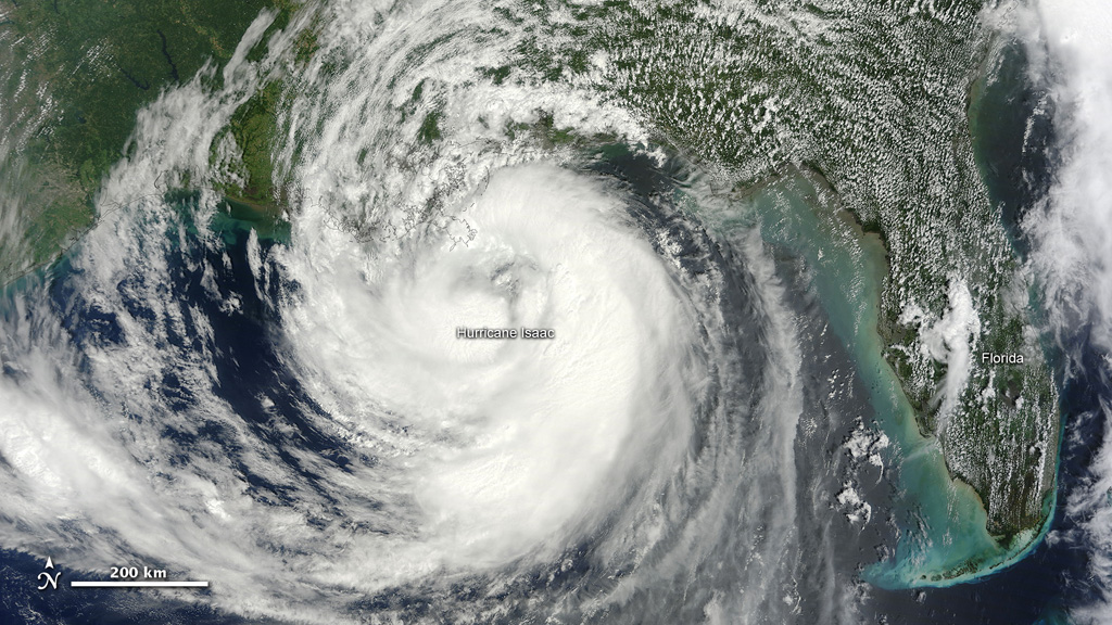
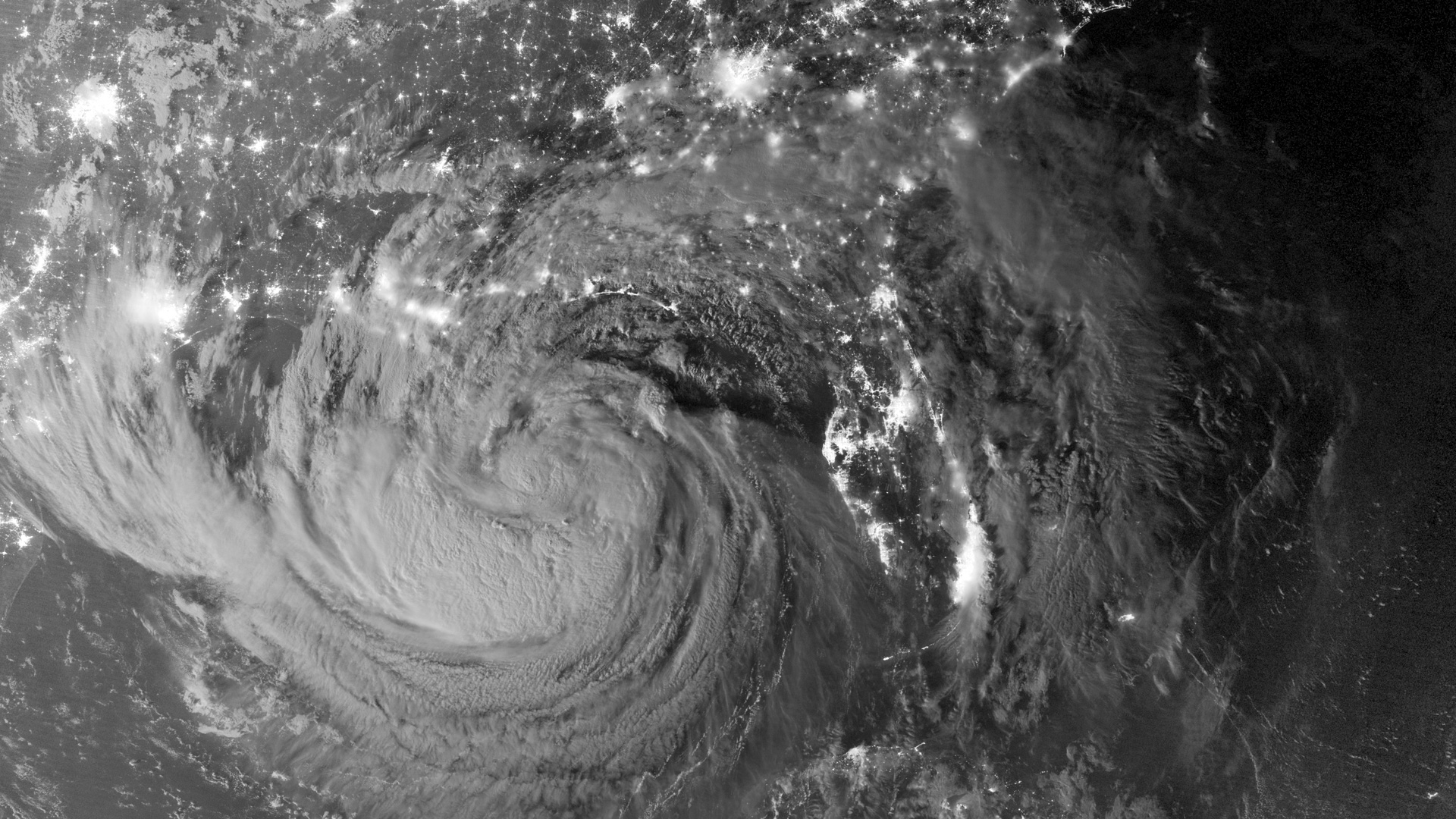
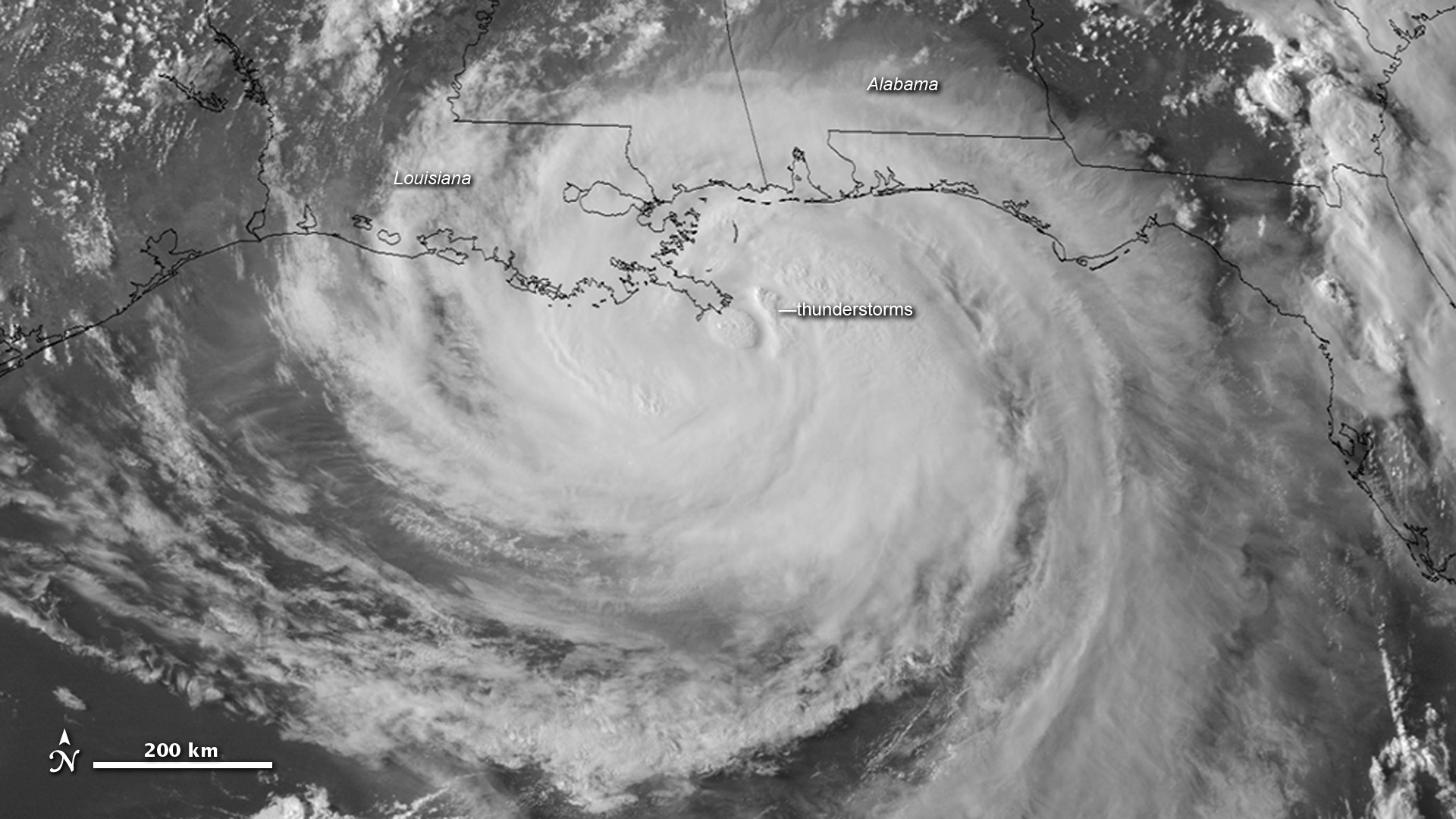
As Hurricane Isaac churned through the Caribbean Sea, past Florida, and toward the Gulf Coast, Earth-observing satellites watched every move. When the Category 1 storm finally battered the coast of Louisiana on August 28, 2012, multiple satellites produced striking views of the storm by day, by night, and in an experimental rapid-fire mode that showed incredibly fine detail of the storm's evolution. The GOES 14 satellite normally captures one image every 15 minutes. But as Isaac made landfall the weather satellite captured one image per minute, illuminating otherwise unseen detail. The movement of clouds at different altitudes creates a textured appearance while thunderstorms near the storm's core bubble up as dusk approaches. The animation shows the GOES 14 view of Isaac from dawn to dusk on August 28, a unique view of the storm as it hit the Gulf Coast.

Dawn To Dusk
For More Information
Story Credits
Lead Visualizer/Animator:
Robert Simmon (Sigma Space Corporation)
Lead Writer:
Adam P. Voiland (Sigma Space Corporation)
Robert Simmon (Sigma Space Corporation)
Lead Writer:
Adam P. Voiland (Sigma Space Corporation)
Please give credit for this item to:
NASA Earth Observatory
GOES 14 imagery courtesy of NOAA and the University of Wisconsin-Madison Cooperative Institute for Meteorological Satellite Studies
NASA Earth Observatory
GOES 14 imagery courtesy of NOAA and the University of Wisconsin-Madison Cooperative Institute for Meteorological Satellite Studies
Short URL to share this page:
https://svs.gsfc.nasa.gov/11079
Keywords:
SVS >> App
NASA Science >> Earth
https://svs.gsfc.nasa.gov/11079
Keywords:
SVS >> App
NASA Science >> Earth

