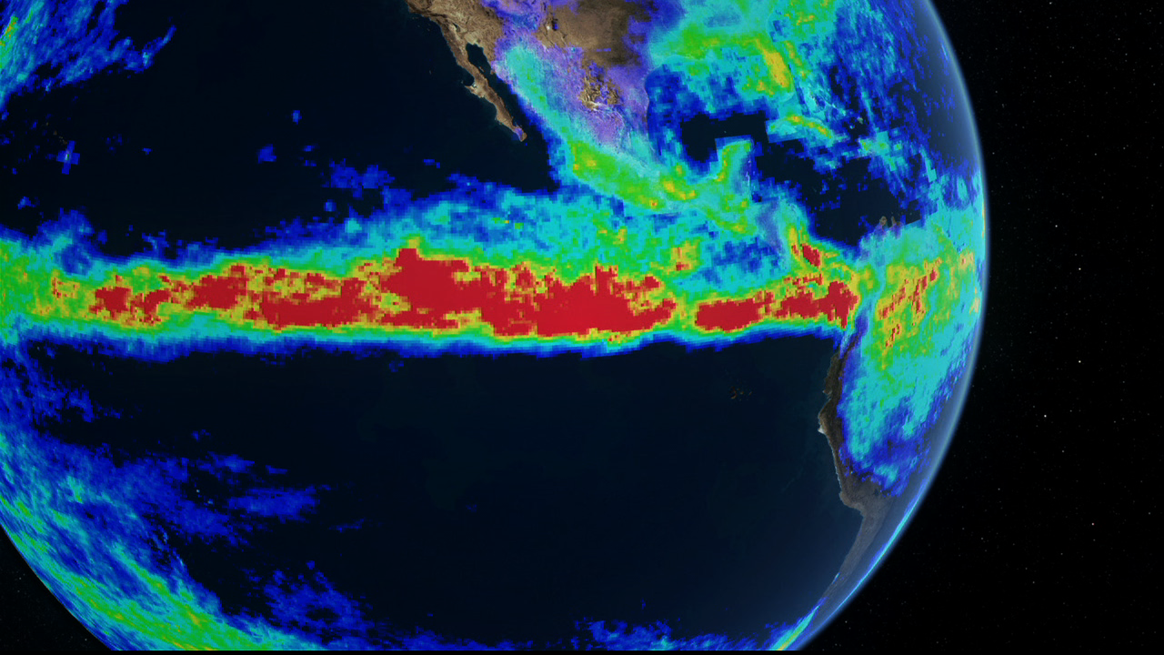
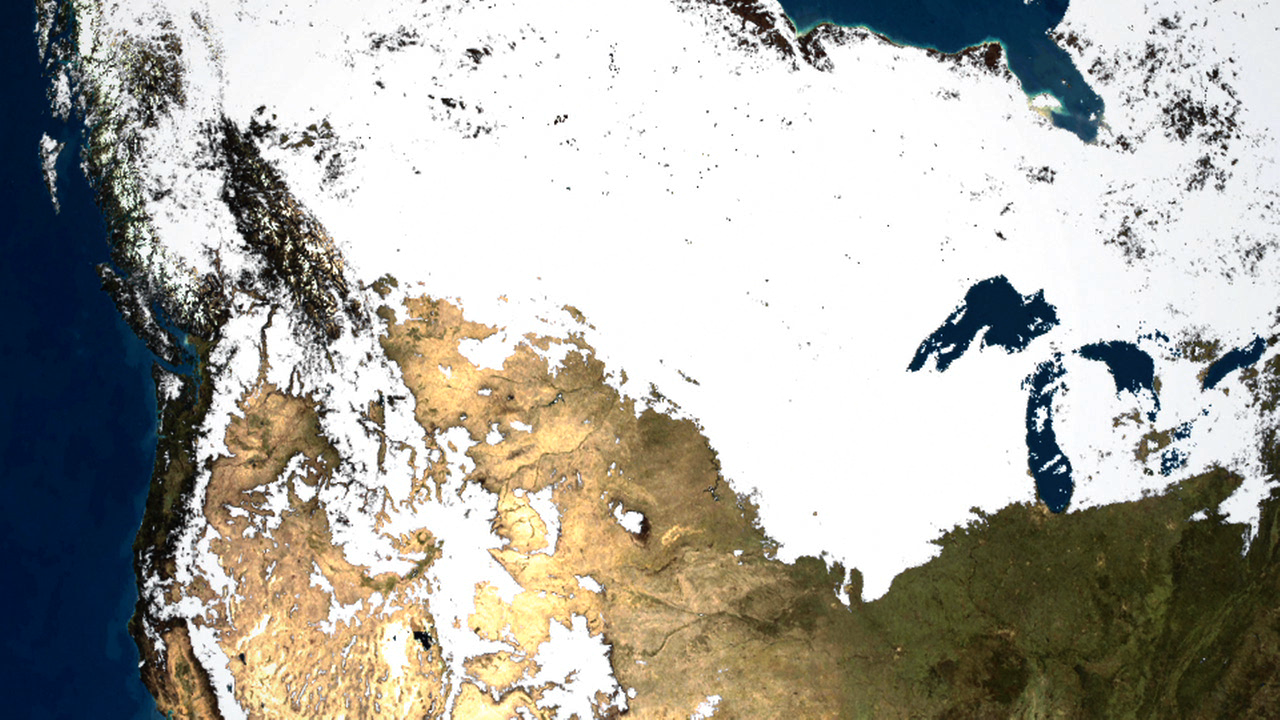
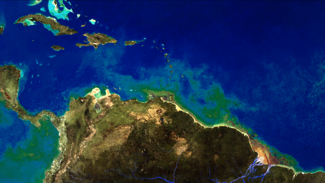
Earth's Water Cycle
Sensors on a suite of NASA satellites observe and measure water on land, in the ocean and in the atmosphere. These measurements are important to understanding the availability and distribution of Earth's water — vital to life and vulnerable to the impacts of climate change on a growing world population.
NASA Earth Observing System Data and Information Systems (EOSDIS)
EOSDIS is a distributed system of twelve data centers and science investigator processing systems. EOSDIS processes, archives, and distributes data from Earth observing satellites, field campaigns, airborne sensors, and related Earth science programs. These data enable the study of Earth from space to advance scientific understanding.
For questions, please contact eosdis-outreach@lists.nasa.gov
For More Information
Credits
Joint project between NASA GSFC and NASA JPL
Design:
Carol Boquist, NASA GSFC
Jennifer Brennan, Adnet Systems Inc., NASA GSFC
Dr. Brian Krupp, Adnet Systems Inc., NASA GSFC
Dr. Eric M. De Jong, NASA JPL
Barbara McGuffie, NASA JPL
Science Advisors:
Dr. Scott Braun, NASA GSFC
Dr. Arthur Hou, NASA GSFC
Dr. Matthew Rodell, NASA GSFC
Jessica Hausman, NASA JPL
David Moroni, NASA JPL
Dr. Jorge Vazquez, NASA JPL
Dr. Jared Entin, NASA HQ
Dr. Eric Lindstrom, NASA HQ
Animation:
Robert Baldwin, Studio Orb
Narration:
Raymond A. Hearn http://raymondhearn.com
Producer/Editor:
Erica Drezek, Honeywell Technology Solutions Inc., NASA GSFC
Special Thanks:
Paul Andres,Jason Craig and Michael Stetson,
Solar System Visualization Project, NASA JPL
Heather K. Dennis, Studio Orb
Dr. Henry Liu, NASA GSFC Dr. Matthew Smith, NASA Global Hydrology Resource Center
Dr. Wendy Tang, NASA JPL
M. Sara Tweedie, Tweedie & Assoc.
Data sets available through:
NASA Earth Observing System Data and Information System (EOSDIS) Data Centers
http://earthdata.nasa.gov
Global Hydrology Resource Center Distributed Active Archive Center (GHRC DAAC)
GOES
GOES data distributed by the National Oceanic and Atmospheric Administration
Goddard Earth Science Data and Information Services Center (GES DISC)
AIRS, TRMM, GLDAS
AIRS imagery created using the NASA GES DISC Giovanni Tool
Land Processes DAAC (LP DAAC) MODIS, ASTER
MODIS Level-1 Atmosphere Archive and Distribution System (MODAPS LAADS)
MODIS
National Snow and Ice Data Center DAAC (NSIDC DAAC)
MODIS
Ocean Biology Processing Group (OBPG)
MODIS, SeaWiFS
Physical Oceanography DAAC (PO.DAAC)
GRACE, OSTIA, QuikSCAT
Socioeconomic Data and Applications Center (SEDAC)
Population Density, Natural Hazard Drought Indices and Flood Risk data
Next Generation Blue Marble courtesy:
NASA Earth Observatory
https://svs.gsfc.nasa.gov/11054
This item is part of this series:
Narrated Movies
Goddard TV Tape:
G2011-032 -- Earth's Water Cycle
Keywords:
DLESE >> Atmospheric science
SVS >> Clouds
SVS >> Earth
DLESE >> Environmental science
SVS >> HDTV
DLESE >> Hydrology
DLESE >> Natural hazards
SVS >> Snow Cover
SVS >> Water
SVS >> Water Cycle
GCMD >> Earth Science >> Atmosphere >> Precipitation
GCMD >> Earth Science >> Hydrosphere >> Ground Water
GCMD >> Earth Science >> Hydrosphere >> Surface Water
GCMD >> Earth Science >> Atmosphere >> Atmospheric Phenomena >> Storms
GCMD >> Earth Science >> Atmosphere >> Atmospheric Temperature >> Air Temperature
GCMD >> Earth Science >> Atmosphere >> Atmospheric Water Vapor >> Water Vapor
GCMD >> Earth Science >> Hydrosphere >> Ground Water >> Aquifers
GCMD >> Earth Science >> Hydrosphere >> Ground Water >> Water Table
GCMD >> Earth Science >> Hydrosphere >> Surface Water >> Discharge/Flow
GCMD >> Earth Science >> Hydrosphere >> Surface Water >> Floods
GCMD >> Earth Science >> Hydrosphere >> Surface Water >> Runoff
GCMD >> Earth Science >> Hydrosphere >> Water Quality/Water Chemistry >> Chlorophyll
GCMD >> Earth Science >> Hydrosphere >> Water Quality/Water Chemistry >> Water Temperature
SVS >> Goddard Space Flight Center
DLESE >> Narrated
NASA Science >> Earth
GCMD keywords can be found on the Internet with the following citation: Olsen, L.M., G. Major, K. Shein, J. Scialdone, S. Ritz, T. Stevens, M. Morahan, A. Aleman, R. Vogel, S. Leicester, H. Weir, M. Meaux, S. Grebas, C.Solomon, M. Holland, T. Northcutt, R. A. Restrepo, R. Bilodeau, 2013. NASA/Global Change Master Directory (GCMD) Earth Science Keywords. Version 8.0.0.0.0