Earth
ID: 10973
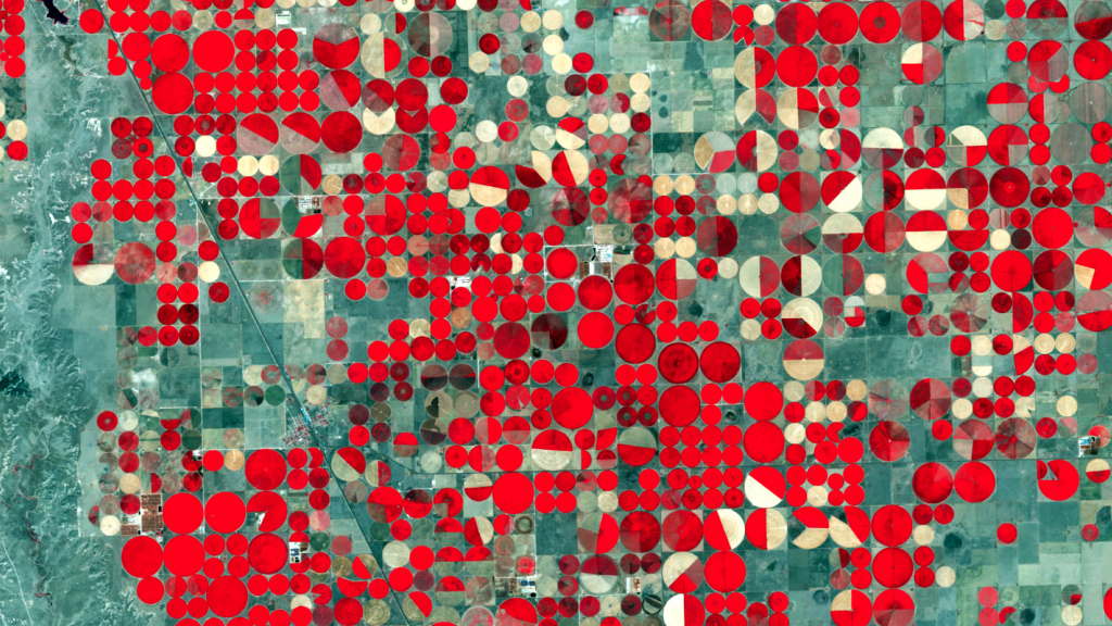
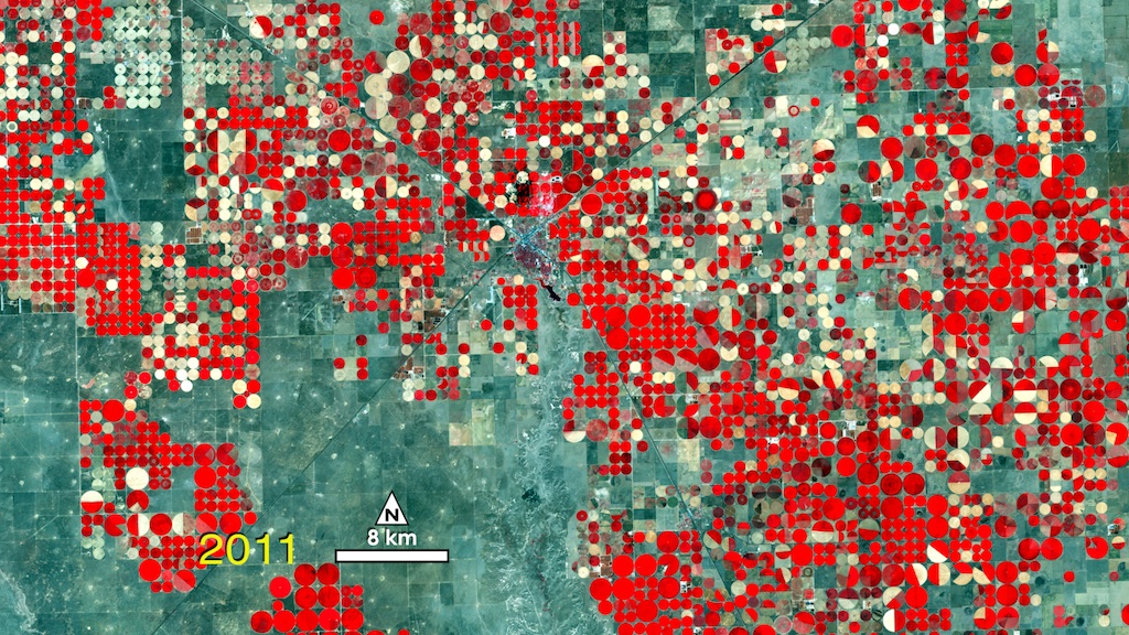
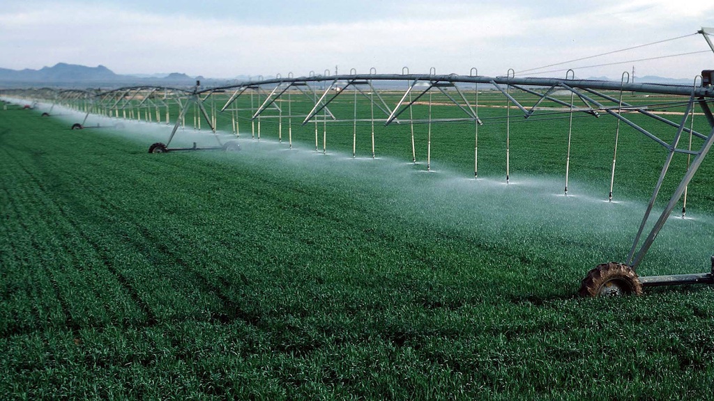
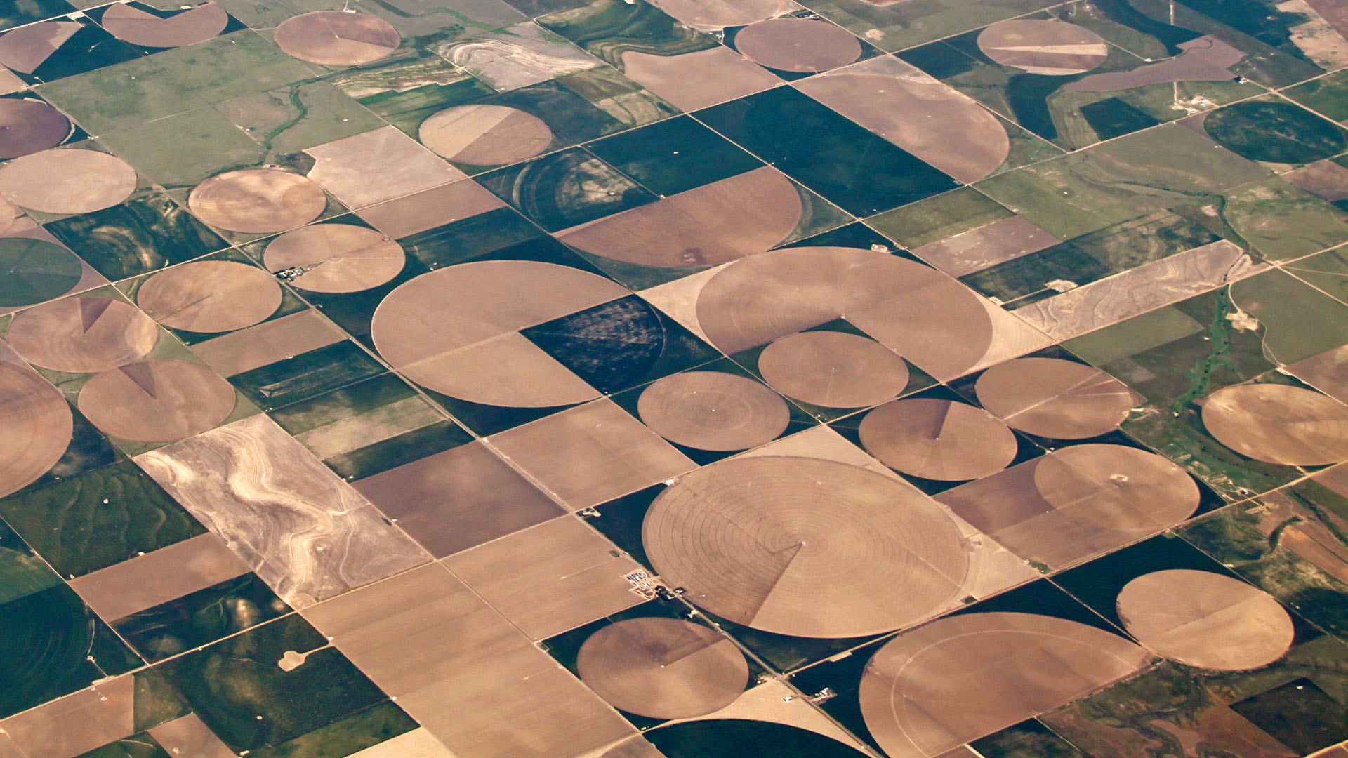
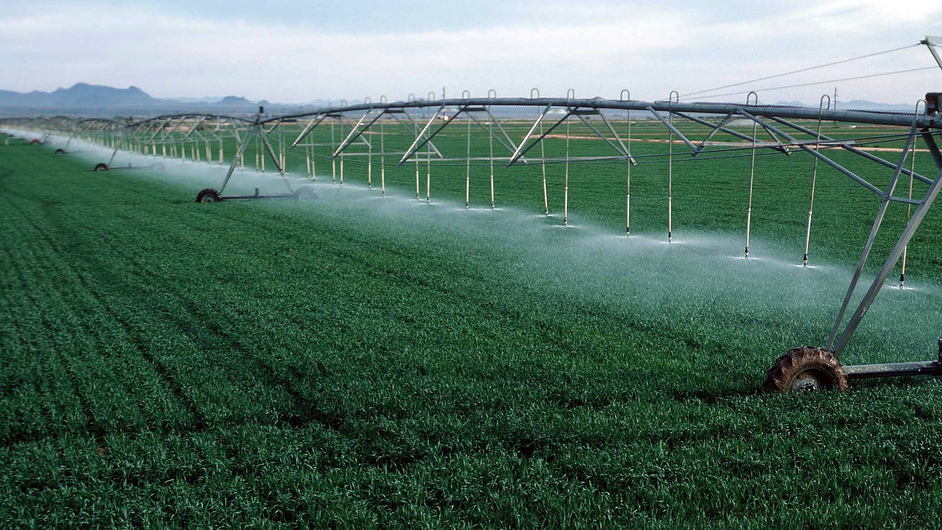
In the fields of the dry Texas panhandle, near the town of Dalhart, the traditional patchwork of working farms has been replaced by polka dots. This geometric transformation was sparked by a farming method called center-pivot irrigation, which pumps water through an extended sprinkler system that rotates like the hand of a clock, necessitating circular fields. Farmers around Dalhart have gradually adopted center-pivot irrigation since its introduction in 1949; it is ideal for the region's rolling, sandy terrain and delivers water with minimal loss to evaporation. The false-color, time-lapse images below show the square-to-circle revolution, as captured by four USGS-NASA Landsat satellites from 1972 to 2011. Red areas show healthy crops, while plots ranging in color from white to green represent bare soils and sparsely vegetated grasslands.


Crop Circles
For More Information
Story Credits
Lead Visualizer/Animator:
Matthew R. Radcliff (USRA)
Producer:
Matthew R. Radcliff (USRA)
Lead Writer:
Ellen T. Gray (ADNET Systems, Inc.)
Matthew R. Radcliff (USRA)
Producer:
Matthew R. Radcliff (USRA)
Lead Writer:
Ellen T. Gray (ADNET Systems, Inc.)
Please give credit for this item to:
NASA's Goddard Space Flight Center
Aerial of the fields photo by John A. Kelley, USDA Natural Resources Conservation Service
Sprinkelrs photo by Gene Alexander, USDA Natural Resources Conservation Service
NASA's Goddard Space Flight Center
Aerial of the fields photo by John A. Kelley, USDA Natural Resources Conservation Service
Sprinkelrs photo by Gene Alexander, USDA Natural Resources Conservation Service
Short URL to share this page:
https://svs.gsfc.nasa.gov/10973
Keywords:
SVS >> App
NASA Science >> Earth
https://svs.gsfc.nasa.gov/10973
Keywords:
SVS >> App
NASA Science >> Earth


