Global High Altitude Wind Speed during Hurricane Frances (WMS)
The Earth's atmosphere exerts pressure based on the weight of the air above. Differences in pressure from place-to-place cause winds to try to flow from high pressure to low pressure regions to even out the differences, but the Earth's rotation and wind friction with the surface act to slow or divert the winds. This animation shows the high altitude wind speeds for the whole globe from September 1, 2004, through September 5, 2004, during the period of Hurricane Frances in the western Atlantic Ocean and Typhoon Songda in the western Pacific Ocean. At high altitudes, the difference between between high pressures from warm tropical air and low pressures from cold polar air try to force air from the tropics toward the poles, but the Earth's rotation diverts this flow to the east, resulting in the high velocity west-to-east jet stream flows at mid-latitudes. The circular flows from Frances and Songda can barely be seen at this altitude.
Global winds at 200 hPa geopotential height from the 0.25 degree resolution fvGCM atmospheric model for the period 9/1/2005 through 9/5/2005.
This product is available through our Web Map Service.
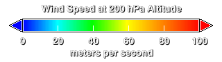
Legend for the high altitude wind speed.
Credits
Please give credit for this item to:
NASA/Goddard Space Flight Center Scientific Visualization Studio
-
Animator
- Horace Mitchell (NASA/GSFC)
-
Scientist
- William Putman (NASA/GSFC)
Release date
This page was originally published on Thursday, July 28, 2005.
This page was last updated on Sunday, November 12, 2023 at 10:00 PM EST.
Datasets used in this visualization
-
Global High Altitude Wind Speed [fvGCM]
ID: 386
Note: While we identify the data sets used in these visualizations, we do not store any further details, nor the data sets themselves on our site.