MOLA Images of the South Pole and Polar Lander Site
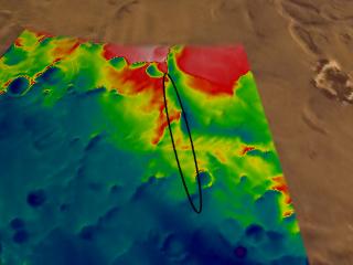
Several of the following visualizations show false-colored renderings of
the topography in the
vicinity of the Lander site. Blue tones represent elevations of less
than 2 kilometers, while reddish tones are greater than about 2.8 km,
relative to the mean equatorial height of Mars. The elevation of the
landing site is about 2.4 km, midway into the polar layered terrain.
The 400 meters (1/4 mile) resolution of the MOLA data gives a smoothed
but vertically exaggerated view of the topography. At this scale it is
impossible to ascertain the actual roughness at the lander's
destination, forcing project directors to make their best guesses based
on available data.
Read More about NASA's Mission to Mars at the
Polar Lander Web Site
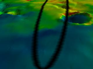
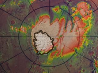
On this image, the ellipse appears within a false color image produced
by the MOLA instrument on board Mars Global Surveyor; it is the probable
landing corridor for the Mars Polar Lander. The blue hues represent
elevations lower than 2 km while red hues are higher than 2.8 km. The
landing target elevation is approx 2.4 km relative to the mean height of
the equator.
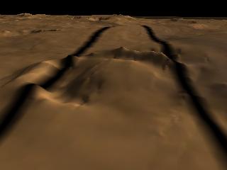
This image shows Viking data of the landing corridor draped over the
terrain. The landing corridor is approximately 225 km long. The
topography in these images is vertically exaggerated.
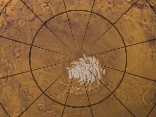
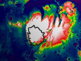
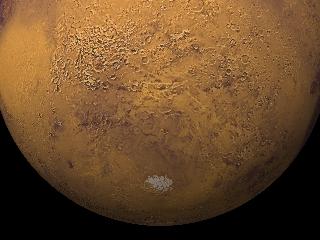
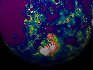
Notice how the southern polar cap appears slightly off to the side of
the actual planetary pole. Theories for this include the possibility
that much of the frozen cap is simply covered by dust, and therefore not
easily visible.
In the second and third images above, the cap appears outlined in
black. The accompanying false color data shows the topographically
inferred extent of the polar layered terrain.
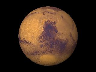
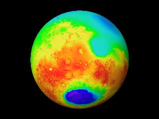
These two images are intended to highlight features in the southern
hemisphere. The first image was created from Viking images. The second,
false color, image came from MOLA data. Here the color scale shows the
darkest blues as roughly 8 km below the mean equatorial height, while
reds indicate elevations up to 5 km above the mean equatorial height.
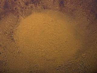
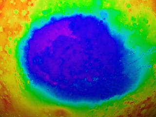
These two images show the Hellas Impact Basin, a crater so large that
Earth's Mt. Everest could just about fit vertically in the bowl. South
of Hellas there's a relatively crater free area on the surface. Experts
say it's possible that this region was resurfaced by polar glaciation in
early Martian history.
South of the Hellas Impact Basis, note the relatively crater free area,
possibly resurfaced by polar glaciation in early Martian history.
This second pair of images focusing on the southern hemisphere
were generated first from Viking data and then with MOLA data. They
highlight the differences in elevation between the Hellas Impact Basin
and surrounding terrain. The deepest point in Hellas is roughly 8200
meters below the equatorial mean.
Read more about MOLA