Berkeley and Richmond, California
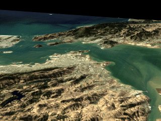
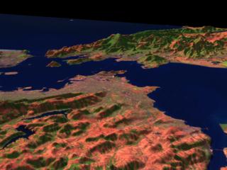
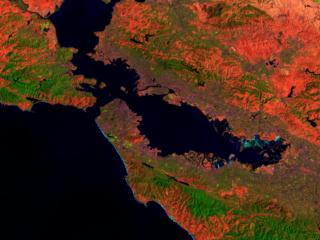
These scenes shows Landsat Thematic Mapper data of the cities of Richmond and Berkely, as well as the San Francisco Bay Area. The first image, which is predominately brown in color, is a "natural color" image which uses the Thematic Mapper bands 3, 2, and 1 displayed as red, green, and blue respectively. This yields a color scheme approximately the same as those seen by the human eye. The other two scenes use data from the infrared portions of the electromagnetic spectrum to maximize the range of wavelengths shown. These images use the shortwave infrared (TM band 5), infrared (TM band 4), and visible green (TM band 2) channels. Digital elevation data was used in the two city scenes to create three dimensional terrain, which is vertically exaggerated by a factor of three to show the relief of the land. The city to the left between the bay and the hills is Berkeley, while the city to its right in the center of the image is Richmond. The Richmond Bridge spans the northern half of the San Francisco Bay, connecting Richmond with San Rafael. The dark green covered hills in the background are the redwood forests of Marin County, with the highest peak being Mt. Tamalpais. San Francisco, Angel Island, Tiburon,and the Golden Gate are all visible on the far side of the bay. The strong brown/grey tone of the natural colour image is a result of the data being taken during the early autumn when ground cover is very dry and the land tends to appear somewhat barren. In the TM 542 scenes, barren exposed land appears red to pink, vegetation appears green, and water is dark blue.
Technical notes:
|
||||