|
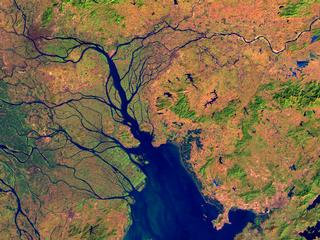
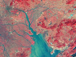
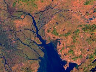
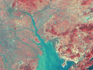
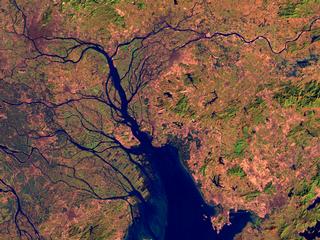
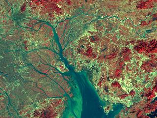
These scenes show the Pearl River Delta in South China as seen by the
Landsat Thematic Mapper (TM) instrument. This area, which is just north
of Hong Kong, includes a number of regions which have experienced very rapid
urban growth and industrialization under government programs to encourage
economic growth. Among the more prominent changes in these
scenes (spanning from 1988 to 1995) are land reclamation from the sea and
river delta to add physical land for agriculture, fish farming, and urban
construction, as well as explosive growth of new communities. One of the
areas of most dramatic areas of change is the Shenzhen Special Economic
Zone which appears in the southeast (lower right) corner of these
images.
In the TM 542 images, the shortwave infrared (TM band 5), infrared (TM
band 4), and visible green (TM band 2) channels are displayed in the images
as red, green, and blue respectively. This combination includes a wide range
of the Landsat TM spectral sensivity combined into a single image. In this
combination, barren and/or recently cleared land ready for construction
appears red to pink, vegetation appears green, water is dark blue, and
artificial structures of concrete and asphalt appear dark grey or black.
In the TM 432 images, infrared (TM band 4) is red, visible red (TM band 3)
is displayed as green, and visible green (TM band 2) is displayed as blue.
This scheme has a very similar appearance to color infrared photography and
is occasionally referred to as "false color infrared". In this TM
band combination, vegetation and urbanization stand out starkly from each
other. The red tones are from vegetation which reflects strongly in the
infrared, while grey is concrete and artificial structures such as roads.
|