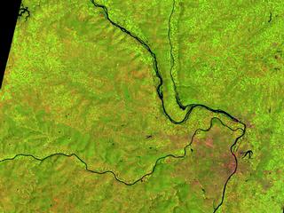
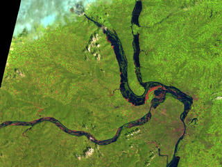
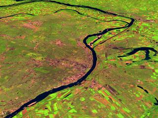
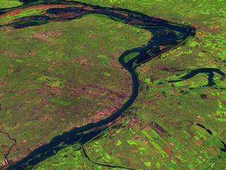
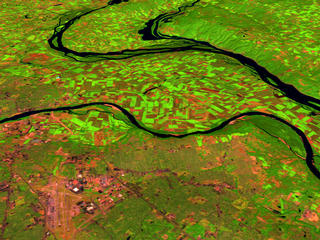
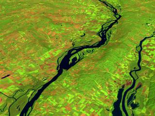
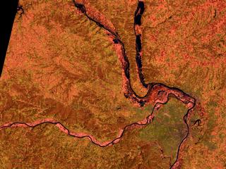
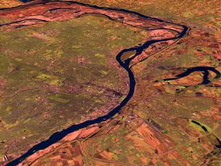
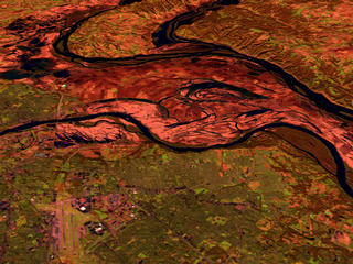
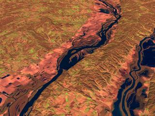
Mississippi River Flooding in 1993
These scenes show various sections of the Mississippi River near St. Louis
before and just after the 1993 floods which peaked in late July/early August.
The images show the area as seen by the Landsat Thematic
Mapper (TM) instrument. The shortwave infrared (TM band 5), infrared (TM
band 4), and visible green (TM band 2) channels are displayed in the images
as red, green, and blue respectively. In this combination, barren and/or
recently cultivated land appears red to pink, vegetation appears green,
water is dark blue, and artificial structures of concrete and asphalt appear
dark grey or black. Reddish areas in the during flood scenes show where
water had started to recede, leaving barren land.
The water has not completely receeded back to its banks even two months
after the peak of the floods. The very different land color tone (green in
August 1991 and red/pink in November 1993) reflects the dramatic difference
in seasons rather than changes due to the flood. By November, trees have
lost their leaves and ground cover and farm fields are lying fallow for
the winter.
Technical notes:
Rendered: April 1999
Data source: Landsat 5 Thematic Mapper; USGS 3-arcsecond DTED
Data date: 14 August 1991; 14 August 1993; 7 November 1993
For: The Landsat Project Team and Goddard Public Affairs Office
|

