Skip all navigation and jump to content Jump to site navigation Jump to section navigation.
NASA Logo - Goddard Space Flight Center + Visit NASA.gov
HOME PROJECTS RESOURCES SEARCH MAP

+ Advanced Search
Home
Home
View Most Recently Released Imagery
View Gallery of Imagery: A topical collection of SVS Imagery
Search Imagery by the keywords assigned to it
Search Imagery by the instruments that supplied data for a visualization product
Search Imagery by the series of visualizations that have been produced
Search Imagery by the scientist providing the data used in a visualization product
Search Imagery by the animator that created the product
Search Imagery by the identification number assigned to the visualization product
See other search options
Learn about the SVS Image Server
  + About the Server
  + Animation List
  + How to Use the Server
blank image

SVS1999-0007


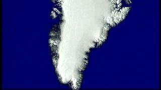
Title: Greenland Ice Changes
Abstract: Using the data taken from a Laser Altimeter, animations show the elevation changes of Greenland.
Metadata date: 2008-09-06
Producer: Wade Sisler
Trt: 00:10:35:23
Audio: No Audio
Movie ID Title Start
Time Code
Stop
Time Code
Airplane collecting ice thickness data over Greenland 580 
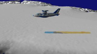
Greenland: Airplane Animation Revealing Ice Change 1:00:08:21  -   1:01:59:18
Animation of flight paths over Greenland showing ice thickness change data from the Airborne Topographic Mapper 581 
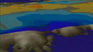
Greenland: Raw Data Flight Paths Showing Ice Change 1:01:59:21  -   1:02:45:25
One flight path over Greenland, colored using ice thickness change data from the Airborne Topographic Mapper 582 
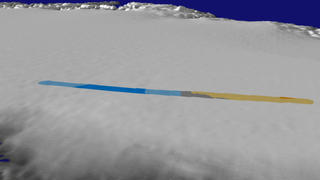
Greenland: Single Flight Path Showing Ice Change 1:02:48:21  -   1:03:55:17
Flight paths showing ice thickness changes as measured by the Airborne Topographic Mapper 583 
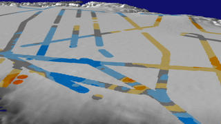
Greenland: Multiple Flight Paths Showing Ice Change 1:04:00:21  -   1:05:06:27
A pan around Greenland showing changes in ice thickness from 1993-1994 to 1998-1999 as measured by the Airborne Topographic Mapper 584 
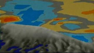
Greenland: Ice Change 1:05:11:21  -   1:06:53:27
Zoom-down to Greenland's east coast 585 Greenland: East Coast Zoom-down without Ice Data 1:06:58:21  -   1:07:50:03
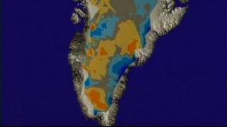
Zoom-down to the east coast of Greenland showing changes in ice thickness from 1993-1994 to 1998-1999 as measured by the Airborne Topographic Mapper 586 Greenland: East Coast Zoom-down with Ice Data 1:07:54:21  -   1:08:49:06
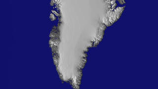
Greenland without ice change data 587 Greenland: East Coast Zoom-out without Ice Data 1:08:53:21  -   1:09:45:14
Zoom-out from the east coast of Greenland showing changes in ice thickness from 1993-1994 to 1998-1999 as measured by the Airborne Topographic Mapper 588 Greenland: East Coast Zoom-out with Ice Data 1:09:49:21  -   1:10:44:14

*Please note: the SVS does not fulfill requests for copies of the tapes in our library. On some of our animation pages, there is a direct link to a video distribution service from which tapes, handled by the Public Affairs Office (PAO)/Goddard TV, including some of our animations may be ordered. General information on this service can be found here.


USA.gov logo - the U.S. Government's official Web portal. + Privacy Policy and Important Notices
+ Reproduction Guidelines
NASA NASA Official:
SVS Contact:
Curator: