Previous Tape   Next Tape

Goddard TV Video Tape: G2013-009 -- LDCM Launch Press


Movie

Title

animation of increase in pivot-irrigated fields in the desert in northwestern Saudi Arabia, as seen by Landsat satellites from 1987-2012.  This image is in false-color, comprised of shortwave infrared, near infrared, and green wavelength signals.  Healthy vegetation shows as bright green. 
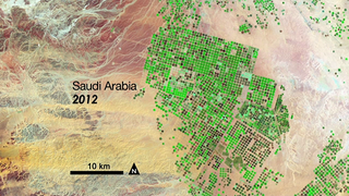
Pivot Irrigation in Saudi Arabia
Video of launch of the Landsat Data Continuity Mission (LDCM) observatory on February 11, 2013, from Vandenberg Air Force Base, riding on an Atlas V-401 rocket. 
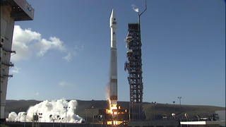
Landsat 8 Launch footage
The Landsat Data Continuity Mission (LDCM) is a collaboration between NASA and the U.S. Geological Survey that will continue the Landsat Program's 40-year data record of monitoring Earth's landscapes from space. LDCM will expand and improve on that record with observations that advance a wide range of Earth sciences and contribute to the management of agriculture, water and forest resources.   For complete transcript, click  here . 
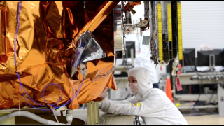
Landsat 8 Video File