Earth
ID: 4492
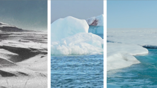
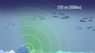
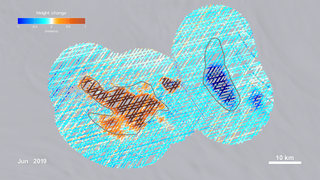
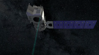
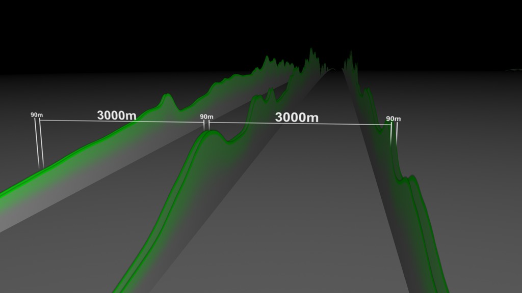
The ATLAS lidar on ICESat-2 uses 6 laser beams to measure the earth’s elevation and elevation change. As a global mission, ICESat-2 will collect data over the entire globe, however the ATLAS instrument is optimized to measure land ice and sea ice elevation in the polar regions. ICESat-2 reports elevations with respect to a reference surface, called an ellipsoid. In this measurement system, shared by GPS devices, an elevation of zero meters indicates the notional sea level, although tides, wind, and waves can make the actual sea level either greater than or less than zero. The Antarctic ice sheet, shown here, ranges up to 4000m above sea level. Over the course of 91 days, ATLAS will generate 1387 ground tracks across Antarctica for each of it’s 6 beams.
ICESat-2 Measurements Over Antarctica (prelaunch)
Used Elsewhere In


Related
Visualization Credits
Greg Shirah (NASA/GSFC): Lead Visualizer
Ryan Fitzgibbons (USRA): Lead Producer
Thorsten Markus (NASA/GSFC): Lead Scientist
Ryan Fitzgibbons (USRA): Lead Producer
Thorsten Markus (NASA/GSFC): Lead Scientist
Please give credit for this item to:
NASA's Scientific Visualization Studio
NASA's Scientific Visualization Studio
Short URL to share this page:
https://svs.gsfc.nasa.gov/4492
Data Used:
Note: While we identify the data sets used in these visualizations, we do not store any further details nor the data sets themselves on our site.
This item is part of this series:
ICESat
Keywords:
DLESE >> Cryology
SVS >> Laser Altimeter
GCMD >> Earth Science >> Cryosphere
SVS >> Hyperwall
NASA Science >> Earth
SVS >> ICESat-2
GCMD keywords can be found on the Internet with the following citation: Olsen, L.M., G. Major, K. Shein, J. Scialdone, S. Ritz, T. Stevens, M. Morahan, A. Aleman, R. Vogel, S. Leicester, H. Weir, M. Meaux, S. Grebas, C.Solomon, M. Holland, T. Northcutt, R. A. Restrepo, R. Bilodeau, 2013. NASA/Global Change Master Directory (GCMD) Earth Science Keywords. Version 8.0.0.0.0
https://svs.gsfc.nasa.gov/4492
Data Used:
also referred to as: KML Icesat2 Satellite Paths
NASA/GSFC
Test satellite paths over Antarctica in KML form.
This item is part of this series:
ICESat
Keywords:
DLESE >> Cryology
SVS >> Laser Altimeter
GCMD >> Earth Science >> Cryosphere
SVS >> Hyperwall
NASA Science >> Earth
SVS >> ICESat-2
GCMD keywords can be found on the Internet with the following citation: Olsen, L.M., G. Major, K. Shein, J. Scialdone, S. Ritz, T. Stevens, M. Morahan, A. Aleman, R. Vogel, S. Leicester, H. Weir, M. Meaux, S. Grebas, C.Solomon, M. Holland, T. Northcutt, R. A. Restrepo, R. Bilodeau, 2013. NASA/Global Change Master Directory (GCMD) Earth Science Keywords. Version 8.0.0.0.0


