Planets and Moons
ID: 4340
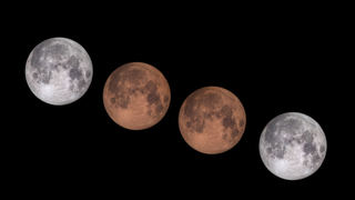
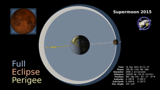
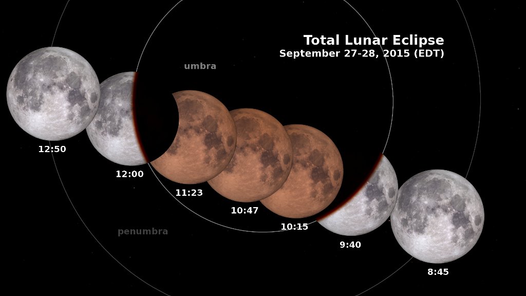
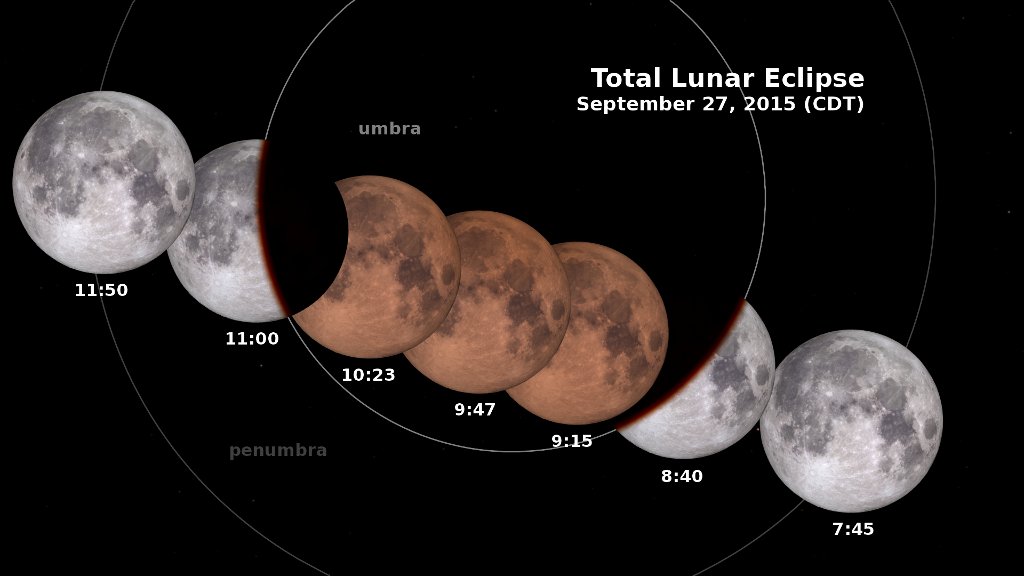
On the evening of September 27, 2015 in the Americas (early morning on September 28 in Europe and most of Africa), the Moon enters the Earth’s shadow, creating a total lunar eclipse, the last of four visible in the Western Hemisphere in a span of 18 months. This animation shows the changing appearance of the Moon as it travels into and out of the Earth’s shadow, along with the times at various stages. Versions of the animation have been created for each of the four time zones of the contiguous United States, as well as one for Universal Time.
All of South America and most of North and Central America will see the entire eclipse, while those west of roughly 120°W will see it in progress at moonrise. You won’t need special equipment to see it. Just go outside and look up!
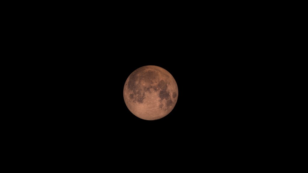
The penumbra is the part of the Earth’s shadow where the Sun is only partially covered by the Earth. The umbra is where the Sun is completely hidden. The Moon's appearance isn't affected much by the penumbra. The real action begins when the Moon starts to disappear as it enters the umbra at about 9:07 Eastern Daylight Time. An hour later, entirely within the umbra, the Moon is a ghostly copper color, and this lasts for over an hour before the Moon begins to emerge from the central shadow.
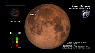
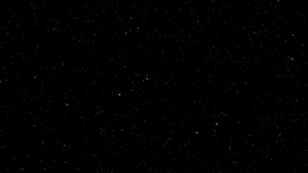
The view in these animations is geocentric. Because of parallax, the Moon's position against the background stars will look a bit different for observers at different locations on the surface of the Earth. The Moon is in the southwestern part of the constellation Pisces.
September 27, 2015 Total Lunar Eclipse: Shadow View
All of South America and most of North and Central America will see the entire eclipse, while those west of roughly 120°W will see it in progress at moonrise. You won’t need special equipment to see it. Just go outside and look up!
The penumbra is the part of the Earth’s shadow where the Sun is only partially covered by the Earth. The umbra is where the Sun is completely hidden. The Moon's appearance isn't affected much by the penumbra. The real action begins when the Moon starts to disappear as it enters the umbra at about 9:07 Eastern Daylight Time. An hour later, entirely within the umbra, the Moon is a ghostly copper color, and this lasts for over an hour before the Moon begins to emerge from the central shadow.
The view in these animations is geocentric. Because of parallax, the Moon's position against the background stars will look a bit different for observers at different locations on the surface of the Earth. The Moon is in the southwestern part of the constellation Pisces.
Related
For More Information
Visualization Credits
Ernie Wright (USRA): Lead Visualizer
David Ladd (USRA): Producer
Michelle Handleman (USRA): Producer
John Keller (NASA/GSFC): Scientist
Noah Petro (NASA/GSFC): Scientist
David Ladd (USRA): Producer
Michelle Handleman (USRA): Producer
John Keller (NASA/GSFC): Scientist
Noah Petro (NASA/GSFC): Scientist
Please give credit for this item to:
NASA's Scientific Visualization Studio
NASA's Scientific Visualization Studio
Short URL to share this page:
https://svs.gsfc.nasa.gov/4340
Mission:
LRO (Lunar Reconnaissance Orbiter)
Data Used:
Note: While we identify the data sets used in these visualizations, we do not store any further details nor the data sets themselves on our site.
This item is part of these series:
The Moon
LRO - Animations
Keywords:
SVS >> HDTV
SVS >> Lunar
SVS >> Moon
SVS >> Hyperwall
SVS >> LRO
SVS >> Lunar Reconnaissance Orbiter
SVS >> Eclipse
SVS >> Lunar Eclipse
NASA Science >> Planets and Moons
SVS >> Presentation
https://svs.gsfc.nasa.gov/4340
Mission:
LRO (Lunar Reconnaissance Orbiter)
Data Used:
LRO/LOLA/Digital Elevation Map also referred to as: DEM
JPL DE421 also referred to as: DE421
Ephemeris - NASA/JPL
Planetary ephemerides
LRO/LROC/WAC 643nm High Sun Global Mosaic
MosaicThis item is part of these series:
The Moon
LRO - Animations
Keywords:
SVS >> HDTV
SVS >> Lunar
SVS >> Moon
SVS >> Hyperwall
SVS >> LRO
SVS >> Lunar Reconnaissance Orbiter
SVS >> Eclipse
SVS >> Lunar Eclipse
NASA Science >> Planets and Moons
SVS >> Presentation


