Earth
ID: 4273
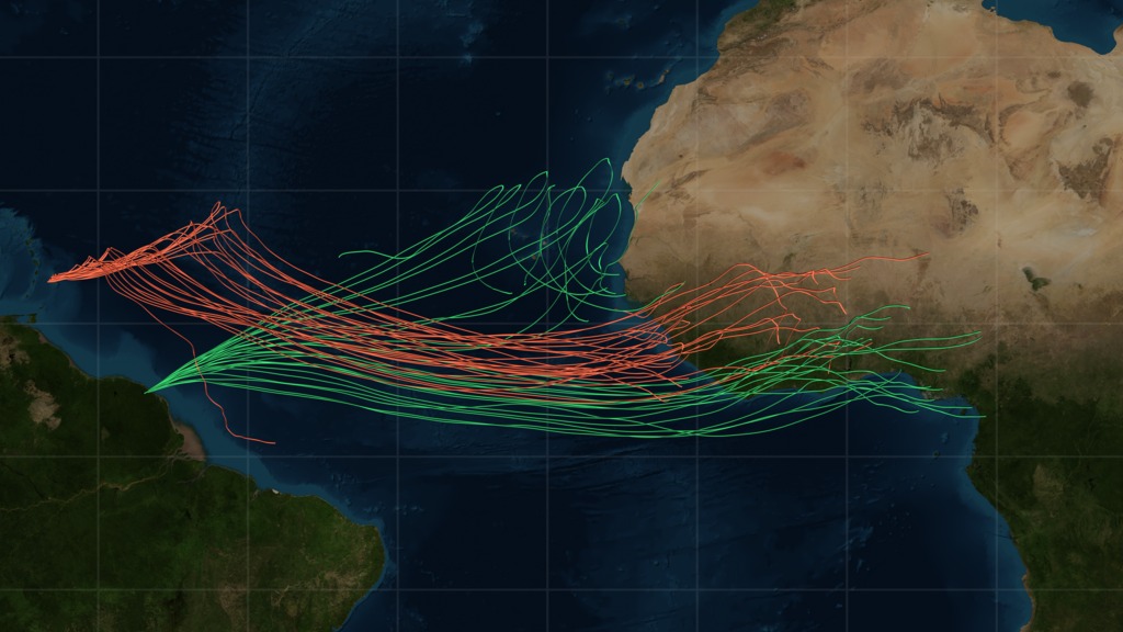
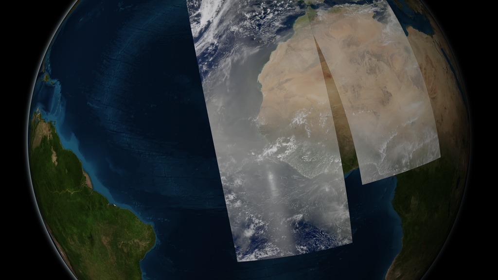
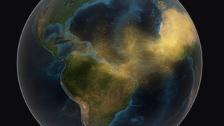
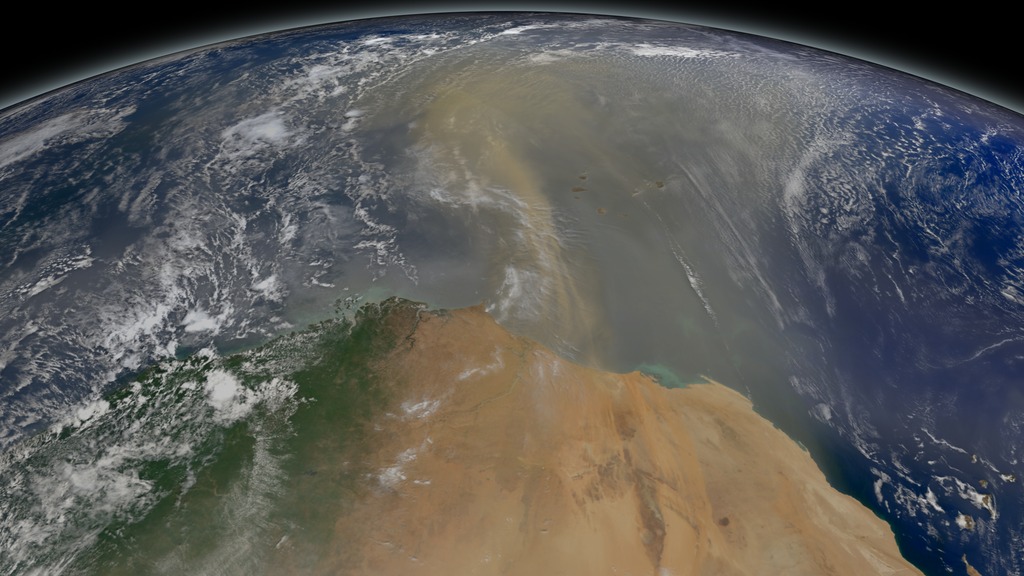
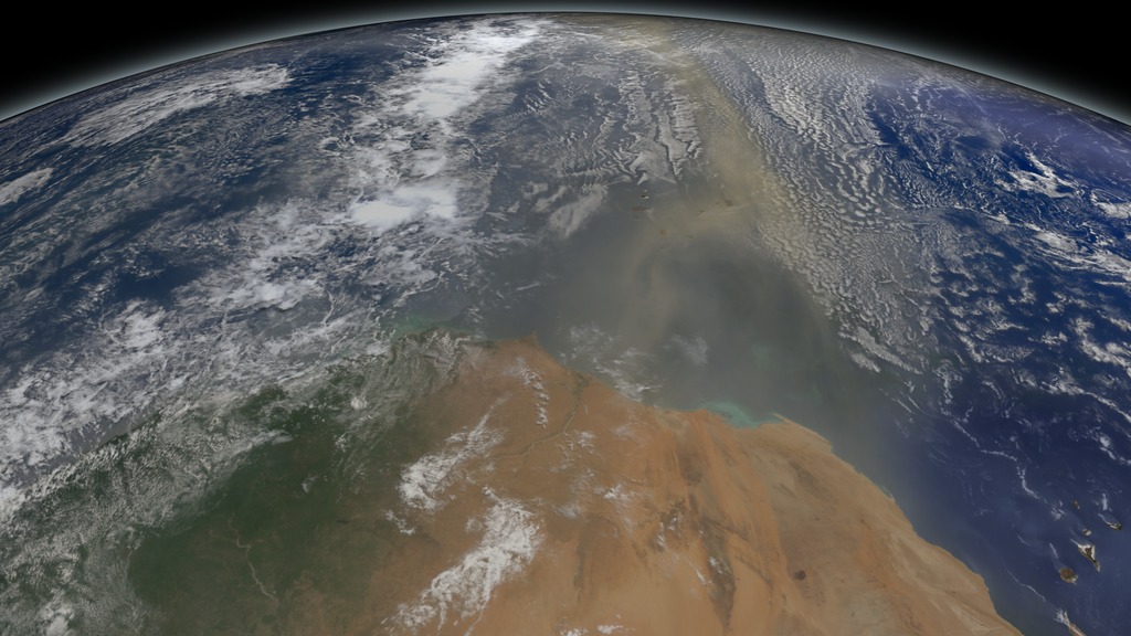
For the first time, a NASA satellite has quantified in three dimensions how much dust makes the trans-Atlantic journey from the Sahara Desert the Amazon rainforest. Among this dust is phosphorus, an essential nutrient that acts like a fertilizer, which the Amazon depends on in order to flourish.
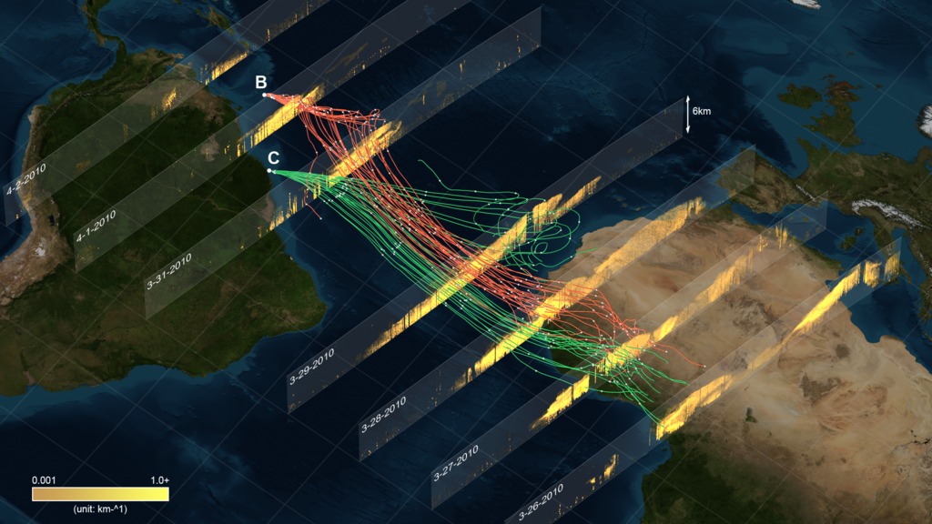
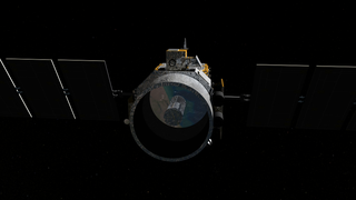
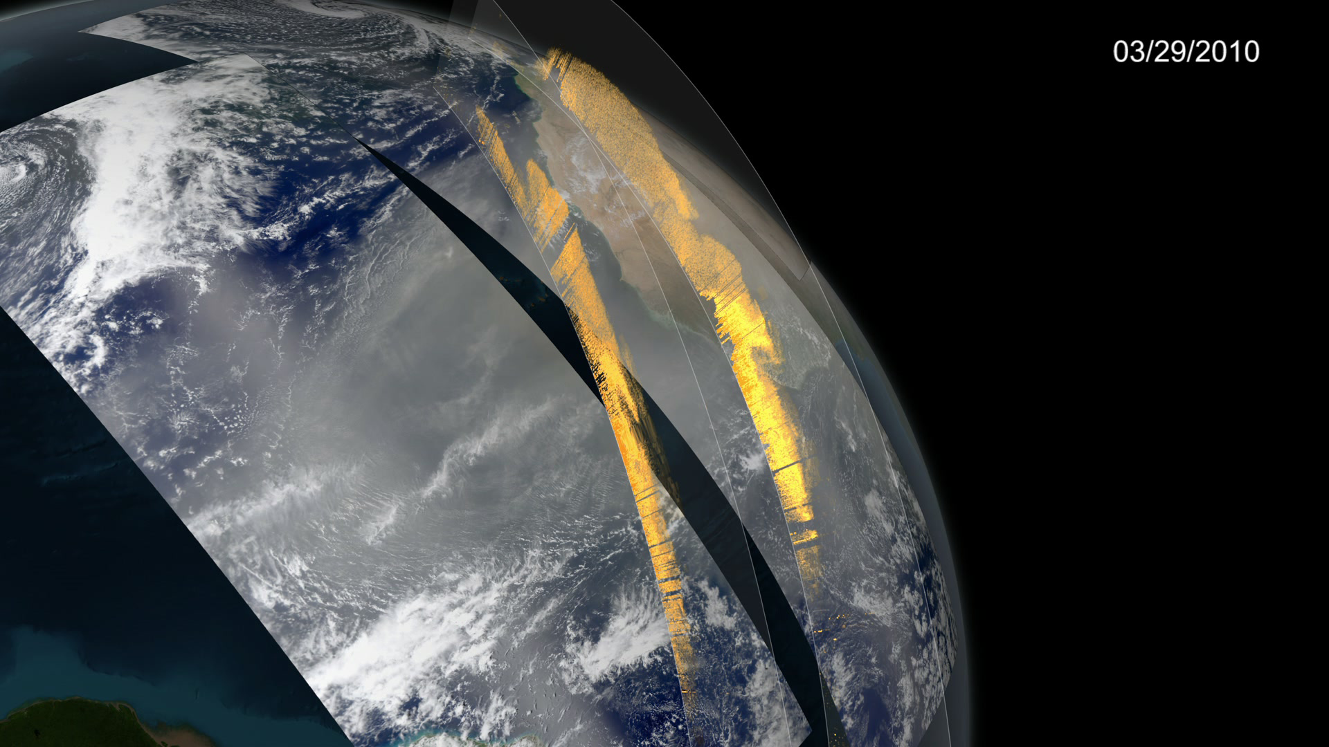
The new dust transport estimates were derived from data collected by a lidar instrument on NASA's Cloud-Aerosol Lidar and Infrared Pathfinder Satellite Observation, or CALIPSO, satellite from 2007 though 2013.
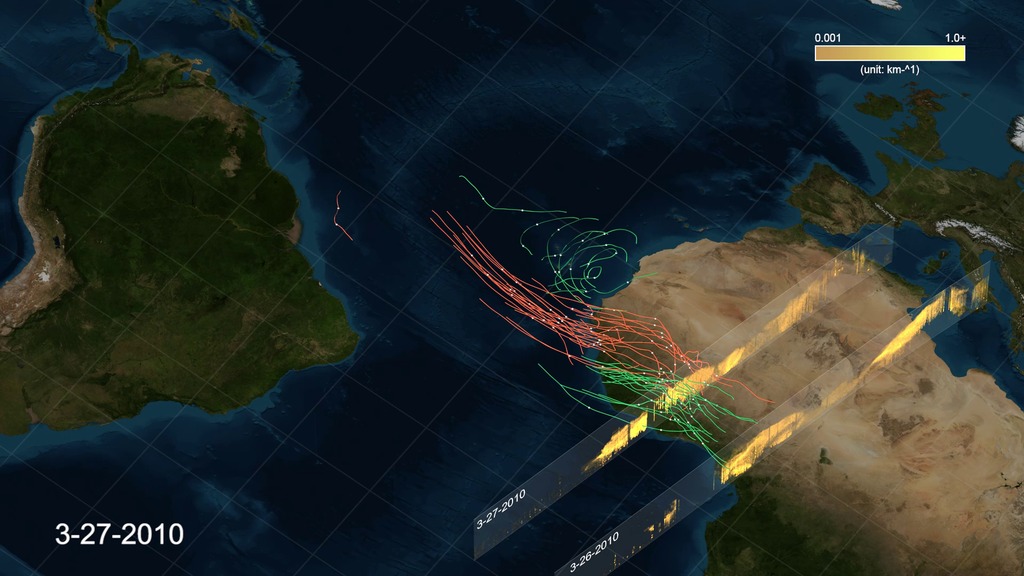
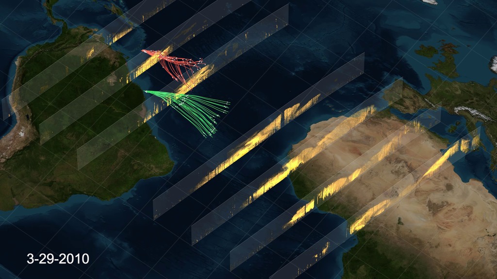
The data show that wind and weather pick up on average 182 million tons of dust each year and carry it past the western edge of the Sahara at longitude 15W. This volume is the equivalent of 689,290 semi trucks filled with dust. The dust then travels 1,600 miles across the Atlantic Ocean, though some drops to the surface or is flushed from the sky by rain. Near the eastern coast of South America, at longitude 35W, 132 million tons remain in the air, and 27.7 million tons – enough to fill 104,908 semi trucks – fall to the surface over the Amazon basin. About 43 million tons of dust travel farther to settle out over the Caribbean Sea, past longitude 75W.
Dust collected from the Bodélé Depression and from ground stations on Barbados and in Miami give scientists an estimate of the proportion of phosphorus in Saharan dust. This estimate is used to calculate how much phosphorus gets deposited in the Amazon basin from this dust transport, an estimated 22,000 tons per year.
The finding is part of a bigger research effort to understand the role of dust and aerosols in the environment and on local and global climate.
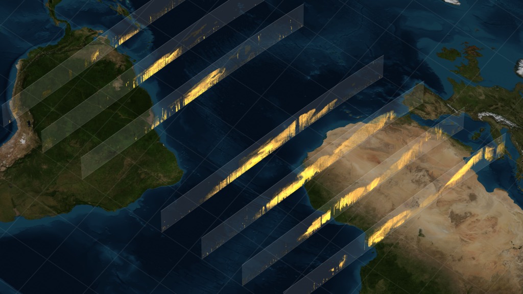
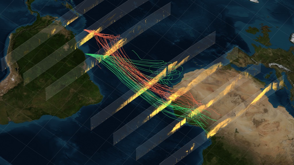

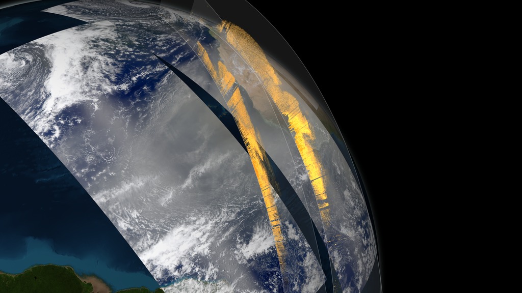
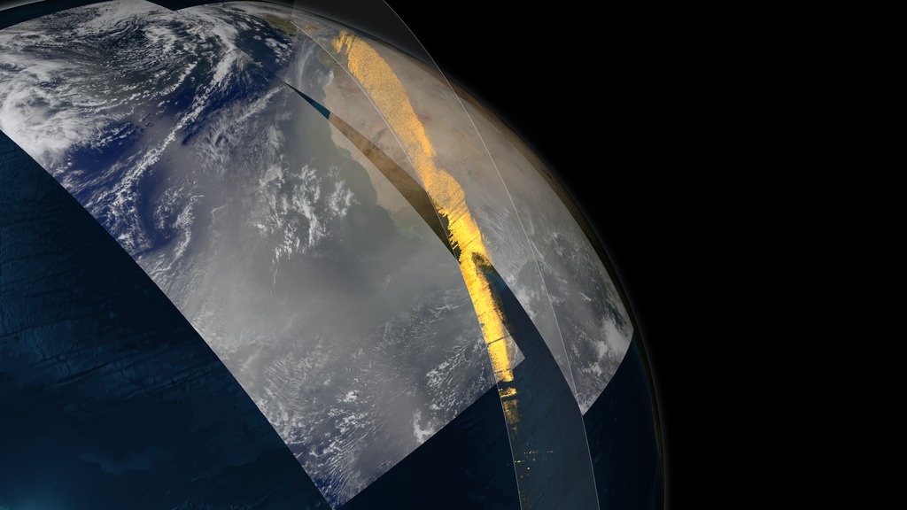
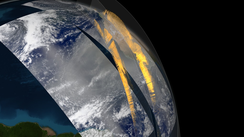
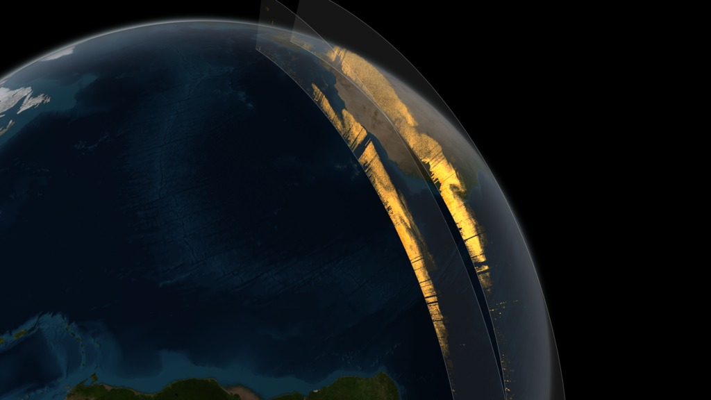
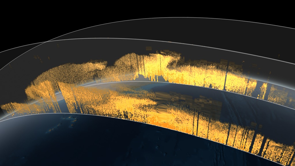
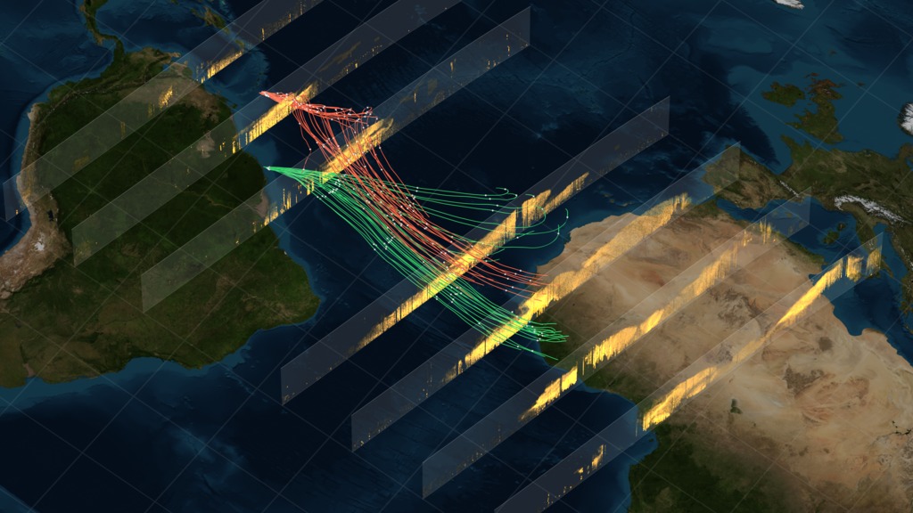
CALIPSO observes Saharan dust crossing the Atlantic Ocean
The new dust transport estimates were derived from data collected by a lidar instrument on NASA's Cloud-Aerosol Lidar and Infrared Pathfinder Satellite Observation, or CALIPSO, satellite from 2007 though 2013.
The data show that wind and weather pick up on average 182 million tons of dust each year and carry it past the western edge of the Sahara at longitude 15W. This volume is the equivalent of 689,290 semi trucks filled with dust. The dust then travels 1,600 miles across the Atlantic Ocean, though some drops to the surface or is flushed from the sky by rain. Near the eastern coast of South America, at longitude 35W, 132 million tons remain in the air, and 27.7 million tons – enough to fill 104,908 semi trucks – fall to the surface over the Amazon basin. About 43 million tons of dust travel farther to settle out over the Caribbean Sea, past longitude 75W.
Dust collected from the Bodélé Depression and from ground stations on Barbados and in Miami give scientists an estimate of the proportion of phosphorus in Saharan dust. This estimate is used to calculate how much phosphorus gets deposited in the Amazon basin from this dust transport, an estimated 22,000 tons per year.
The finding is part of a bigger research effort to understand the role of dust and aerosols in the environment and on local and global climate.
Used Elsewhere In
Related


For More Information
Visualization Credits
Kel Elkins (USRA): Lead Animator
Greg Shirah (NASA/GSFC): Animator
Horace Mitchell (NASA/GSFC): Animator
Joy Ng (USRA): Producer
Hongbin Yu (JCET UMBC): Scientist
Ellen T. Gray (ADNET Systems, Inc.): Science Writer
Ian Jones (ADNET Systems, Inc.): Project Support
Laurence Schuler (ADNET Systems, Inc.): Project Support
Norman Kuring (NASA/GSFC): Graphics
Please give credit for this item to:
NASA's Scientific Visualization Studio
NASA's Scientific Visualization Studio
Short URL to share this page:
https://svs.gsfc.nasa.gov/4273
Mission:
CALIPSO
Data Used:
Note: While we identify the data sets used in these visualizations, we do not store any further details nor the data sets themselves on our site.
This item is part of this series:
Narrated Movies
Keywords:
SVS >> Dust Cloud
SVS >> HDTV
SVS >> Hyperwall
SVS >> Calipso
NASA Science >> Earth
NASA Earth Science Focus Areas >> Atmospheric Composition
https://svs.gsfc.nasa.gov/4273
Mission:
CALIPSO
Data Used:
CALIPSO/CALIOP
Cloud-Aerosol Lidar with Orthogonal Polarization
This item is part of this series:
Narrated Movies
Keywords:
SVS >> Dust Cloud
SVS >> HDTV
SVS >> Hyperwall
SVS >> Calipso
NASA Science >> Earth
NASA Earth Science Focus Areas >> Atmospheric Composition


