Lunar Far Side: From Luna 3 to LRO
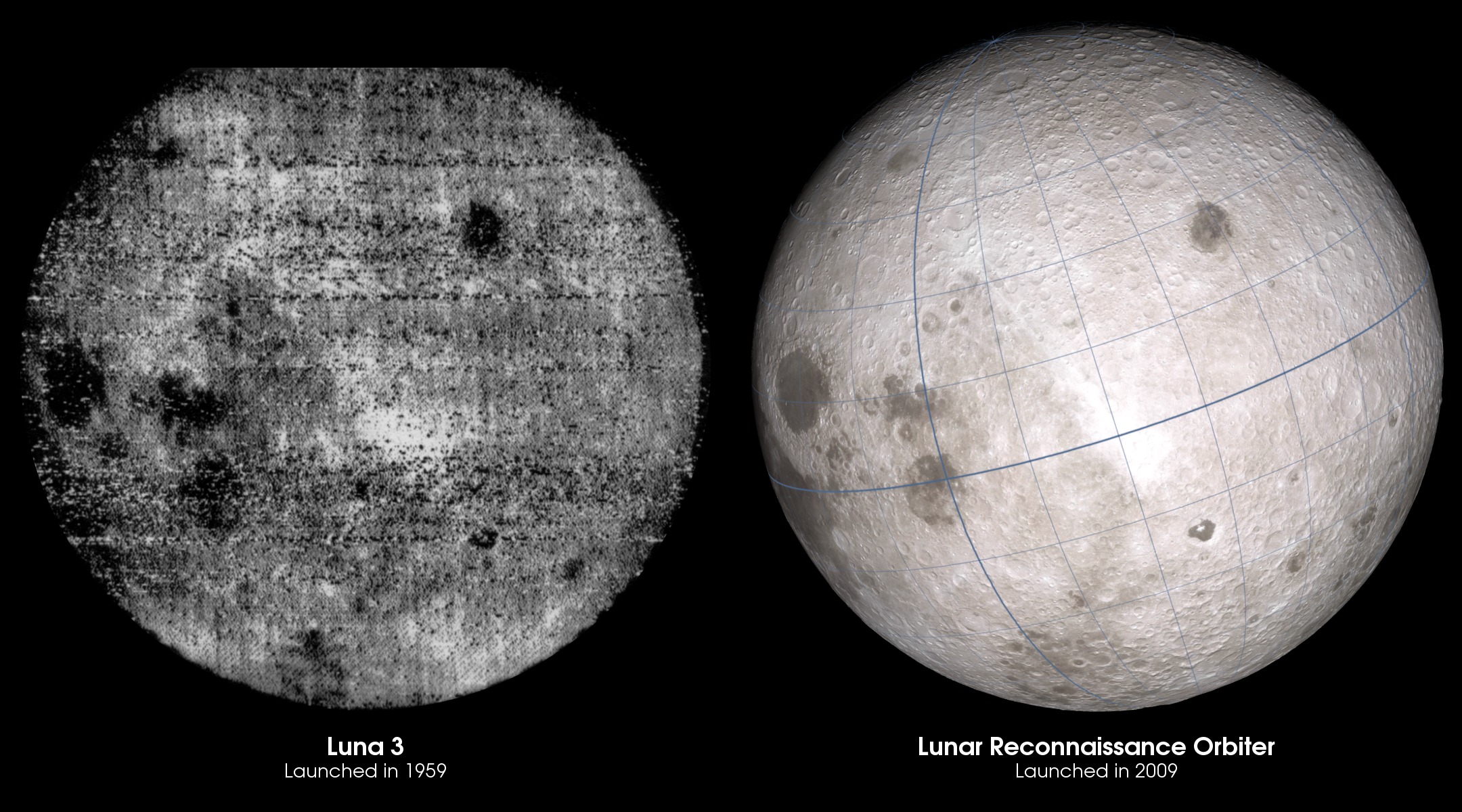
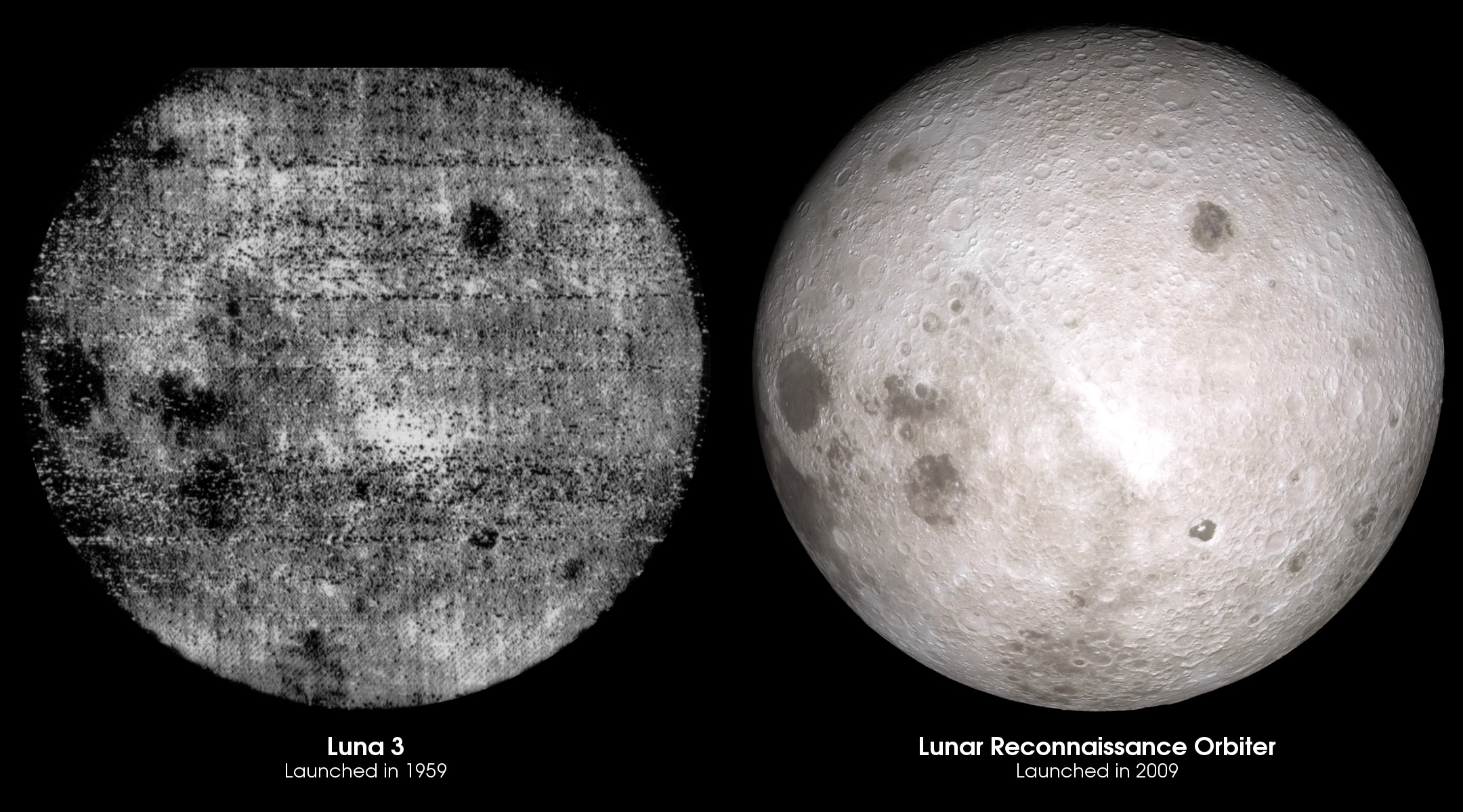
In October of 1959, the Luna 3 spacecraft launched from the Baikonur Cosmodrome in Kazakhstan. Luna 3 was the third spacecraft to reach the Moon and the first to send back pictures of the Moon's far side. The pictures were noisy and indistinct, but because the Moon always presents the same face to the Earth, they offered views of a part of the Moon that had never been seen before.
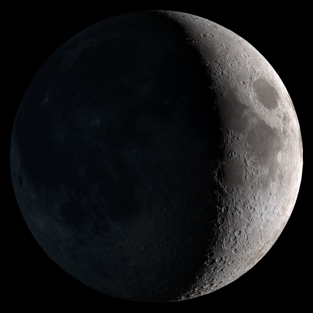
The far side of the Moon is surprisingly different. The most striking difference evident in the Luna 3 pictures is the absence of the large, dark seas of cooled lava, called maria, that cover a substantial fraction of the Earth-facing near side. The far side is instead densely peppered with impact craters of every size and age.
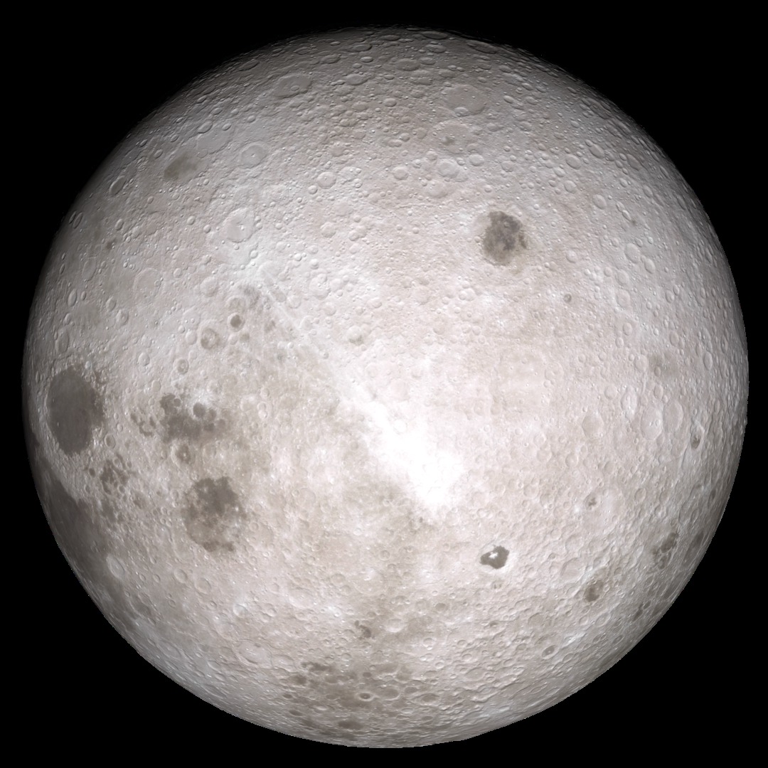
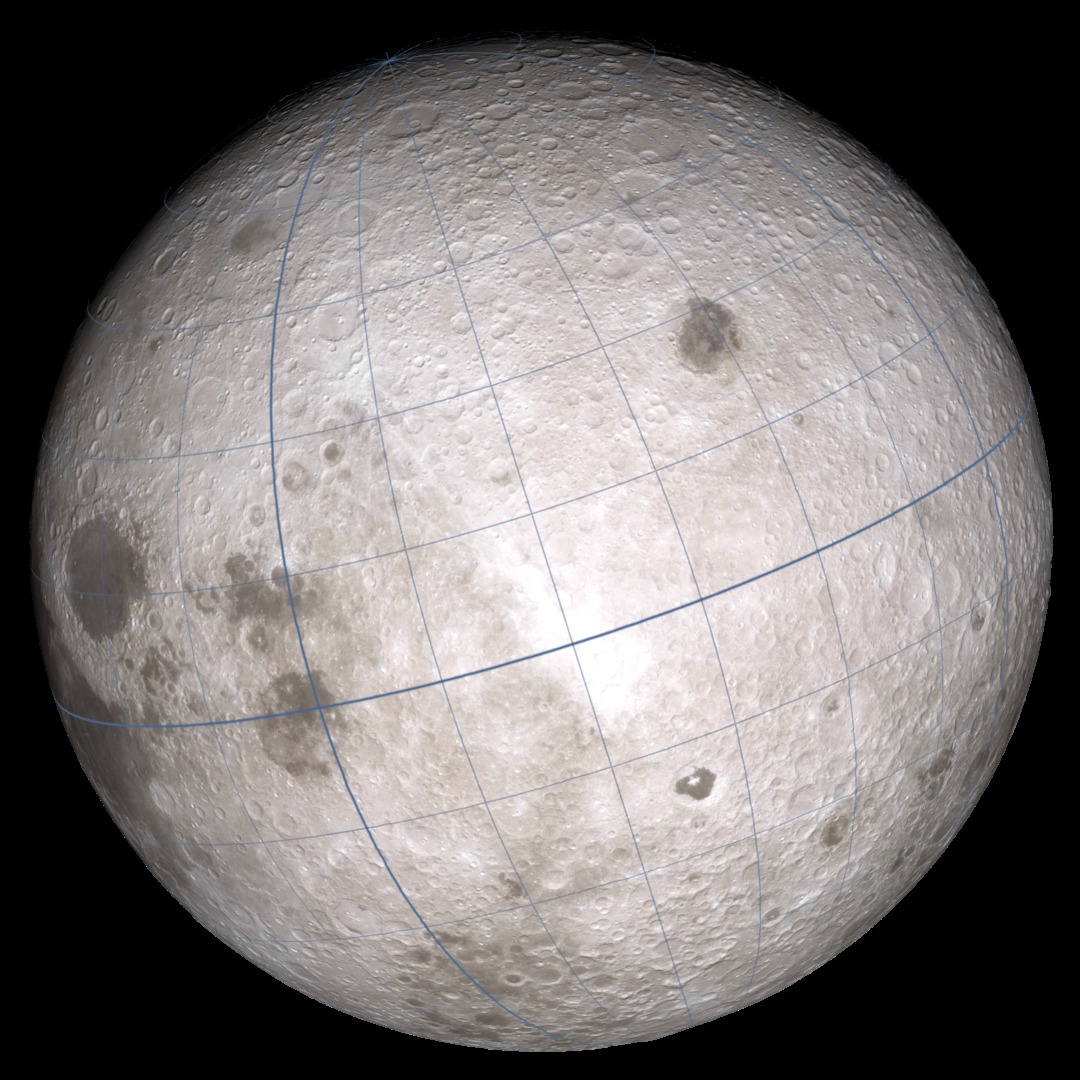
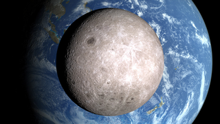
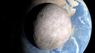
Fifty years later, in June of 2009, Lunar Reconnaissance Orbiter (LRO) launched from Kennedy Space Center in Florida. Using LRO's global elevation maps and photographic mosaics, both of which are of unprecedented quality and detail, it's possible to accurately recreate the view captured in the pictures from Luna 3. As seen here, Luna 3 was directly over 12°N 120°E at a distance of 61,700 kilometers above the surface, and its camera was banked 17.5° clockwise from vertical relative to the Moon's north pole.
The thicker blue longitude line at 90°E, along the left side of the LRO image, marks the boundary between the near and far sides of the Moon. To the left of that line are the familiar maria Crisium (the circular spot near the 9 o'clock position), Marginis, Smythii (both east of Crisium), Humboldtianum (in the north), Australe (near the south pole), and the eastern edge of Fecunditatis. The bright spot near the center of the disk is a complex of unnamed craters bordered by King, Langemak, Gregory, and Abul Wafa craters. The brightness is enhanced because it's near the subsolar point. The dark, sharp-edged shield shape in the southern hemisphere, with the white dot in the middle, is Tsiolkovskiy crater and its central peak. The dark spot to the southeast of Tsiolkovskiy is the crater Jules Verne. The mare in the northeast is Moscoviense.
Related
Visualization Credits
James Green (NASA/GSFC): Scientist
Richard Vondrak (NASA/GSFC): Scientist
NASA's Goddard Space Flight Center Scientific Visualization Studio
https://svs.gsfc.nasa.gov/4109
Mission:
LRO (Lunar Reconnaissance Orbiter)
Data Used:
LRO/LOLA/Digital Elevation Map also referred to as: DEM
LRO/LROC/WAC 643nm High Sun Global Mosaic
MosaicThis item is part of these series:
The Moon
LRO - Still Images
Keywords:
SVS >> Lunar
SVS >> Moon
SVS >> Hyperwall
SVS >> LRO
SVS >> Lunar Reconnaissance Orbiter
SVS >> LOLA
SVS >> LROC
SVS >> Solar System >> Moon >> Lunar Surface
NASA Science >> Planets and Moons


