Earth
ID: 3939
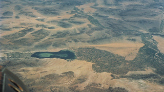
The Landsat Data Continuity Mission (LDCM), also to be named Landsat 8 after its scheduled launch in February 2013, will be the eighth in the series of Landsat satellites. Since 1972, Landsat satellites have been observing and measuring Earth's continental and coastal landscapes at 15 to 30 meter resolution, where human impacts and natural changes can be monitored and characterized over time.
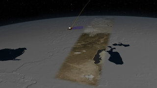
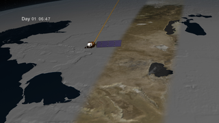
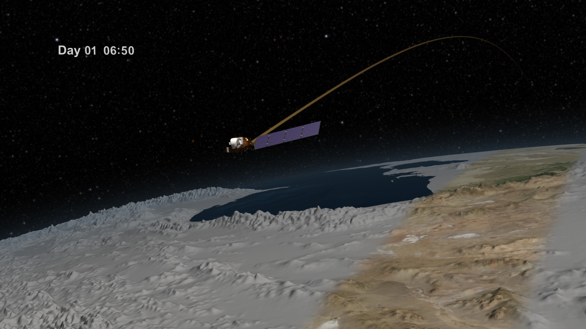
Landsat Data Continuity Mission (LDCM) Orbits
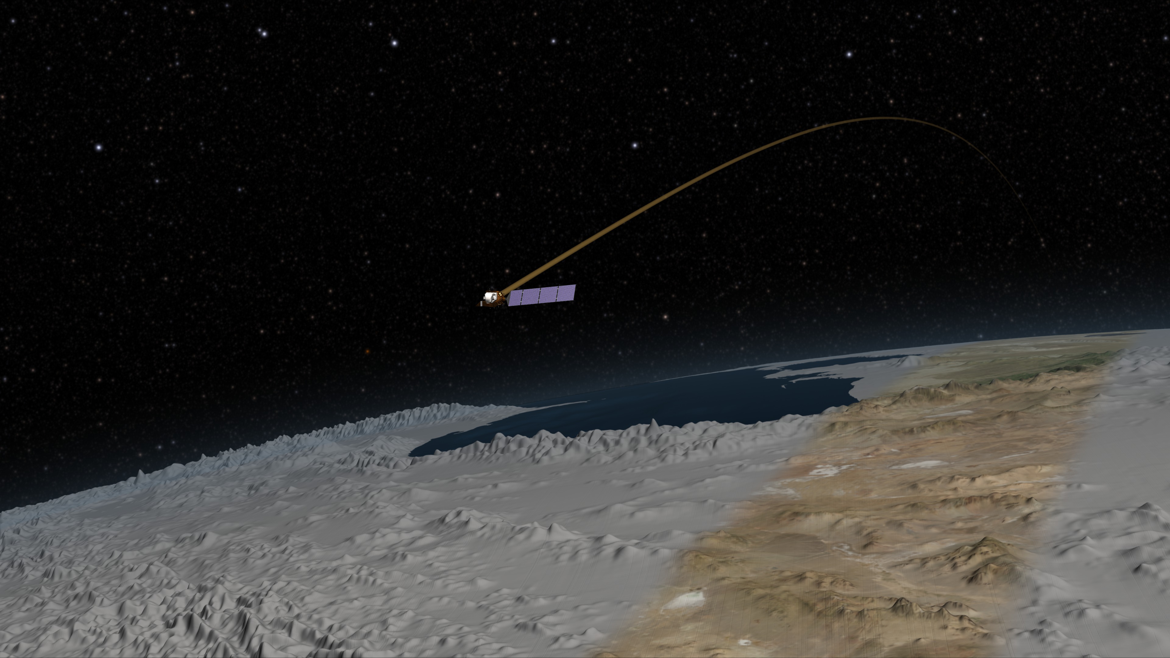
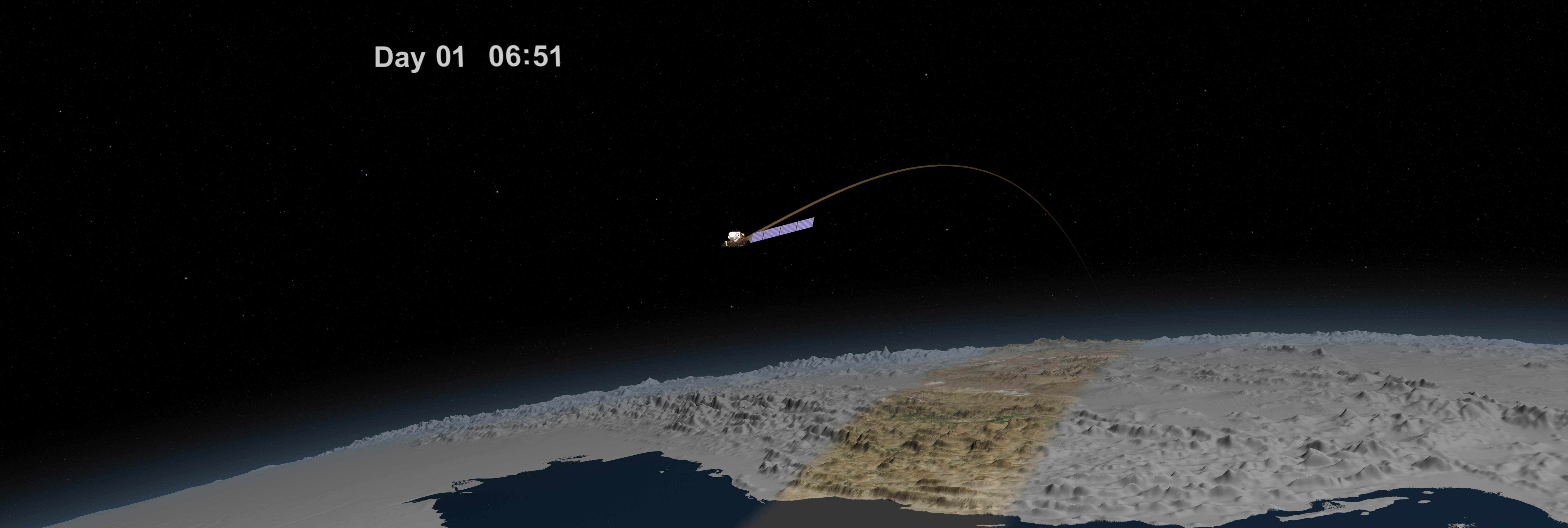
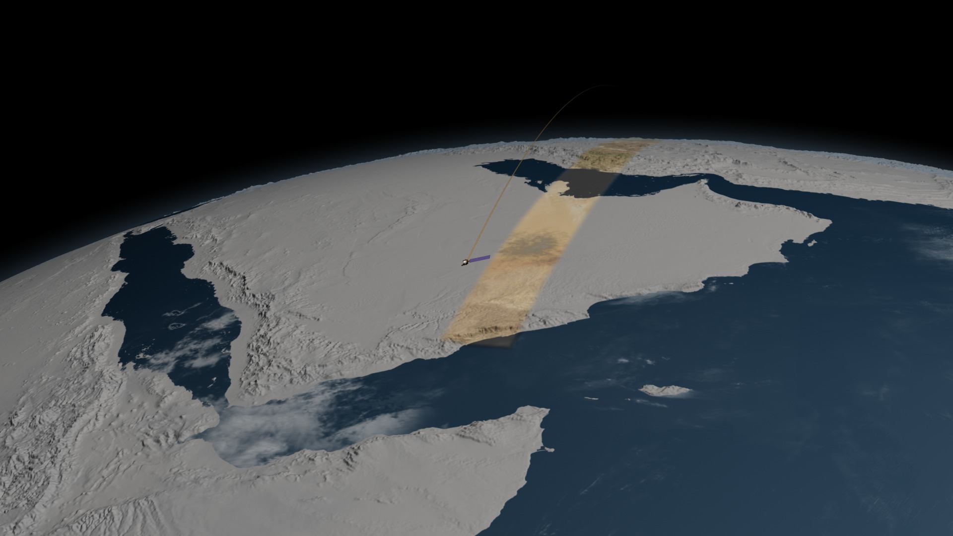
This animation portrays how the LDCM satellite will orbit the Earth 13 times per day at an altitude of 705 km collecting landcover data. With a cross-track width of 185 km, the satellite will completely cover the globe in a 16 day period compiling a total of 233 orbits. A day number and the elapsed time are shown to clearly depict the passage of time which starts slowly in the beginning and increases to day-by-day steps at the end of the animation. The terrain is exaggerated by 6 times during the first day portrayed, but is increased to 12 times when the camera pulls out to a global view. An artificial orbit trail is shown following the spacecraft to indicate its position when the satellite itself is too small to be visible.
Used Elsewhere In

Related
Visualization Credits
Cindy Starr (Global Science and Technology, Inc.): Lead Visualizer
Greg Shirah (NASA/GSFC): Animator
Ernie Wright (USRA): Animator
Walt Feimer (HTSI): Animator
Rachel Kreutzinger (USRA): Animator
Matthew R. Radcliff (USRA): Producer
James R. Irons (NASA/GSFC): Scientist
Greg Shirah (NASA/GSFC): Animator
Ernie Wright (USRA): Animator
Walt Feimer (HTSI): Animator
Rachel Kreutzinger (USRA): Animator
Matthew R. Radcliff (USRA): Producer
James R. Irons (NASA/GSFC): Scientist
Please give credit for this item to:
NASA/Goddard Space Flight Center Scientific Visualization Studio The Blue Marble data is courtesy of Reto Stockli (NASA/GSFC).
NASA/Goddard Space Flight Center Scientific Visualization Studio The Blue Marble data is courtesy of Reto Stockli (NASA/GSFC).
Short URL to share this page:
https://svs.gsfc.nasa.gov/3939
Missions:
Global Precipitation Measurement (GPM)
Ice, Cloud, and land Elevation Satellite (ICESat)
Landsat
LDCM: Landsat Data Continuity Mission
Terra
Data Used:
Note: While we identify the data sets used in these visualizations, we do not store any further details nor the data sets themselves on our site.
Keywords:
SVS >> HDTV
SVS >> Landsat
SVS >> Orbit
SVS >> Hyperwall
SVS >> LDCM
NASA Science >> Earth
https://svs.gsfc.nasa.gov/3939
Missions:
Global Precipitation Measurement (GPM)
Ice, Cloud, and land Elevation Satellite (ICESat)
Landsat
LDCM: Landsat Data Continuity Mission
Terra
Data Used:
ICESat/GLAS also referred to as: GLAS/ICESat 1 km Laser Altimetry Digital Elevation Model of Greenland
Terra and Aqua/MODIS/Blue Marble Cloud Cover
Credit:
The Blue Marble data is courtesy of Reto Stockli (NASA/GSFC).
The Blue Marble data is courtesy of Reto Stockli (NASA/GSFC).
Terra and Aqua/MODIS/Blue Marble: Next Generation also referred to as: BMNG
Credit:
The Blue Marble data is courtesy of Reto Stockli (NASA/GSFC).
The Blue Marble data is courtesy of Reto Stockli (NASA/GSFC).
GTOPO30 Topography and Bathymetry
Data Compilation - USGSKeywords:
SVS >> HDTV
SVS >> Landsat
SVS >> Orbit
SVS >> Hyperwall
SVS >> LDCM
NASA Science >> Earth


