Earth
ID: 3872
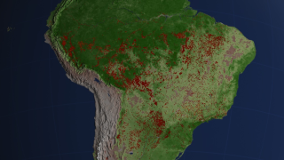
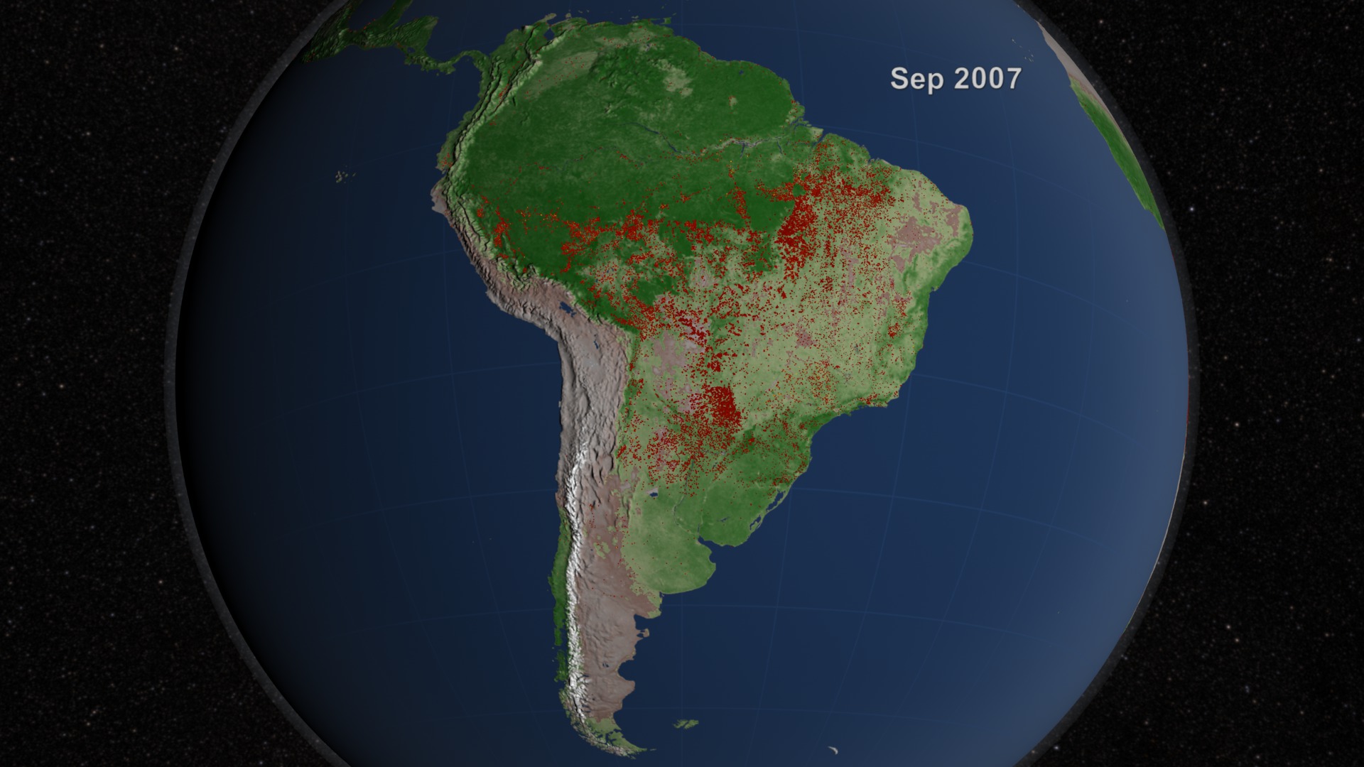
From space, we can understand fires in ways that are impossible from the ground. NASA research has contributed to much improved detection of fire for scientific purposes using satellite remote sensing and geographic information systems. This visualization of South America shows fire observations made by MODerate Resolution Imaging Spectroradiometer (MODIS) instruments on board the Terra and Aqua satellites . South America exhibits a steady flickering of fire across much of the Amazon rainforest with peaks of activity in September and November. Almost all of the fires in the Amazon are the direct result of human activity, including slash-and-burn agriculture, because the high moisture levels in the region prevent inhibit natural fires from occurring.
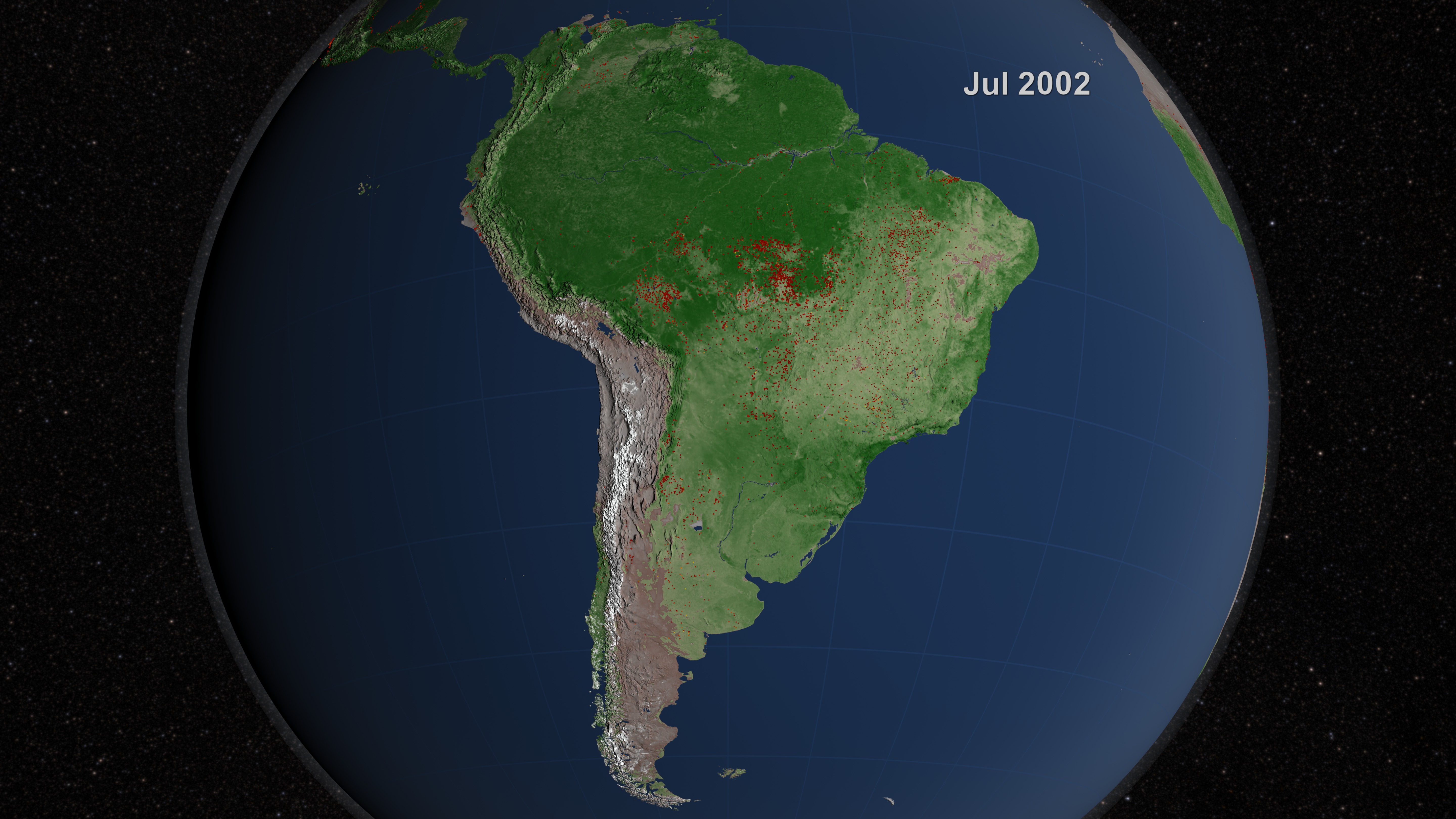
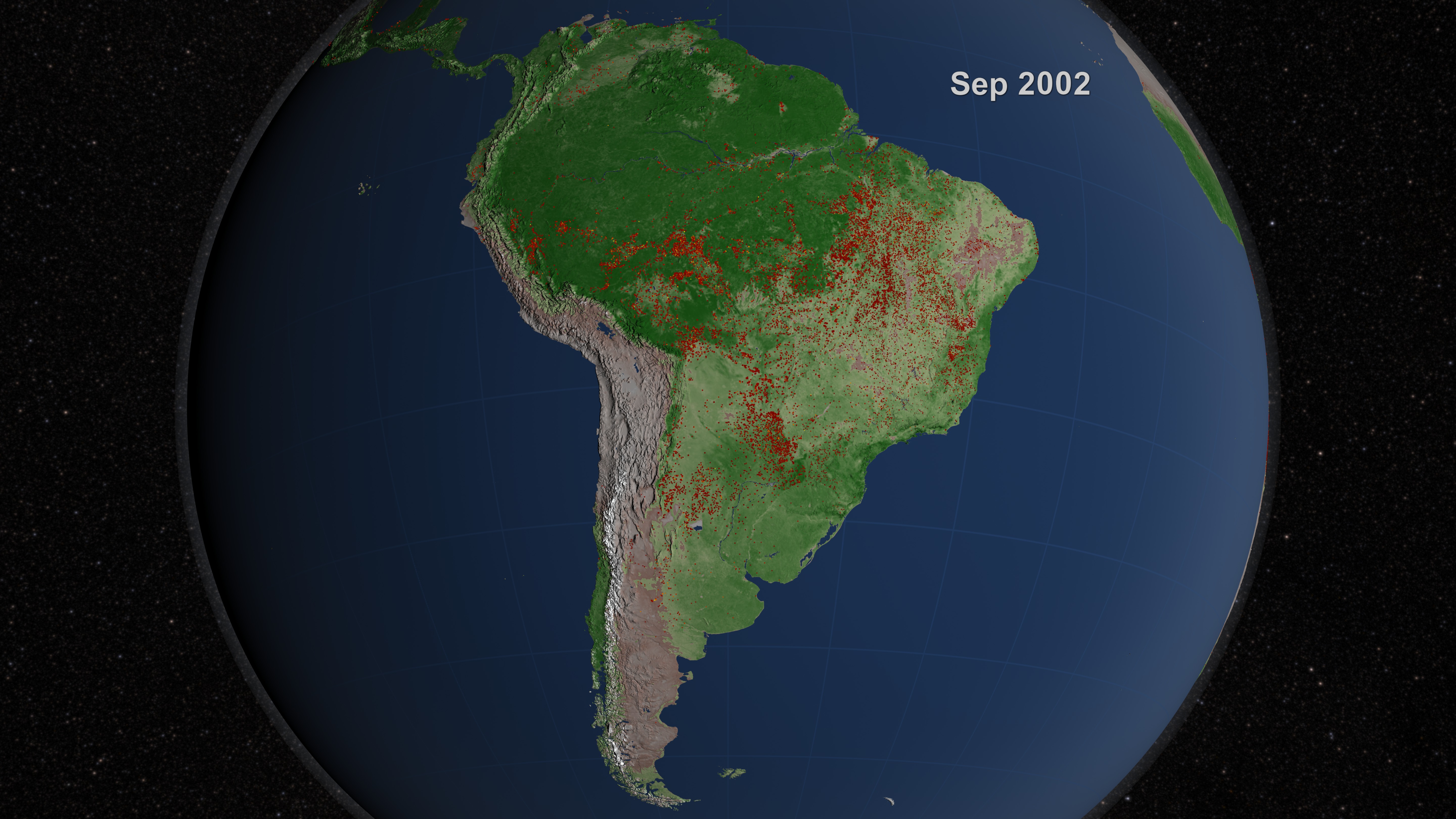
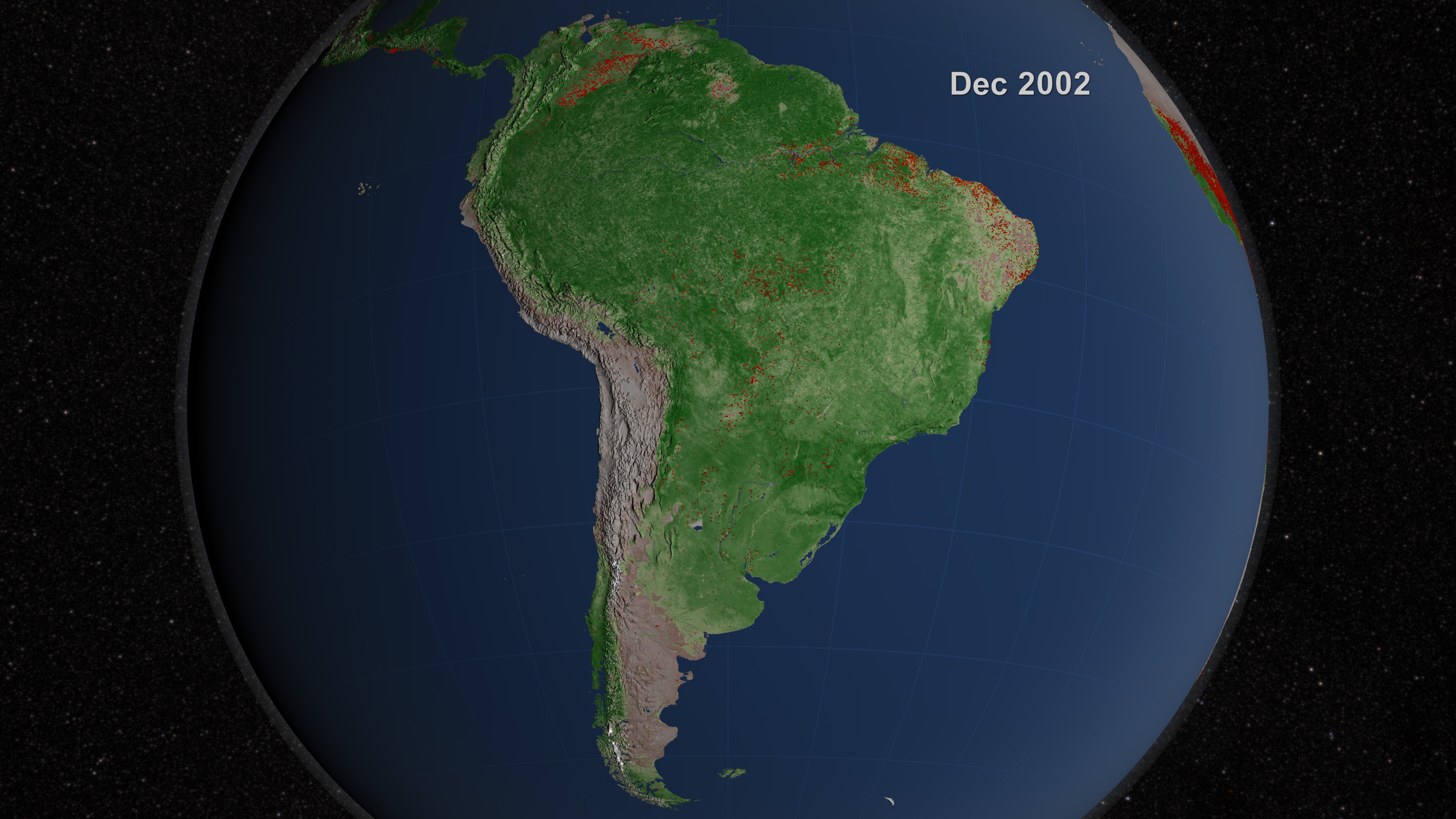
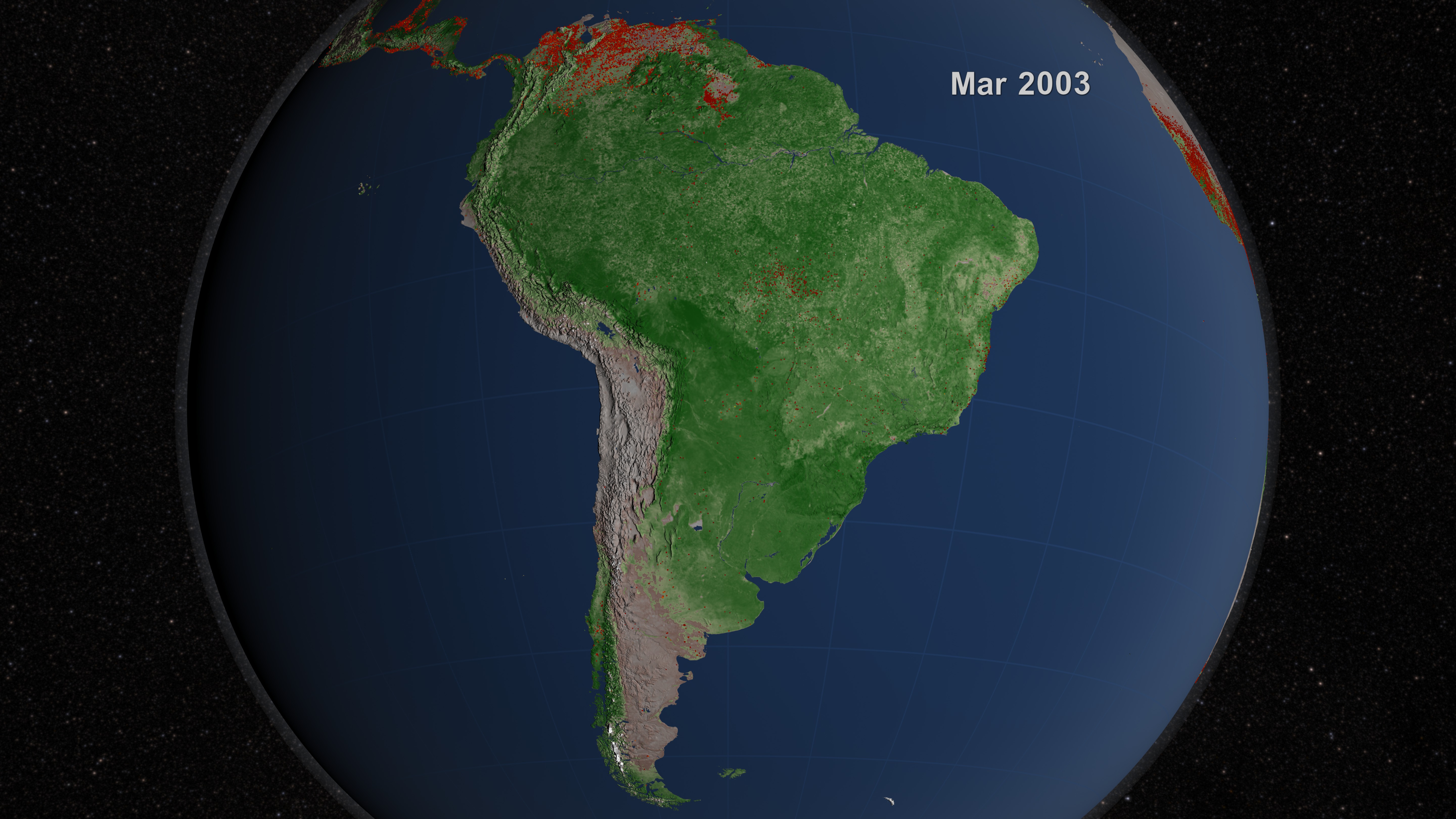
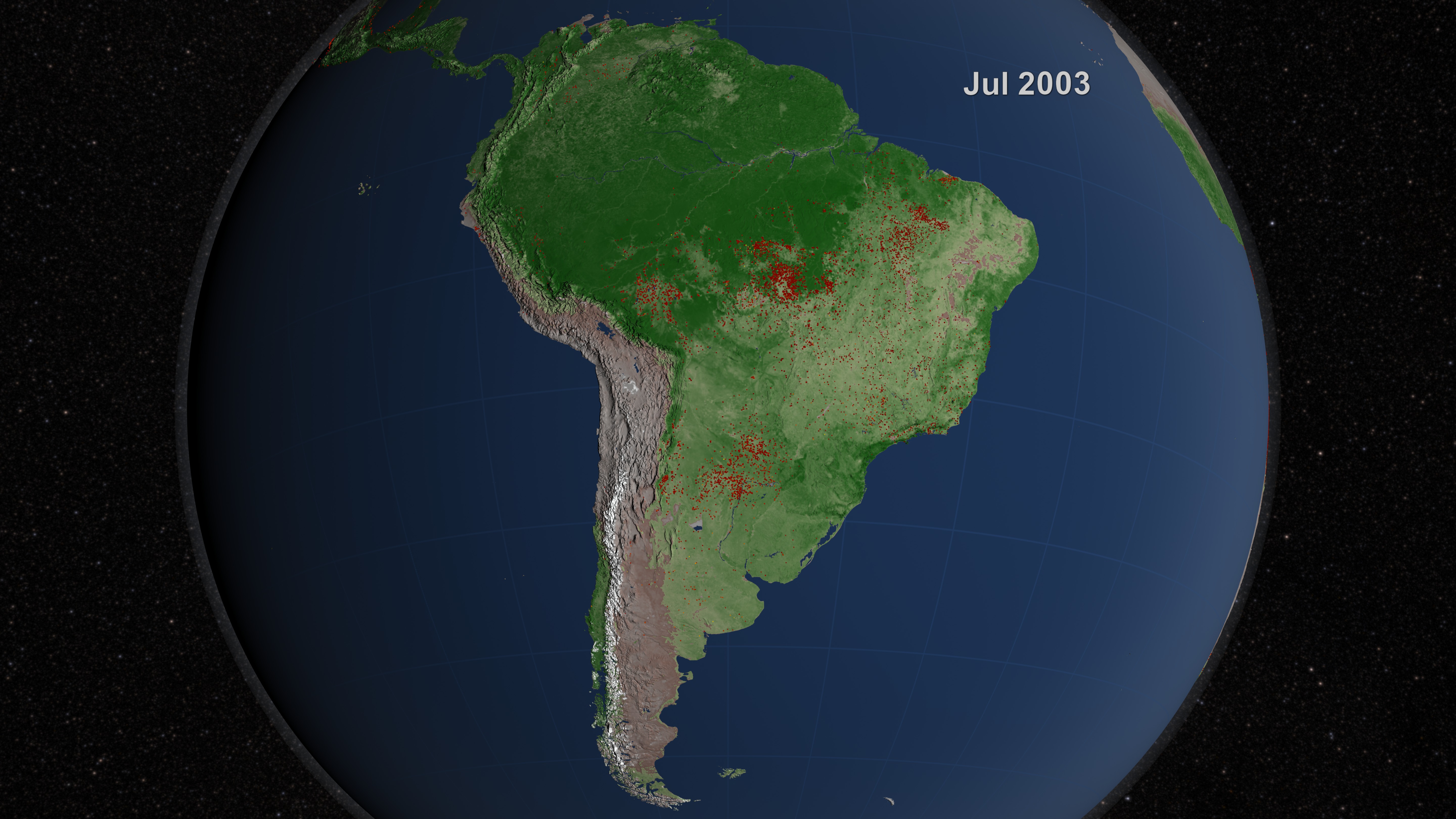
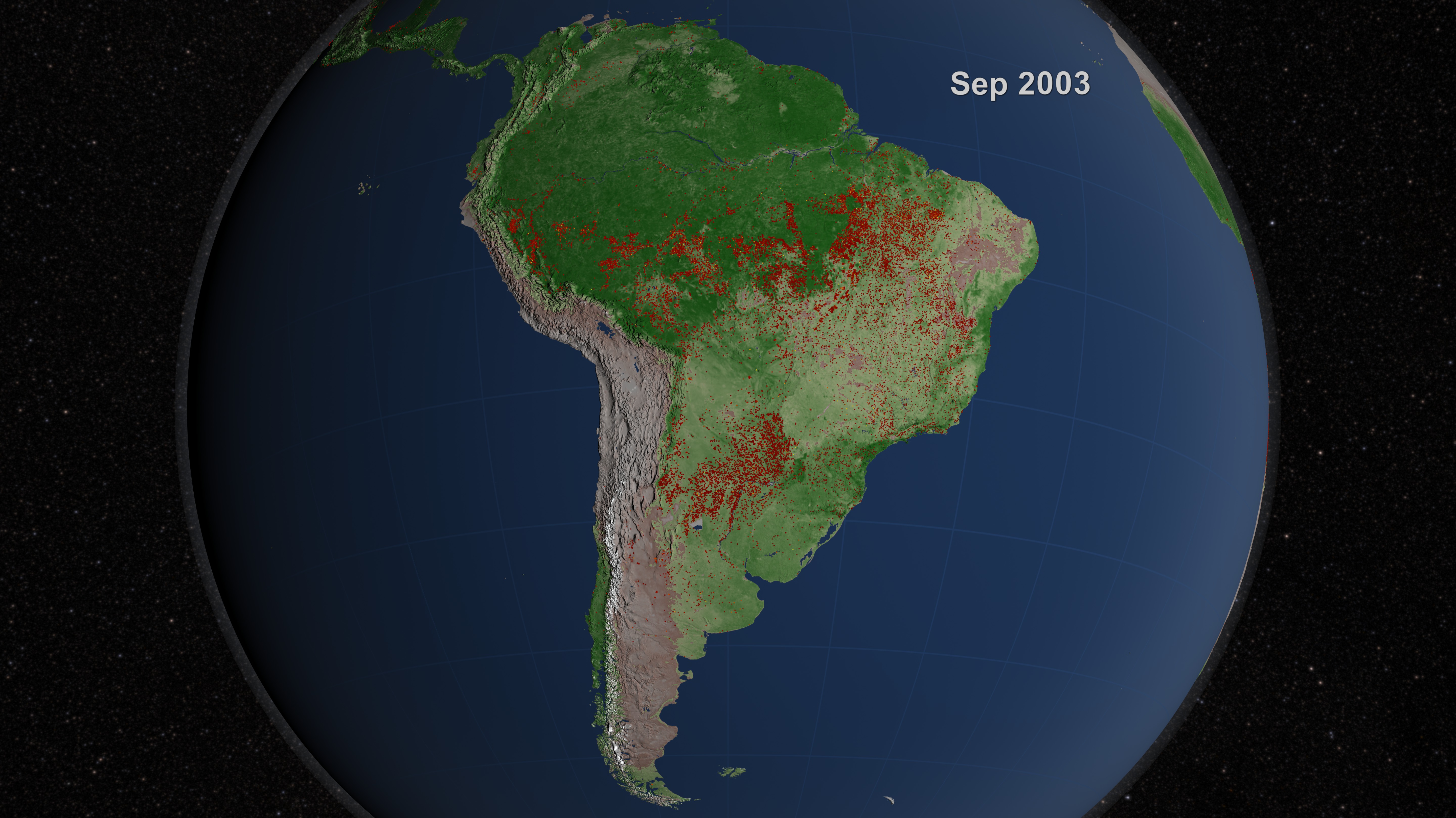
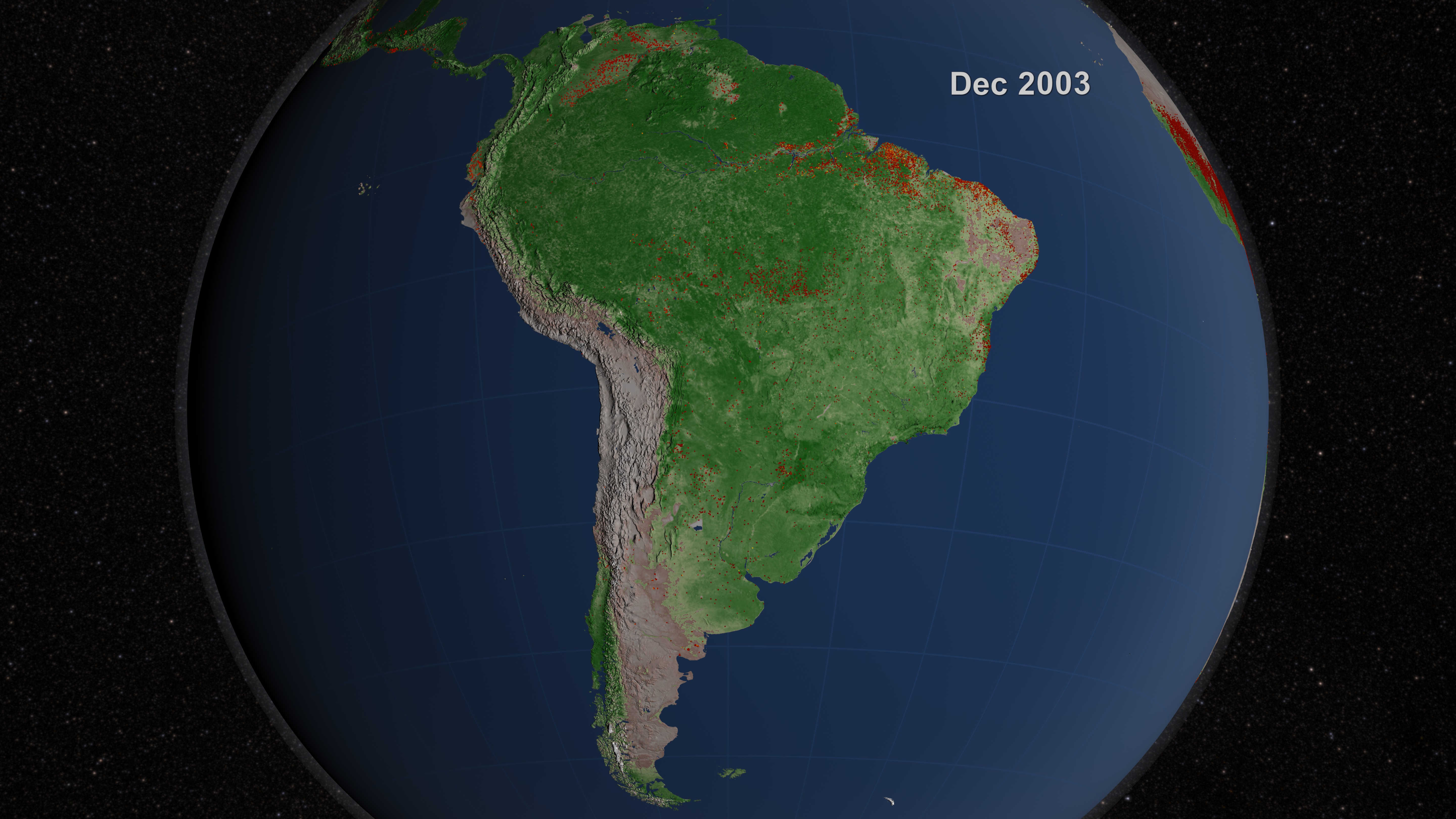
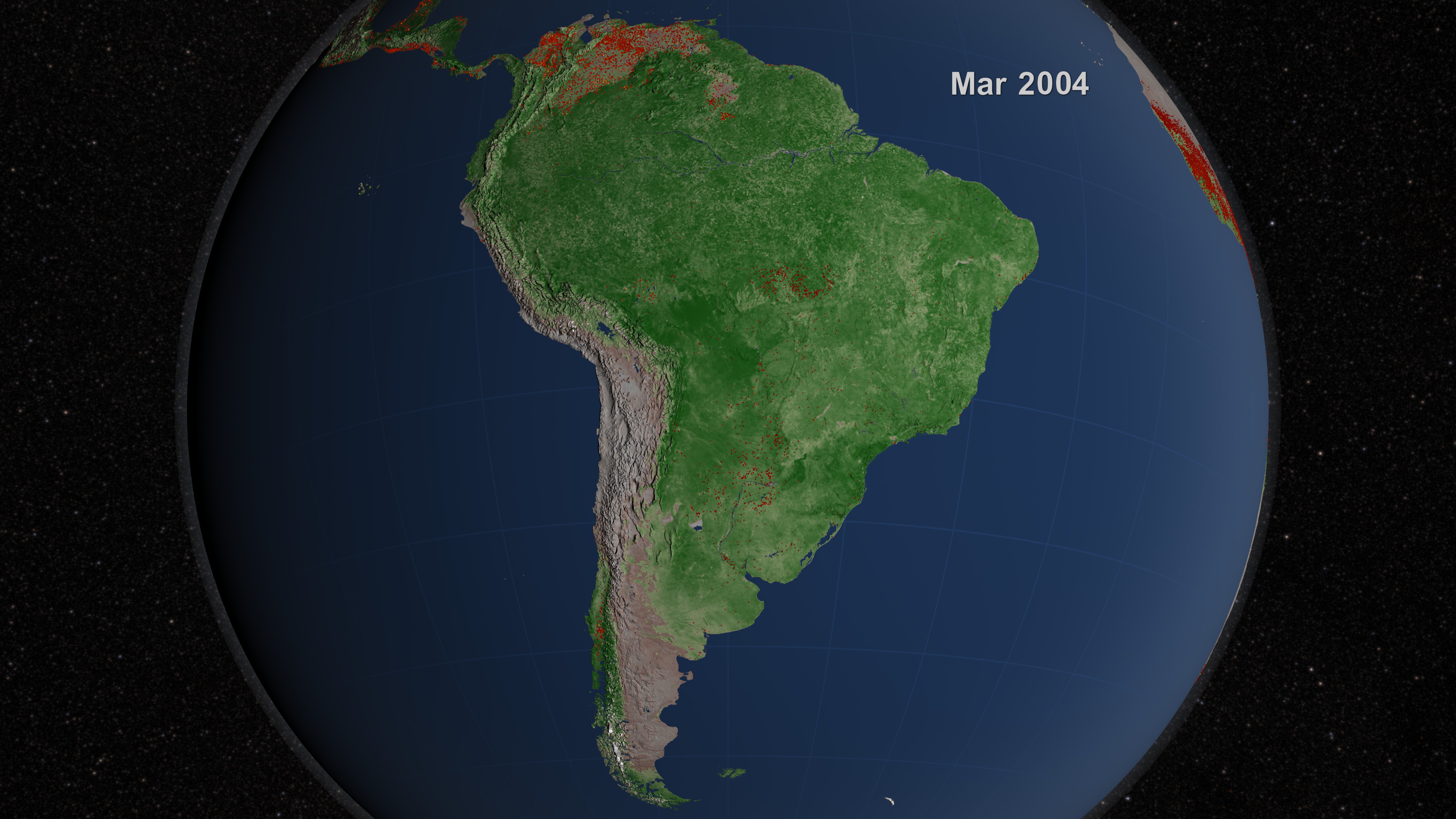

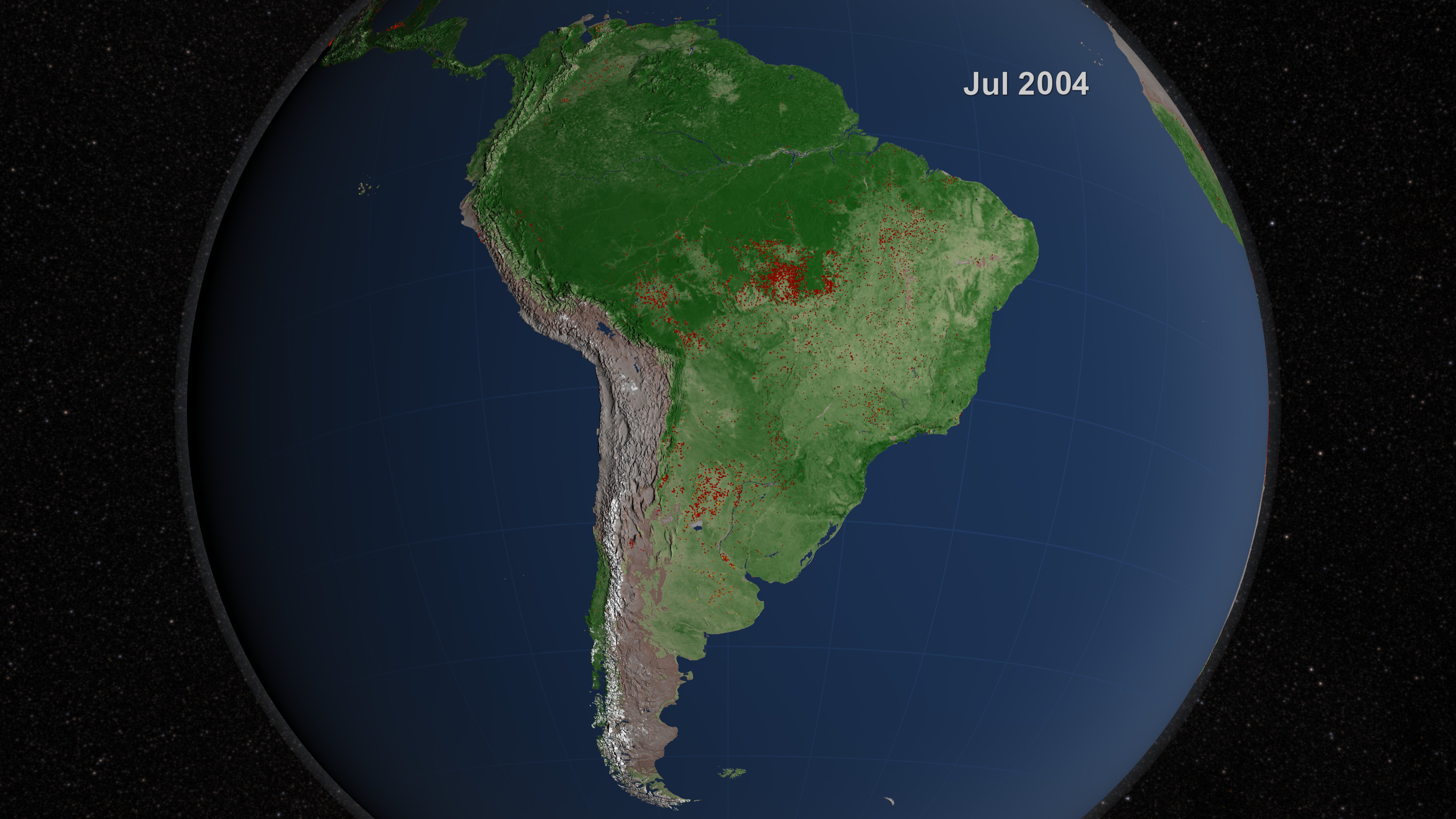
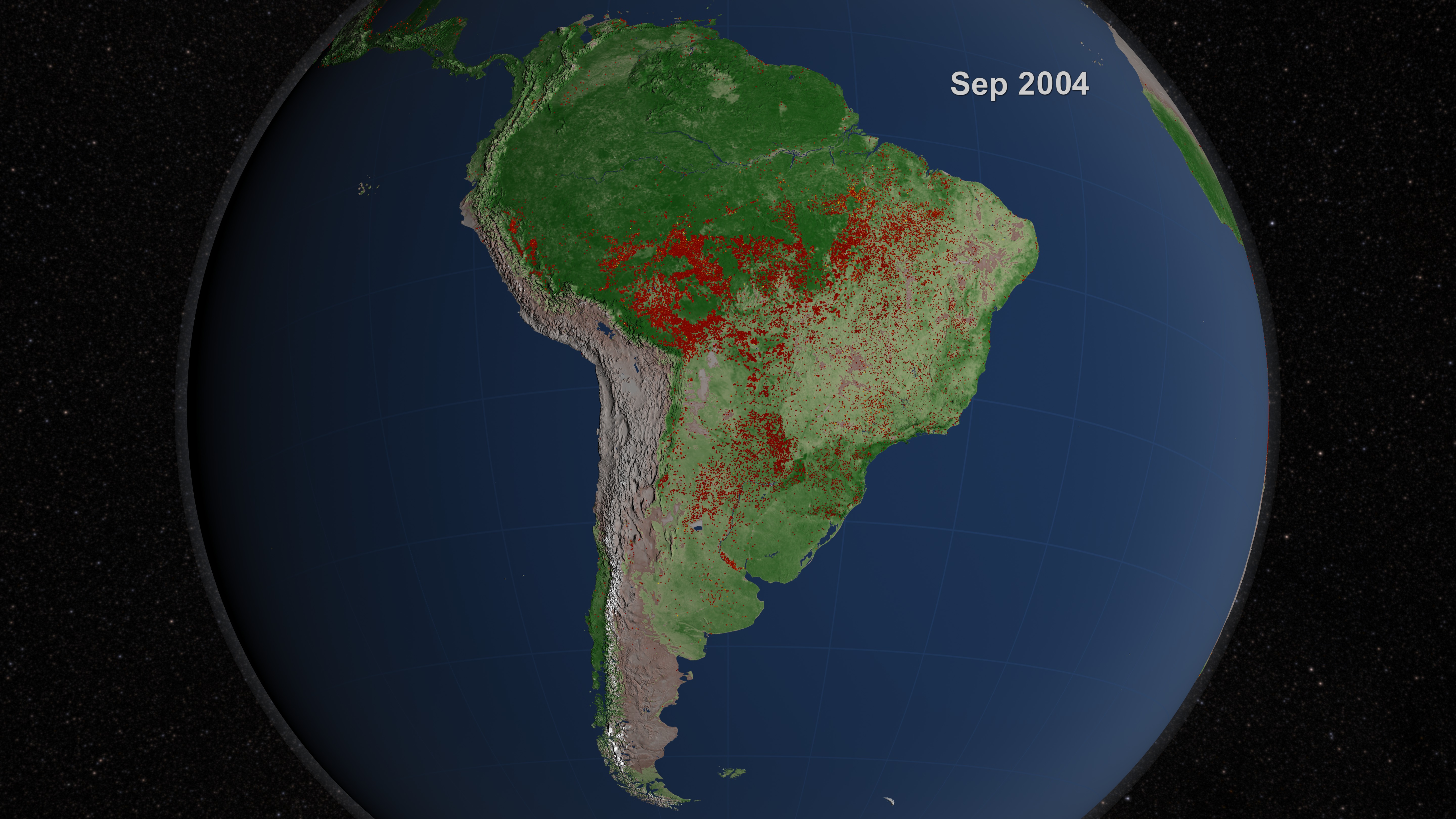
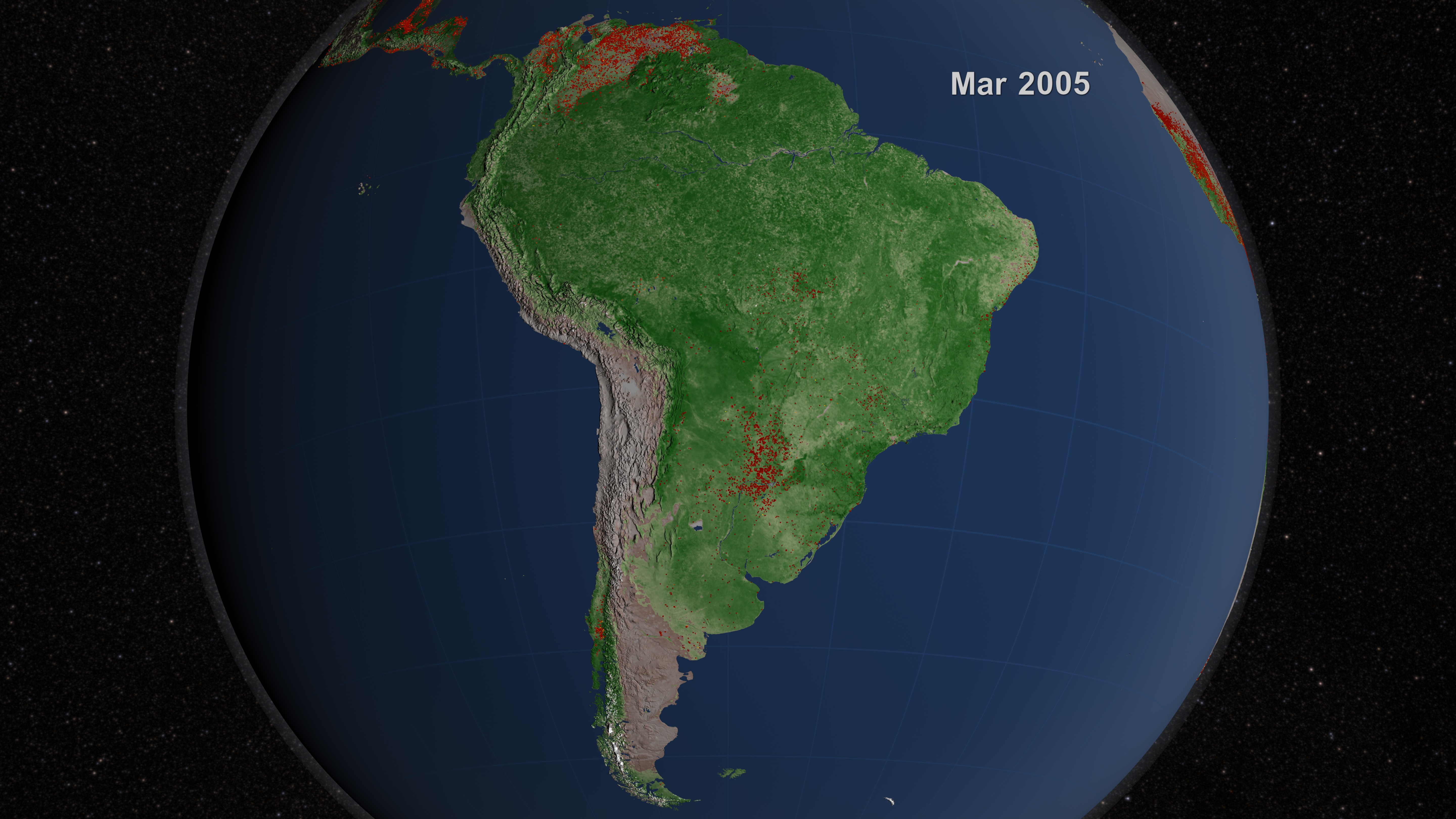
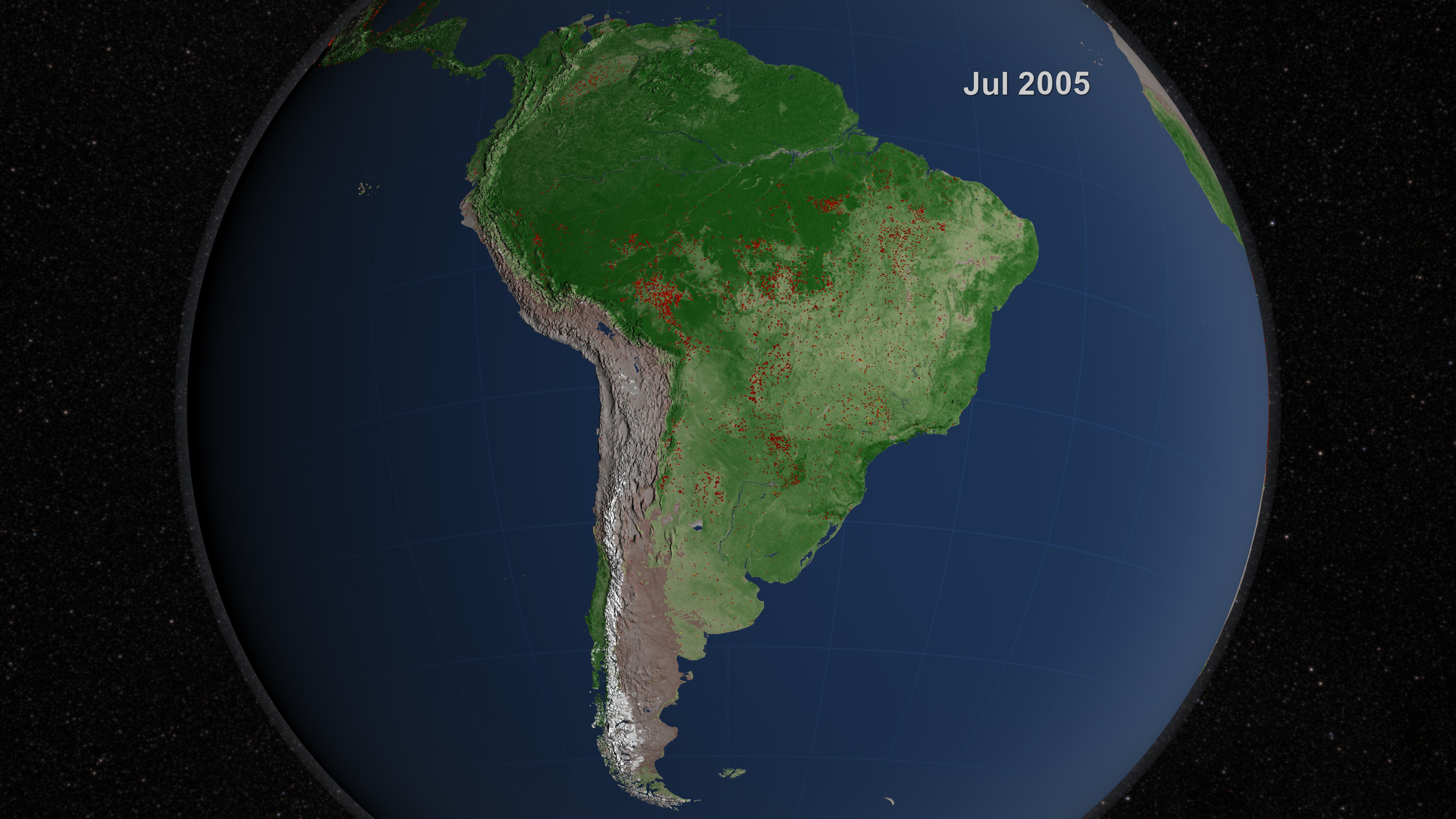
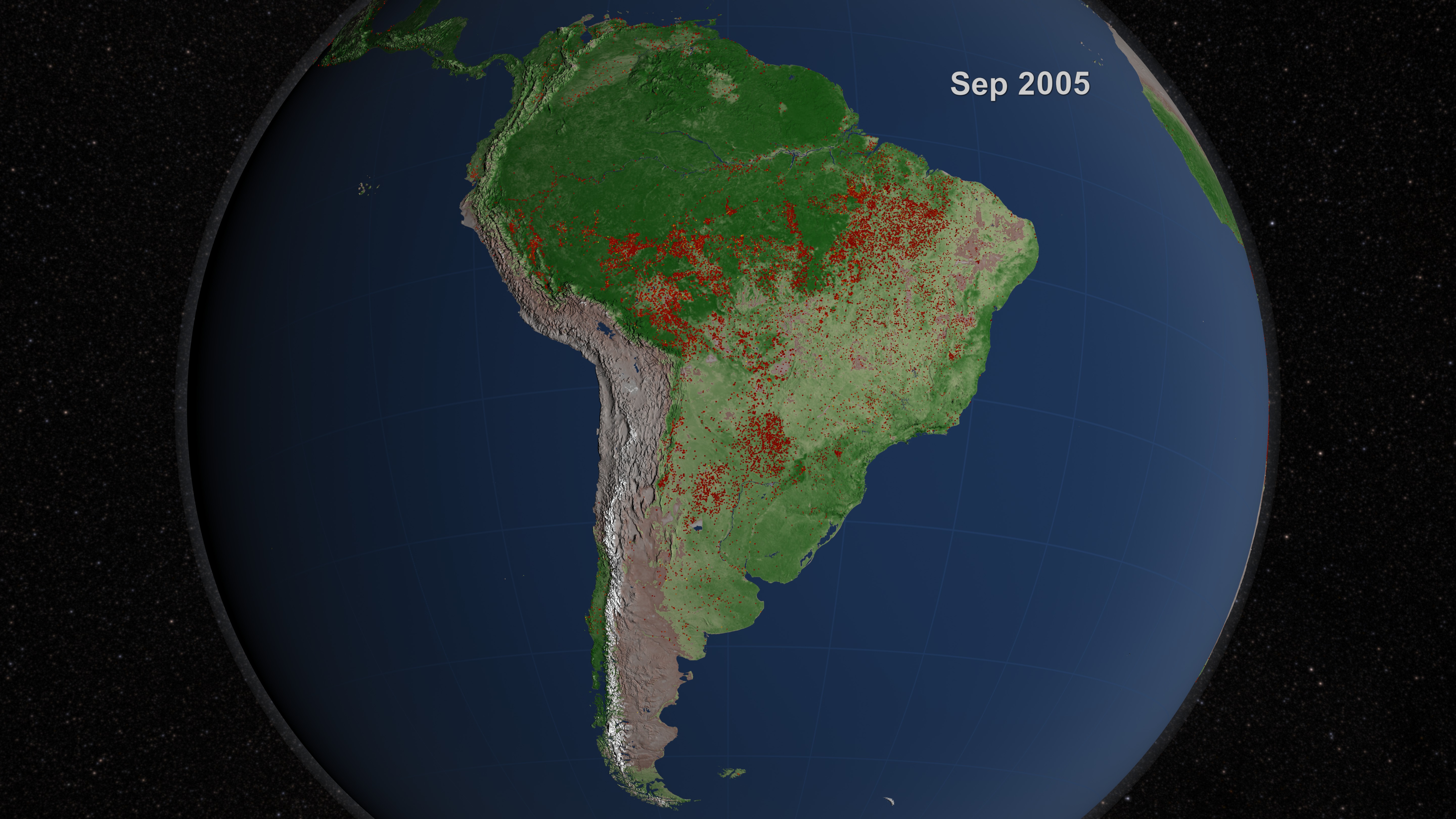

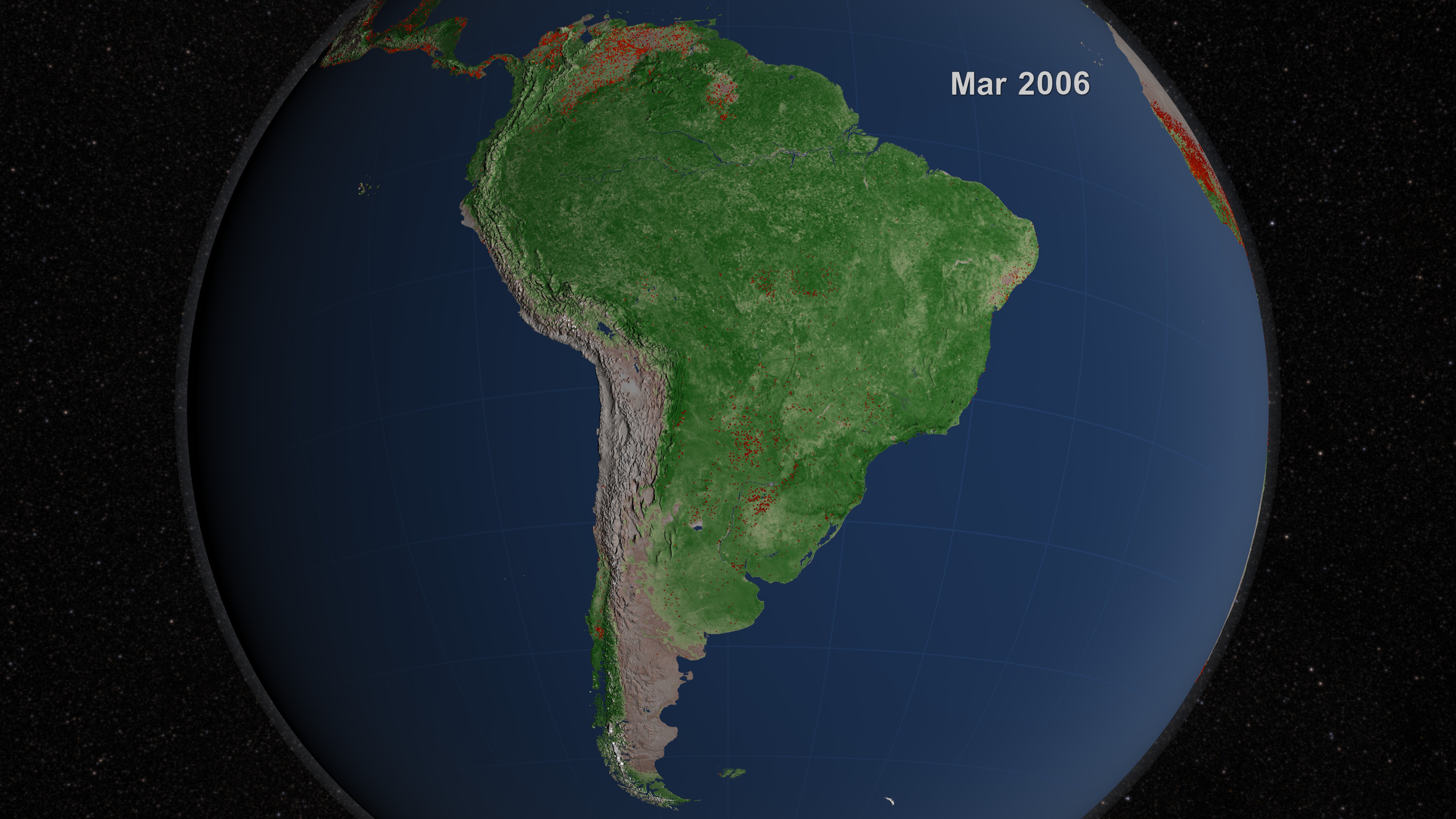
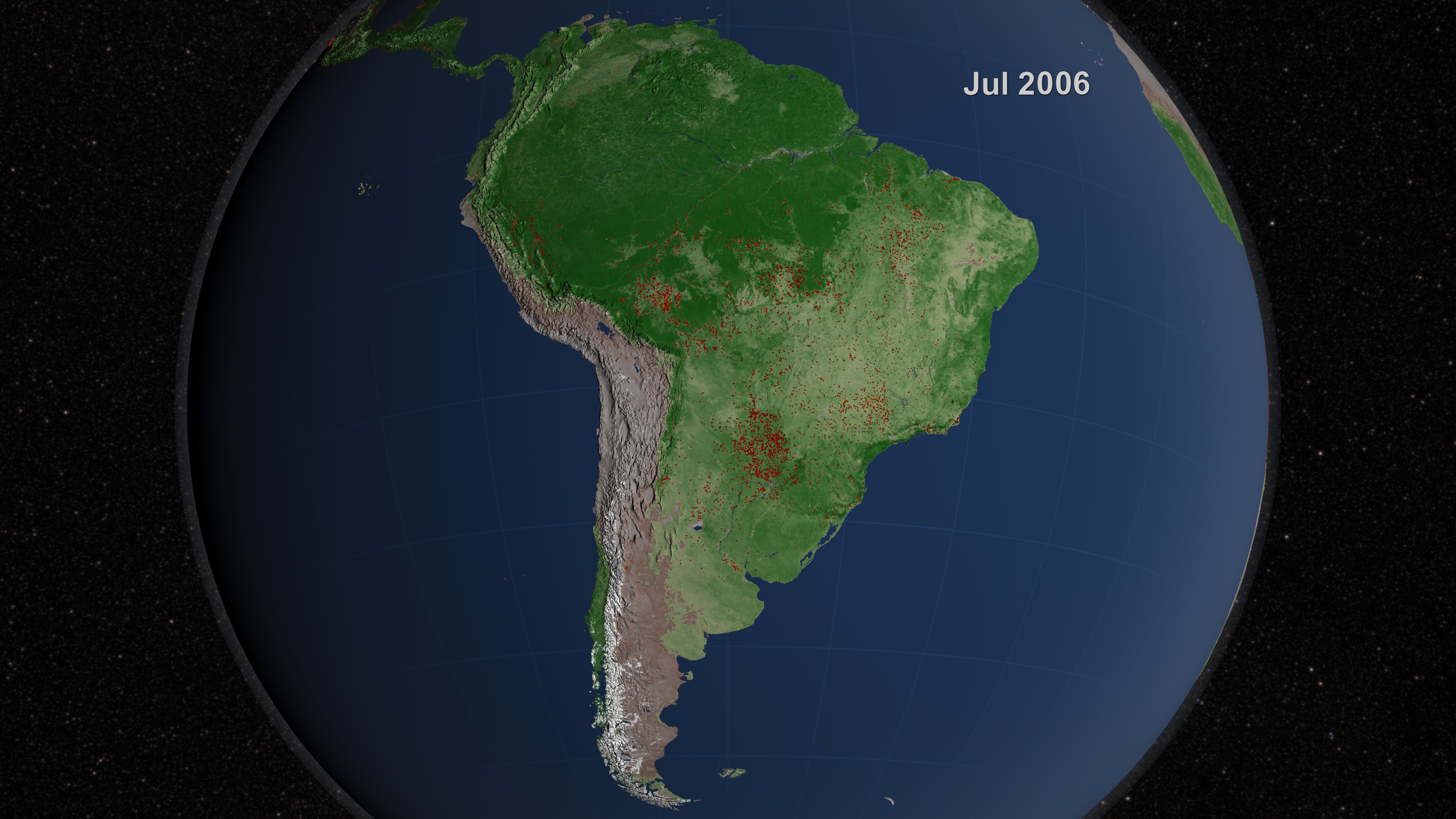
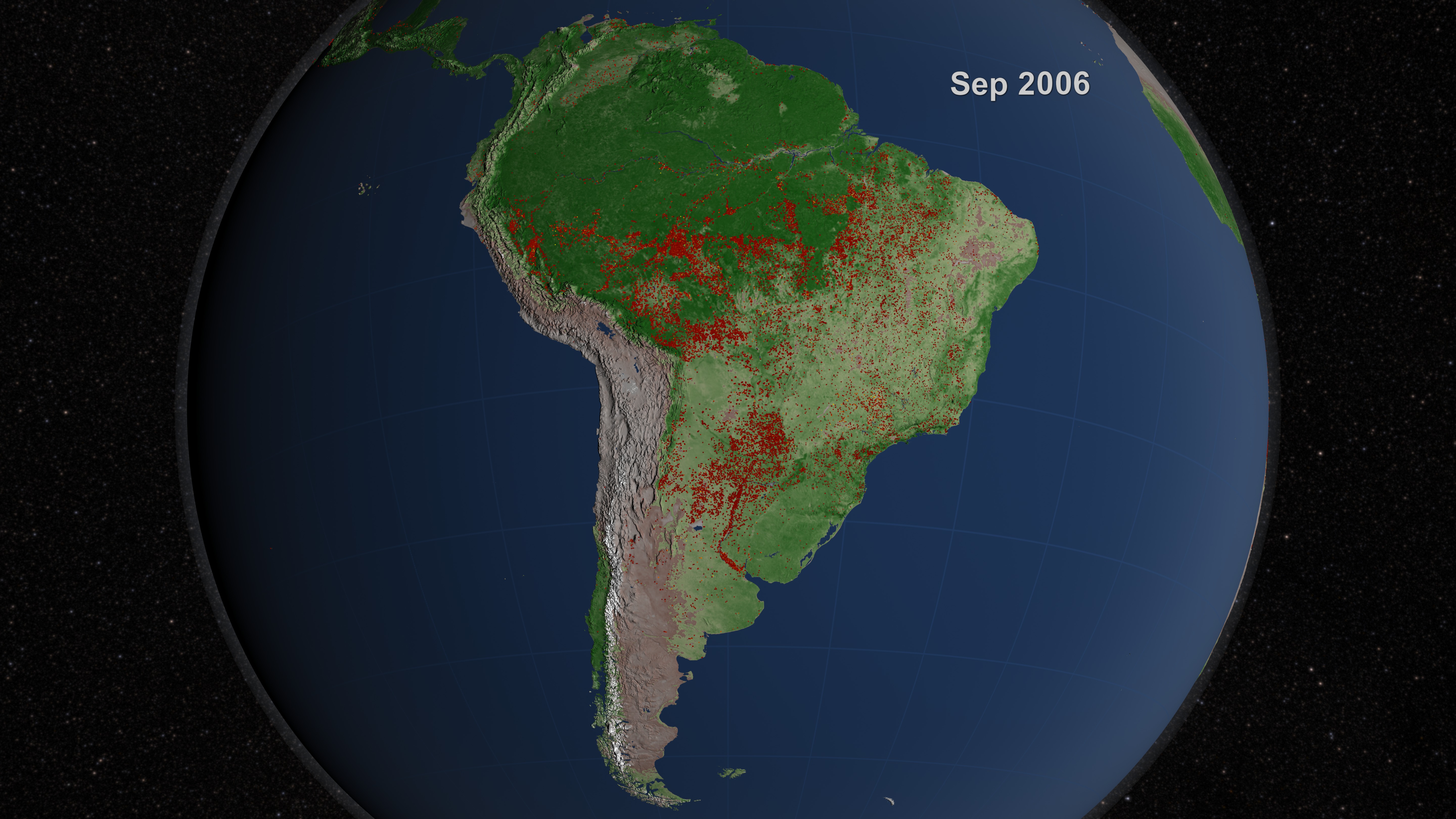
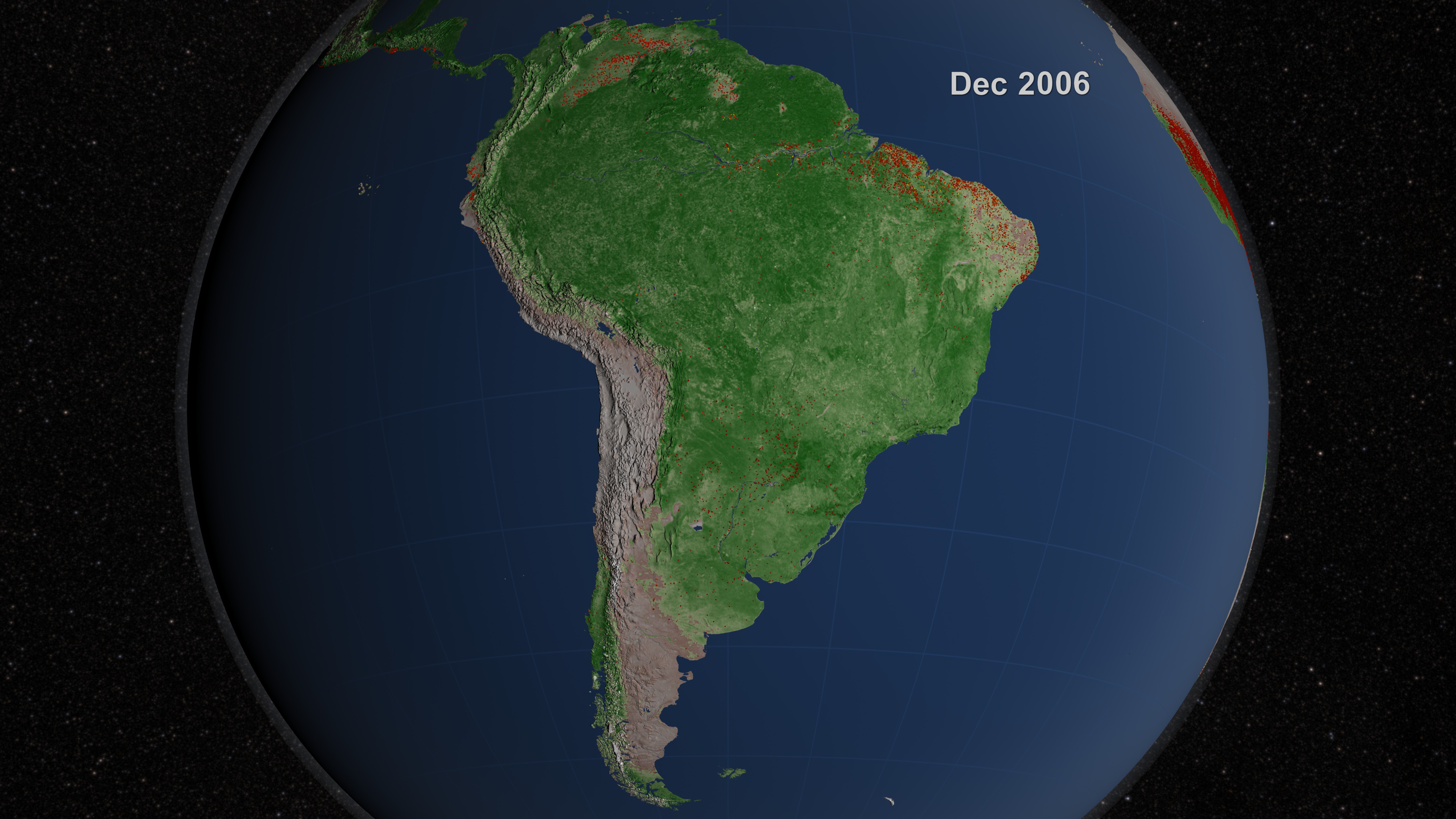
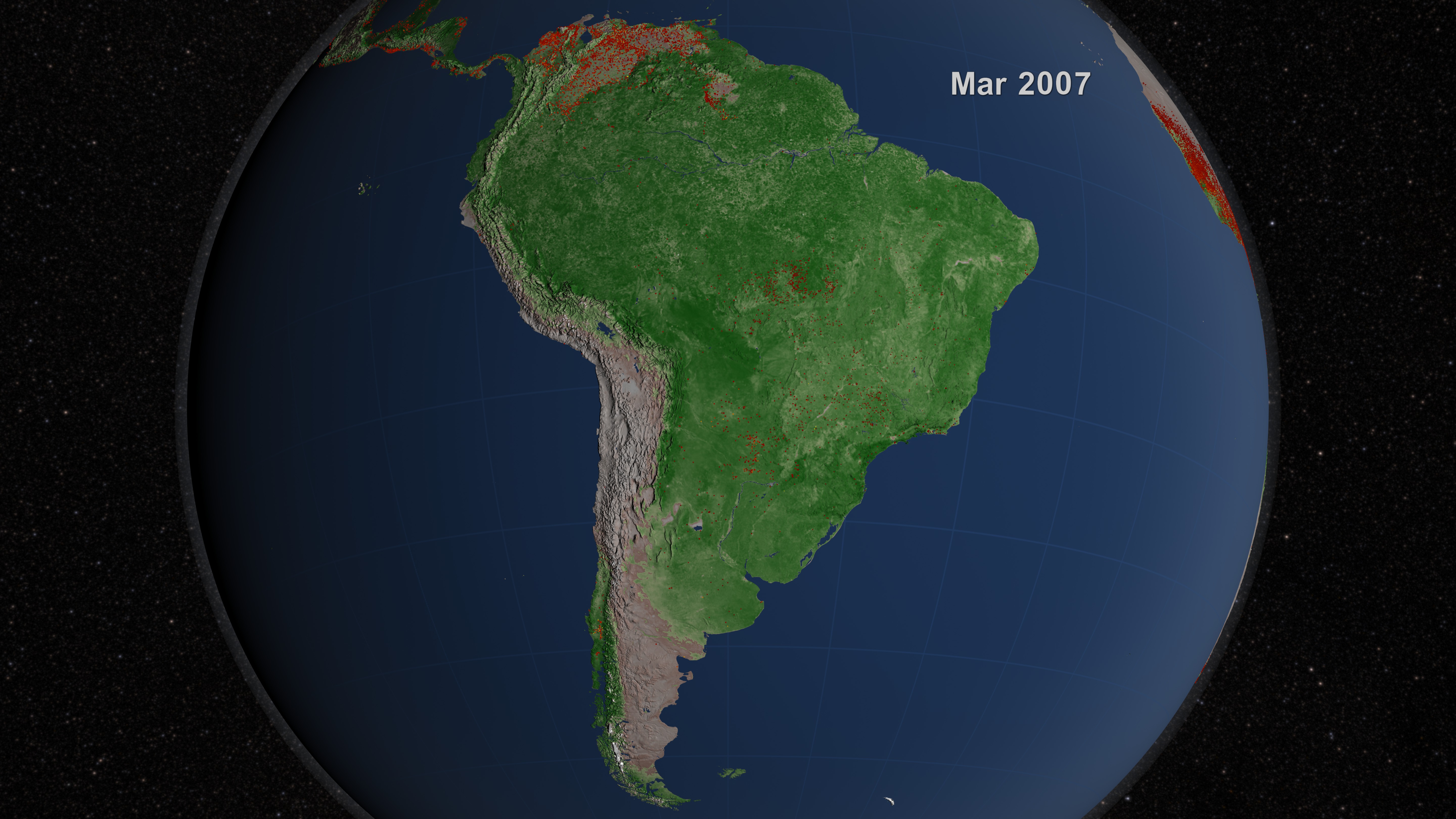
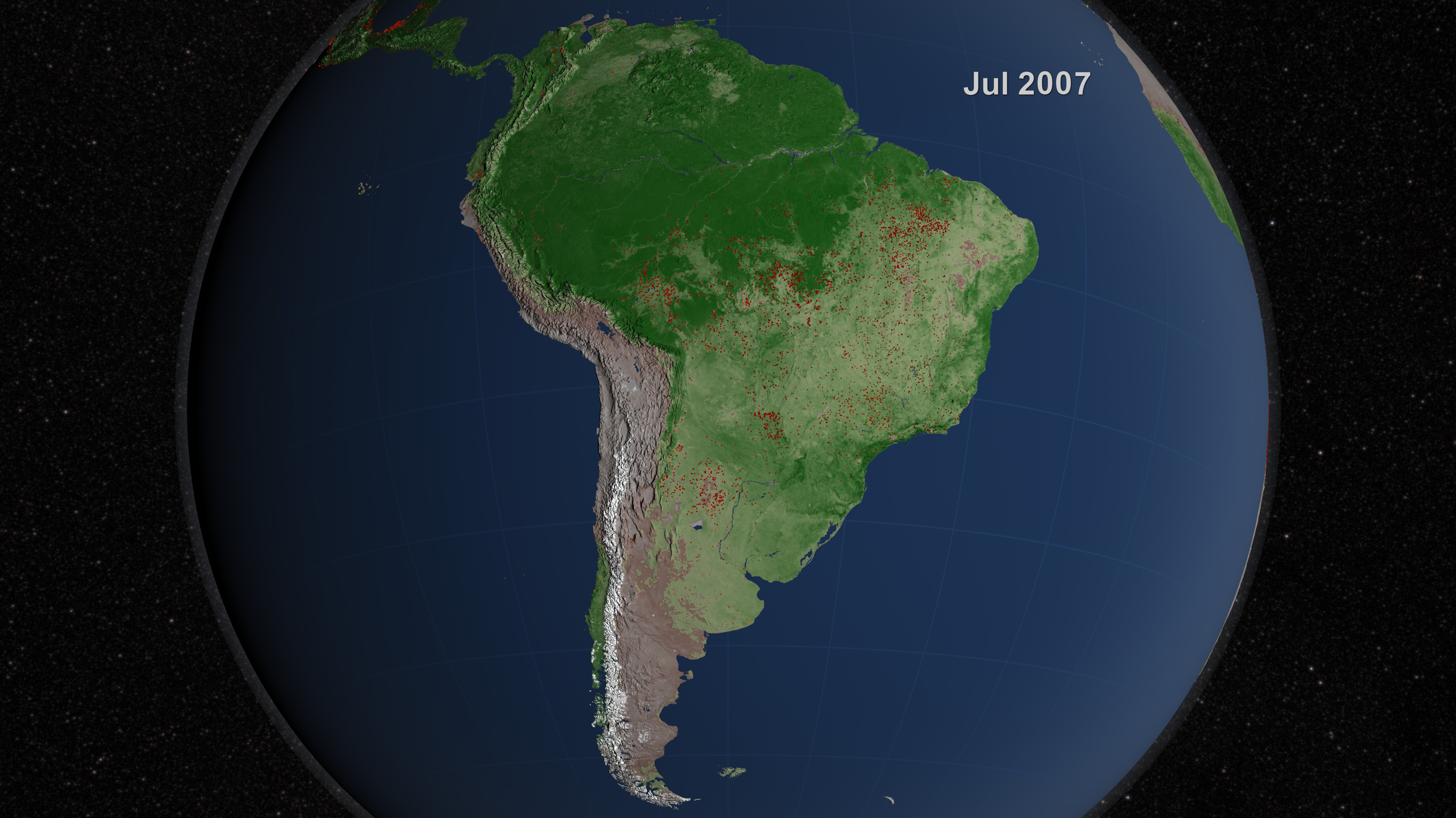
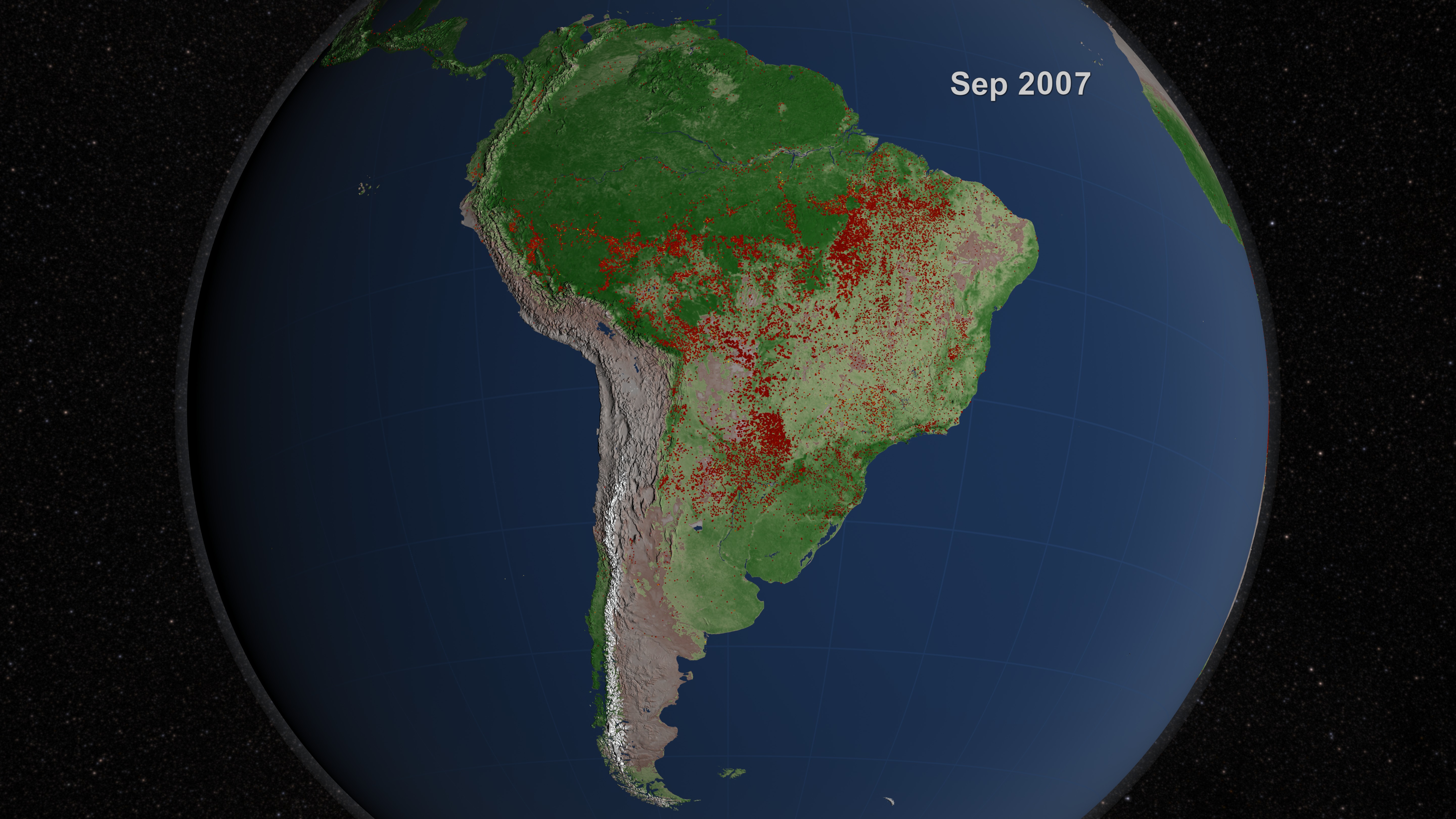
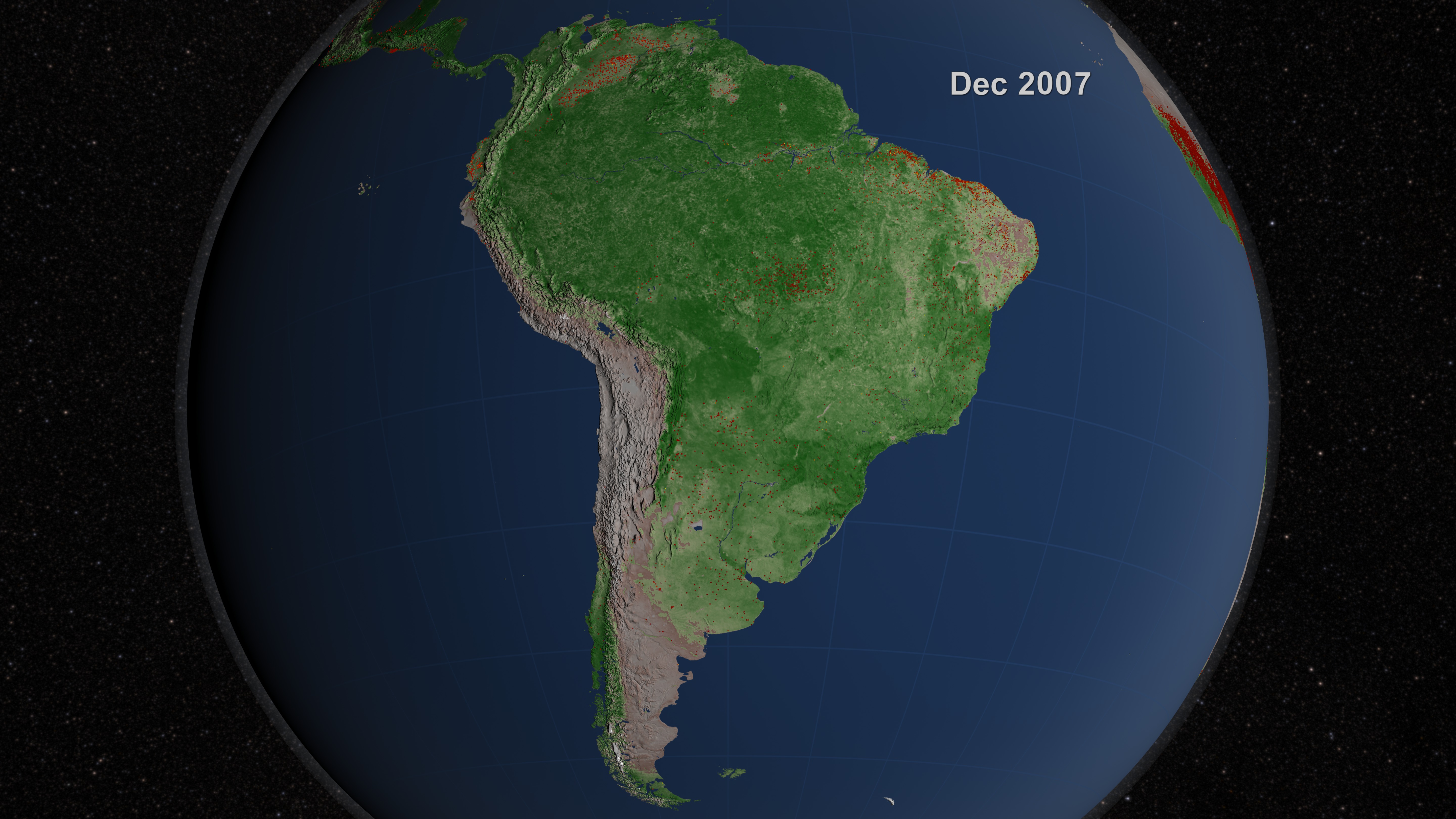
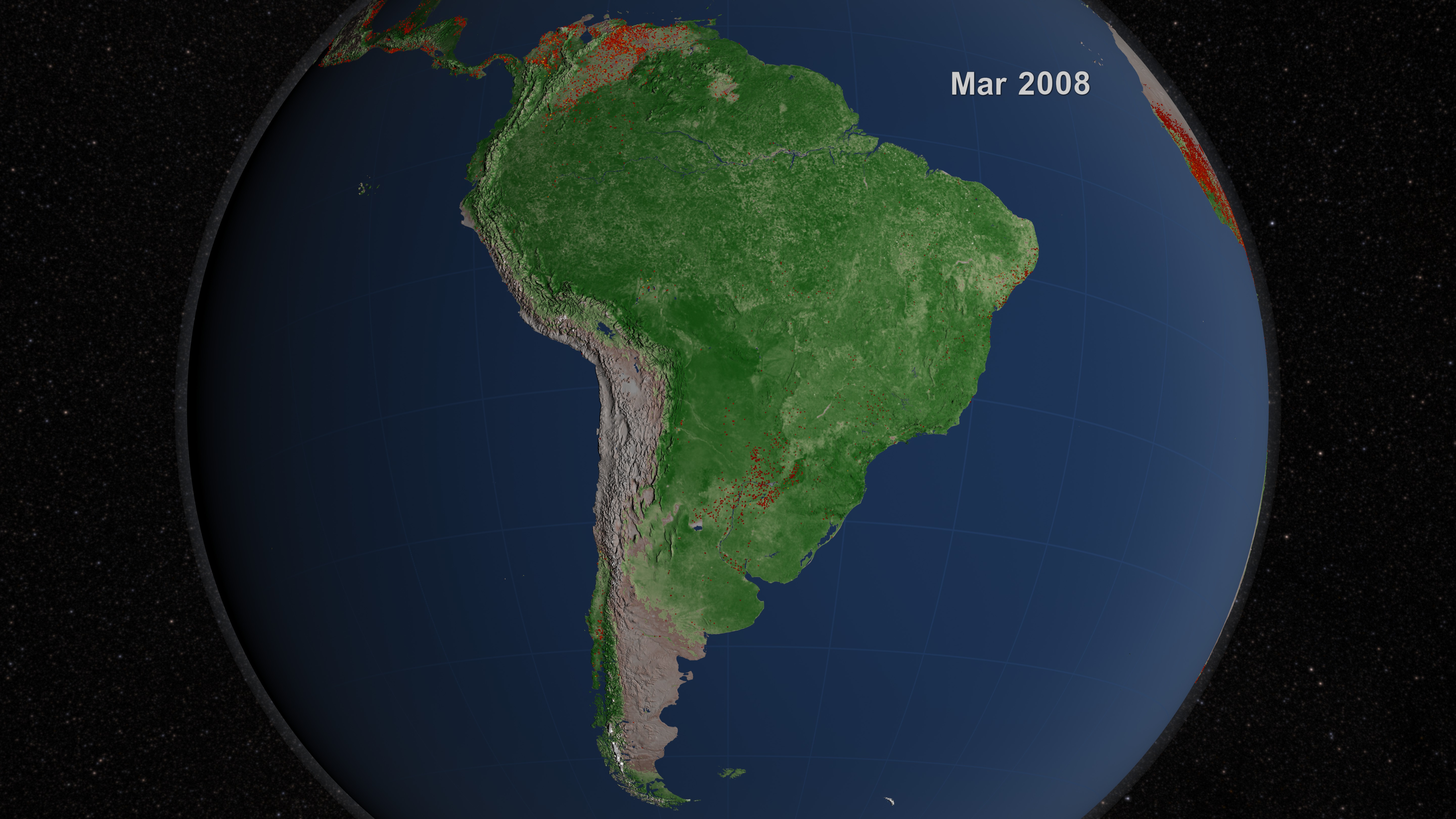
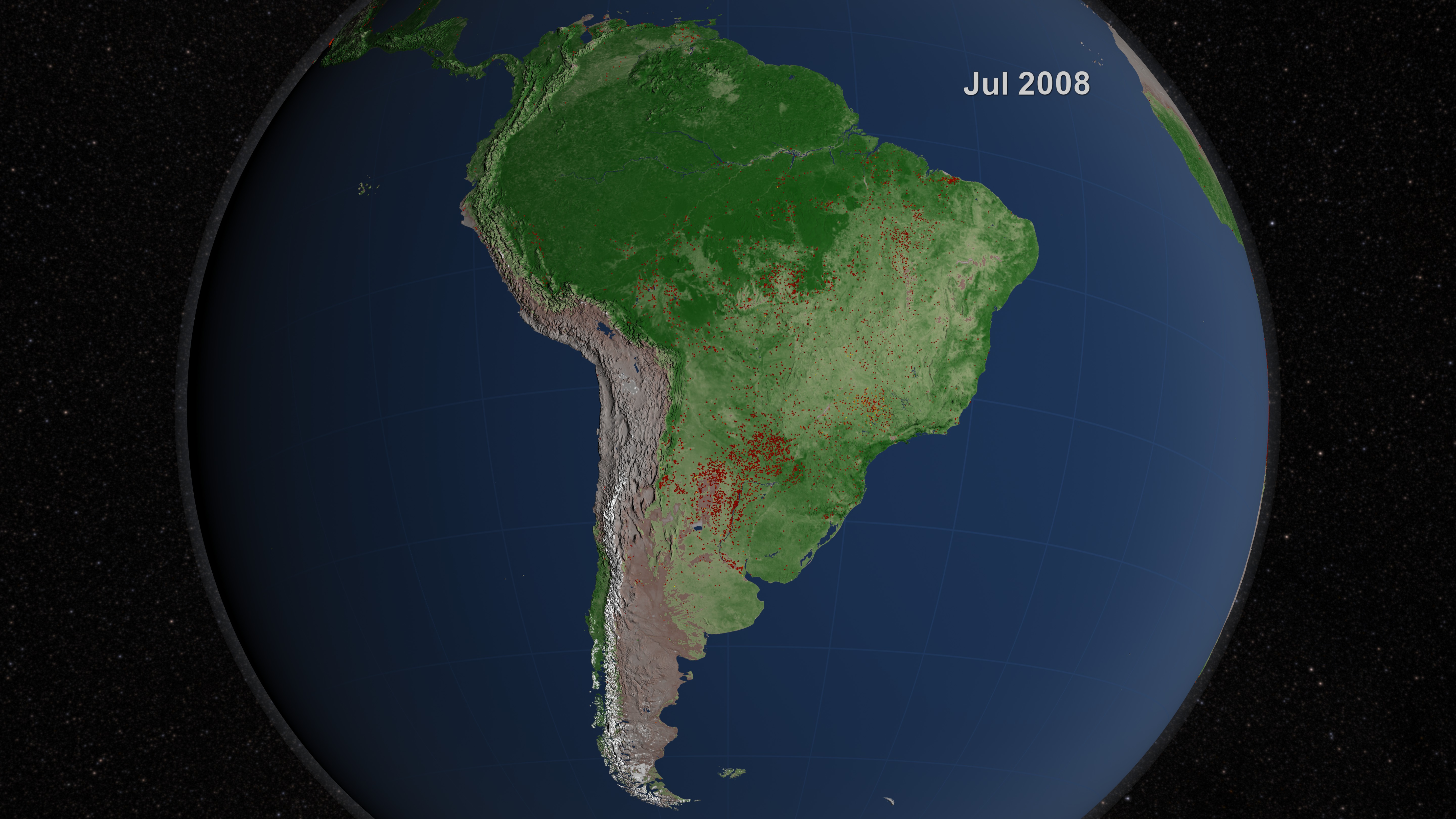
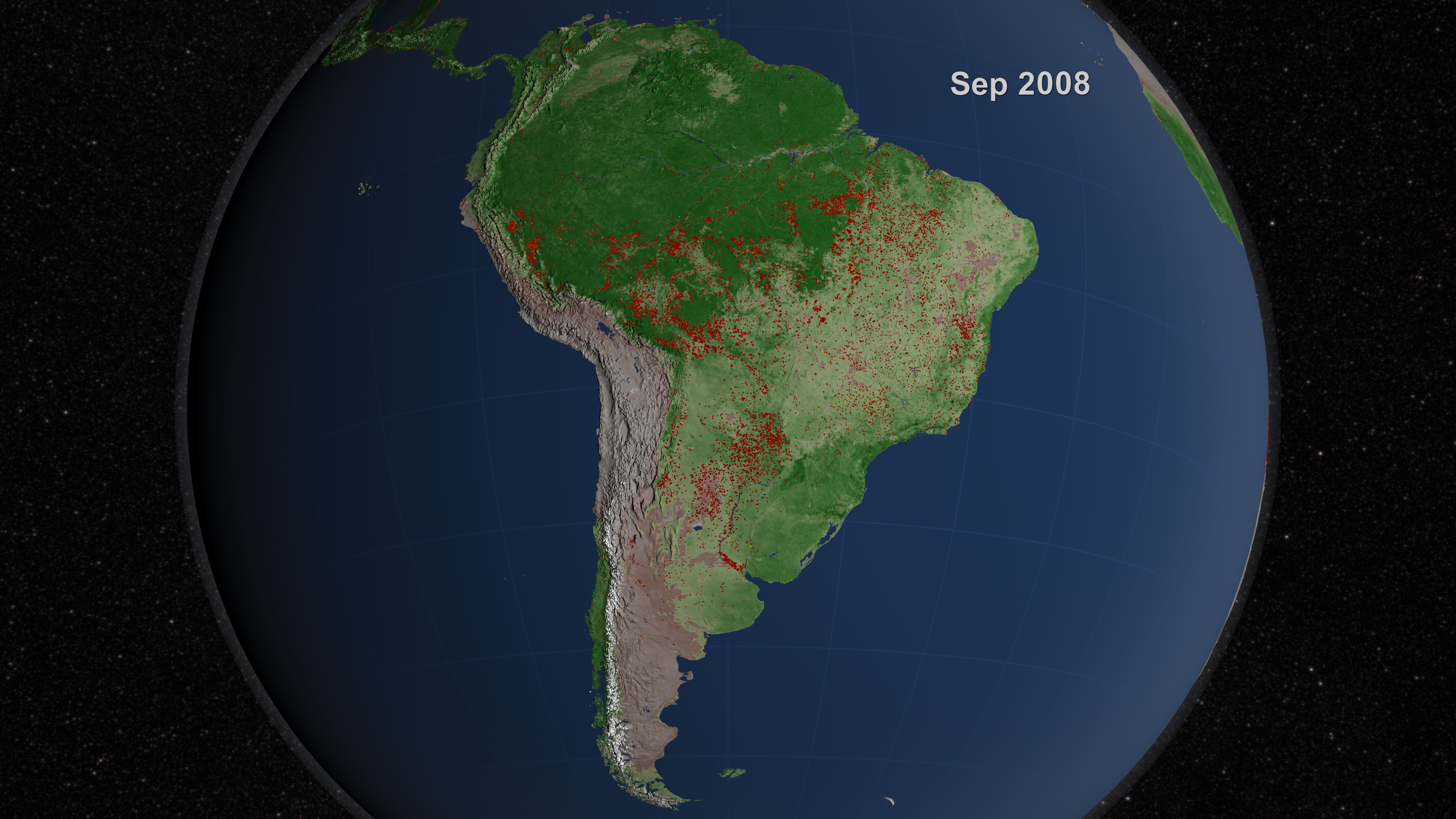

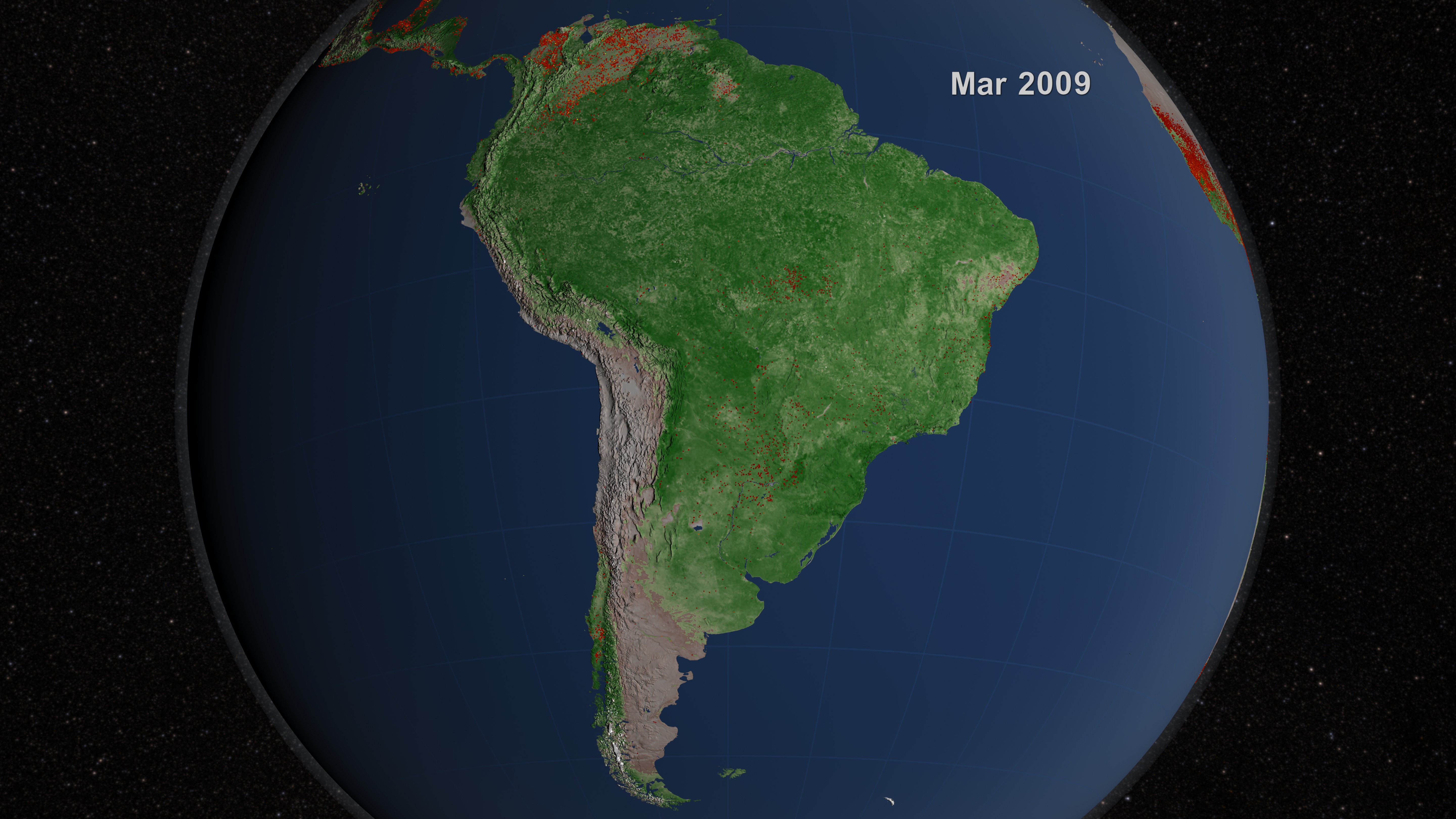
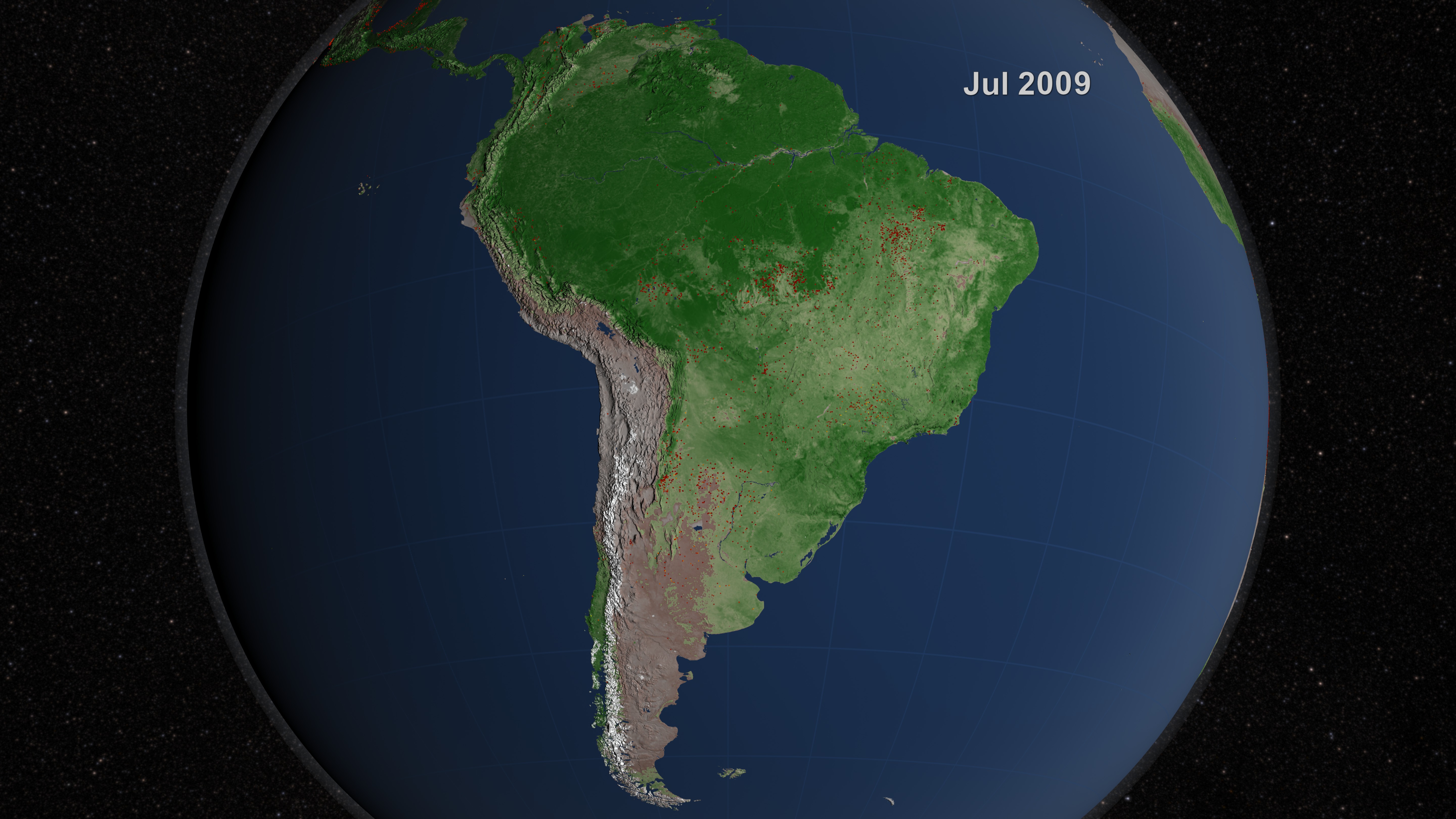
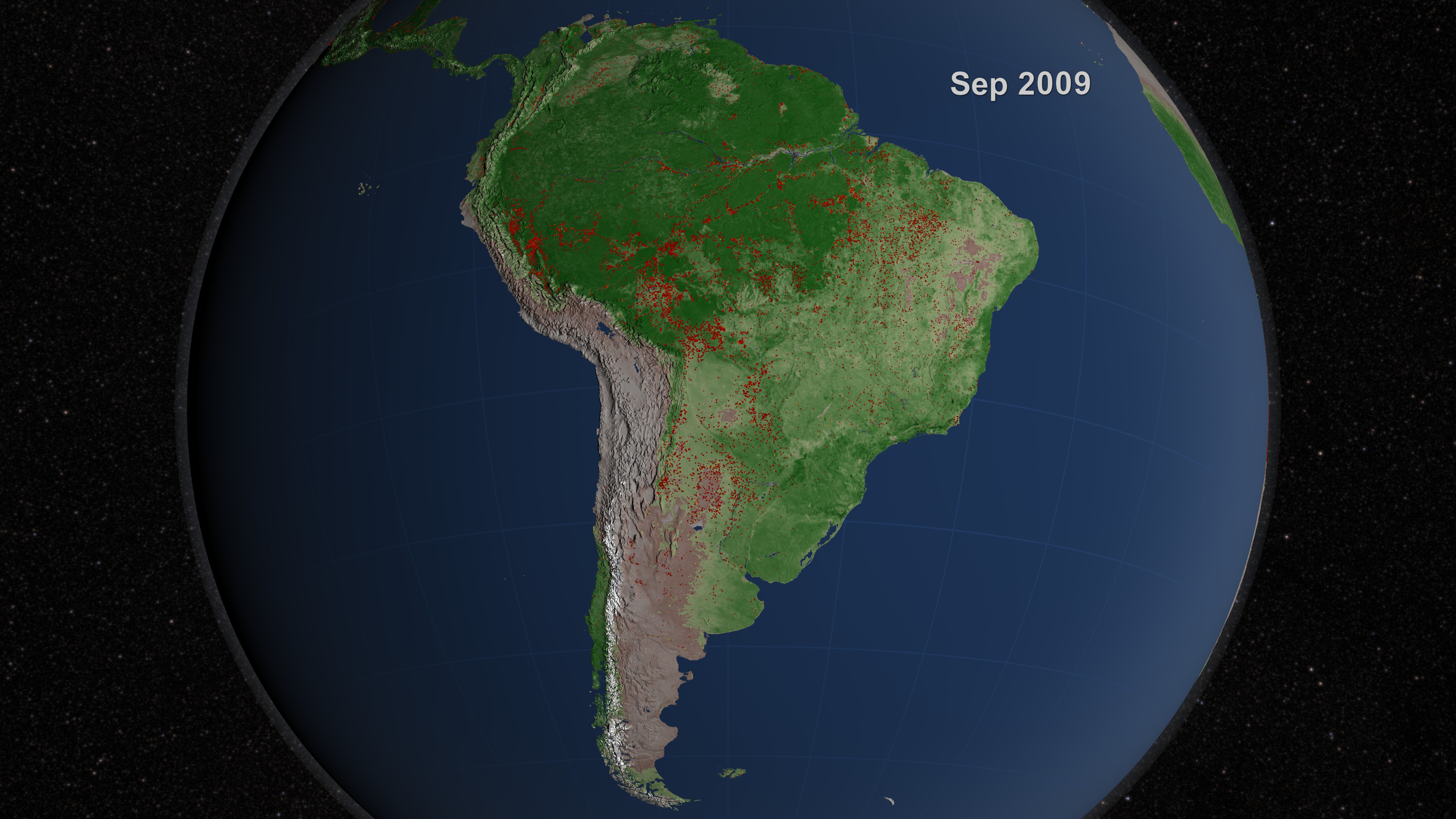
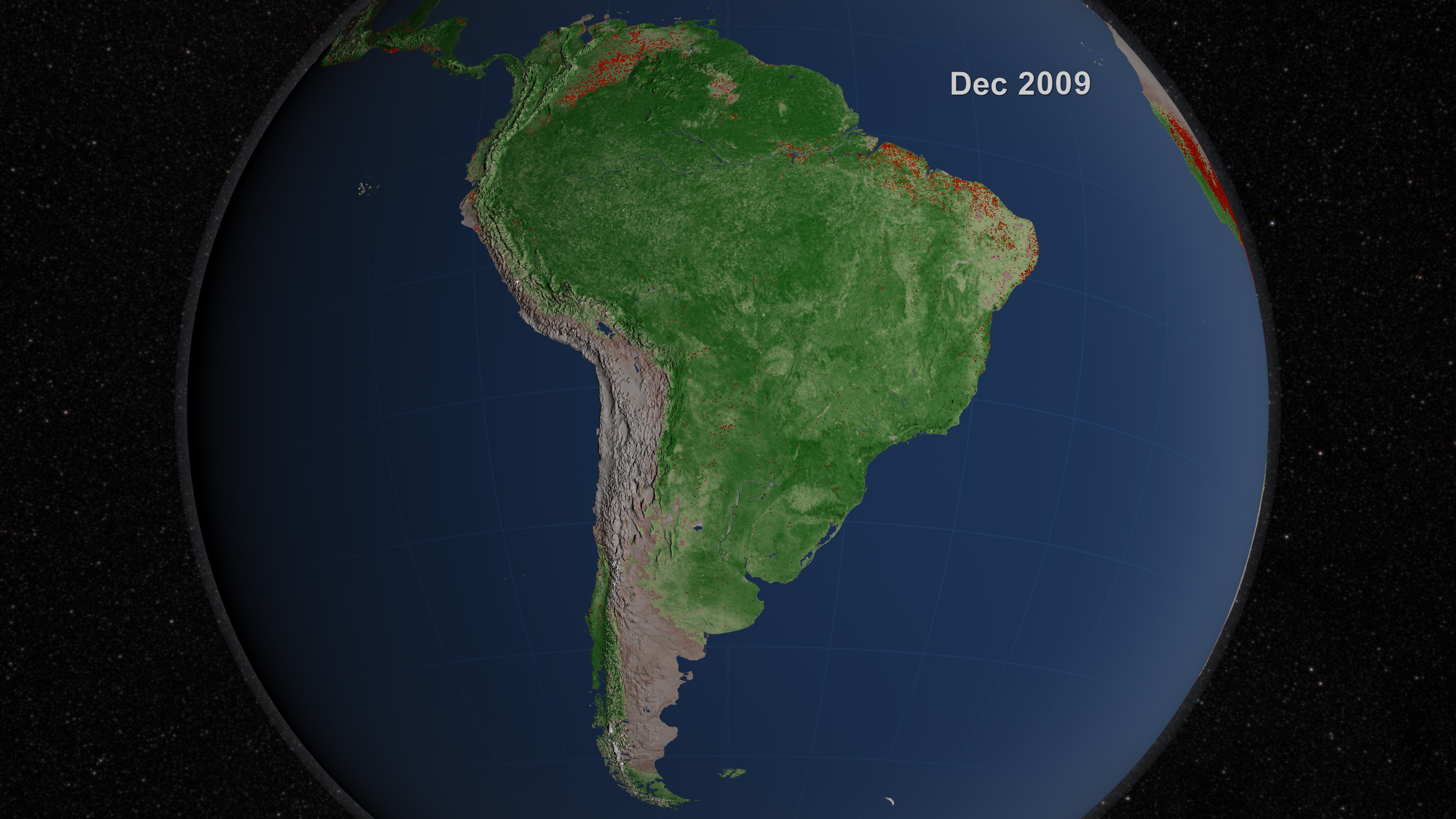
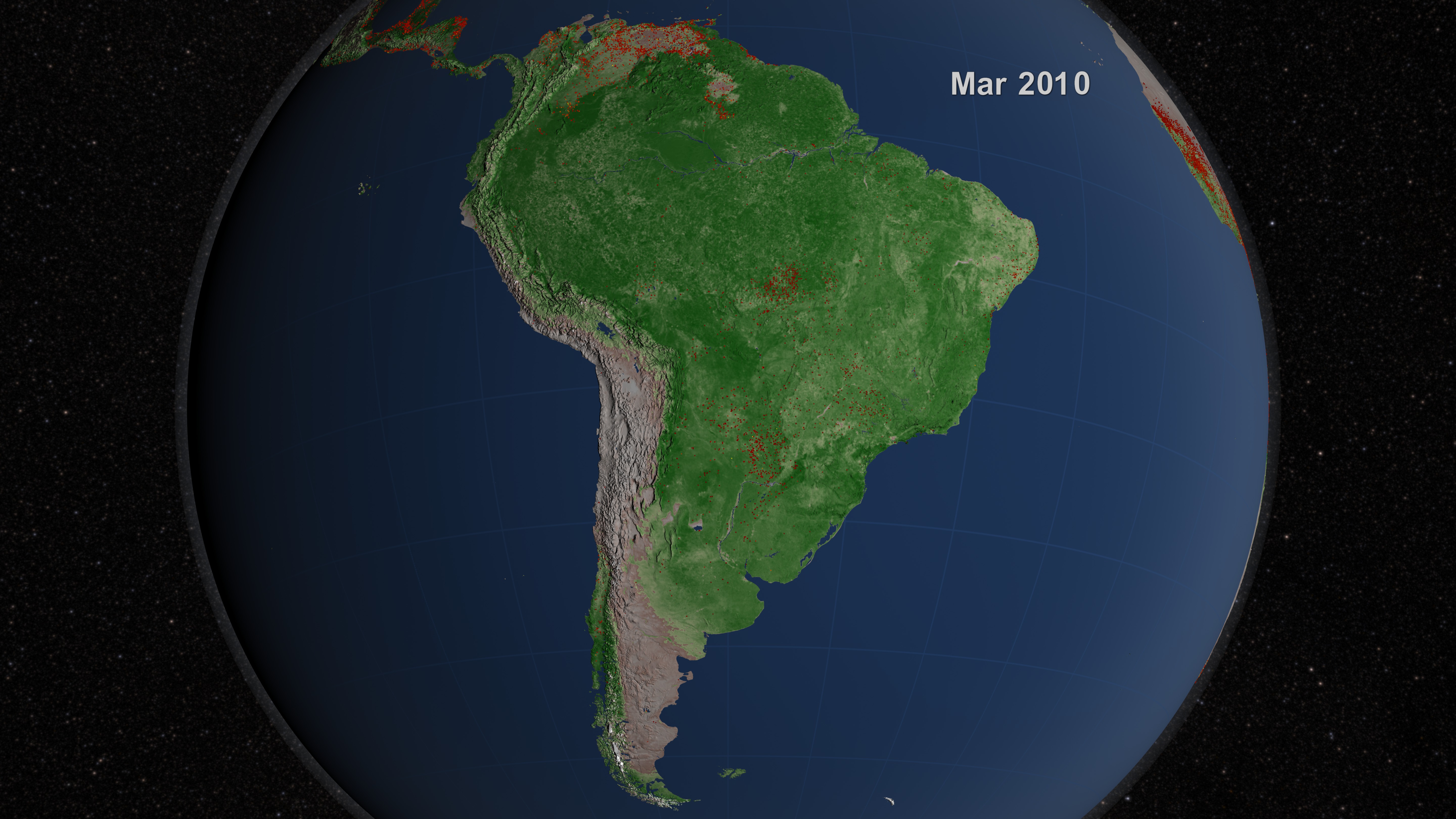


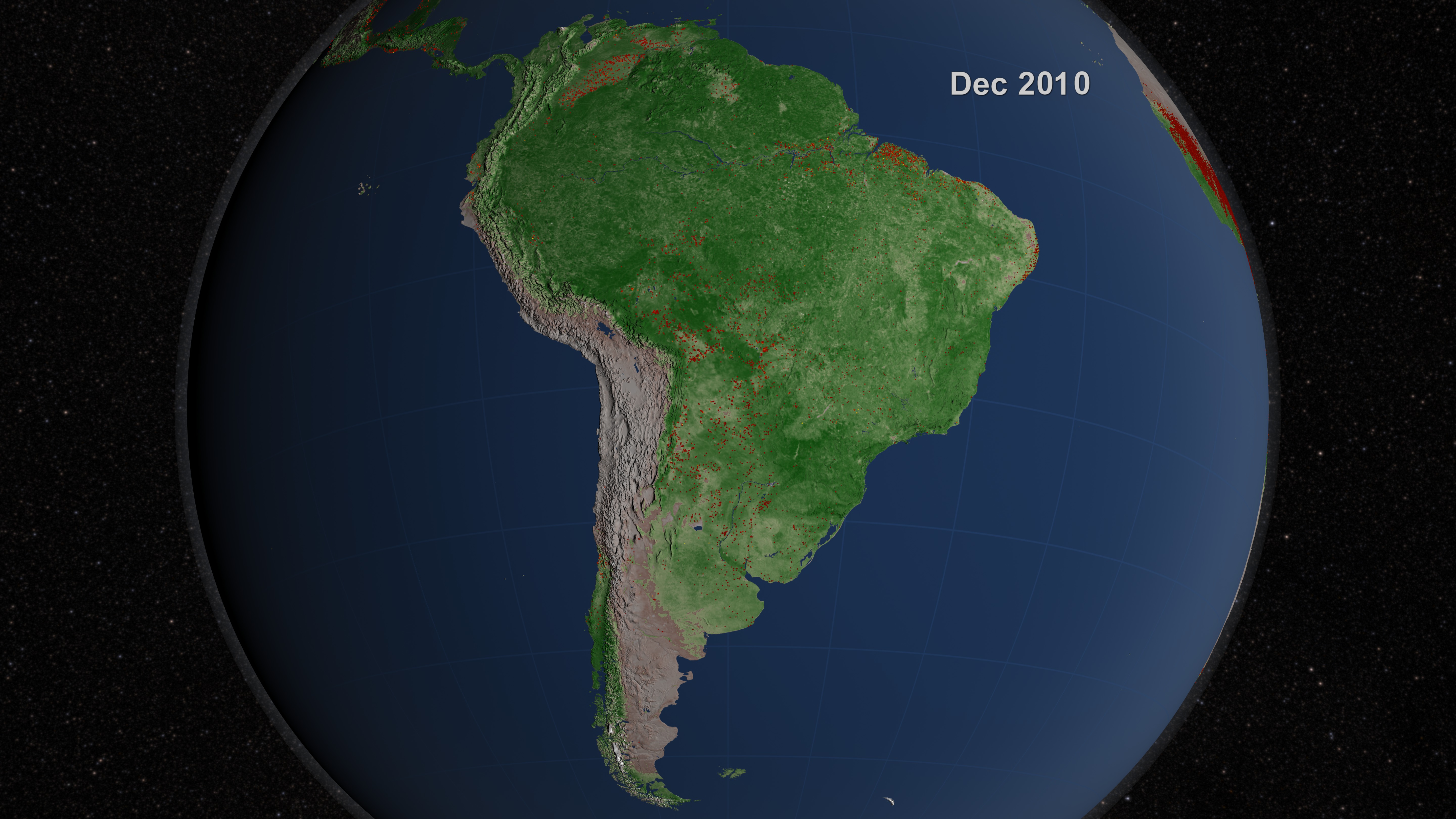

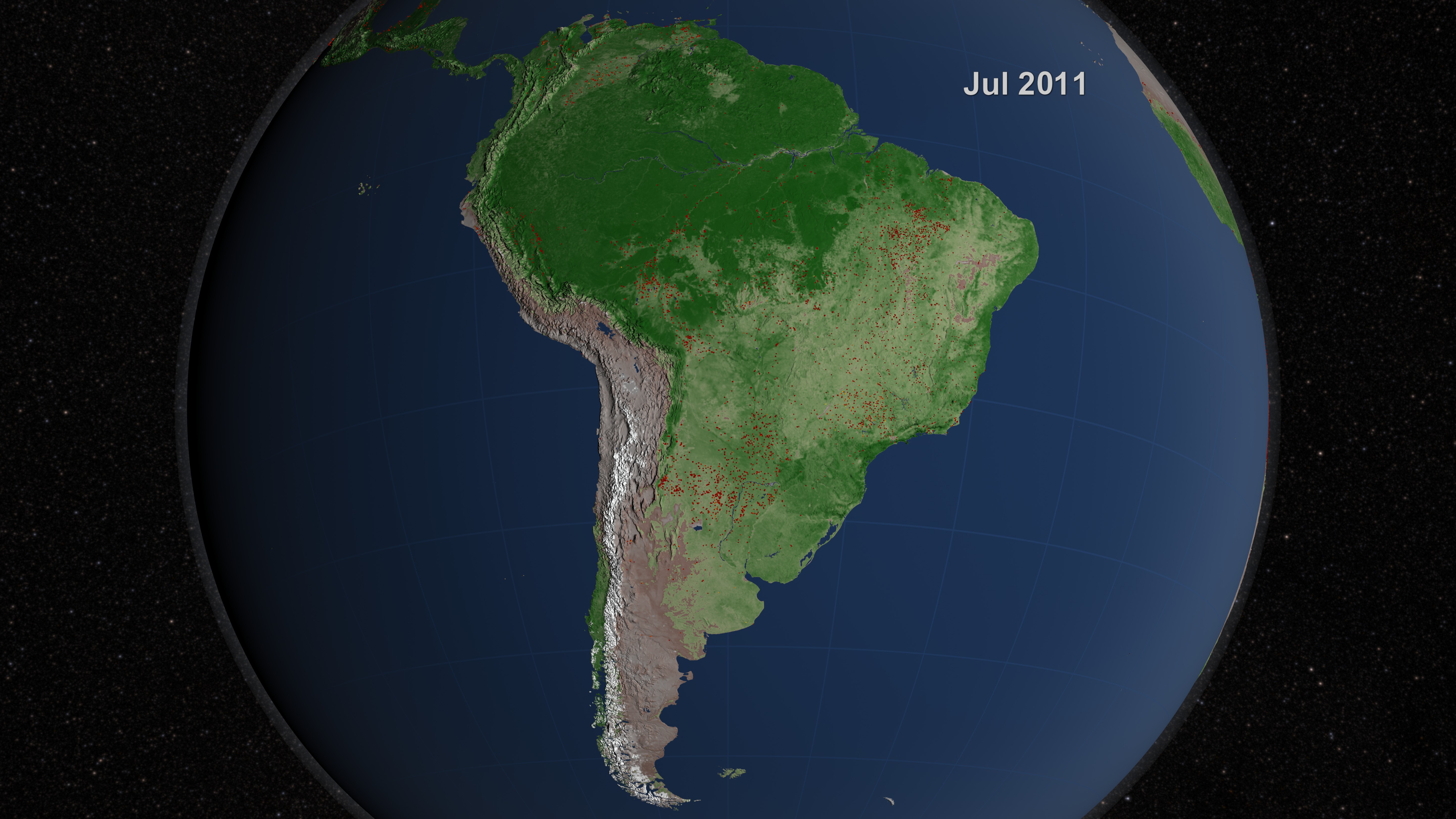
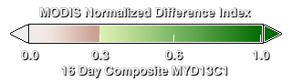
South American Fire Observations and MODIS NDVI
More information on the Fire Information for Resource Management (FIRMS) is available at http://maps.geog.umd.edu/firms/.
Related
Visualization Credits
Lori Perkins (NASA/GSFC): Lead Animator
Greg Shirah (NASA/GSFC): Animator
Kayvon Sharghi (USRA): Producer
Chris Justice (University of Maryland): Scientist
Louis Giglio (SSAI): Scientist
Luigi Boschetti Ph.D. (University Of Maryland College Park): Scientist
Adam P Voiland (Wyle Information Systems): Writer
Greg Shirah (NASA/GSFC): Animator
Kayvon Sharghi (USRA): Producer
Chris Justice (University of Maryland): Scientist
Louis Giglio (SSAI): Scientist
Luigi Boschetti Ph.D. (University Of Maryland College Park): Scientist
Adam P Voiland (Wyle Information Systems): Writer
Please give credit for this item to:
NASA/Goddard Space Flight Center Scientific Visualization Studio
NASA/Goddard Space Flight Center Scientific Visualization Studio
Short URL to share this page:
https://svs.gsfc.nasa.gov/3872
Mission:
Terra
Data Used:
Note: While we identify the data sets used in these visualizations, we do not store any further details nor the data sets themselves on our site.
Dates of Data Used:
2002/07/01 - 2011/07/30
This item is part of these series:
Fires
Multisensor Fire Observations
NDVI
Agriculture Animations - Fires
Keywords:
DLESE >> Atmospheric science
DLESE >> Forestry
SVS >> HDTV
DLESE >> Natural hazards
GCMD >> Earth Science >> Biosphere >> Ecological Dynamics >> Fire Occurrence
GCMD >> Earth Science >> Human Dimensions >> Natural Hazards >> Fires
SVS >> Hyperwall
SVS >> For Educators
SVS >> Ecosystems
SVS >> Natural Disaster
NASA Science >> Earth
NASA Earth Science Focus Areas >> Carbon Cycle and Ecosystems
GCMD keywords can be found on the Internet with the following citation: Olsen, L.M., G. Major, K. Shein, J. Scialdone, S. Ritz, T. Stevens, M. Morahan, A. Aleman, R. Vogel, S. Leicester, H. Weir, M. Meaux, S. Grebas, C.Solomon, M. Holland, T. Northcutt, R. A. Restrepo, R. Bilodeau, 2013. NASA/Global Change Master Directory (GCMD) Earth Science Keywords. Version 8.0.0.0.0
https://svs.gsfc.nasa.gov/3872
Mission:
Terra
Data Used:
Terra and Aqua/MODIS/Fire Location
Credit:
Fire location data courtesy of MODIS Rapid Response Project (NASA/GSFC and University of Maryland - http://rapidfire.sci.gsfc.nasa.gov)
Fire location data courtesy of MODIS Rapid Response Project (NASA/GSFC and University of Maryland - http://rapidfire.sci.gsfc.nasa.gov)
Terra and Aqua/MODIS/Normalized Difference Vegetation Index (NDVI) also referred to as: NDVI
NASADates of Data Used:
2002/07/01 - 2011/07/30
This item is part of these series:
Fires
Multisensor Fire Observations
NDVI
Agriculture Animations - Fires
Keywords:
DLESE >> Atmospheric science
DLESE >> Forestry
SVS >> HDTV
DLESE >> Natural hazards
GCMD >> Earth Science >> Biosphere >> Ecological Dynamics >> Fire Occurrence
GCMD >> Earth Science >> Human Dimensions >> Natural Hazards >> Fires
SVS >> Hyperwall
SVS >> For Educators
SVS >> Ecosystems
SVS >> Natural Disaster
NASA Science >> Earth
NASA Earth Science Focus Areas >> Carbon Cycle and Ecosystems
GCMD keywords can be found on the Internet with the following citation: Olsen, L.M., G. Major, K. Shein, J. Scialdone, S. Ritz, T. Stevens, M. Morahan, A. Aleman, R. Vogel, S. Leicester, H. Weir, M. Meaux, S. Grebas, C.Solomon, M. Holland, T. Northcutt, R. A. Restrepo, R. Bilodeau, 2013. NASA/Global Change Master Directory (GCMD) Earth Science Keywords. Version 8.0.0.0.0


