Earth
ID: 3871
From space, we can understand fires in ways that are impossible from the ground. The MODIS instrument onboard the Terra and Aqua satellite, was specifically designed to detect fires. This visualization shows fire detections from July 2002 through July 2011. The visualization also includes vegetation and snow cover data to show how fires respond to seasonal changes. The tour begins in Australia in 2002 by showing a network of massive grassland fires spreading across interior Australia as well as the greener Eucalyptus forests in the northern and eastern part of the continent.
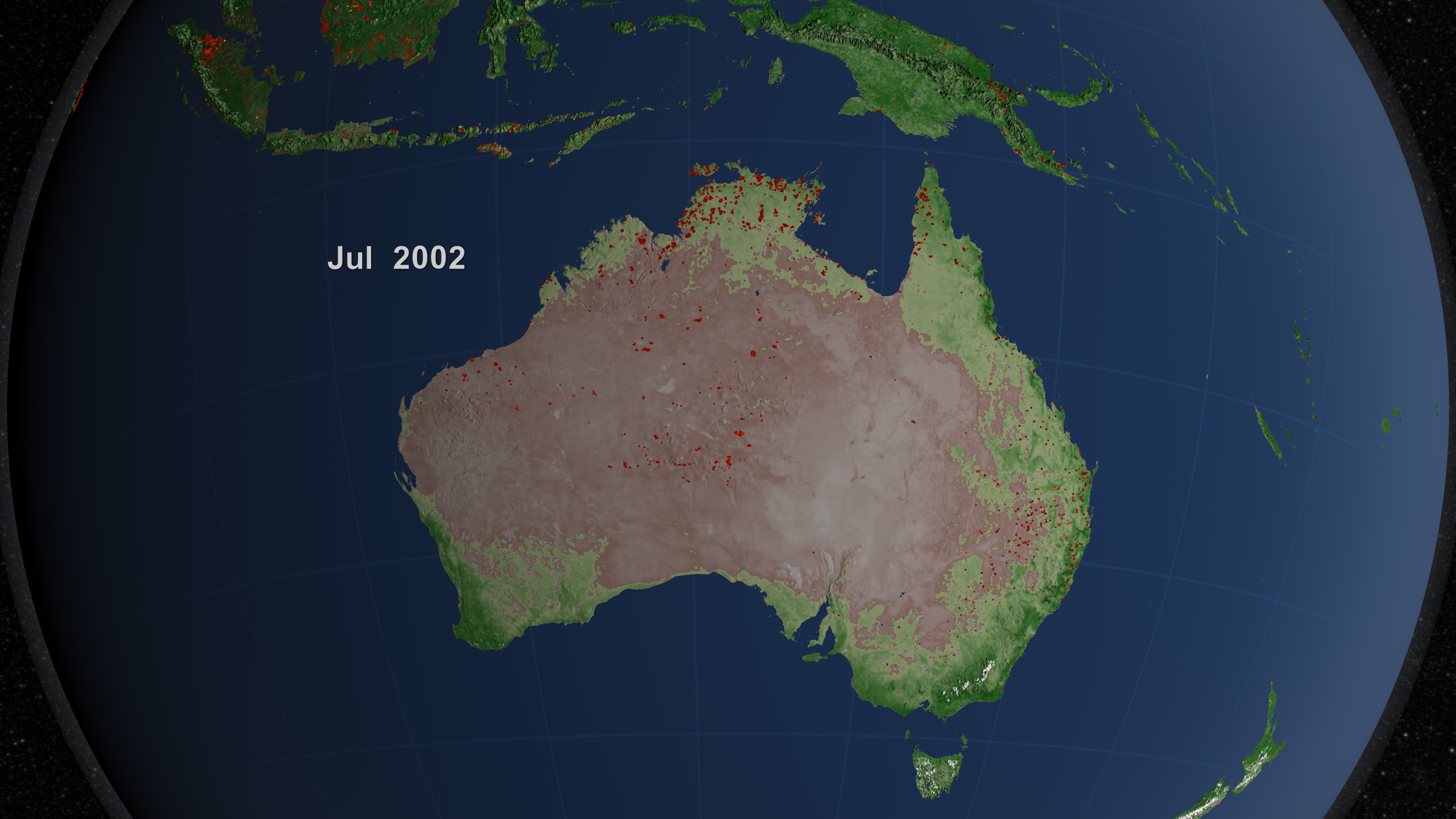
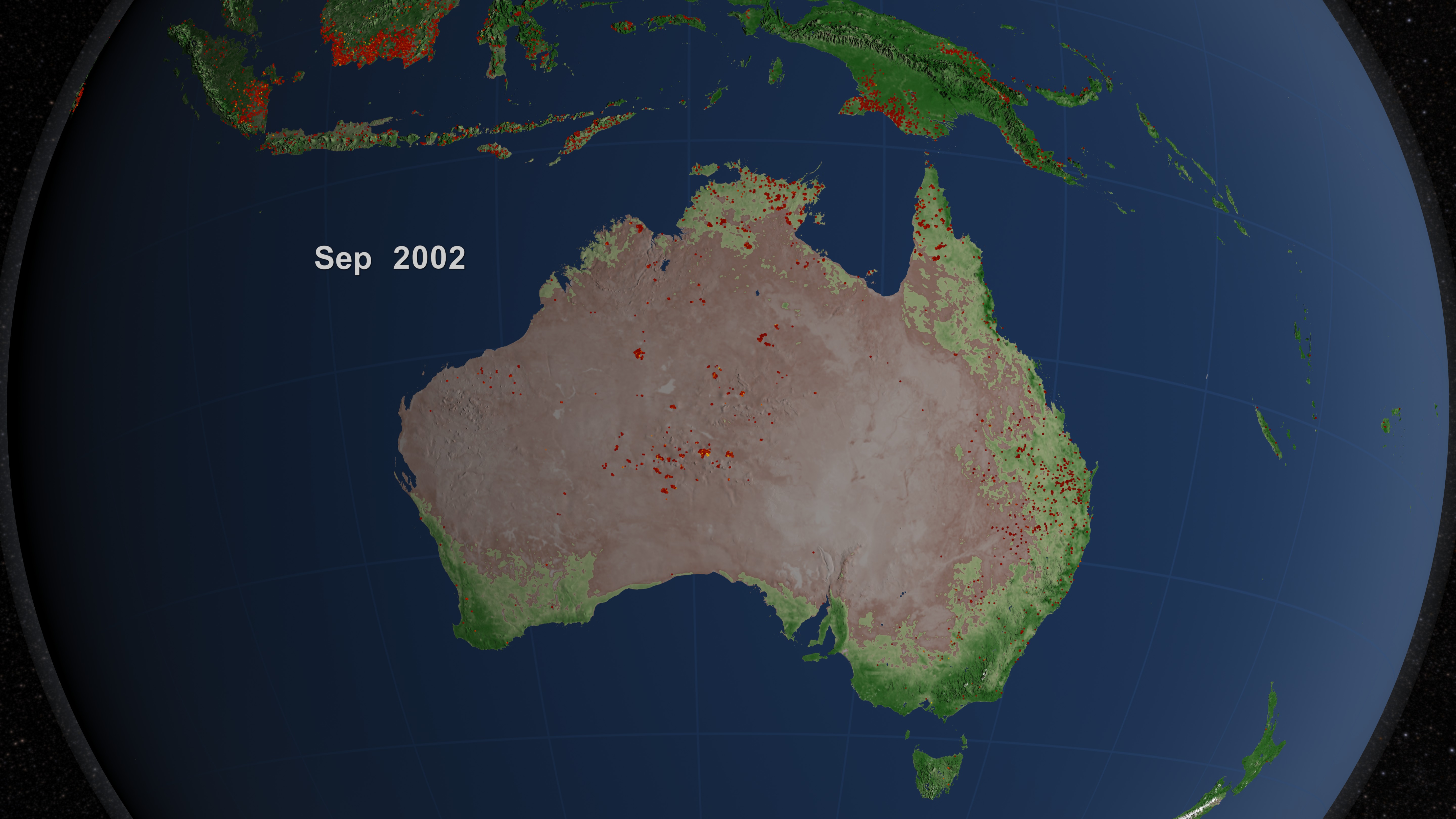
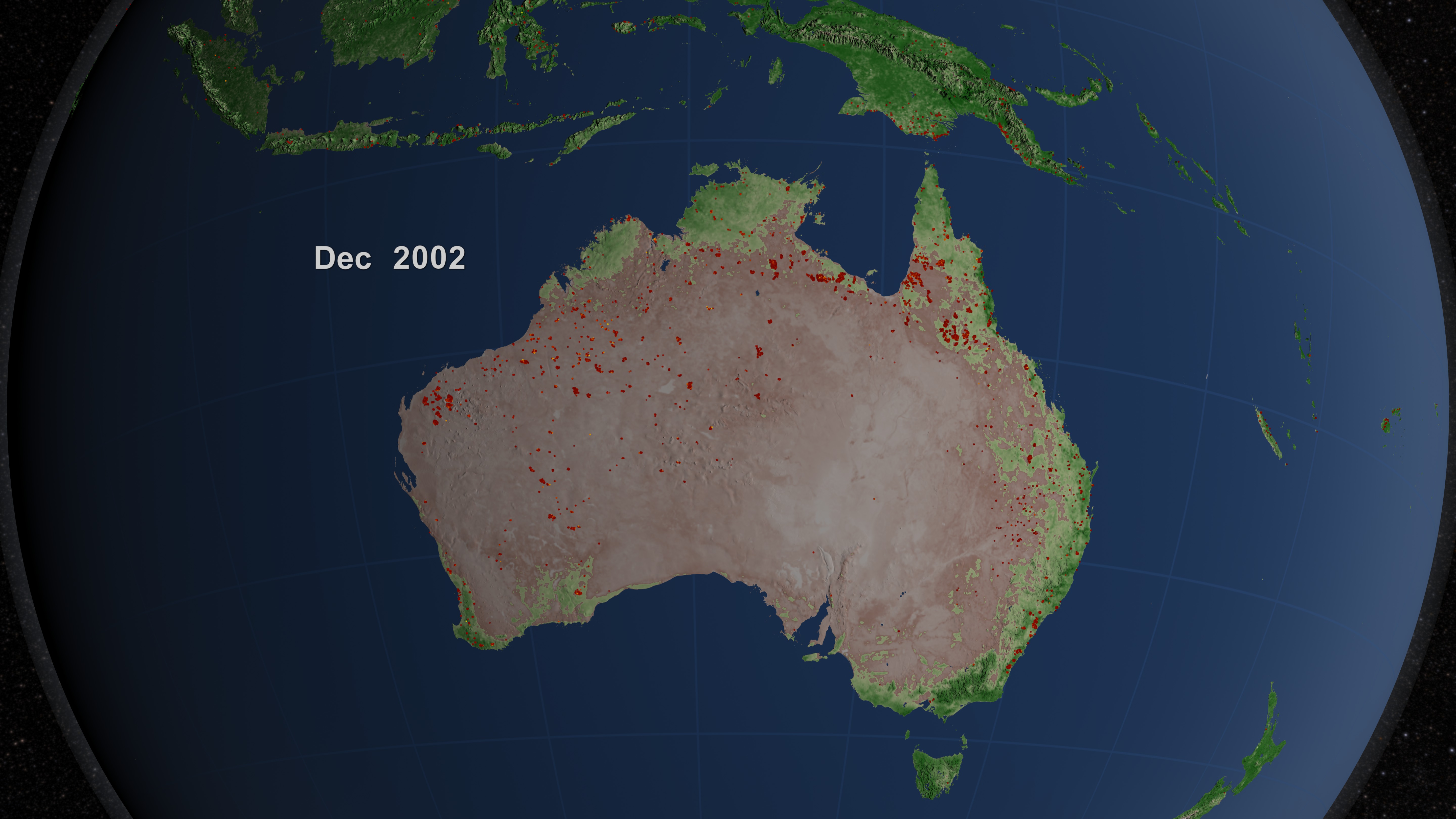
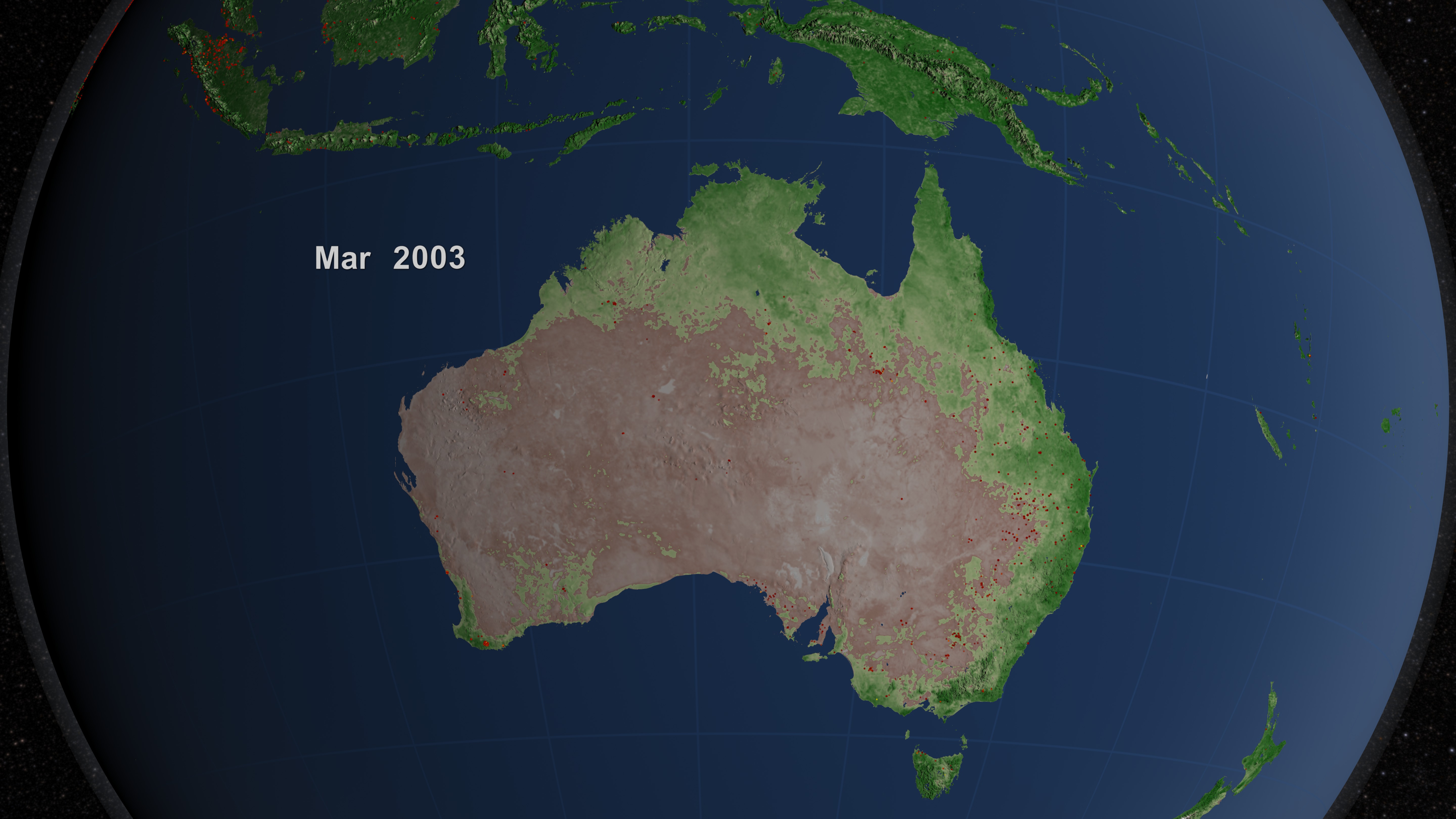


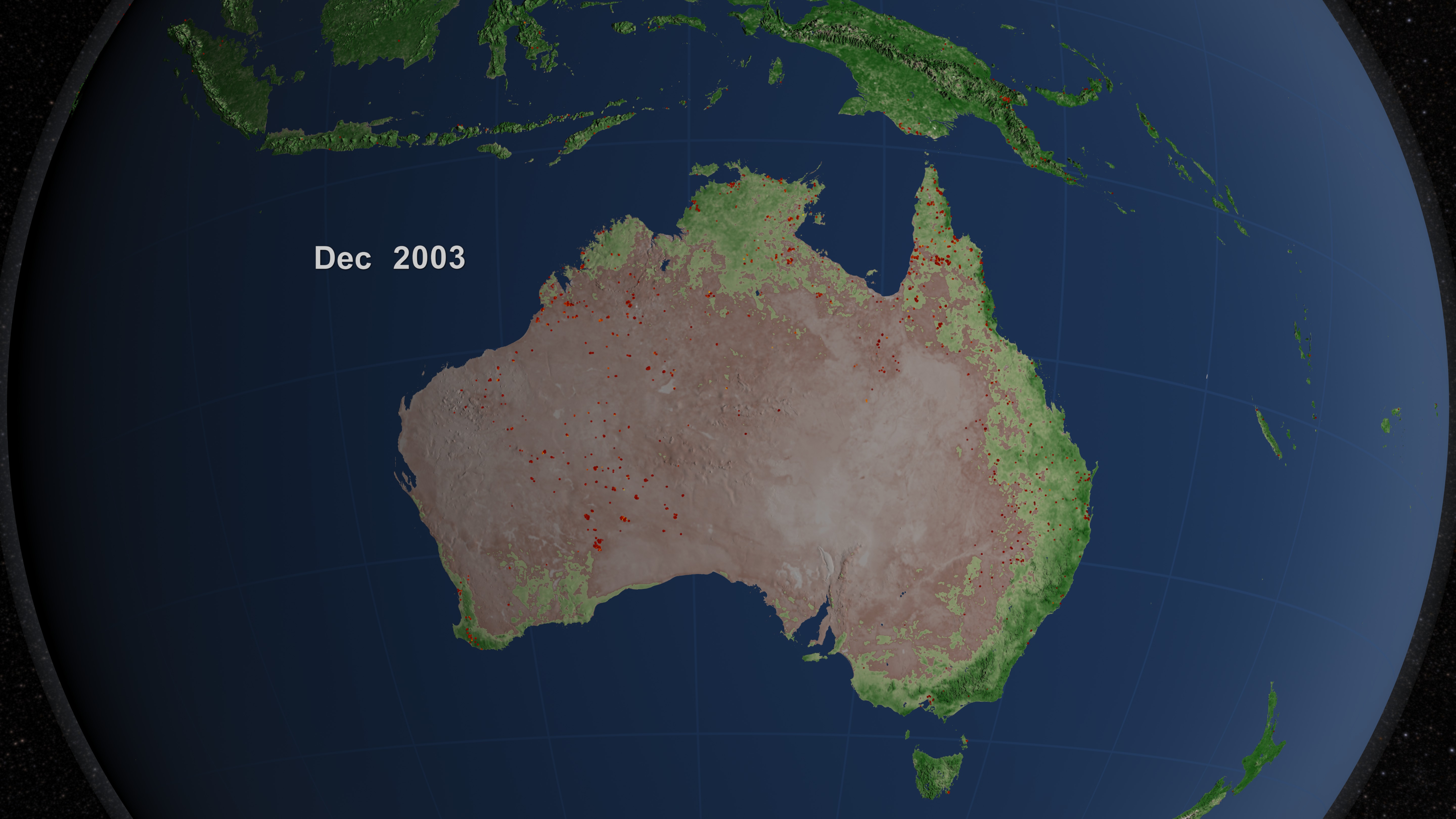

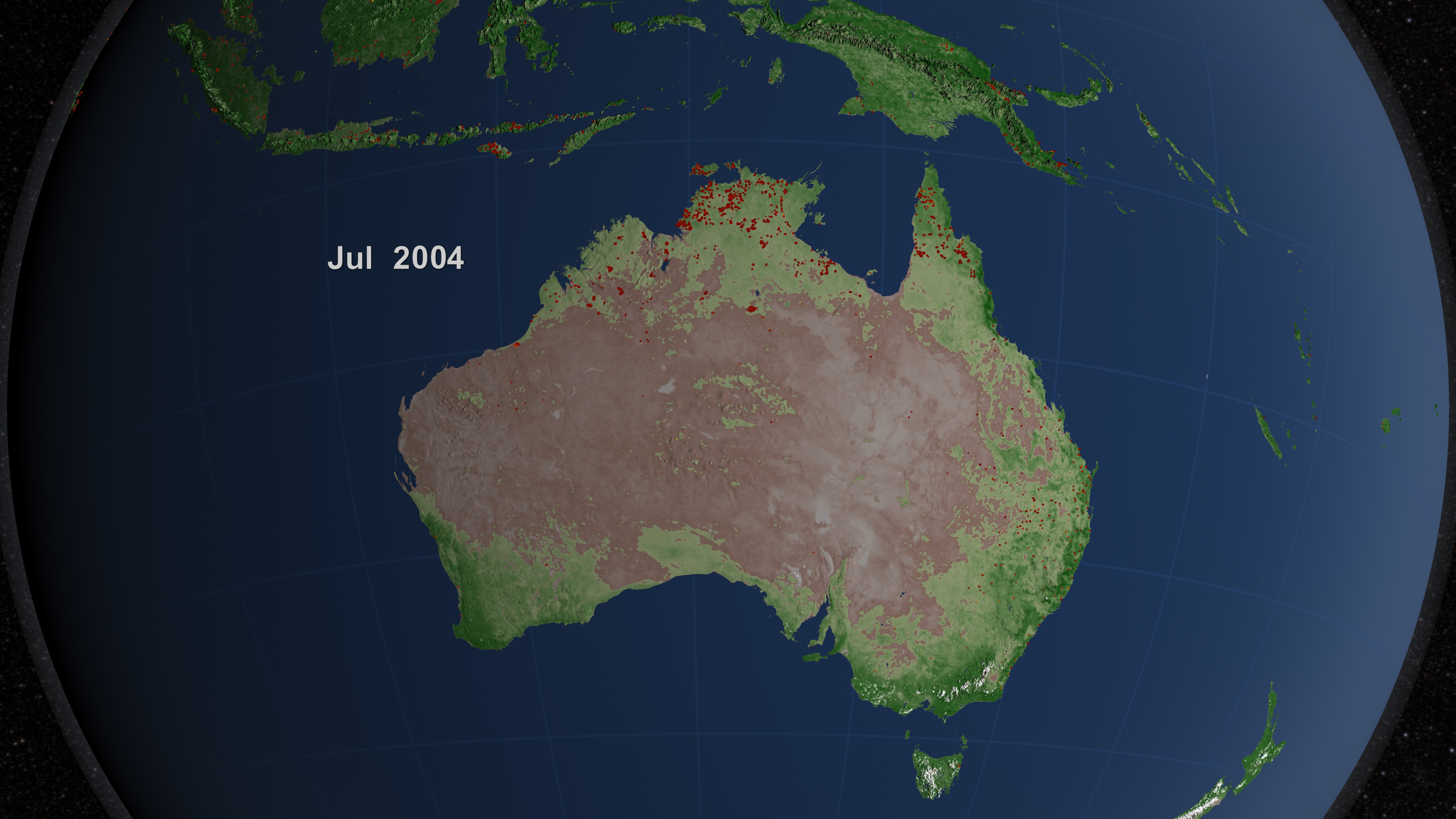

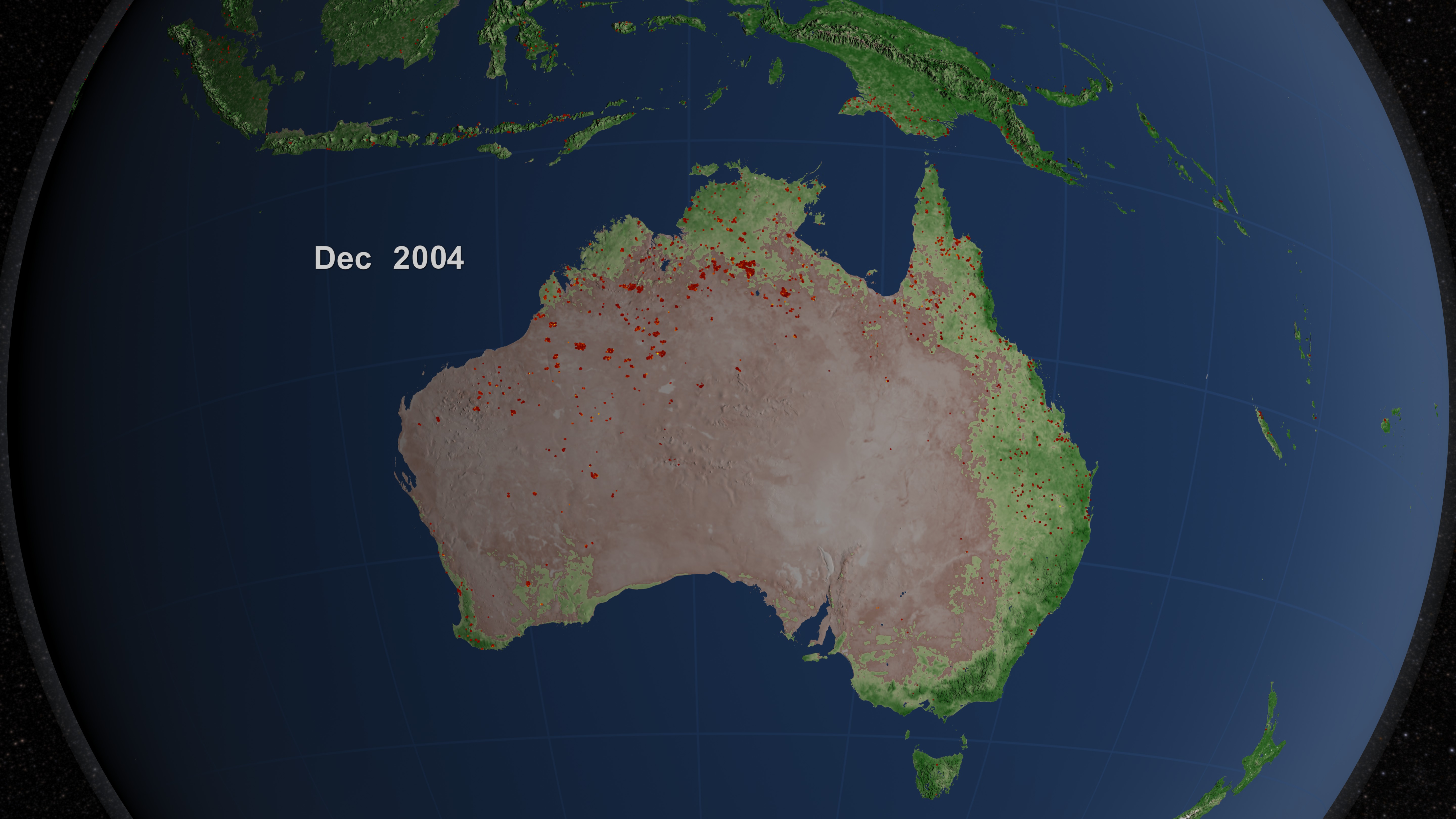


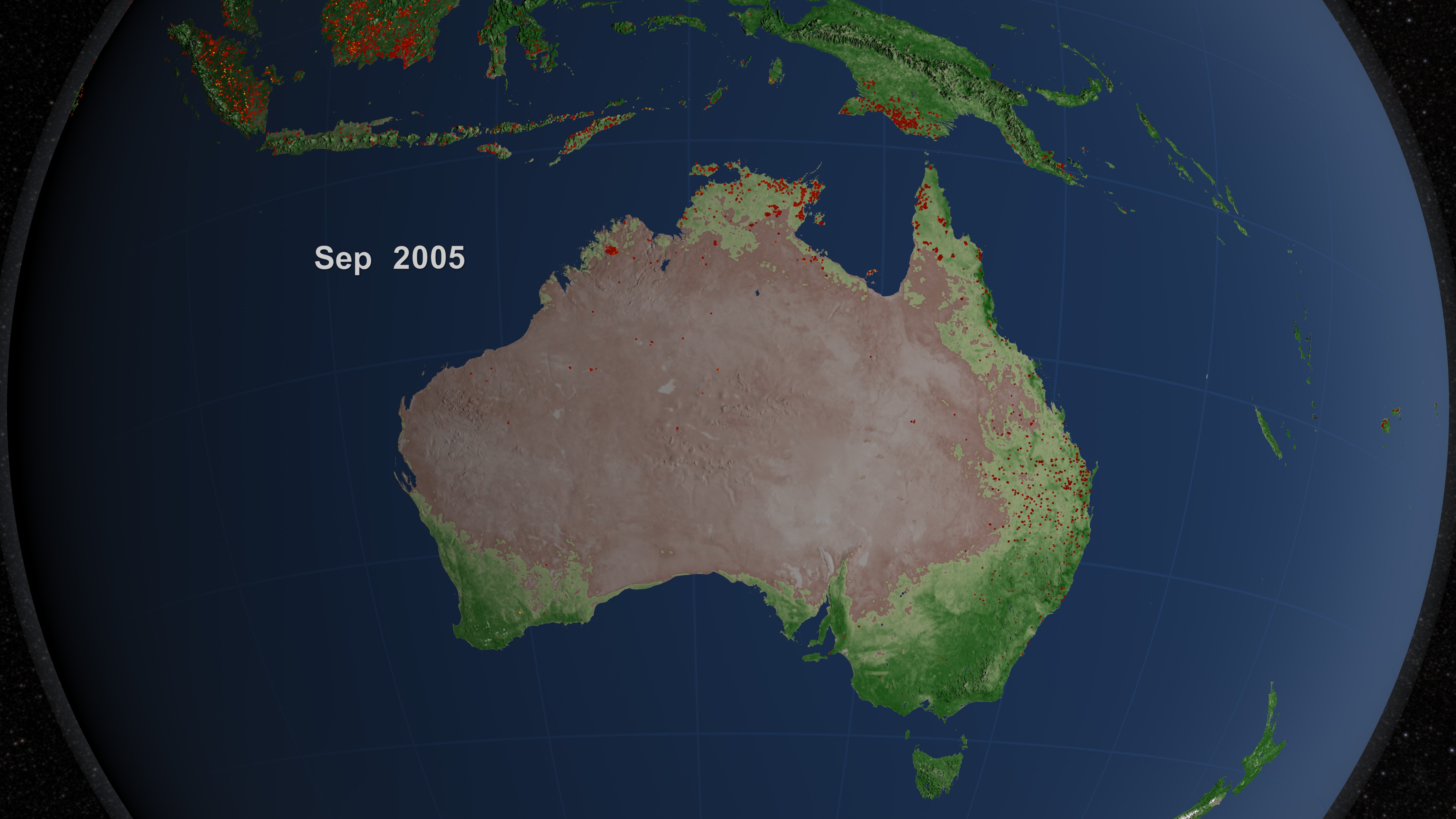

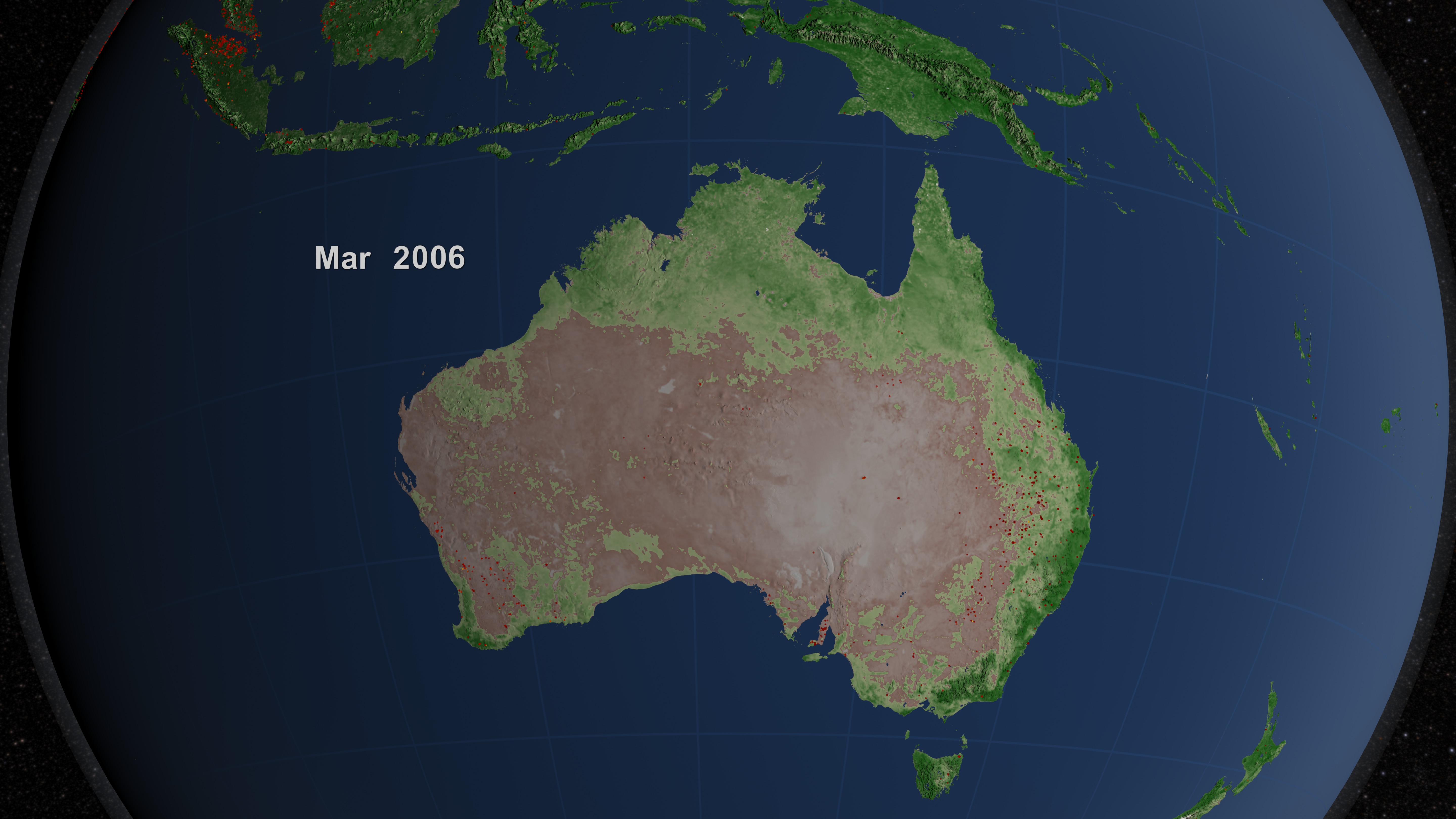


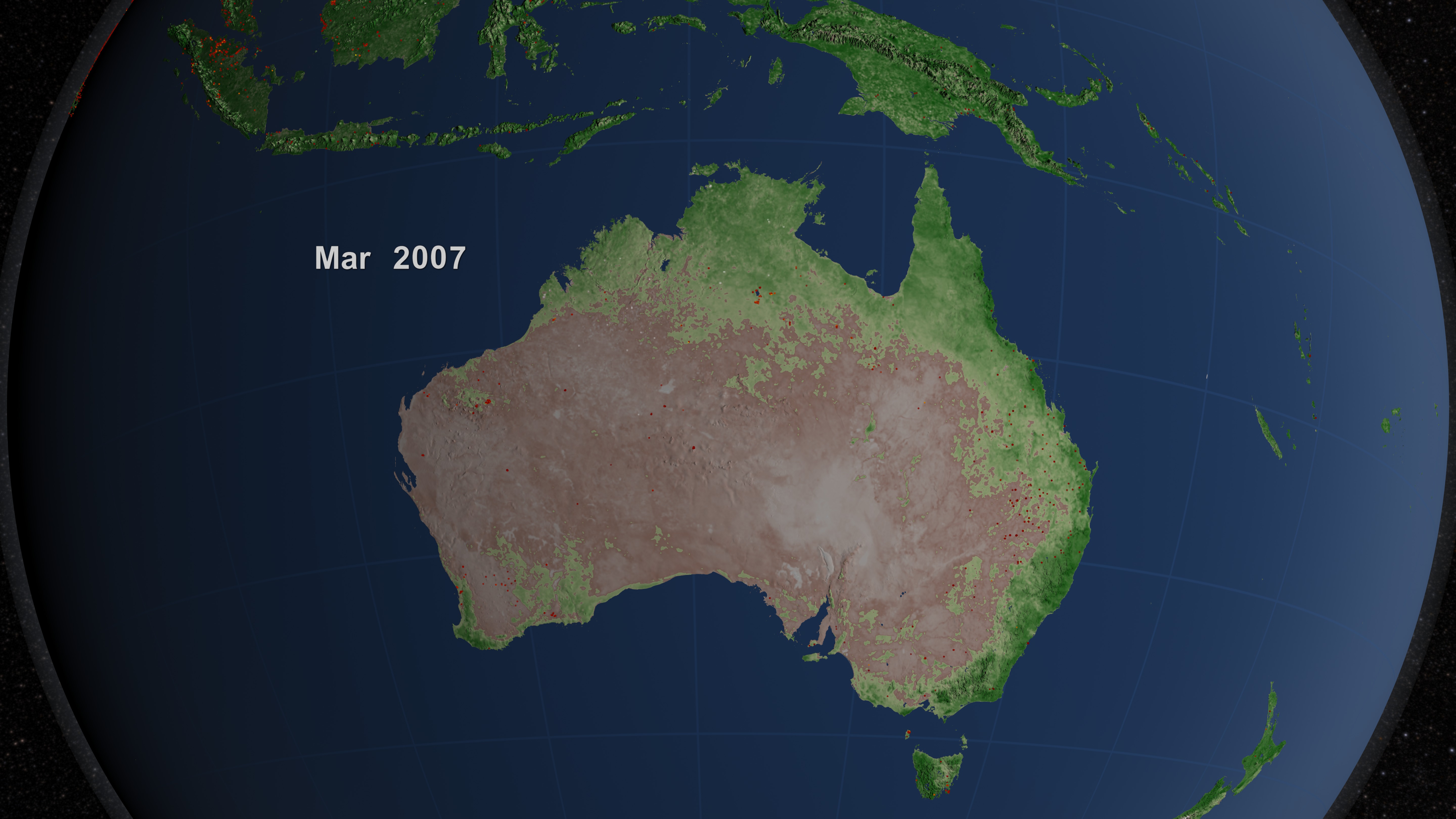
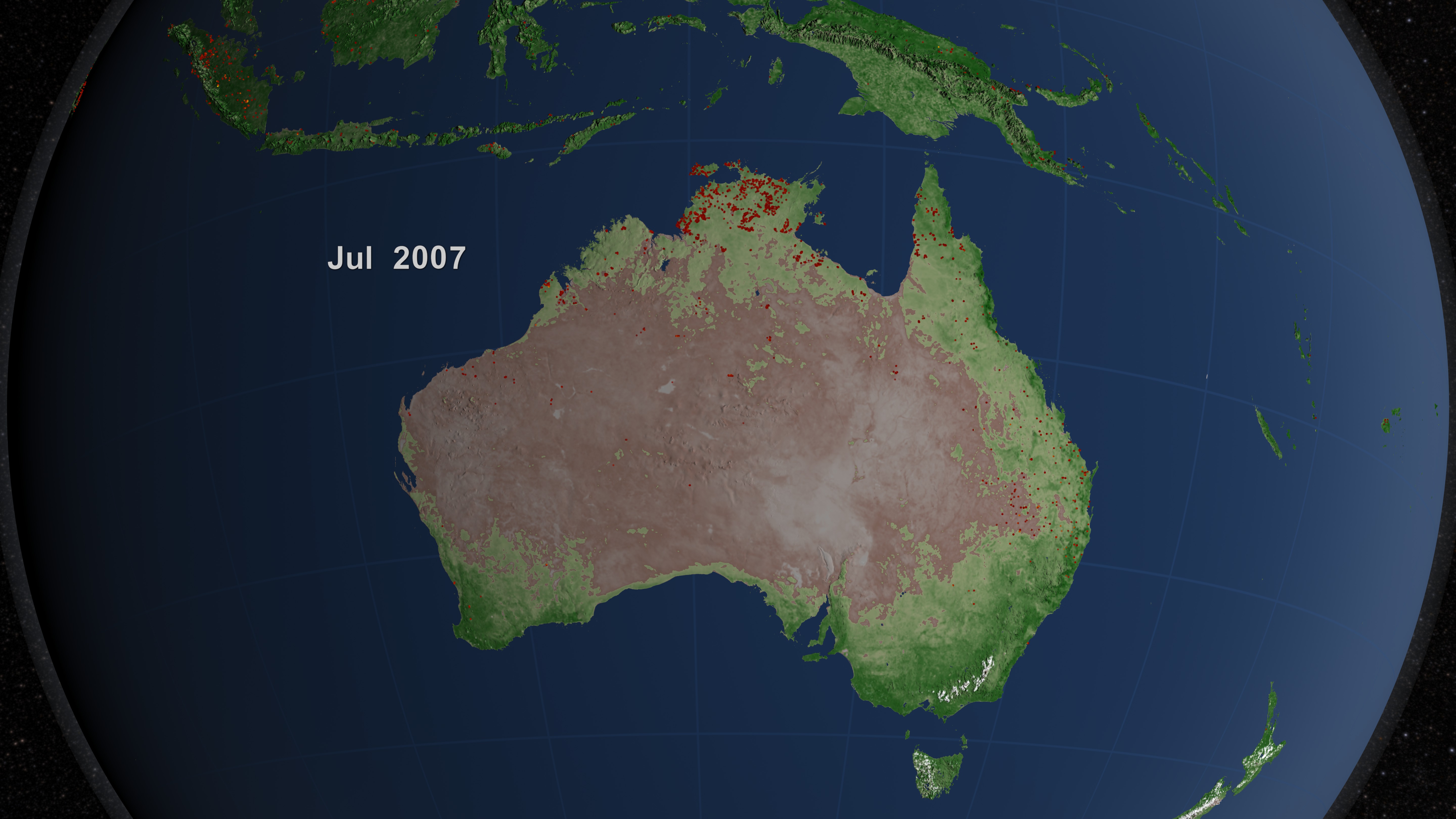

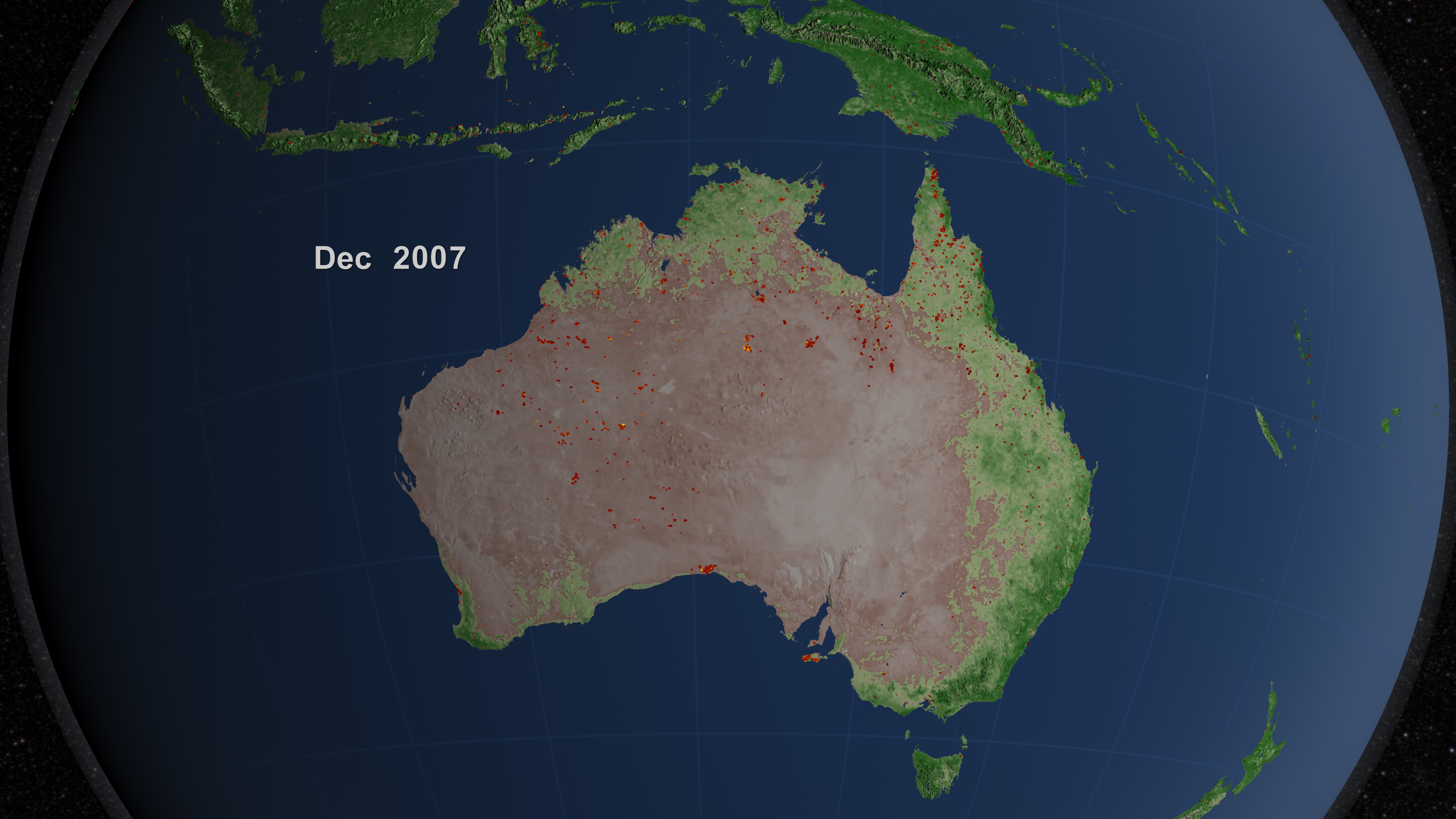

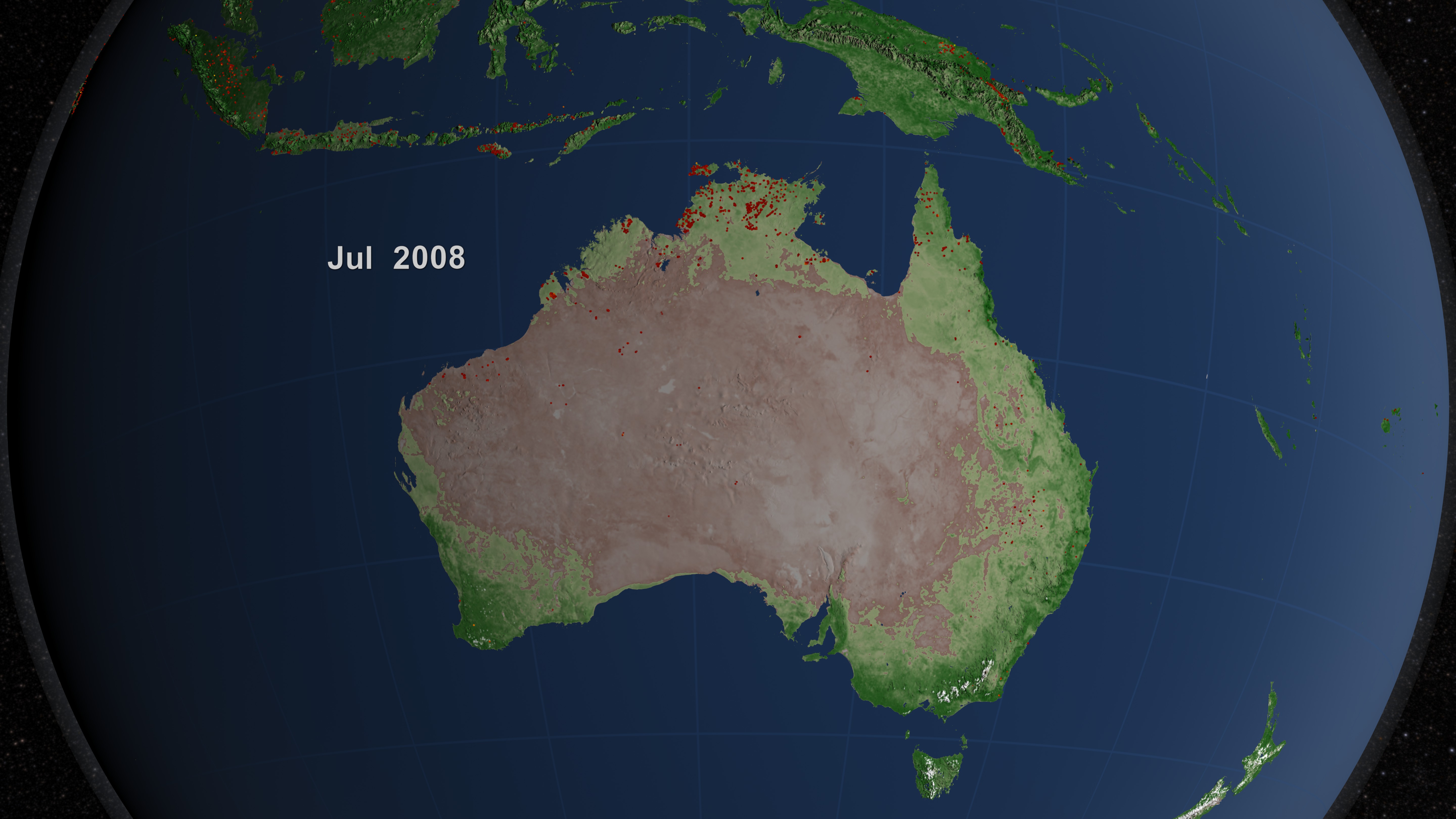
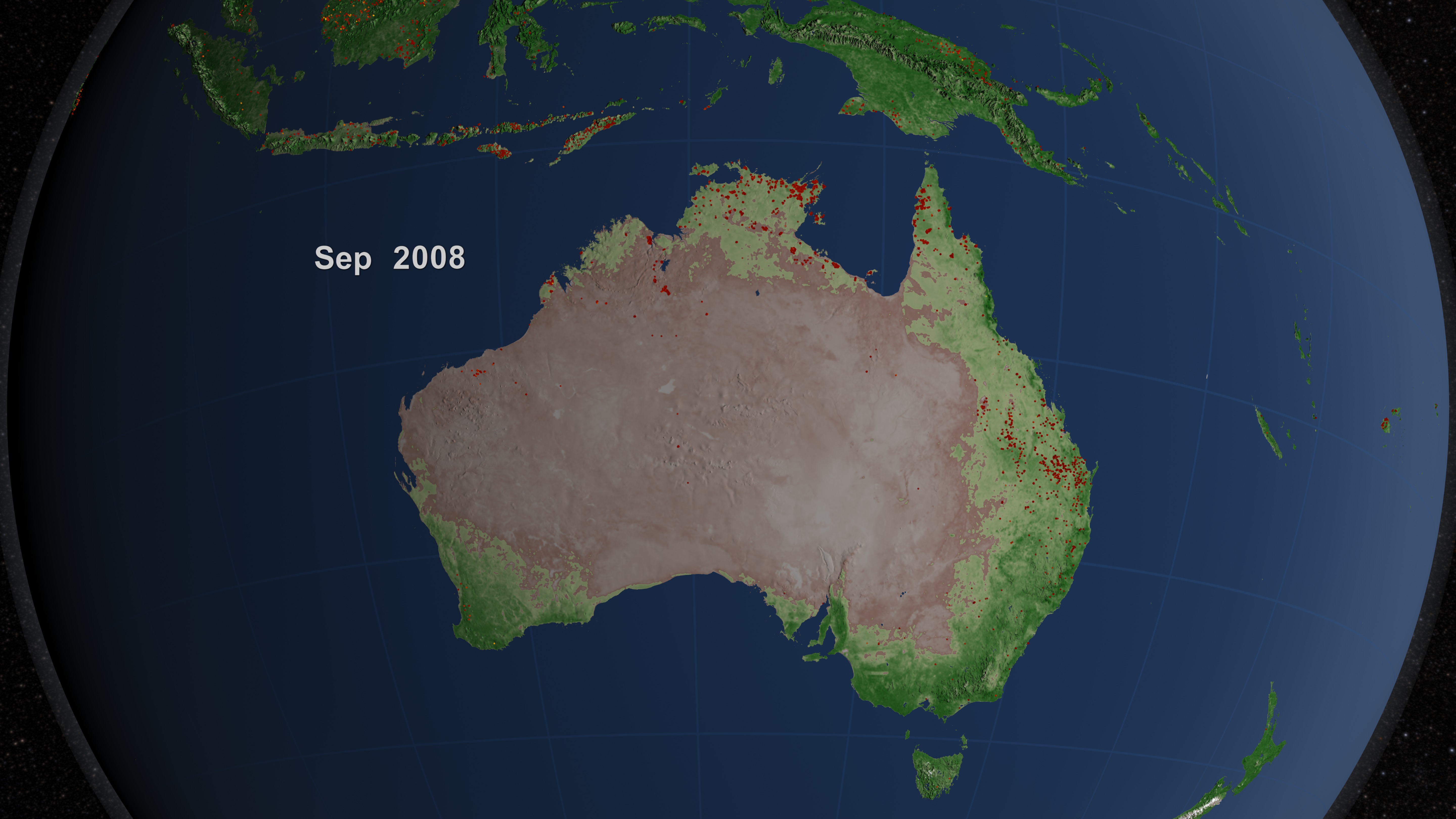
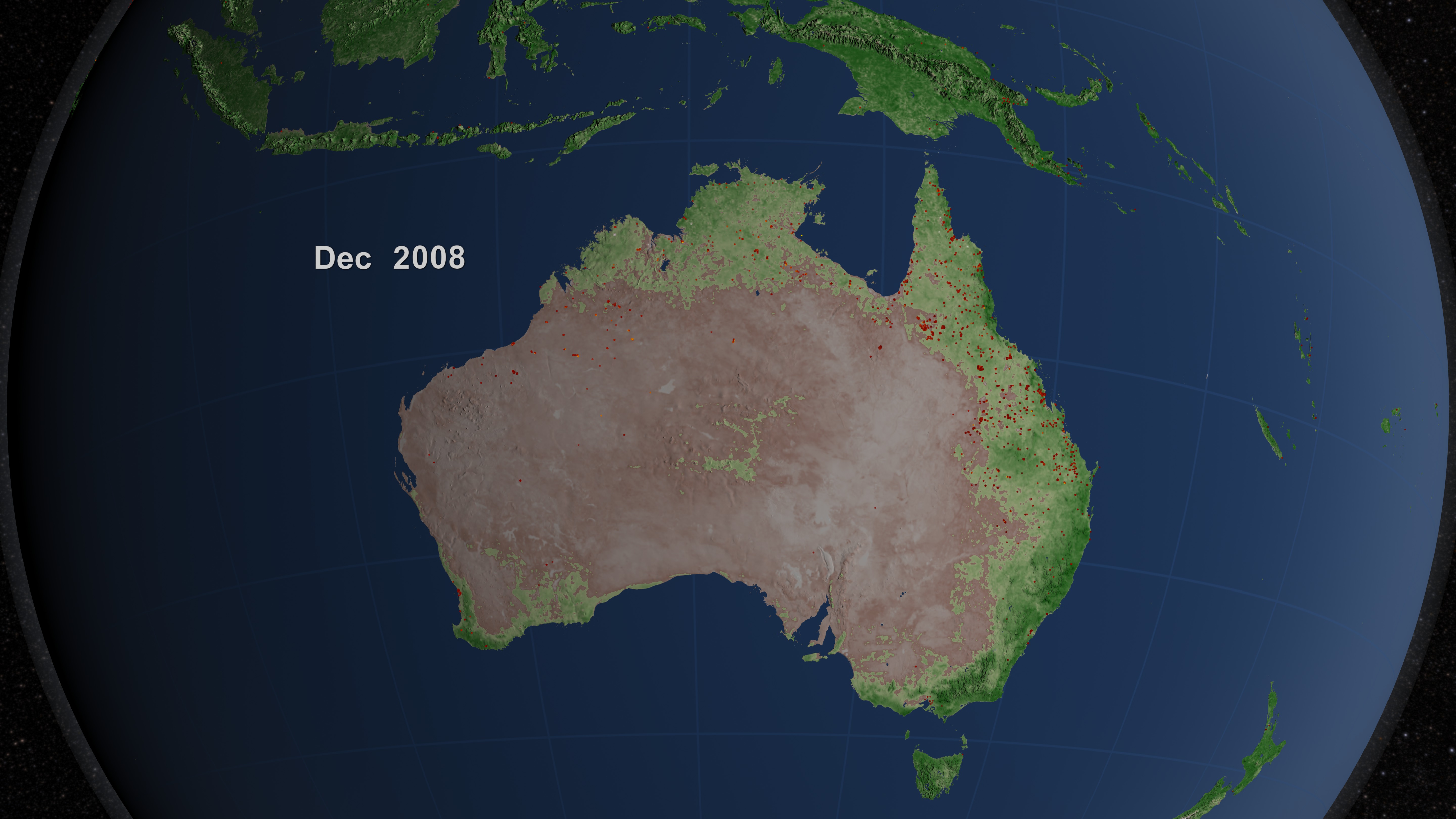

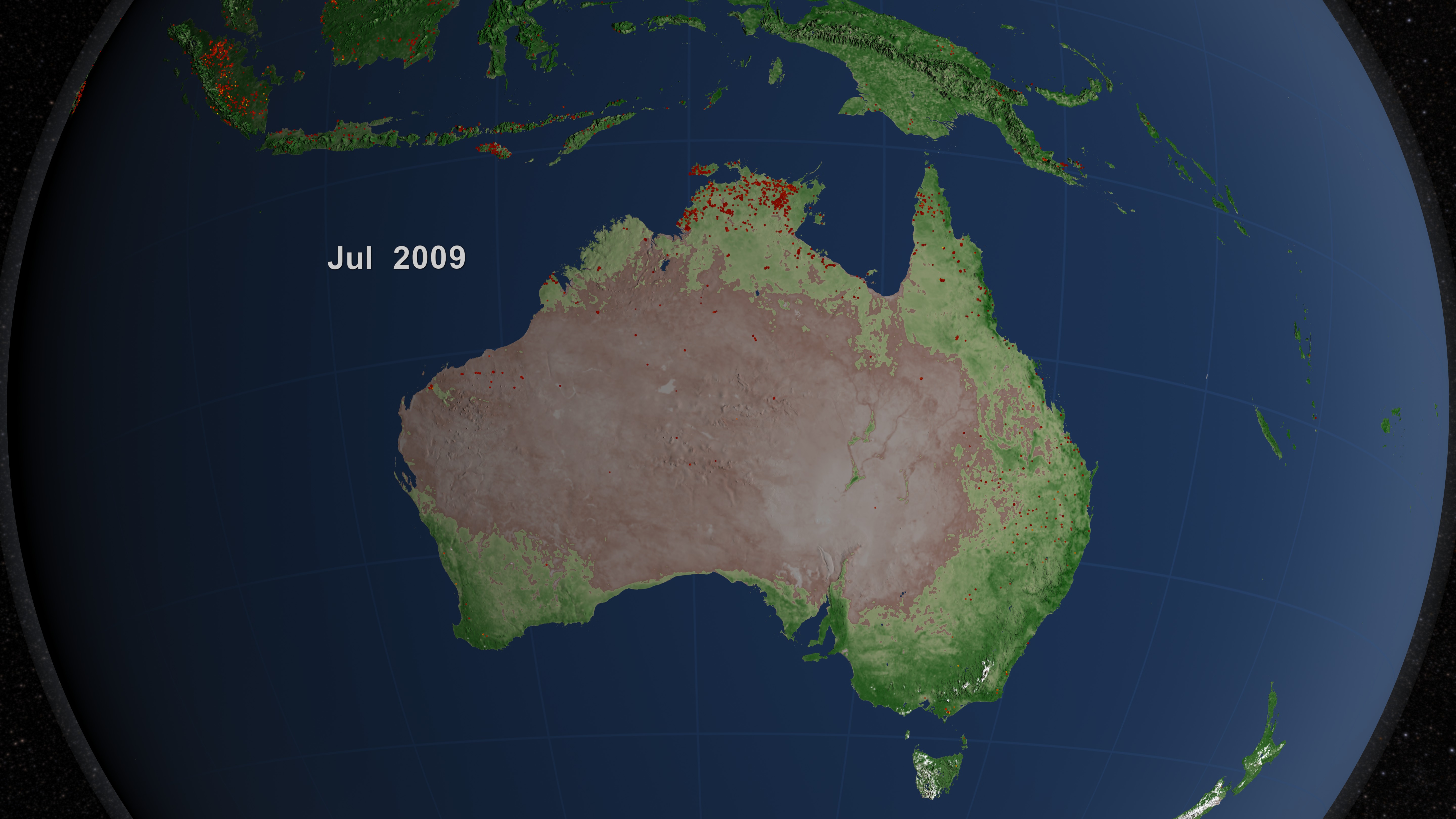
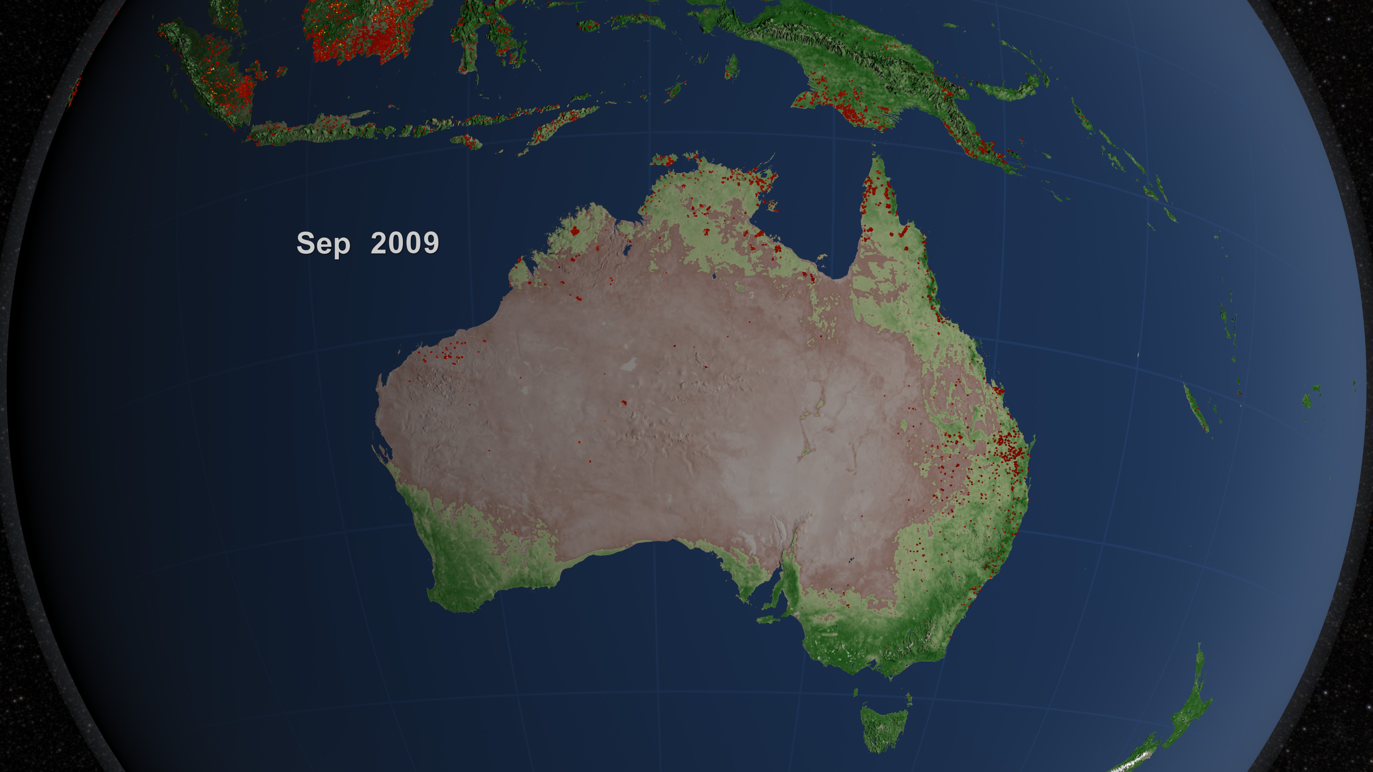

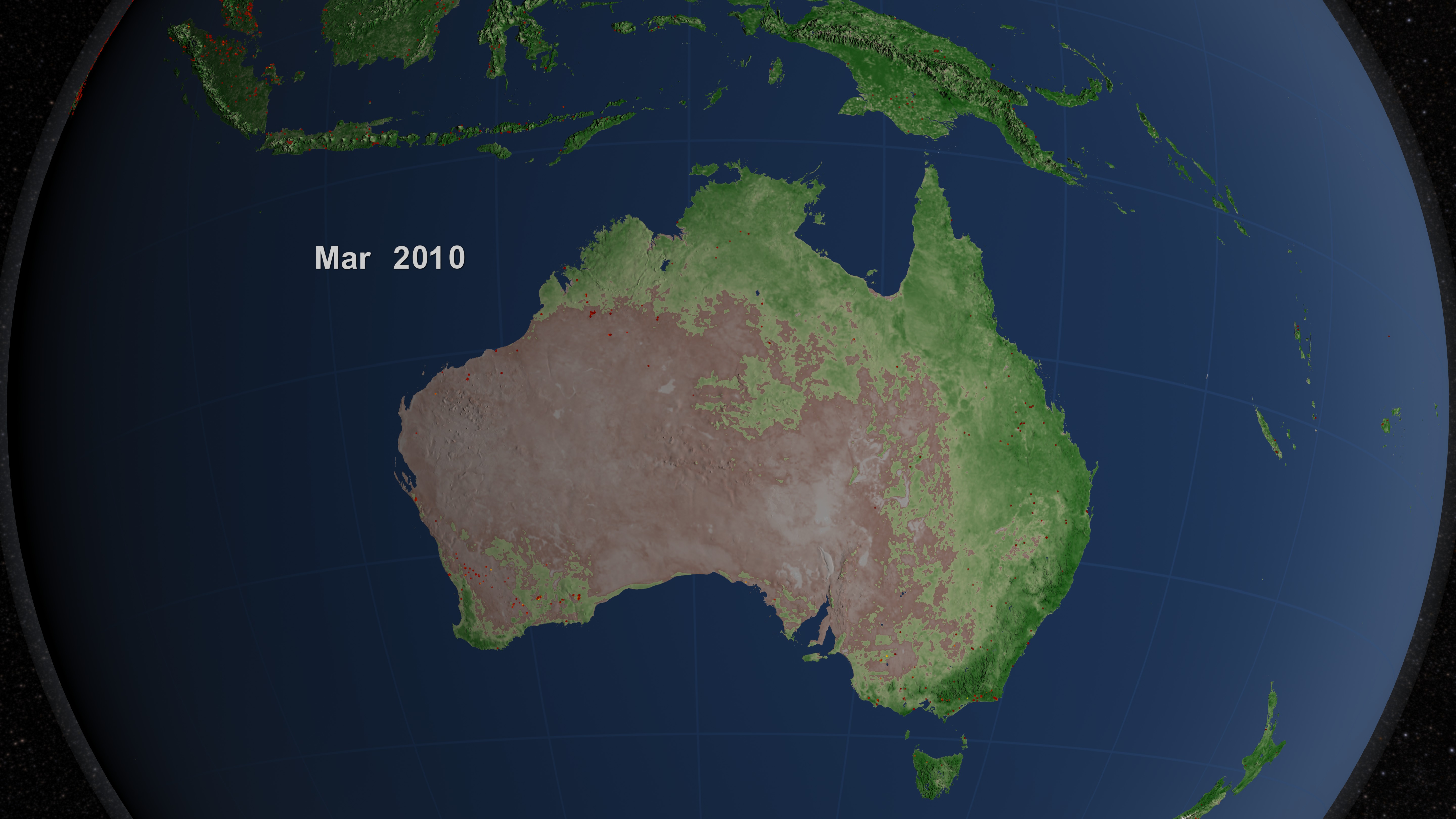

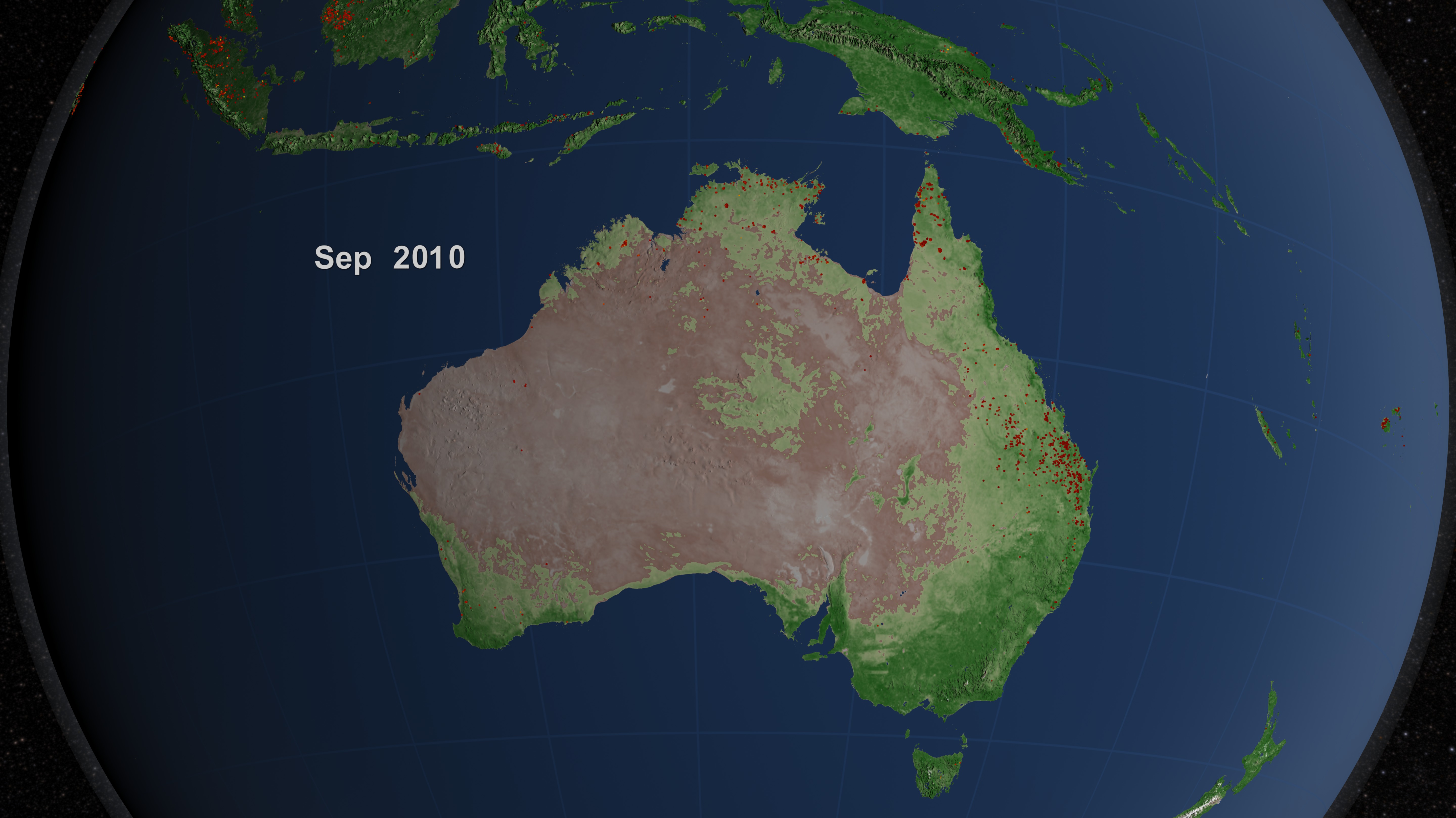
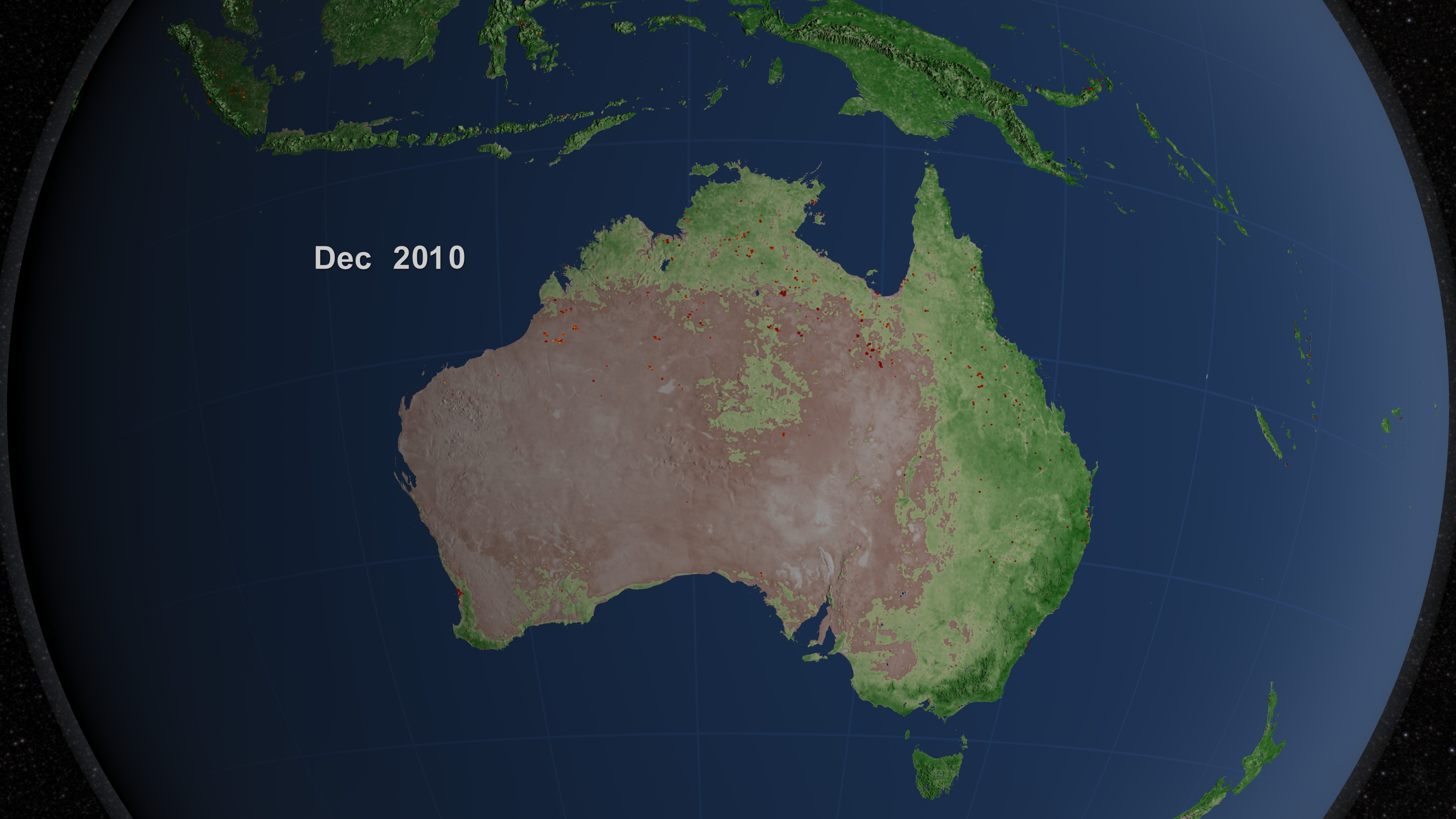
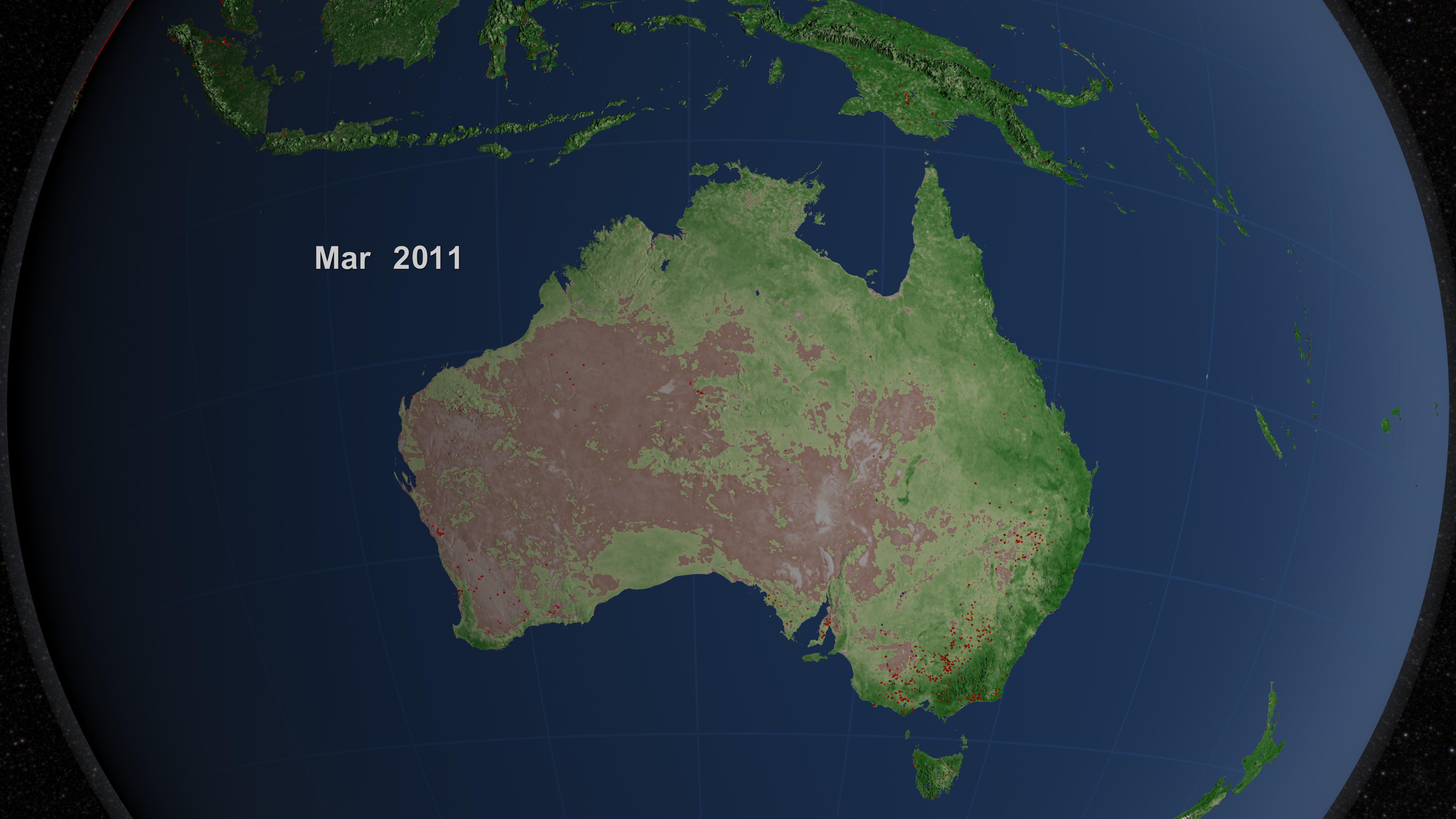

Australia Fire Observations and MODIS NDVI
More information on the Fire Information for Resource Management (FIRMS) is available at http://maps.geog.umd.edu/firms/.
Related
Visualization Credits
Lori Perkins (NASA/GSFC): Lead Animator
Greg Shirah (NASA/GSFC): Animator
Kayvon Sharghi (USRA): Producer
Chris Justice (University of Maryland): Scientist
Louis Giglio (SSAI): Scientist
Luigi Boschetti Ph.D. (University Of Maryland College Park): Scientist
Adam P Voiland (Wyle Information Systems): Writer
Greg Shirah (NASA/GSFC): Animator
Kayvon Sharghi (USRA): Producer
Chris Justice (University of Maryland): Scientist
Louis Giglio (SSAI): Scientist
Luigi Boschetti Ph.D. (University Of Maryland College Park): Scientist
Adam P Voiland (Wyle Information Systems): Writer
Please give credit for this item to:
NASA/Goddard Space Flight Center Scientific Visualization Studio
NASA/Goddard Space Flight Center Scientific Visualization Studio
Short URL to share this page:
https://svs.gsfc.nasa.gov/3871
Mission:
Terra
Data Used:
Note: While we identify the data sets used in these visualizations, we do not store any further details nor the data sets themselves on our site.
Dates of Data Used:
2001/07/01 - 2011/07/30
This item is part of these series:
Fires
Multisensor Fire Observations
NDVI
Agriculture Animations - Fires
Keywords:
DLESE >> Atmospheric science
DLESE >> Forestry
SVS >> HDTV
DLESE >> Natural hazards
GCMD >> Earth Science >> Biosphere >> Ecological Dynamics >> Fire Occurrence
GCMD >> Earth Science >> Human Dimensions >> Natural Hazards >> Fires
SVS >> For Educators
SVS >> Ecosystems
SVS >> Natural Disaster
NASA Science >> Earth
NASA Earth Science Focus Areas >> Carbon Cycle and Ecosystems
GCMD keywords can be found on the Internet with the following citation: Olsen, L.M., G. Major, K. Shein, J. Scialdone, S. Ritz, T. Stevens, M. Morahan, A. Aleman, R. Vogel, S. Leicester, H. Weir, M. Meaux, S. Grebas, C.Solomon, M. Holland, T. Northcutt, R. A. Restrepo, R. Bilodeau, 2013. NASA/Global Change Master Directory (GCMD) Earth Science Keywords. Version 8.0.0.0.0
https://svs.gsfc.nasa.gov/3871
Mission:
Terra
Data Used:
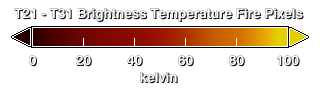
Terra and Aqua/MODIS/Fire Location
Credit:
Fire location data courtesy of MODIS Rapid Response Project (NASA/GSFC and University of Maryland - http://rapidfire.sci.gsfc.nasa.gov)
Fire location data courtesy of MODIS Rapid Response Project (NASA/GSFC and University of Maryland - http://rapidfire.sci.gsfc.nasa.gov)
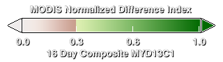
Terra and Aqua/MODIS/Normalized Difference Vegetation Index (NDVI) also referred to as: NDVI
NASADates of Data Used:
2001/07/01 - 2011/07/30
This item is part of these series:
Fires
Multisensor Fire Observations
NDVI
Agriculture Animations - Fires
Keywords:
DLESE >> Atmospheric science
DLESE >> Forestry
SVS >> HDTV
DLESE >> Natural hazards
GCMD >> Earth Science >> Biosphere >> Ecological Dynamics >> Fire Occurrence
GCMD >> Earth Science >> Human Dimensions >> Natural Hazards >> Fires
SVS >> For Educators
SVS >> Ecosystems
SVS >> Natural Disaster
NASA Science >> Earth
NASA Earth Science Focus Areas >> Carbon Cycle and Ecosystems
GCMD keywords can be found on the Internet with the following citation: Olsen, L.M., G. Major, K. Shein, J. Scialdone, S. Ritz, T. Stevens, M. Morahan, A. Aleman, R. Vogel, S. Leicester, H. Weir, M. Meaux, S. Grebas, C.Solomon, M. Holland, T. Northcutt, R. A. Restrepo, R. Bilodeau, 2013. NASA/Global Change Master Directory (GCMD) Earth Science Keywords. Version 8.0.0.0.0


