Earth
ID: 3829
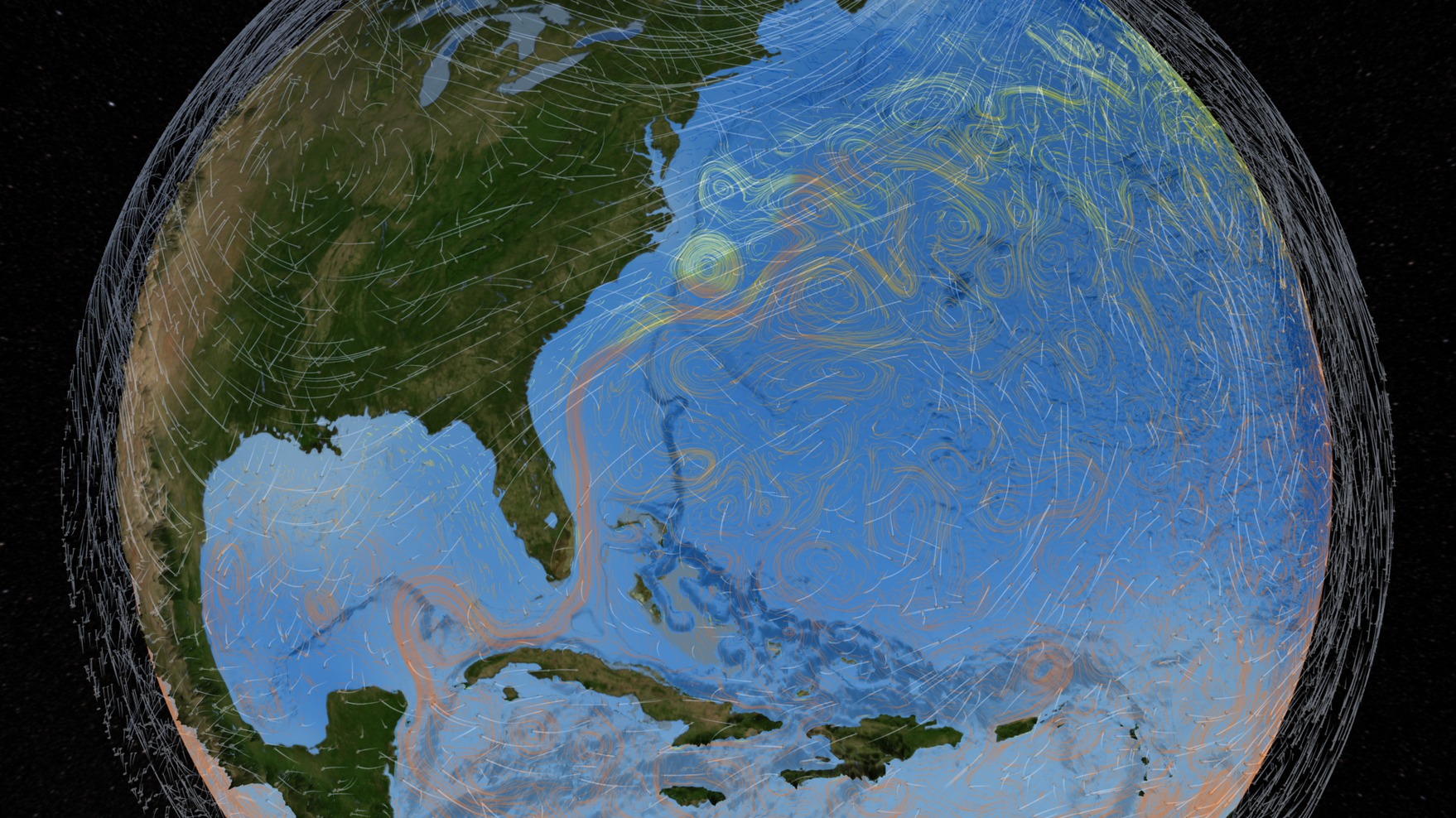
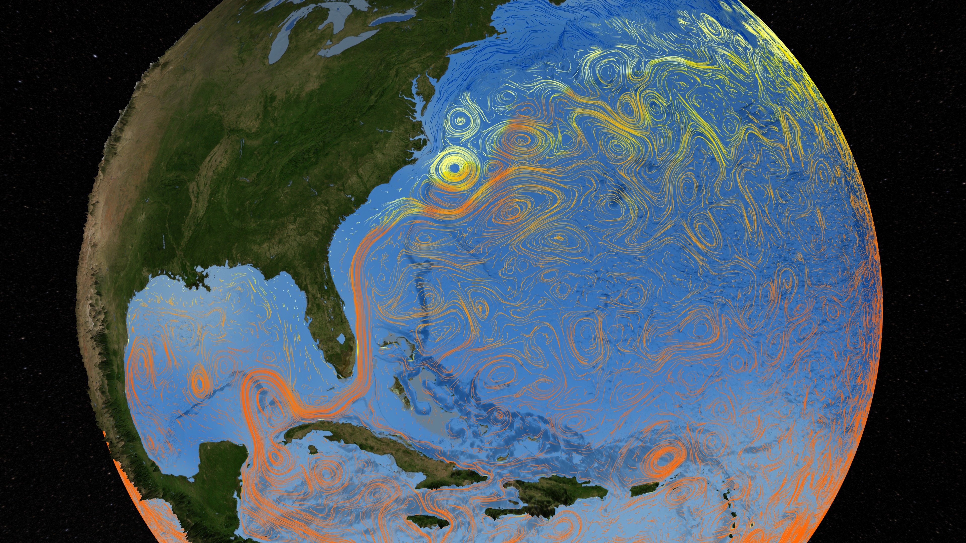
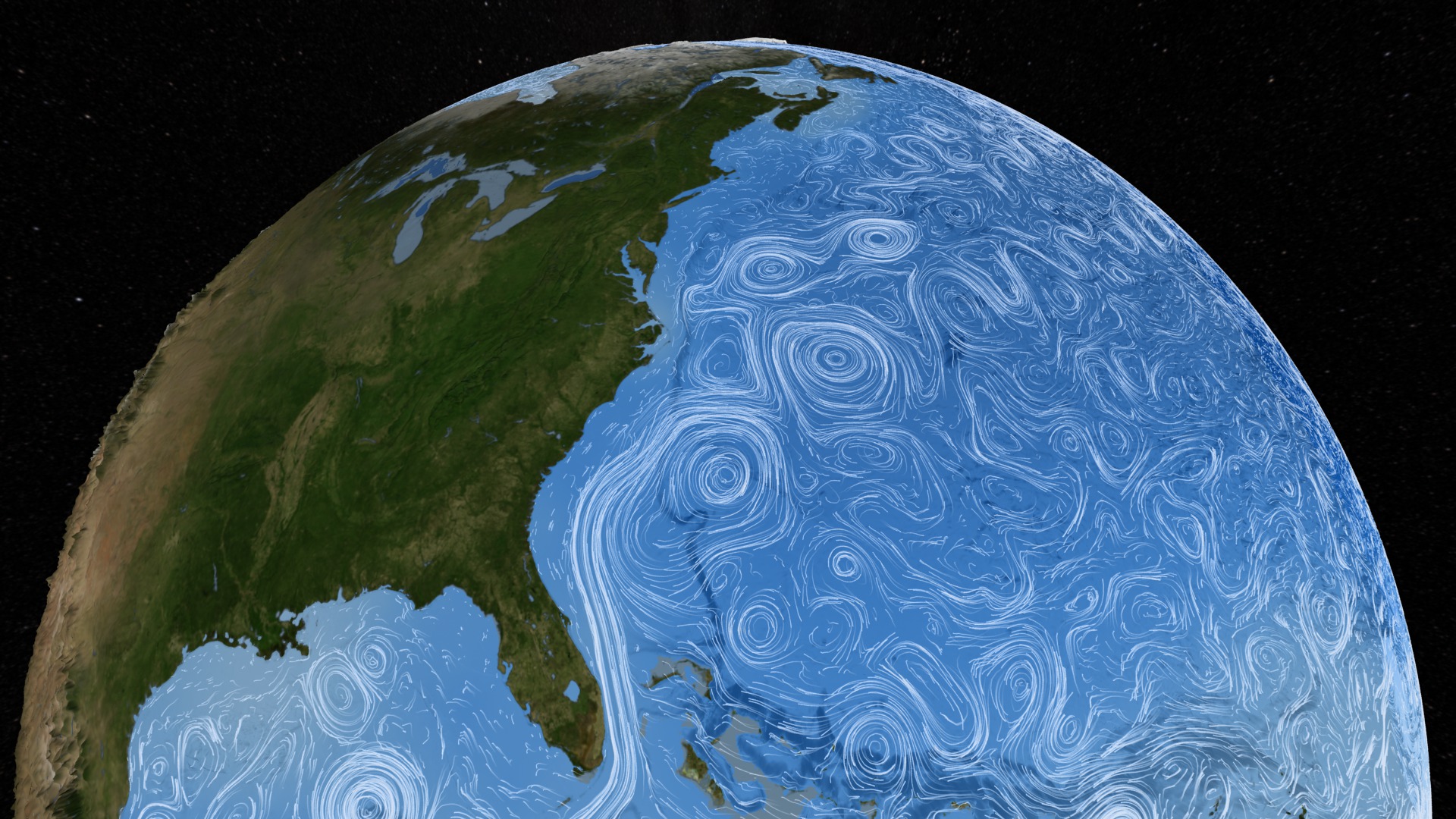
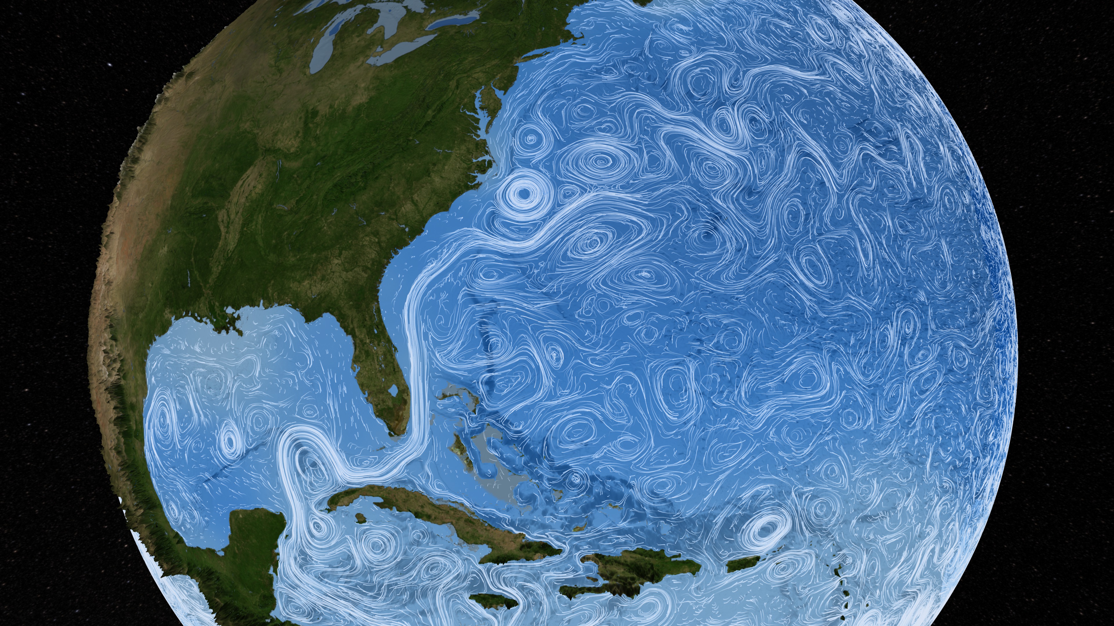
Aquarius is a focused satellite mission to measure global Sea Surface Salinity. During its nominal three-year mission, Aquarius will map the salinity at the ocean surface to improve our understanding of Earth's water cycle and ocean circulation. Aquarius will help scientists see how freshwater moves between the ocean and the atmosphere. It will monitor changes in the water cycle due to rainfall, evaporation, ice melting, and river runoff. Aquarius will also demonstrate a measurement capability that can be applied to future operational missions. Ocean circulation is driven in large part by changes in water density, which is determined by temperature and salinity. Cold, high-salinity water masses sink and trigger the ocean's "themalhaline circulation" - the surface and deep currents that distribute solar energy to regulate Earth's climate. By measuring salinity, Aquarius will provide new insight into this global process.
Aquarius studies Ocean and Wind Flows
Aquarius' measurements of ocean salinity will provide a new perspective on the ocean and its links to climate, greatly expanding upon limited past measurements. Aquarius salinity data - combined with data from other sensors that measure sea level, ocean color, temperature, winds and rainfall will give us a much clearer picture of how the ocean works, how it is linked to climate, and how it may respond to climate change.
Aquarius will provide information that will help improve predictions of future climate trends and short-term climate events such as El Niño and La Niña. Precise salinity measurements from Aquarius will reveal changes in patterns of global precipitation and evaporation and show how these changes may affect ocean circulation.
Visualization Credits
Lori Perkins (NASA/GSFC): Lead Animator
Horace Mitchell (NASA/GSFC): Animator
Greg Shirah (NASA/GSFC): Animator
Cindy Starr (Global Science and Technology, Inc.): Visualizer
Brooke Harris (UMBC): Producer
Annette DeCharon (University of Maine): Scientist
Annette DeCharon (University of Maine): Writer
Horace Mitchell (NASA/GSFC): Animator
Greg Shirah (NASA/GSFC): Animator
Cindy Starr (Global Science and Technology, Inc.): Visualizer
Brooke Harris (UMBC): Producer
Annette DeCharon (University of Maine): Scientist
Annette DeCharon (University of Maine): Writer
Please give credit for this item to:
NASA/Goddard Space Flight Center Scientific Visualization Studio The Blue Marble Next Generation data is courtesy of Reto Stockli (NASA/GSFC) and NASA's Earth Observatory.
NASA/Goddard Space Flight Center Scientific Visualization Studio The Blue Marble Next Generation data is courtesy of Reto Stockli (NASA/GSFC) and NASA's Earth Observatory.
Short URL to share this page:
https://svs.gsfc.nasa.gov/3829
Missions:
Aquarius
Global Precipitation Measurement (GPM)
Terra
Data Used:
Note: While we identify the data sets used in these visualizations, we do not store any further details nor the data sets themselves on our site.
This item is part of this series:
Narrated Movies
Keywords:
SVS >> HDTV
SVS >> Ocean Floor
DLESE >> Physical oceanography
GCMD >> Earth Science >> Oceans
GCMD >> Earth Science >> Oceans >> Ocean Circulation
GCMD >> Earth Science >> Oceans >> Ocean Heat Budget
GCMD >> Earth Science >> Oceans >> Ocean Circulation >> Ocean Currents
GCMD >> Earth Science >> Oceans >> Ocean Temperature >> Sea Surface Temperature
GCMD >> Earth Science >> Oceans >> Salinity/Density >> Density
GCMD >> Earth Science >> Oceans >> Salinity/Density >> Salinity
SVS >> Aquarius
NASA Science >> Earth
GCMD keywords can be found on the Internet with the following citation: Olsen, L.M., G. Major, K. Shein, J. Scialdone, S. Ritz, T. Stevens, M. Morahan, A. Aleman, R. Vogel, S. Leicester, H. Weir, M. Meaux, S. Grebas, C.Solomon, M. Holland, T. Northcutt, R. A. Restrepo, R. Bilodeau, 2013. NASA/Global Change Master Directory (GCMD) Earth Science Keywords. Version 8.0.0.0.0
https://svs.gsfc.nasa.gov/3829
Missions:
Aquarius
Global Precipitation Measurement (GPM)
Terra
Data Used:
ECCO2 High Resolution Ocean and Sea Ice Model also referred to as: ECCO2
Model - NASA/JPL - 2/1/2005 til 12/30/2005MERRA
Analysis - 8/24/2005 til 9/30/2005Terra and Aqua/MODIS/Blue Marble: Next Generation also referred to as: BMNG
Credit:
The Blue Marble data is courtesy of Reto Stockli (NASA/GSFC).
The Blue Marble data is courtesy of Reto Stockli (NASA/GSFC).
World Ocean Atlas 2005 (WOA05) Annual Temperature Climatology also referred to as: Temperature
AtlasGTOPO30 Topography and Bathymetry
Data Compilation - USGSThis item is part of this series:
Narrated Movies
Keywords:
SVS >> HDTV
SVS >> Ocean Floor
DLESE >> Physical oceanography
GCMD >> Earth Science >> Oceans
GCMD >> Earth Science >> Oceans >> Ocean Circulation
GCMD >> Earth Science >> Oceans >> Ocean Heat Budget
GCMD >> Earth Science >> Oceans >> Ocean Circulation >> Ocean Currents
GCMD >> Earth Science >> Oceans >> Ocean Temperature >> Sea Surface Temperature
GCMD >> Earth Science >> Oceans >> Salinity/Density >> Density
GCMD >> Earth Science >> Oceans >> Salinity/Density >> Salinity
SVS >> Aquarius
NASA Science >> Earth
GCMD keywords can be found on the Internet with the following citation: Olsen, L.M., G. Major, K. Shein, J. Scialdone, S. Ritz, T. Stevens, M. Morahan, A. Aleman, R. Vogel, S. Leicester, H. Weir, M. Meaux, S. Grebas, C.Solomon, M. Holland, T. Northcutt, R. A. Restrepo, R. Bilodeau, 2013. NASA/Global Change Master Directory (GCMD) Earth Science Keywords. Version 8.0.0.0.0


