Planets and Moons
ID: 3728
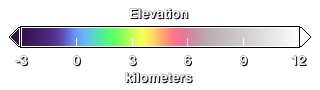
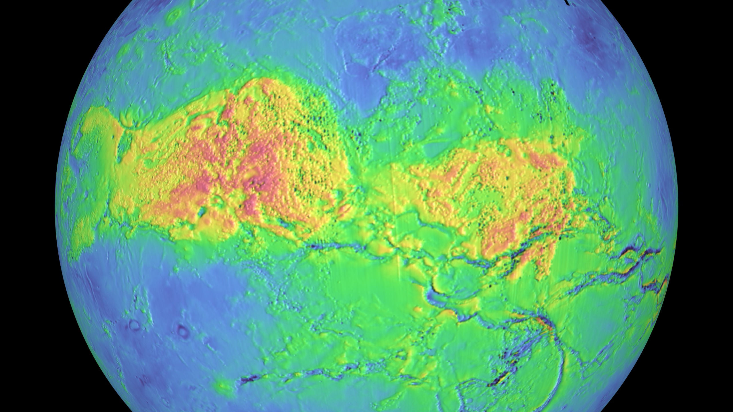
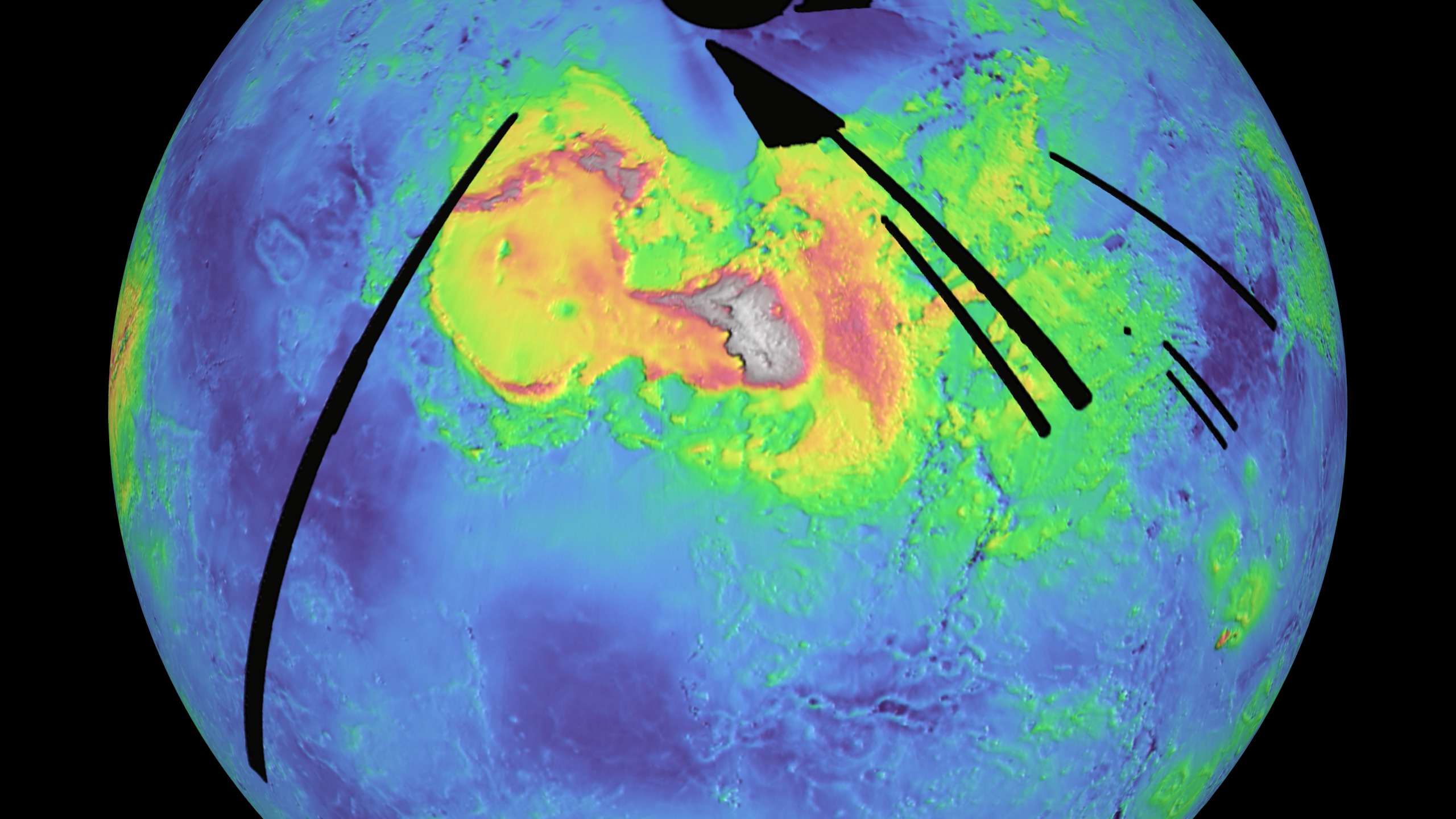
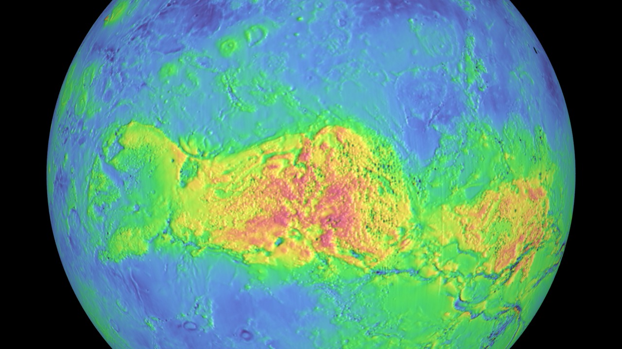
This animation is a brief tour of the global terrain of the planet Venus as revealed by radar onboard the Magellan spacecraft. The height of the terrain is color-coded, with blues and greens representing low altitudes and reds representing high altitudes. Highlighted are two large "continents," or highlands, Aphrodite Terra and Ishtar Terra; the Maxwell Montes mountain range; and Maat Mons, a large, currently dormant volcano.
Magellan arrived at Venus in August of 1990 and spent four years there collecting data. The elevation map used here was created with data collected during the first mapping cycle. Many of the coverage gaps, represented here by black pixels, were filled in during later mapping cycles.


Magellan: Venus False-Color Terrain
Magellan arrived at Venus in August of 1990 and spent four years there collecting data. The elevation map used here was created with data collected during the first mapping cycle. Many of the coverage gaps, represented here by black pixels, were filled in during later mapping cycles.
Related
Visualization Credits
Ernie Wright (UMBC): Lead Animator
Andrew Freeberg (NASA/GSFC): Producer
James Garvin (NASA/GSFC): Scientist
Andrew Freeberg (NASA/GSFC): Producer
James Garvin (NASA/GSFC): Scientist
Please give credit for this item to:
NASA/Goddard Space Flight Center Scientific Visualization Studio.
NASA/Goddard Space Flight Center Scientific Visualization Studio.
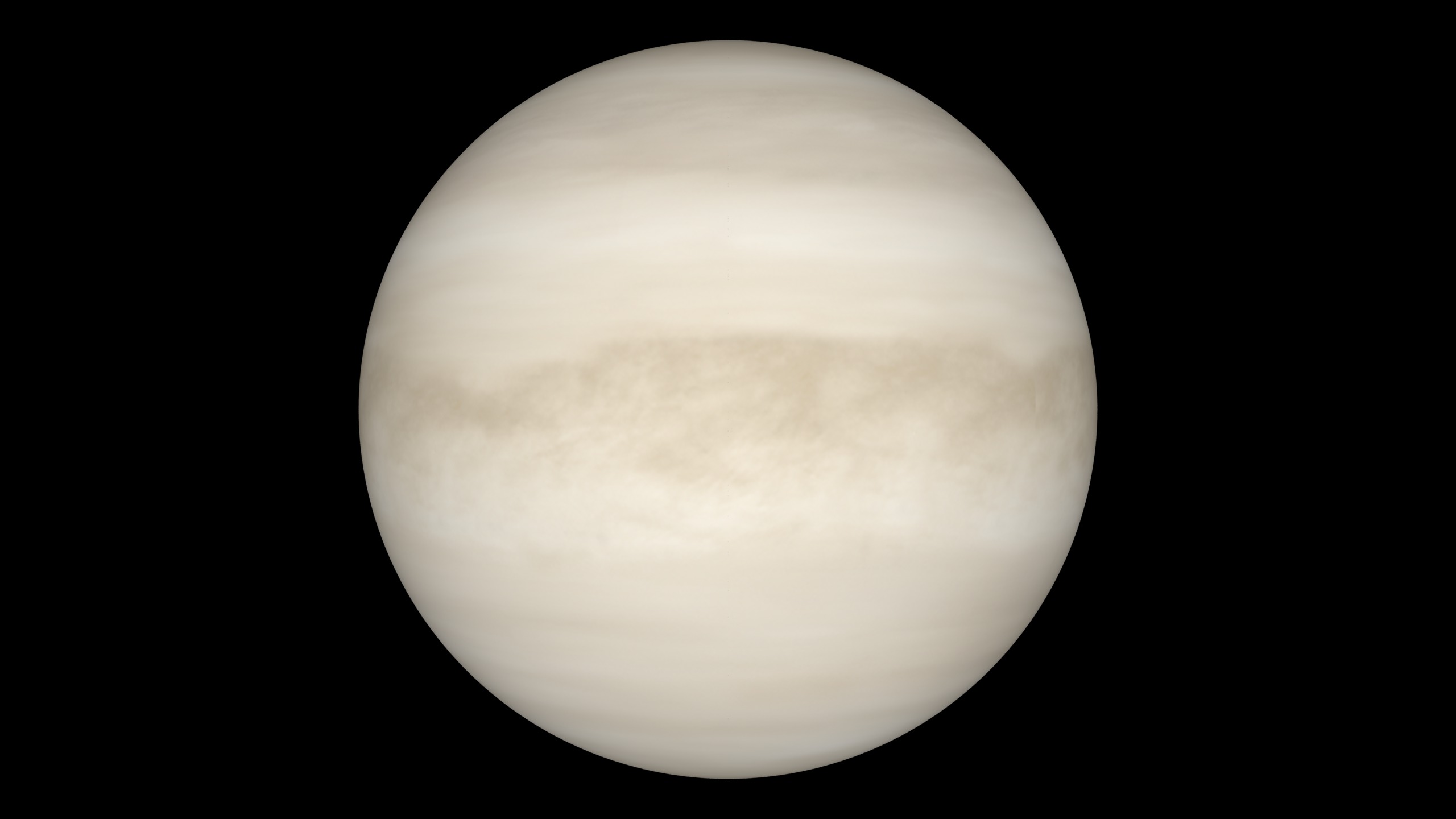
The clouds are an altered version of an image by David Seal, courtesy NASA/JPL-Caltech.
Short URL to share this page:
https://svs.gsfc.nasa.gov/3728
Mission:
Magellan
Data Used:
Note: While we identify the data sets used in these visualizations, we do not store any further details nor the data sets themselves on our site.
Keywords:
SVS >> Elevation data
SVS >> False Color
SVS >> HDTV
SVS >> Venus
SVS >> Magellan
SVS >> For Educators
SVS >> Solar System >> Planets >> Venus
SVS >> Solar System >> Planets >> Venus >> Surface
SVS >> Solar System >> Planets >> Venus >> Atmosphere
NASA Science >> Planets and Moons
https://svs.gsfc.nasa.gov/3728
Mission:
Magellan
Data Used:
Magellan/Radar/Global Slope also referred to as: GSDR
Mosaic - MIT - 1990-09-15 to 1992-09-14Magellan/Radar/Global Topography also referred to as: GTDR
Mosaic - MIT - 1990-09-15 to 1992-09-14Keywords:
SVS >> Elevation data
SVS >> False Color
SVS >> HDTV
SVS >> Venus
SVS >> Magellan
SVS >> For Educators
SVS >> Solar System >> Planets >> Venus
SVS >> Solar System >> Planets >> Venus >> Surface
SVS >> Solar System >> Planets >> Venus >> Atmosphere
NASA Science >> Planets and Moons


