Planets and Moons
ID: 3686
The Lunar Reconnaissance Oribiter (LRO) was launched on June 18, 2009. Its mission is to map the moon's surface, find safe landing sites, locate potential resources, characterize the radiation environment, and demonstrate new technology. One of the instruments on board is the Lunar Orbiter Laser Altimeter (LOLA) which measures landing site slopes, lunar surface roughness, and has begun generation of a high resolution 3D map of the Moon.

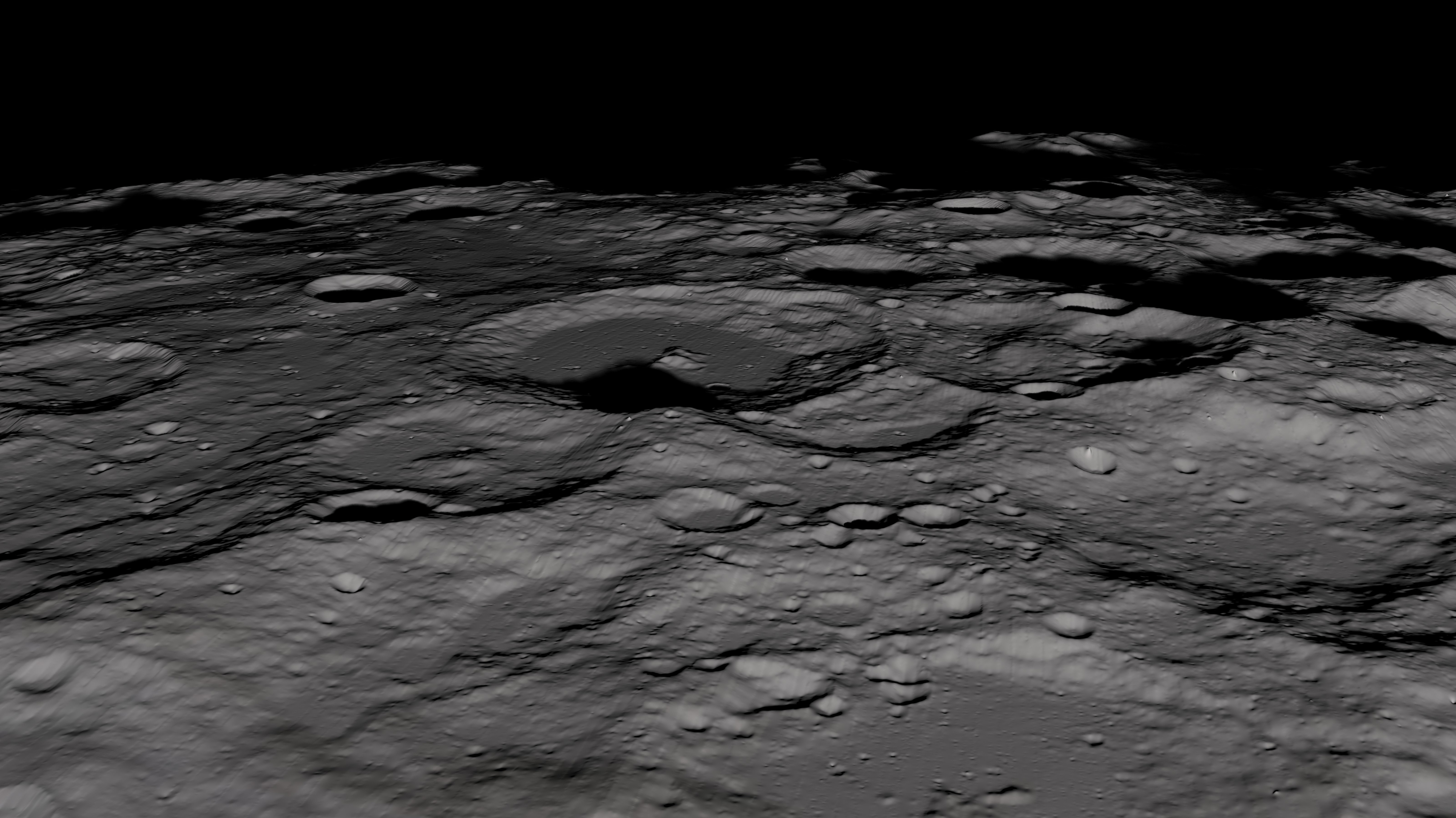
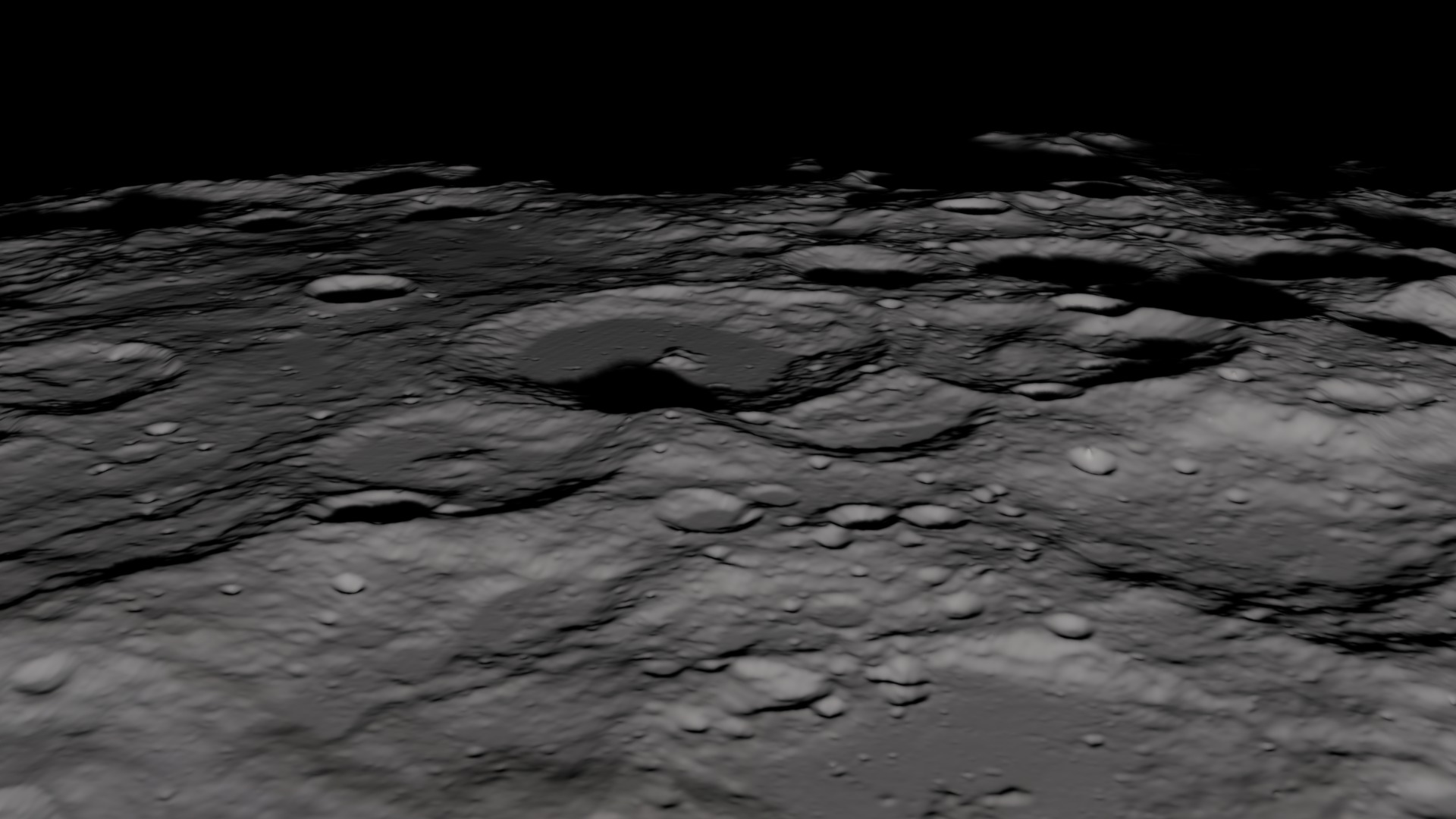
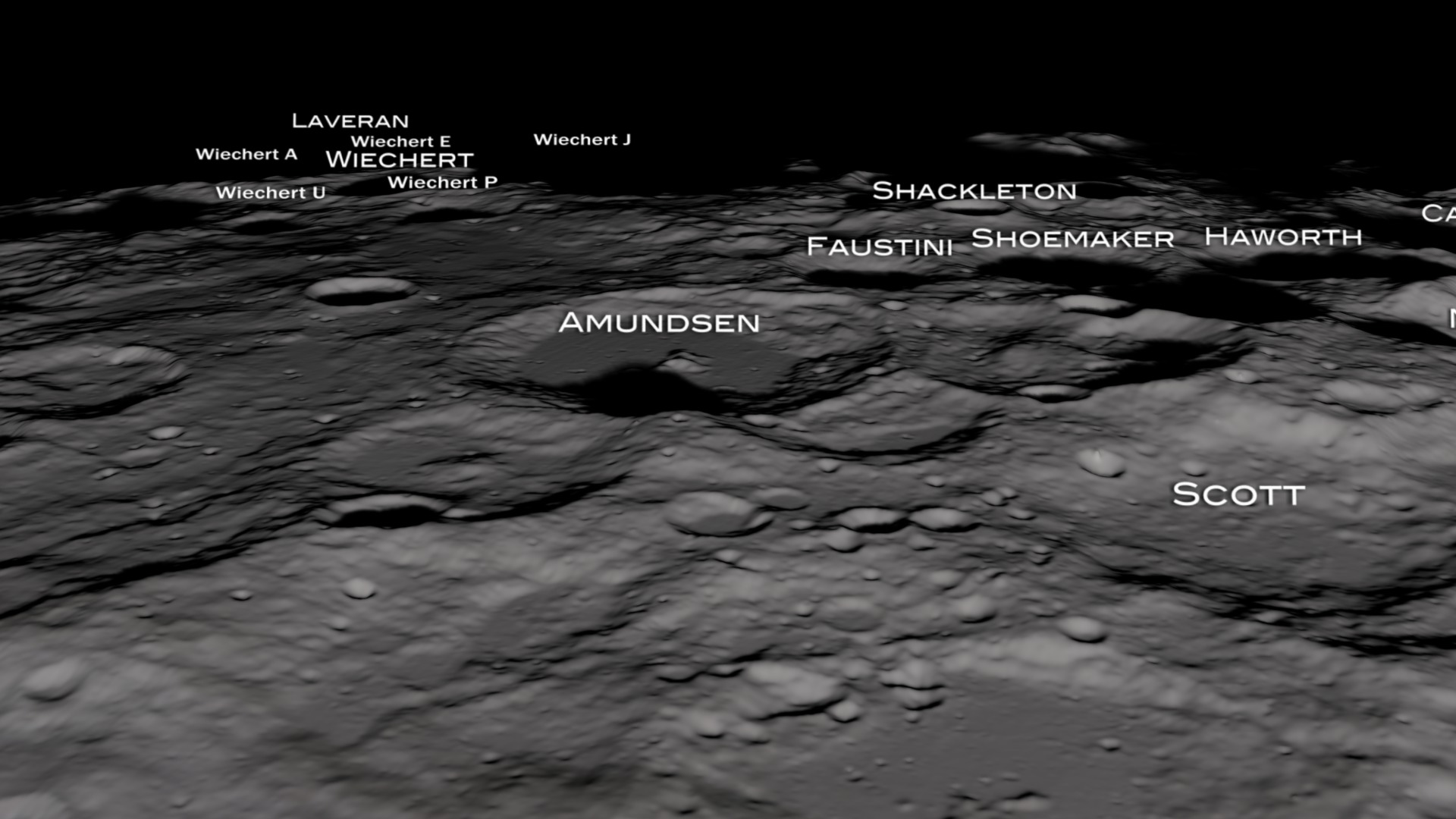
LRO/LOLA Lunar South Pole Flyover
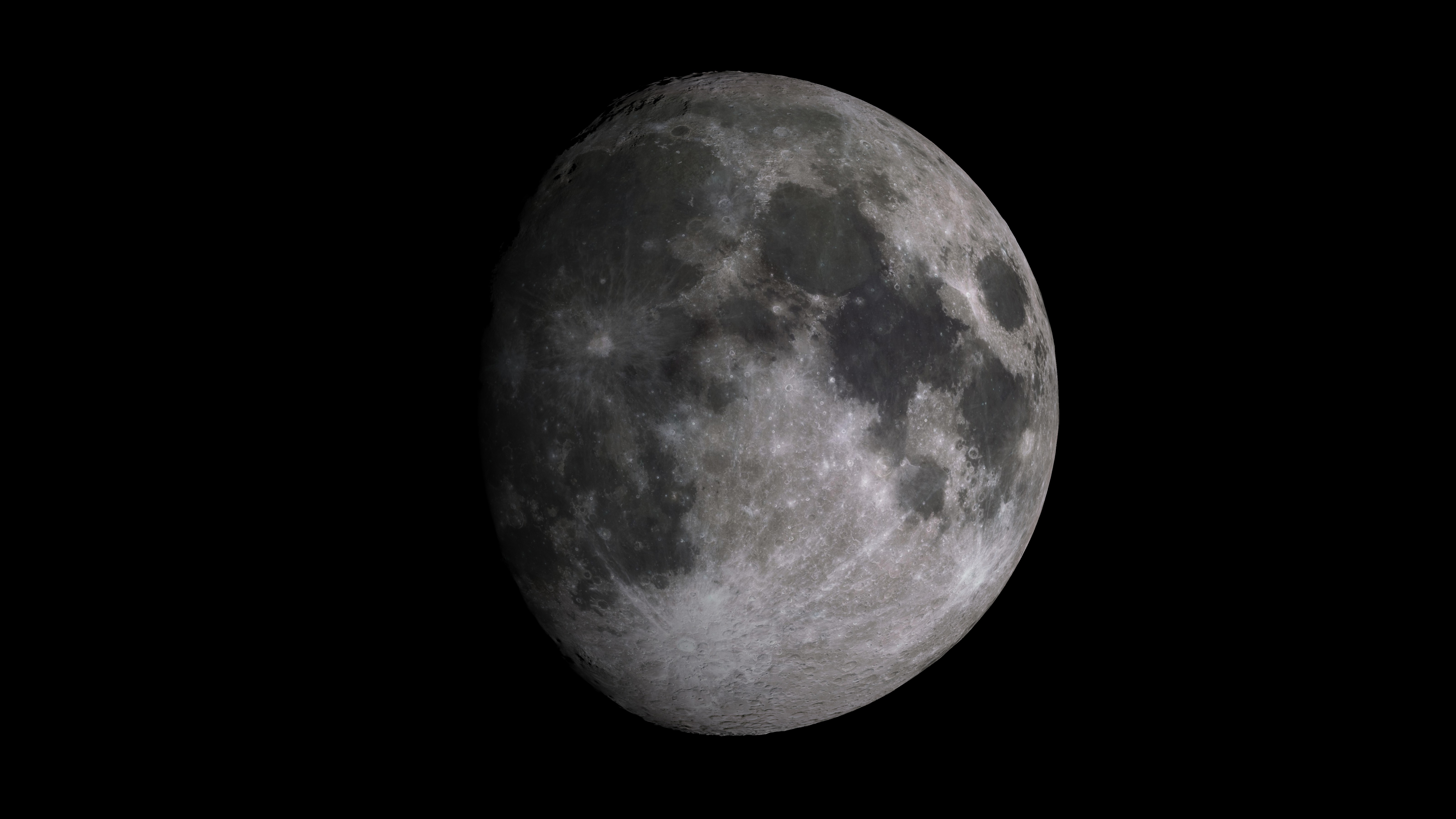
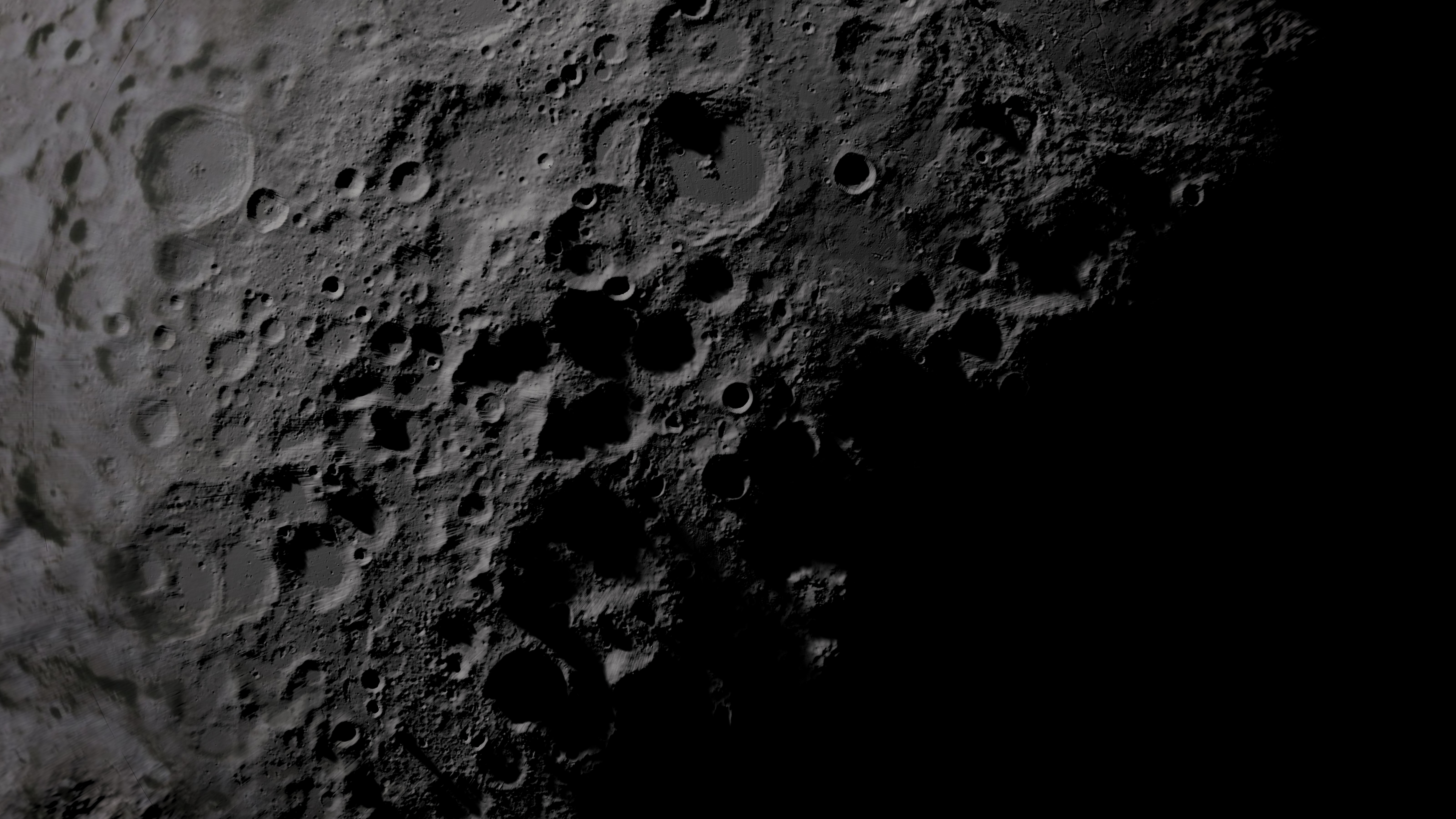
This visualization uses Clementine data for the global view of the moon, but then transitions to using only LRO/LOLA DEM with a neutral gray texture when flying around the lunar south pole. The DEM by itself creates an amazingly realistic view of the lunar southpole. As better maps are created from the other instruments aboard LRO, an even clearer picture of the moon will emerge.
Please note that this visualization is match-frame rendered to The Moon's South Pole in 3D via LRO/LOLA First Light Data (#3633).
Used Elsewhere In

Visualization Credits
Alex Kekesi (Global Science and Technology, Inc.): Lead Animator
Ernie Wright (UMBC): Animator
Marte Newcombe (GST): Animator
Andrew Freeberg (NASA/GSFC): Producer
David Smith (NASA/GSFC): Scientist
Gregory A. Neumann (NASA/GSFC): Scientist
John Keller (NASA/GSFC): Scientist
James W. Williams (GST): Project Support
Shiloh Heurich (GST): Project Support
Ernie Wright (UMBC): Animator
Marte Newcombe (GST): Animator
Andrew Freeberg (NASA/GSFC): Producer
David Smith (NASA/GSFC): Scientist
Gregory A. Neumann (NASA/GSFC): Scientist
John Keller (NASA/GSFC): Scientist
James W. Williams (GST): Project Support
Shiloh Heurich (GST): Project Support
Please give credit for this item to:
NASA/Goddard Space Flight Center Scientific Visualization Studio
NASA/Goddard Space Flight Center Scientific Visualization Studio
Short URL to share this page:
https://svs.gsfc.nasa.gov/3686
Missions:
Clementine
LRO (Lunar Reconnaissance Orbiter)
Data Used:
Note: While we identify the data sets used in these visualizations, we do not store any further details nor the data sets themselves on our site.
This item is part of these series:
The Moon
LRO - Animations
Keywords:
SVS >> Moon
SVS >> South Pole
SVS >> LRO
SVS >> Lunar Reconnaissance Orbiter
SVS >> LOLA
SVS >> For Educators
SVS >> Craters
SVS >> Moon >> South Pole
SVS >> Topographical Map
NASA Science >> Planets and Moons
https://svs.gsfc.nasa.gov/3686
Missions:
Clementine
LRO (Lunar Reconnaissance Orbiter)
Data Used:
Clementine/UVVIS Camera/750-nm Basemap
Mosaic - 1994/02/26-1994/05/05LRO/LOLA/Digital Elevation Map also referred to as: DEM
2009/07/13-2009/11/12This item is part of these series:
The Moon
LRO - Animations
Keywords:
SVS >> Moon
SVS >> South Pole
SVS >> LRO
SVS >> Lunar Reconnaissance Orbiter
SVS >> LOLA
SVS >> For Educators
SVS >> Craters
SVS >> Moon >> South Pole
SVS >> Topographical Map
NASA Science >> Planets and Moons


