Planets and Moons
ID: 3654
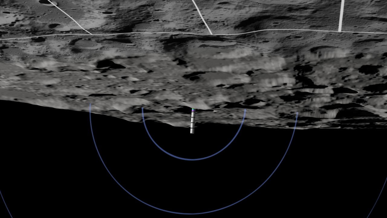
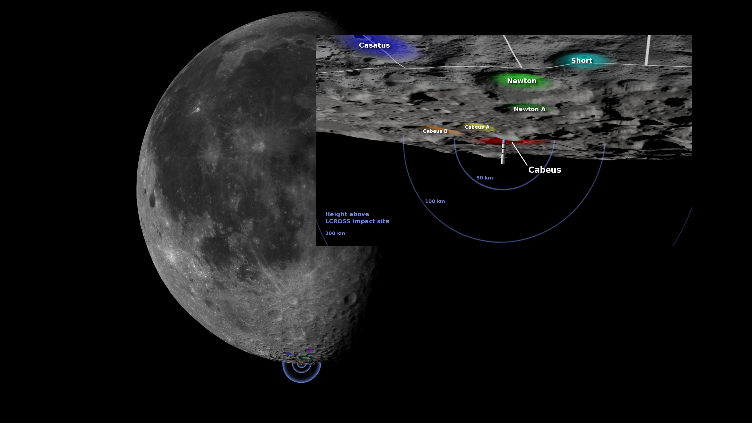
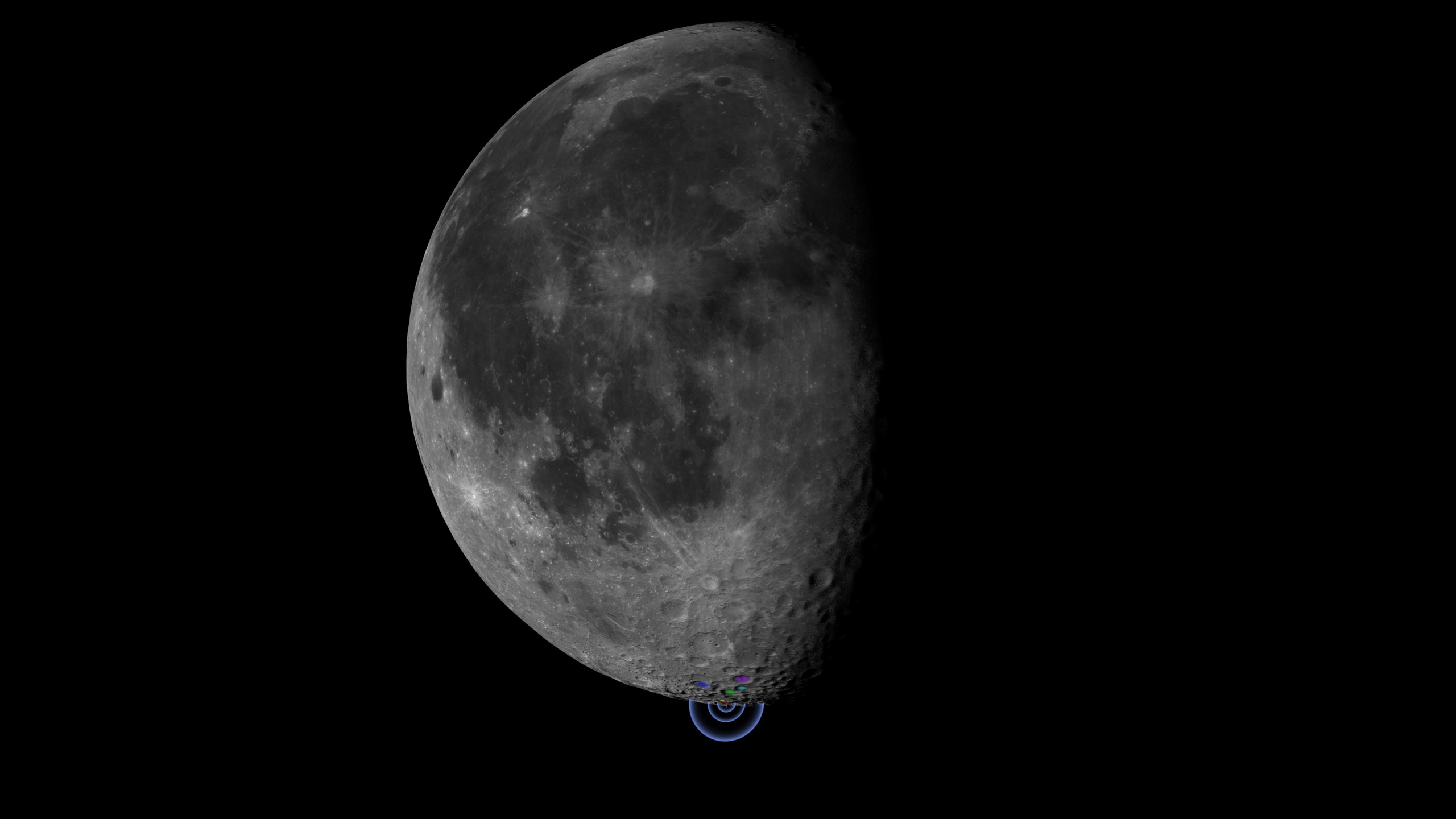
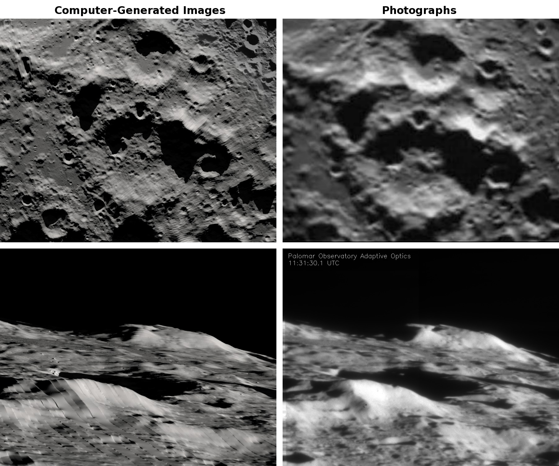
A two-ton Atlas Centaur rocket body, part of the Lunar Crater Observation and Sensing Satellite (LCROSS), struck the floor of Cabeus crater, near the south pole of the moon, at 11:31 UT on October 9, 2009. The purpose of the crash was to create a plume of debris that could be examined for the presence of water and other chemicals in the lunar regolith. The effects of the impact were captured by sensors onboard a shepherding satellite travelling four minutes behind the Centaur. They were also watched by Earth-based observatories and several Earth-orbiting satellites, including the Hubble Space Telescope.

Modeling the LCROSS Impact Site
The images here were created in the weeks prior to the impact. They visualize the viewing angle, terrain, and shadows around the target crater at the time of the impact. Astronomers in New Mexico, Arizona, California, and Hawaii used them as visual reference while guiding their telescopes. LCROSS project scientists also used these and similar images to evaluate a number of potential impact locations.
Using the Jet Propulsion Laboratory's DE421 ephemeris and early terrain data from Lunar Reconnaissance Orbiter's laser altimeter, the artist was able to accurately depict the sunlight direction, shadows, moon orientation, terrain, and field of view for several representative observing locations on the Earth.
For More Information
Visualization Credits
Ernie Wright (UMBC): Lead Animator
Alex Kekesi (Global Science and Technology, Inc.): Animator
Marte Newcombe (GST): Animator
Tim McClanahan (NASA): Scientist
Anthony Colaprete (NASA/ARC-SST): Scientist
Alex Kekesi (Global Science and Technology, Inc.): Animator
Marte Newcombe (GST): Animator
Tim McClanahan (NASA): Scientist
Anthony Colaprete (NASA/ARC-SST): Scientist
Please give credit for this item to:
NASA/Goddard Space Flight Center Scientific Visualization Studio
Palomar image credit: A. Bouchez, Palomar Observatory
NASA/Goddard Space Flight Center Scientific Visualization Studio
Palomar image credit: A. Bouchez, Palomar Observatory
Short URL to share this page:
https://svs.gsfc.nasa.gov/3654
Missions:
LCROSS
LRO (Lunar Reconnaissance Orbiter)
Data Used:
Note: While we identify the data sets used in these visualizations, we do not store any further details nor the data sets themselves on our site.
Keywords:
SVS >> Moon
SVS >> South Pole
GCMD >> Earth Science >> Land Surface >> Topography
SVS >> LRO
SVS >> For Educators
SVS >> Lunar Ice
SVS >> Moon >> South Pole
SVS >> Cabeus Crater
NASA Science >> Planets and Moons
GCMD keywords can be found on the Internet with the following citation: Olsen, L.M., G. Major, K. Shein, J. Scialdone, S. Ritz, T. Stevens, M. Morahan, A. Aleman, R. Vogel, S. Leicester, H. Weir, M. Meaux, S. Grebas, C.Solomon, M. Holland, T. Northcutt, R. A. Restrepo, R. Bilodeau, 2013. NASA/Global Change Master Directory (GCMD) Earth Science Keywords. Version 8.0.0.0.0
https://svs.gsfc.nasa.gov/3654
Missions:
LCROSS
LRO (Lunar Reconnaissance Orbiter)
Data Used:
LRO/LOLA/Digital Elevation Map also referred to as: DEM
LCROSS
NASA
Lunar Crater Observation and Sensing Satellite
Keywords:
SVS >> Moon
SVS >> South Pole
GCMD >> Earth Science >> Land Surface >> Topography
SVS >> LRO
SVS >> For Educators
SVS >> Lunar Ice
SVS >> Moon >> South Pole
SVS >> Cabeus Crater
NASA Science >> Planets and Moons
GCMD keywords can be found on the Internet with the following citation: Olsen, L.M., G. Major, K. Shein, J. Scialdone, S. Ritz, T. Stevens, M. Morahan, A. Aleman, R. Vogel, S. Leicester, H. Weir, M. Meaux, S. Grebas, C.Solomon, M. Holland, T. Northcutt, R. A. Restrepo, R. Bilodeau, 2013. NASA/Global Change Master Directory (GCMD) Earth Science Keywords. Version 8.0.0.0.0


