Earth
ID: 3476
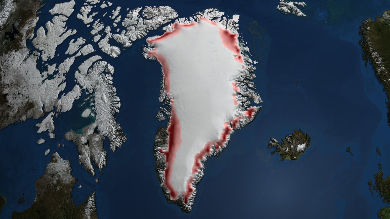
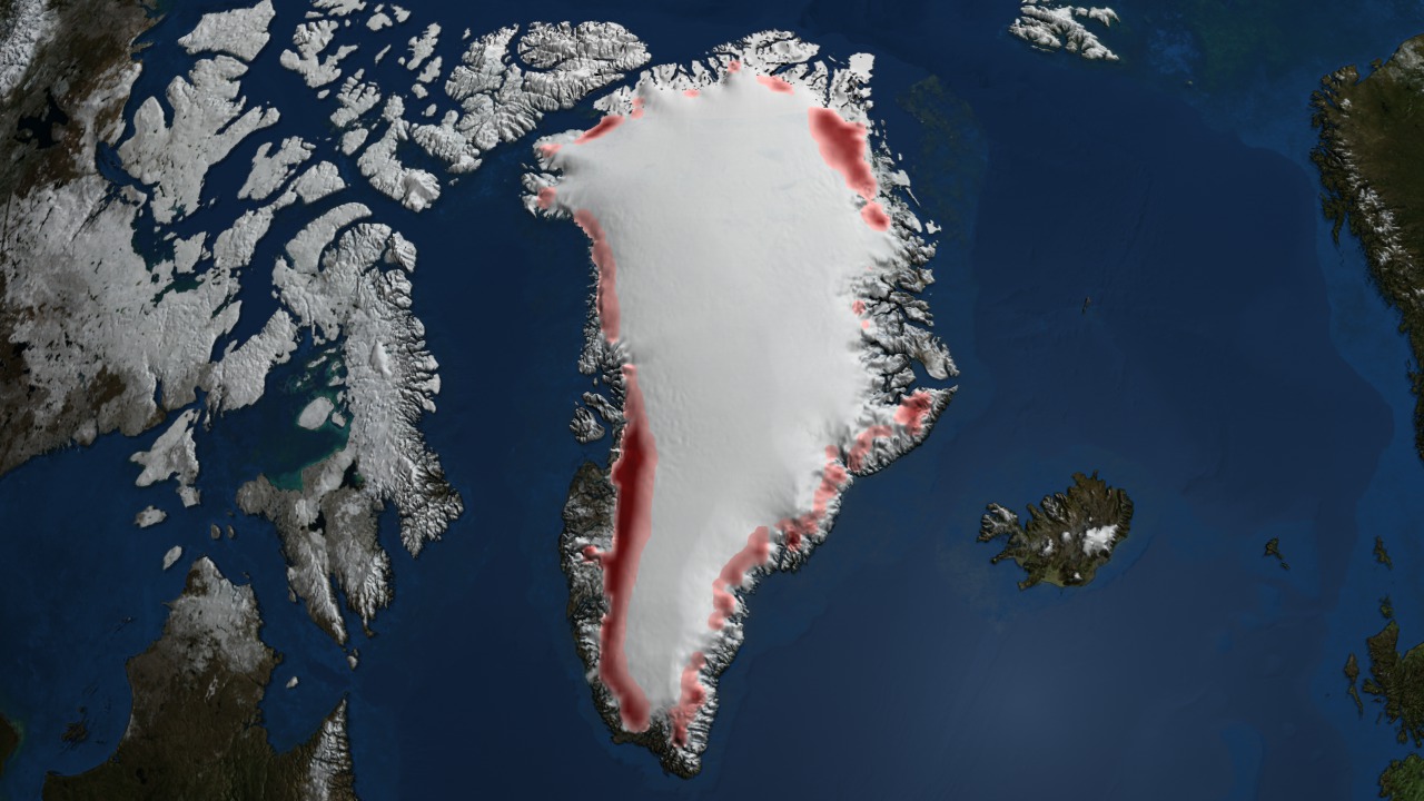
The ice sheet melt extent is a daily (or every-other-day, prior to August, 1987) estimate of the spatial extent of wet snow on the Greenland ice sheet derived from passive microwave satellite brightness temperature characteristics. This indicator of melt on each area of the ice sheet for each day of observation is physically based on the changes in microwave emission characteristics observable in data. Although it is not a direct measure of the snow wetness, it is representative of the amount of ice loss due to seasonal melting that occurs on the Greenland ice sheet.
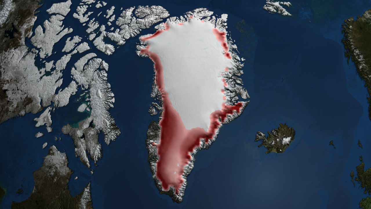
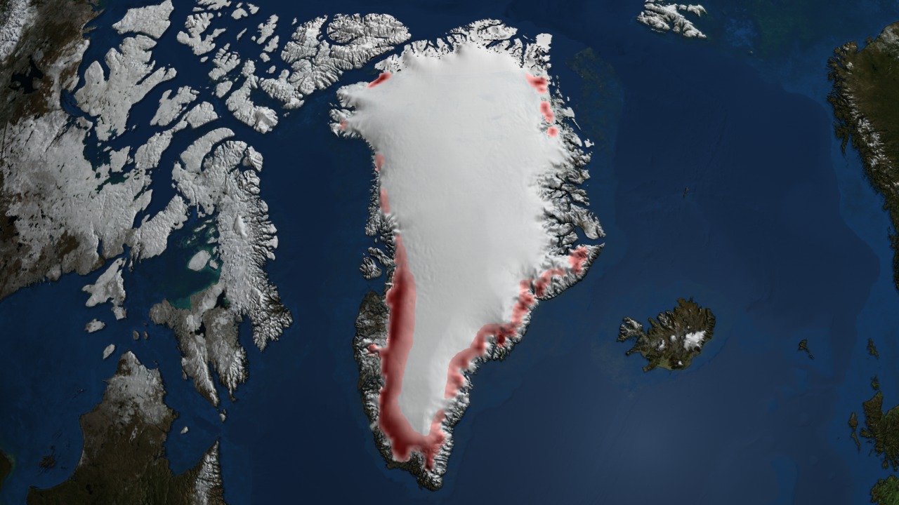
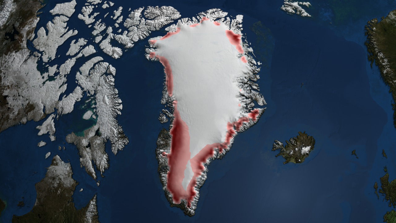
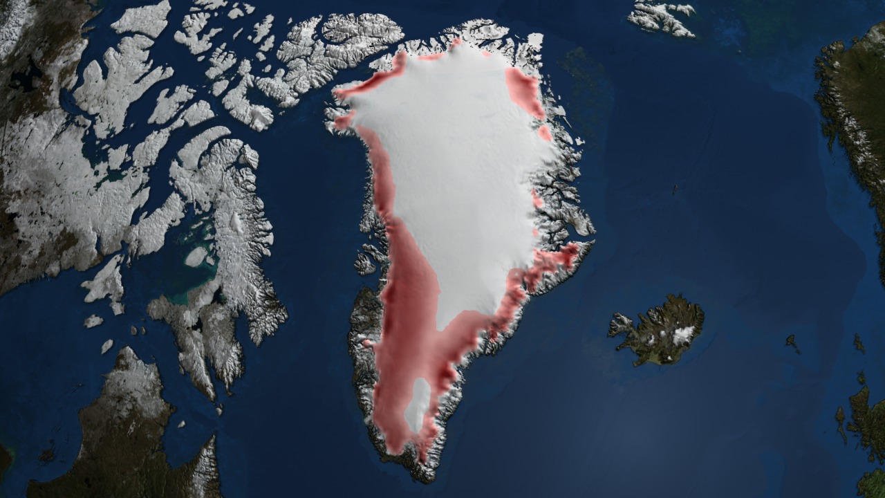
This animation is a time series showing the regions of the Greenland ice sheet where melt occurred for more than three days between May 1st and September 30th for each year. Areas in which melt occurred for longer time periods are shown in a darker red while those areas melted for fewer days are shown in lighter red. Areas melted three or less days during the year are not colored.


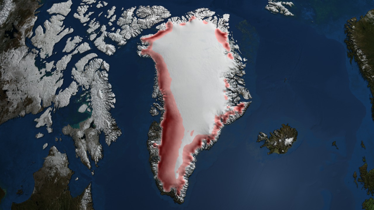


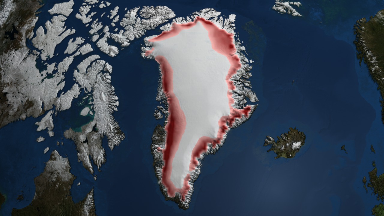

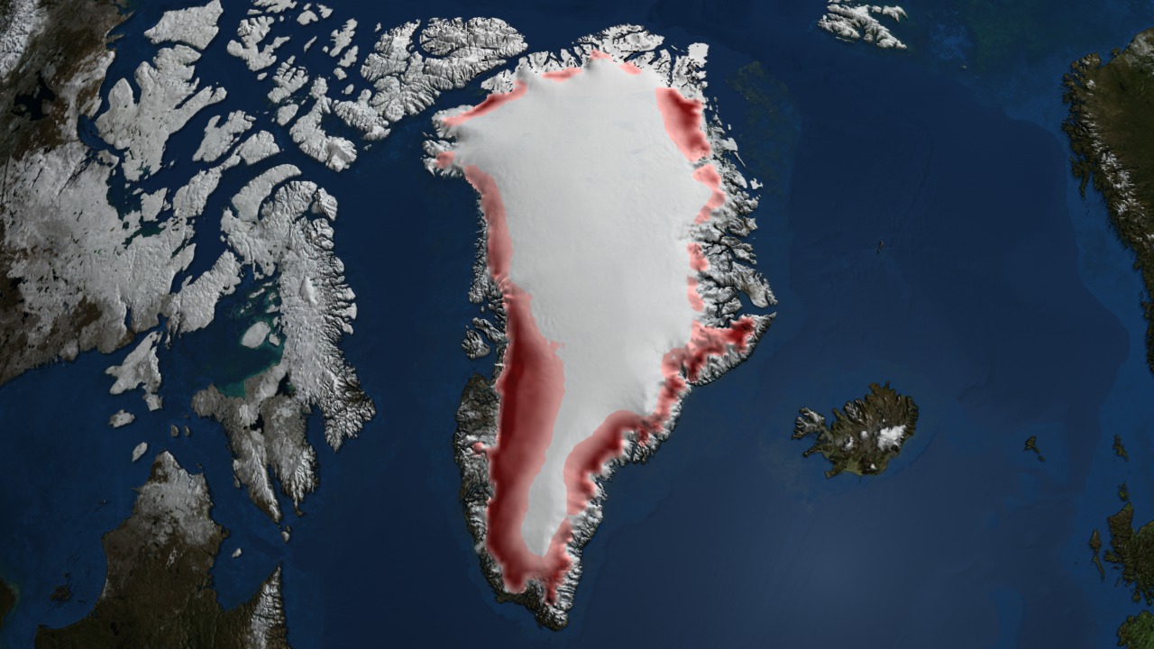


Annual Gradient Melt over Greenland 1979 through 2007
This animation is a time series showing the regions of the Greenland ice sheet where melt occurred for more than three days between May 1st and September 30th for each year. Areas in which melt occurred for longer time periods are shown in a darker red while those areas melted for fewer days are shown in lighter red. Areas melted three or less days during the year are not colored.
Visualization Credits
Cindy Starr (Global Science and Technology, Inc.): Lead Visualizer
Waleed Abdalati (NASA/GSFC): Scientist
Waleed Abdalati (NASA/GSFC): Scientist
Please give credit for this item to:
NASA/Goddard Space Flight Center Scientific Visualization Studio The Next Generation Blue Marble data is courtesy of Reto Stockli (NASA/GSFC).
NASA/Goddard Space Flight Center Scientific Visualization Studio The Next Generation Blue Marble data is courtesy of Reto Stockli (NASA/GSFC).
Short URL to share this page:
https://svs.gsfc.nasa.gov/3476
Data Used:
Note: While we identify the data sets used in these visualizations, we do not store any further details nor the data sets themselves on our site.
Keywords:
DLESE >> Cryology
SVS >> Global Warming
SVS >> HDTV
GCMD >> Earth Science >> Cryosphere
GCMD >> Earth Science >> Cryosphere >> Snow/Ice
GCMD >> Earth Science >> Hydrosphere >> Snow/Ice
GCMD >> Earth Science >> Cryosphere >> Sea Ice >> Ice Growth/Melt
GCMD >> Earth Science >> Cryosphere >> Snow/Ice >> Freeze/Thaw
GCMD >> Earth Science >> Cryosphere >> Snow/Ice >> Ice Growth/Melt
GCMD >> Earth Science >> Cryosphere >> Snow/Ice >> Snow Melt
GCMD >> Earth Science >> Hydrosphere >> Snow/Ice >> Snow Melt
SVS >> iPod
SVS >> Climate Change
SVS >> For Educators
NASA Science >> Earth
GCMD keywords can be found on the Internet with the following citation: Olsen, L.M., G. Major, K. Shein, J. Scialdone, S. Ritz, T. Stevens, M. Morahan, A. Aleman, R. Vogel, S. Leicester, H. Weir, M. Meaux, S. Grebas, C.Solomon, M. Holland, T. Northcutt, R. A. Restrepo, R. Bilodeau, 2013. NASA/Global Change Master Directory (GCMD) Earth Science Keywords. Version 8.0.0.0.0
https://svs.gsfc.nasa.gov/3476
Data Used:
Greenland Ice Sheet Melt Characteristics
Data Compilation - NSIDC - May 1 through September 30 each year from 1979 through 2007DMSP/SSM/I
May 1 through September 30 each year from 1979 through 2007
Defense Meteorological Satellite Program Special Sensor Microwave Imager
Nimbus-7/SMMR
May 1 through September 30 each year from 1979 through 2007Keywords:
DLESE >> Cryology
SVS >> Global Warming
SVS >> HDTV
GCMD >> Earth Science >> Cryosphere
GCMD >> Earth Science >> Cryosphere >> Snow/Ice
GCMD >> Earth Science >> Hydrosphere >> Snow/Ice
GCMD >> Earth Science >> Cryosphere >> Sea Ice >> Ice Growth/Melt
GCMD >> Earth Science >> Cryosphere >> Snow/Ice >> Freeze/Thaw
GCMD >> Earth Science >> Cryosphere >> Snow/Ice >> Ice Growth/Melt
GCMD >> Earth Science >> Cryosphere >> Snow/Ice >> Snow Melt
GCMD >> Earth Science >> Hydrosphere >> Snow/Ice >> Snow Melt
SVS >> iPod
SVS >> Climate Change
SVS >> For Educators
NASA Science >> Earth
GCMD keywords can be found on the Internet with the following citation: Olsen, L.M., G. Major, K. Shein, J. Scialdone, S. Ritz, T. Stevens, M. Morahan, A. Aleman, R. Vogel, S. Leicester, H. Weir, M. Meaux, S. Grebas, C.Solomon, M. Holland, T. Northcutt, R. A. Restrepo, R. Bilodeau, 2013. NASA/Global Change Master Directory (GCMD) Earth Science Keywords. Version 8.0.0.0.0


