Earth
ID: 3400
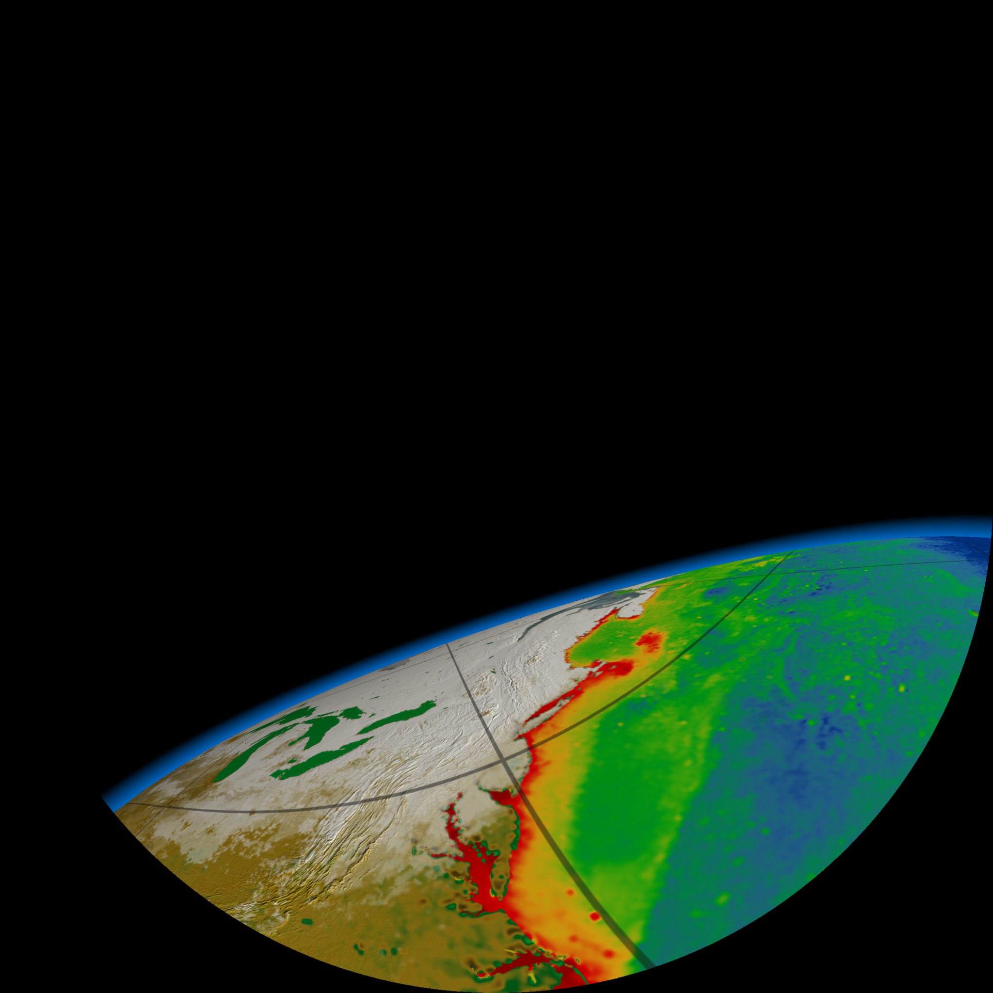
This visualization was a prototype affiliated with 'Dynamic Earth', a proposed Earth science planetarium show. The visualization shows a flyover of North America towards Greenland. MODIS Blue Marble data is initially used, then fading to SeaWiFS based biosphere data. MODIS based snow and ice are overlayed on the biosphere data.
The images were rendered using a fish eye technique so that they would project properly onto a planetarium dome. The horizon was kept at approximately the 'sweet spot' based on typical viewer locations in a planetarium.
Dynamic Earth Dome Protoype: Fly Around
The images were rendered using a fish eye technique so that they would project properly onto a planetarium dome. The horizon was kept at approximately the 'sweet spot' based on typical viewer locations in a planetarium.
Visualization Credits
Greg Shirah (NASA/GSFC): Lead Animator
Cindy Starr (Global Science and Technology, Inc.): Visualizer
Gene Feldman (NASA/GSFC): Scientist
Cindy Starr (Global Science and Technology, Inc.): Visualizer
Gene Feldman (NASA/GSFC): Scientist
Please give credit for this item to:
NASA/Goddard Space Flight Center, The SeaWiFS Project and GeoEye, Scientific Visualization Studio. NOTE: All SeaWiFS images and data presented on this web site are for research and educational use only. All commercial use of SeaWiFS data must be coordinated with GeoEye (NOTE: In January 2013, DigitalGlobe and GeoEye combined to become DigitalGlobe).
NASA/Goddard Space Flight Center, The SeaWiFS Project and GeoEye, Scientific Visualization Studio. NOTE: All SeaWiFS images and data presented on this web site are for research and educational use only. All commercial use of SeaWiFS data must be coordinated with GeoEye (NOTE: In January 2013, DigitalGlobe and GeoEye combined to become DigitalGlobe).
Short URL to share this page:
https://svs.gsfc.nasa.gov/3400
Mission:
Terra
Data Used:
Note: While we identify the data sets used in these visualizations, we do not store any further details nor the data sets themselves on our site.
Keywords:
DLESE >> Biology
DLESE >> Cryology
GCMD >> Earth Science >> Biosphere
GCMD >> Earth Science >> Cryosphere >> Snow/Ice
NASA Science >> Earth
SVS >> Planetarium
GCMD keywords can be found on the Internet with the following citation: Olsen, L.M., G. Major, K. Shein, J. Scialdone, S. Ritz, T. Stevens, M. Morahan, A. Aleman, R. Vogel, S. Leicester, H. Weir, M. Meaux, S. Grebas, C.Solomon, M. Holland, T. Northcutt, R. A. Restrepo, R. Bilodeau, 2013. NASA/Global Change Master Directory (GCMD) Earth Science Keywords. Version 8.0.0.0.0
https://svs.gsfc.nasa.gov/3400
Mission:
Terra
Data Used:
SeaStar/SeaWiFS
02/10/1998 to 11/01/2001
NOTE: All SeaWiFS images and data presented on this web site are for research and educational use only. All commercial use of SeaWiFS data must be coordinated with GeoEye
Credit:
NASA/Goddard Space Flight Center, The SeaWiFS Project and GeoEye, Scientific Visualization Studio. NOTE: All SeaWiFS images and data presented on this web site are for research and educational use only. All commercial use of SeaWiFS data must be coordinated with GeoEye (NOTE: In January 2013, DigitalGlobe and GeoEye combined to become one DigitalGlobe.).
NASA/Goddard Space Flight Center, The SeaWiFS Project and GeoEye, Scientific Visualization Studio. NOTE: All SeaWiFS images and data presented on this web site are for research and educational use only. All commercial use of SeaWiFS data must be coordinated with GeoEye (NOTE: In January 2013, DigitalGlobe and GeoEye combined to become one DigitalGlobe.).
Aqua/AMSR-E/Daily L3 12.5km Tb, Sea Ice Concentration, and Snow Depth also referred to as: Sea Ice Concentration
Sea ice: 2005, Snow: 2002Terra and Aqua/MODIS/Blue Marble Land Cover
Credit:
The Blue Marble data is courtesy of Reto Stockli (NASA/GSFC).
The Blue Marble data is courtesy of Reto Stockli (NASA/GSFC).
TOPEX/Poseidon/Sea Surface Height Anomaly
Keywords:
DLESE >> Biology
DLESE >> Cryology
GCMD >> Earth Science >> Biosphere
GCMD >> Earth Science >> Cryosphere >> Snow/Ice
NASA Science >> Earth
SVS >> Planetarium
GCMD keywords can be found on the Internet with the following citation: Olsen, L.M., G. Major, K. Shein, J. Scialdone, S. Ritz, T. Stevens, M. Morahan, A. Aleman, R. Vogel, S. Leicester, H. Weir, M. Meaux, S. Grebas, C.Solomon, M. Holland, T. Northcutt, R. A. Restrepo, R. Bilodeau, 2013. NASA/Global Change Master Directory (GCMD) Earth Science Keywords. Version 8.0.0.0.0


