Earth
ID: 3360
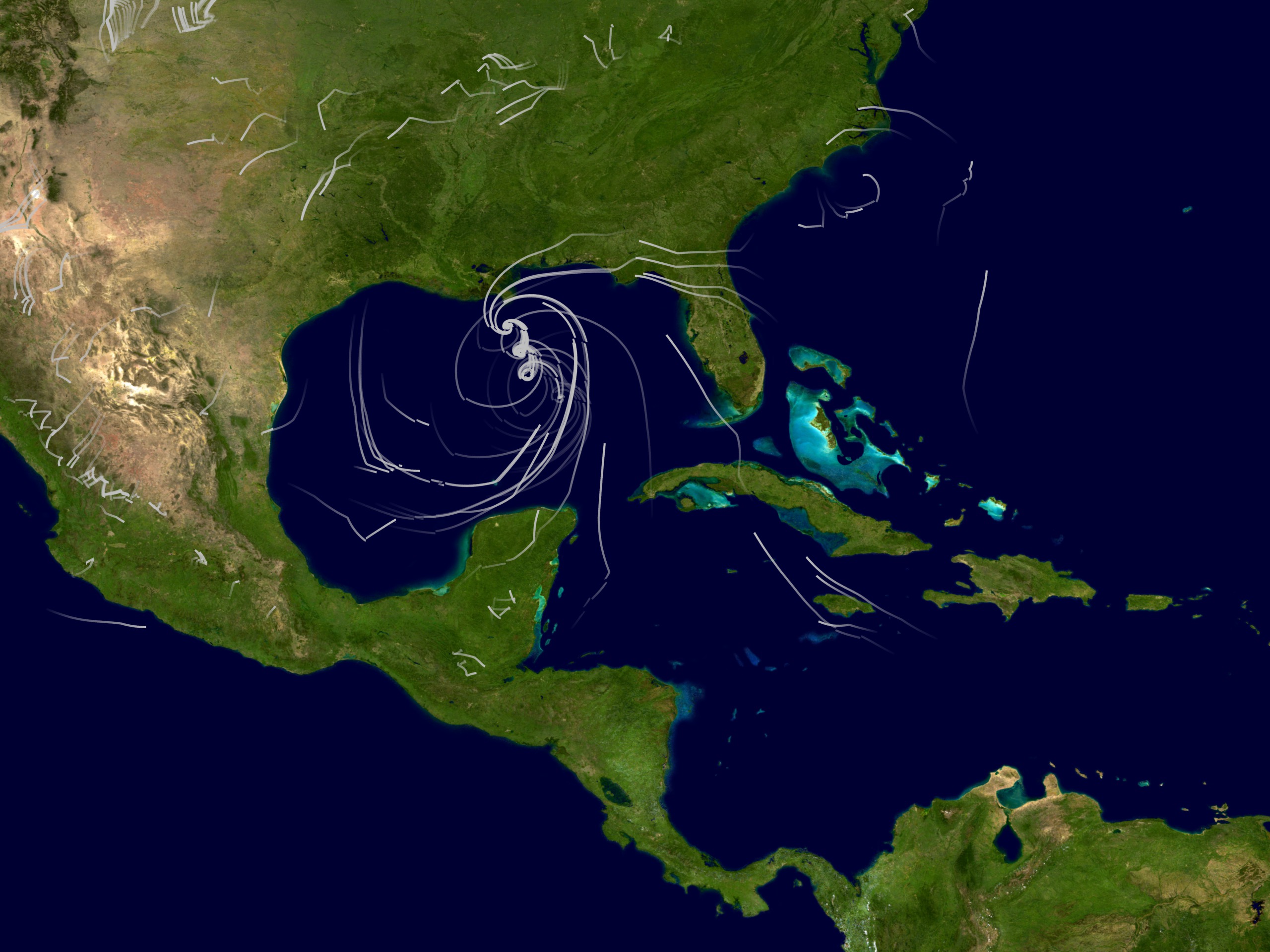
During the summer of 2005, the Earth-Sun Exploration Division of NASA/Goddard Space Flight Center(GSFC) brought together resources from NASA to study tropical cyclones. The MAP '05 Project, so named for its affiliation with NASA's Modeling, Analysis, and Prediction (MAP) program, applies NASA's advanced satellite remote sensing technologies and earth system modeling capabilities to improve our understanding of tropical cyclones that develop in and move across the Atlantic basin. MAP '05 implemented the most recent version of the NASA/Goddard Earth Observing System (GEOS) fifth-generation global atmospheric model and the Gridpoint Statistical Interpolation (GSI) analysis system under development as a collaboration between NOAA's National Centers for Environmental Prediction (NCEP) and the Global Modeling and Assimilation Office (GMAO) at GSFC. This animation displays MAP '05's wind analysis data for every 6 hour interval from August 23 through August 31, 2005.

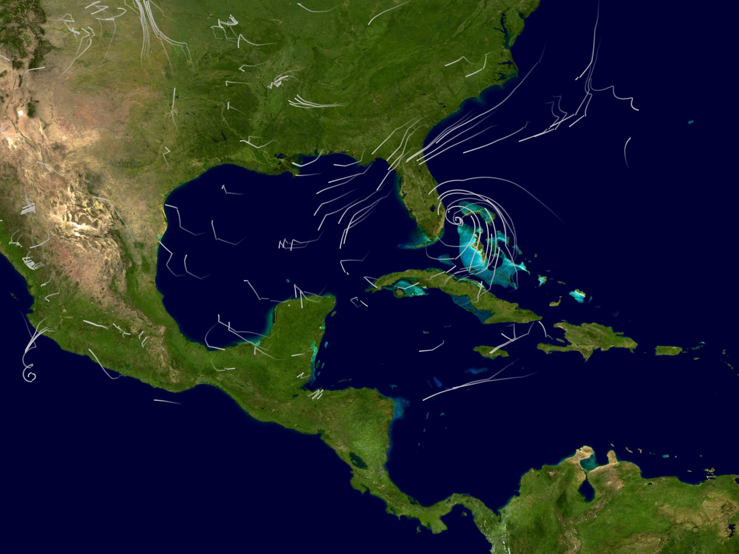
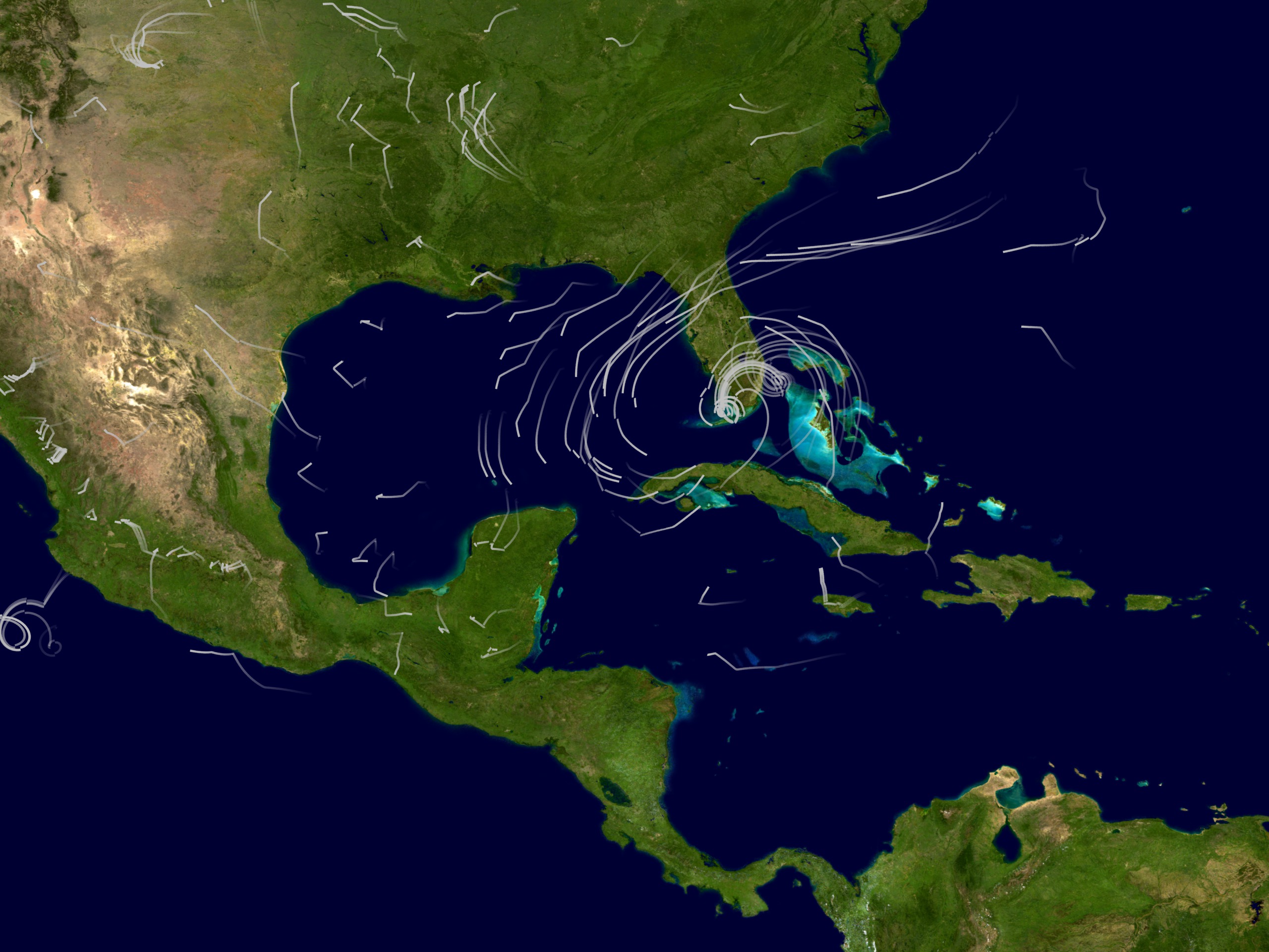
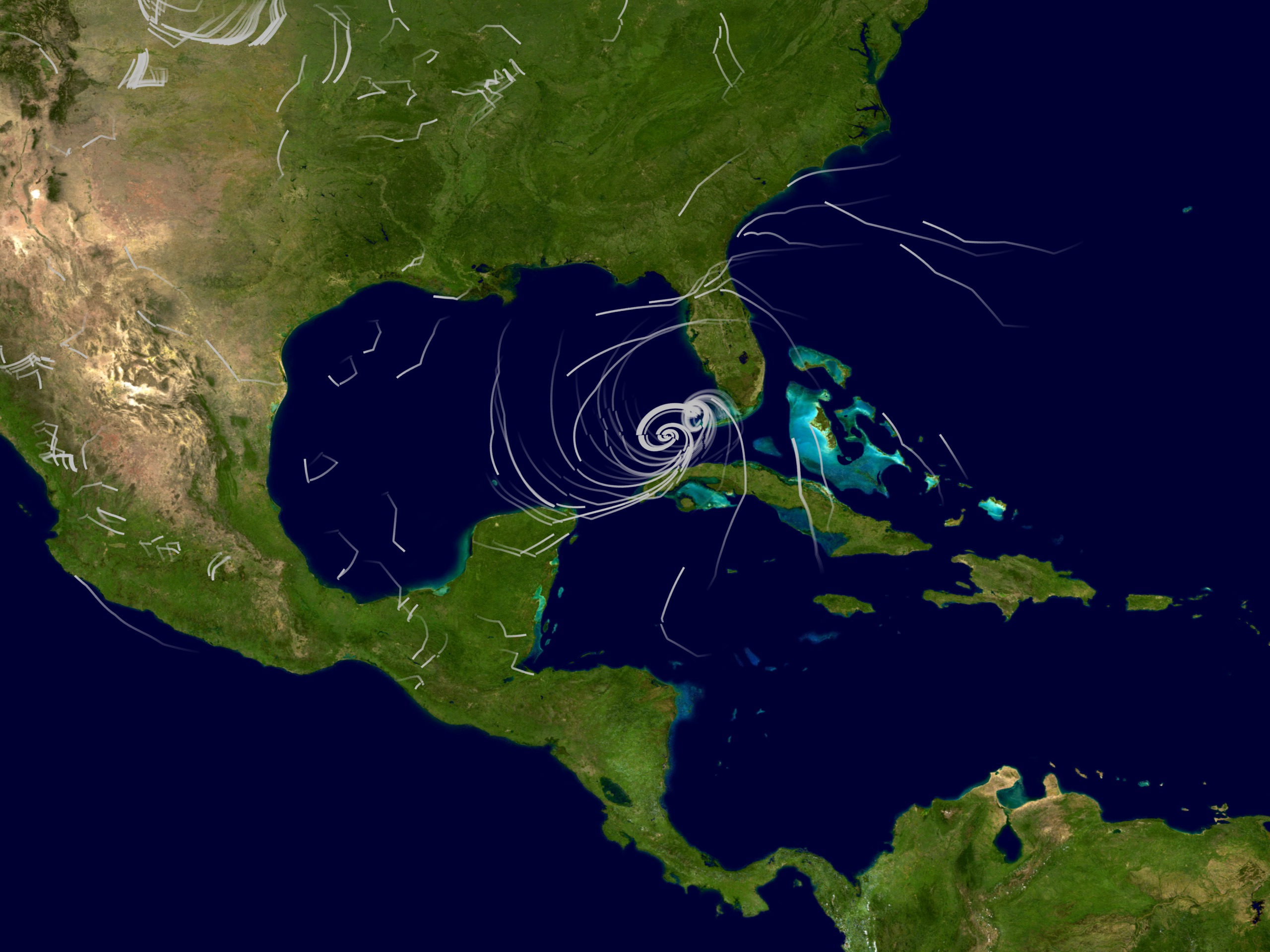


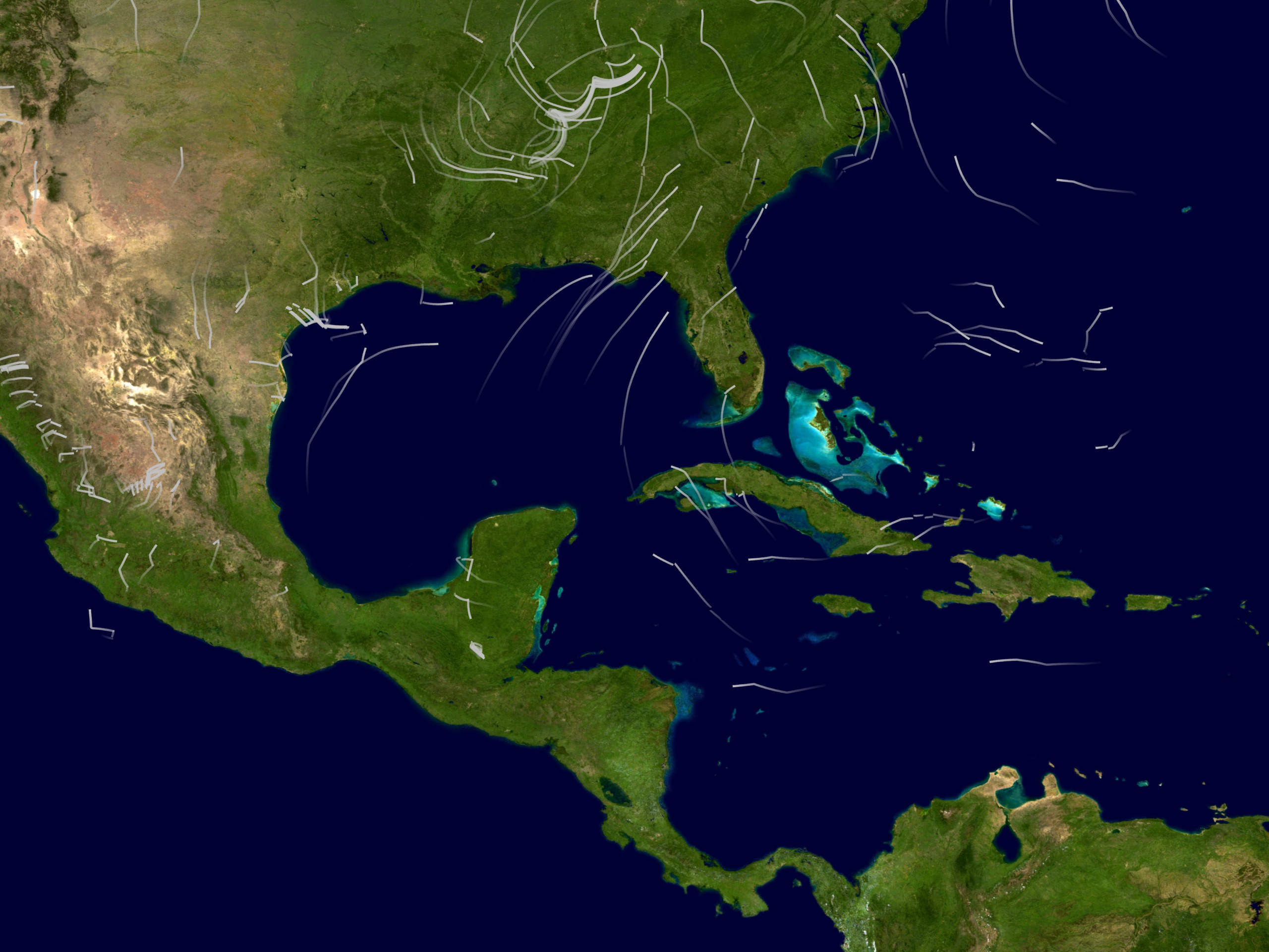
MAP '05 Models Hurricane Katrina's Winds from August 23, 2005 through August 31, 2005
Related Documentation
Visualization Credits
Lori Perkins (NASA/GSFC): Lead Animator
Jeff de La Beaujardiere (NASA): Animator
Greg Shirah (NASA/GSFC): Animator
William Putman (NASA/GSFC): Scientist
Jeff de La Beaujardiere (NASA): Animator
Greg Shirah (NASA/GSFC): Animator
William Putman (NASA/GSFC): Scientist
Please give credit for this item to:
NASA/Goddard Space Flight Center Scientific Visualization Studio
NASA/Goddard Space Flight Center Scientific Visualization Studio
Short URL to share this page:
https://svs.gsfc.nasa.gov/3360
Data Used:
Note: While we identify the data sets used in these visualizations, we do not store any further details nor the data sets themselves on our site.
Dates of Data Used:
2005/08/23 - 2005/08/31
This item is part of this series:
Hurricane Katrina
Keywords:
DLESE >> Atmospheric science
DLESE >> Natural hazards
GCMD >> Earth Science >> Atmosphere >> Atmospheric Phenomena >> Hurricanes
GCMD >> Earth Science >> Human Dimensions >> Natural Hazards >> Meteorological Hazards
SVS >> Hurricane Forecasting
NASA Science >> Earth
GCMD keywords can be found on the Internet with the following citation: Olsen, L.M., G. Major, K. Shein, J. Scialdone, S. Ritz, T. Stevens, M. Morahan, A. Aleman, R. Vogel, S. Leicester, H. Weir, M. Meaux, S. Grebas, C.Solomon, M. Holland, T. Northcutt, R. A. Restrepo, R. Bilodeau, 2013. NASA/Global Change Master Directory (GCMD) Earth Science Keywords. Version 8.0.0.0.0
https://svs.gsfc.nasa.gov/3360
Data Used:
GEOS5-DAS
Model - NASA/GSFC GMAO - 2005/08/23 - 2005/08/31
The GEOS5 model with the DAS data preloaded when executed.
Dates of Data Used:
2005/08/23 - 2005/08/31
This item is part of this series:
Hurricane Katrina
Keywords:
DLESE >> Atmospheric science
DLESE >> Natural hazards
GCMD >> Earth Science >> Atmosphere >> Atmospheric Phenomena >> Hurricanes
GCMD >> Earth Science >> Human Dimensions >> Natural Hazards >> Meteorological Hazards
SVS >> Hurricane Forecasting
NASA Science >> Earth
GCMD keywords can be found on the Internet with the following citation: Olsen, L.M., G. Major, K. Shein, J. Scialdone, S. Ritz, T. Stevens, M. Morahan, A. Aleman, R. Vogel, S. Leicester, H. Weir, M. Meaux, S. Grebas, C.Solomon, M. Holland, T. Northcutt, R. A. Restrepo, R. Bilodeau, 2013. NASA/Global Change Master Directory (GCMD) Earth Science Keywords. Version 8.0.0.0.0


