Earth
ID: 3265
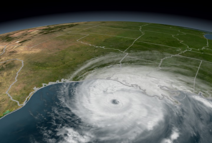
A progression of Hurricane Rita from 9/19/05 to 9/24/05 using Aqua/MODIS and NOAA/GOES data. Hurricane Rita followed in the wake of Hurricane Katrina, through the Gulf of Mexico, threatening Louisiana residents yet again. Although the city of New Orleans was mostly spared from this second Gulf hurricane, large areas of rural Texas and Louisiana were flooded.
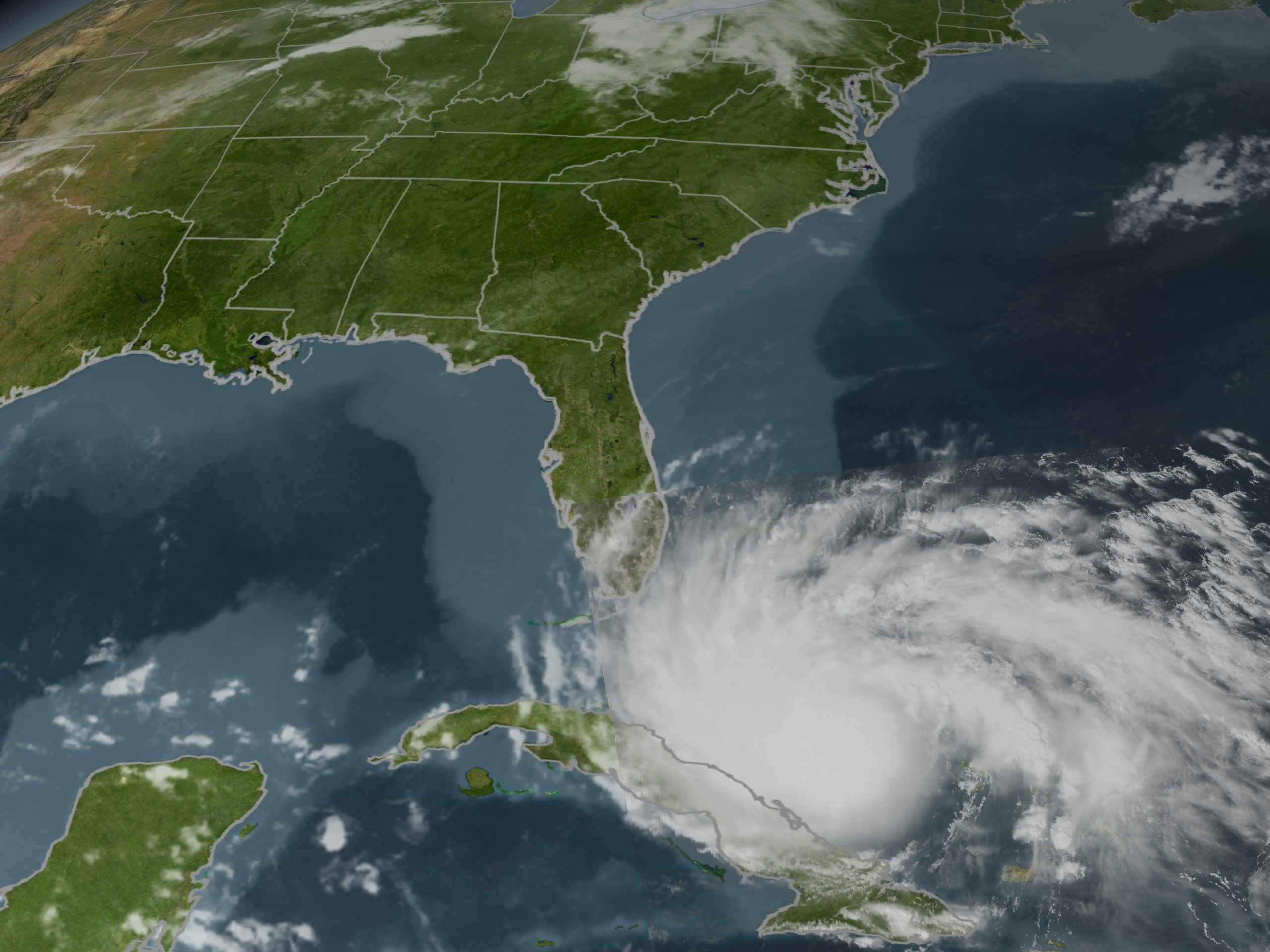

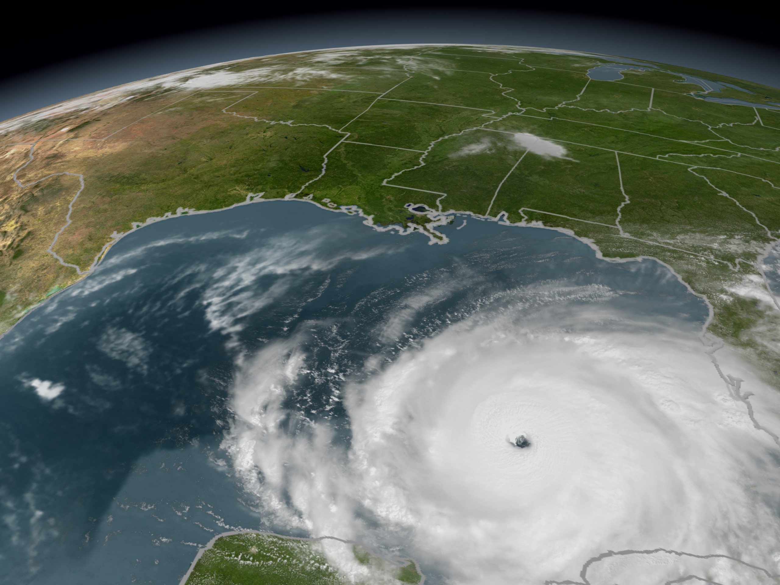


Hurricane Rita MODIS Progression
Visualization Credits
Alex Kekesi (Global Science and Technology, Inc.): Lead Animator
Please give credit for this item to:
NASA/Goddard Space Flight Center Scientific Visualization Studio
NASA/Goddard Space Flight Center Scientific Visualization Studio
Short URL to share this page:
https://svs.gsfc.nasa.gov/3265
Data Used:
Note: While we identify the data sets used in these visualizations, we do not store any further details nor the data sets themselves on our site.
This item is part of this series:
Hurricane Rita
Keywords:
DLESE >> Hydrology
DLESE >> Natural hazards
GCMD >> Earth Science >> Atmosphere >> Atmospheric Phenomena >> Hurricanes
GCMD >> Earth Science >> Human Dimensions >> Natural Hazards >> Meteorological Hazards
GCMD >> Location >> Gulf Of Mexico
SVS >> Hurricane Rita
SVS >> GOES
NASA Science >> Earth
GCMD keywords can be found on the Internet with the following citation: Olsen, L.M., G. Major, K. Shein, J. Scialdone, S. Ritz, T. Stevens, M. Morahan, A. Aleman, R. Vogel, S. Leicester, H. Weir, M. Meaux, S. Grebas, C.Solomon, M. Holland, T. Northcutt, R. A. Restrepo, R. Bilodeau, 2013. NASA/Global Change Master Directory (GCMD) Earth Science Keywords. Version 8.0.0.0.0
https://svs.gsfc.nasa.gov/3265
Data Used:
Aqua/MODIS
9/19/05 - 9/24/05GOES-12/Imager/Visible
9/19/05 - 9/24/05This item is part of this series:
Hurricane Rita
Keywords:
DLESE >> Hydrology
DLESE >> Natural hazards
GCMD >> Earth Science >> Atmosphere >> Atmospheric Phenomena >> Hurricanes
GCMD >> Earth Science >> Human Dimensions >> Natural Hazards >> Meteorological Hazards
GCMD >> Location >> Gulf Of Mexico
SVS >> Hurricane Rita
SVS >> GOES
NASA Science >> Earth
GCMD keywords can be found on the Internet with the following citation: Olsen, L.M., G. Major, K. Shein, J. Scialdone, S. Ritz, T. Stevens, M. Morahan, A. Aleman, R. Vogel, S. Leicester, H. Weir, M. Meaux, S. Grebas, C.Solomon, M. Holland, T. Northcutt, R. A. Restrepo, R. Bilodeau, 2013. NASA/Global Change Master Directory (GCMD) Earth Science Keywords. Version 8.0.0.0.0


