Earth
ID: 3065
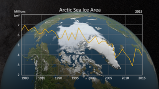
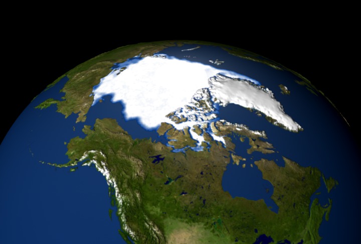
This animation shows the annual minimum sea ice extent and concentration for 25 years, from 1979 to 2004. The year 2002 showed lowest level of sea ice on record. This visualization was created in support of the December 2004 American Geophysical Union (AGU) meeting. NOTE: this version has a slightly different camera angle than the 2003 version, animation ID 2850 (the original camera angle was lost).
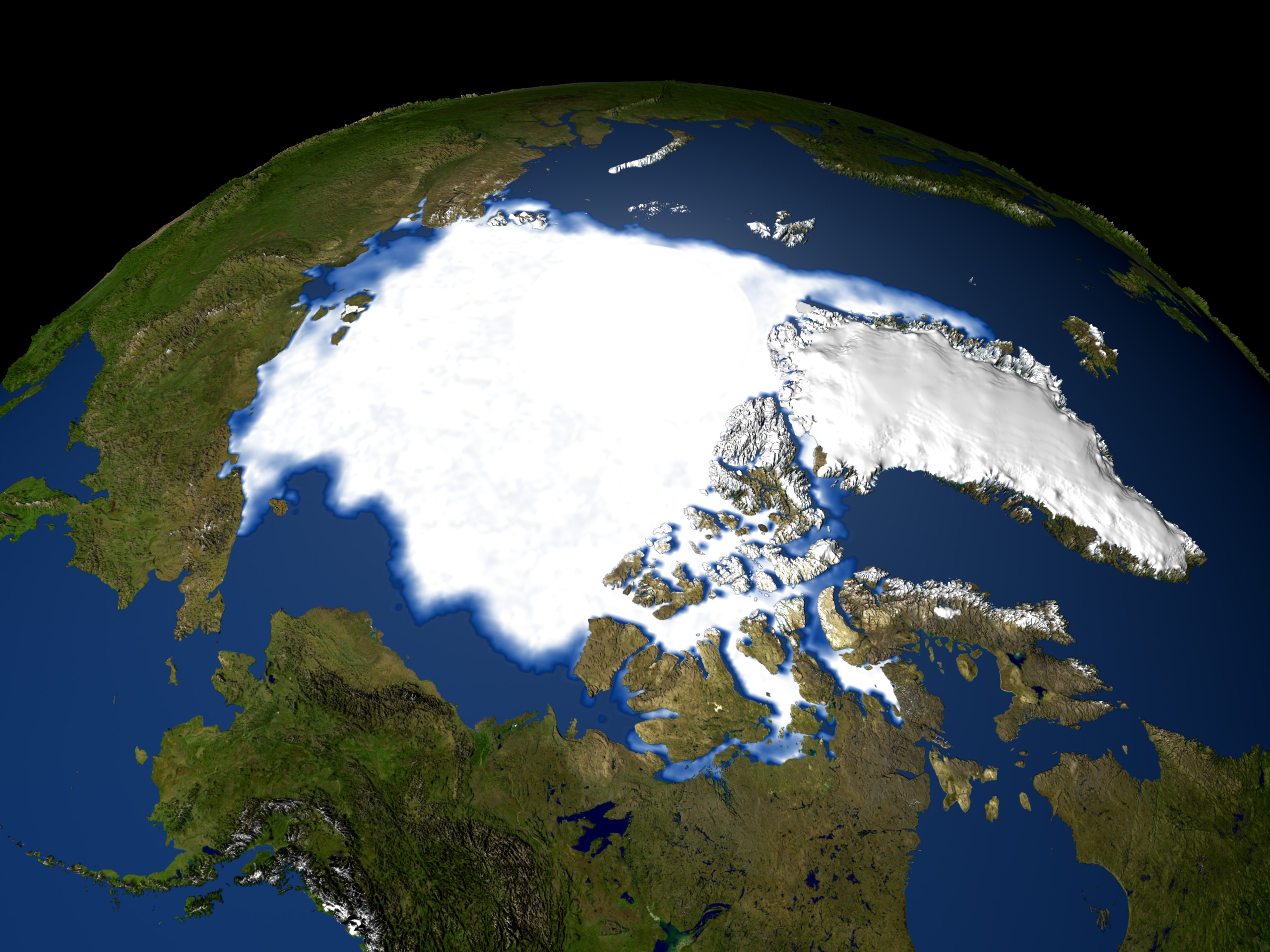
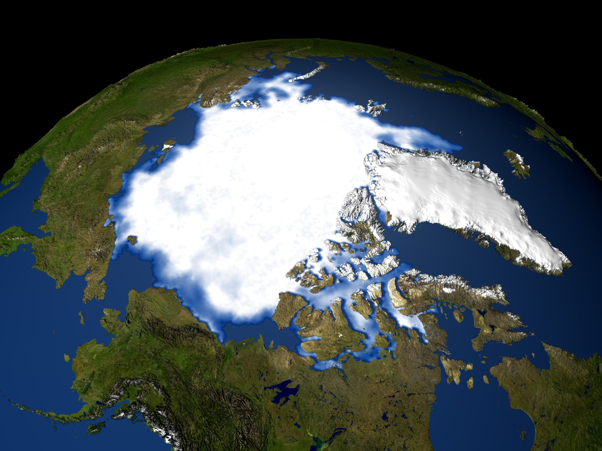

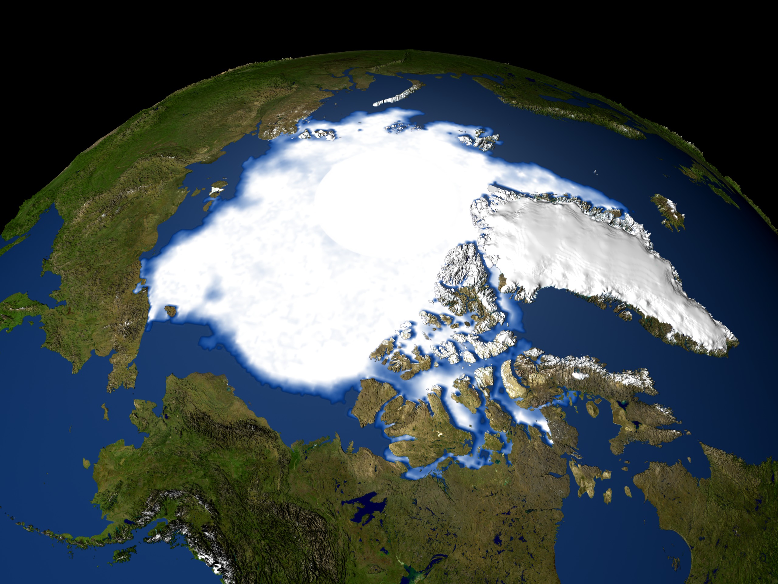
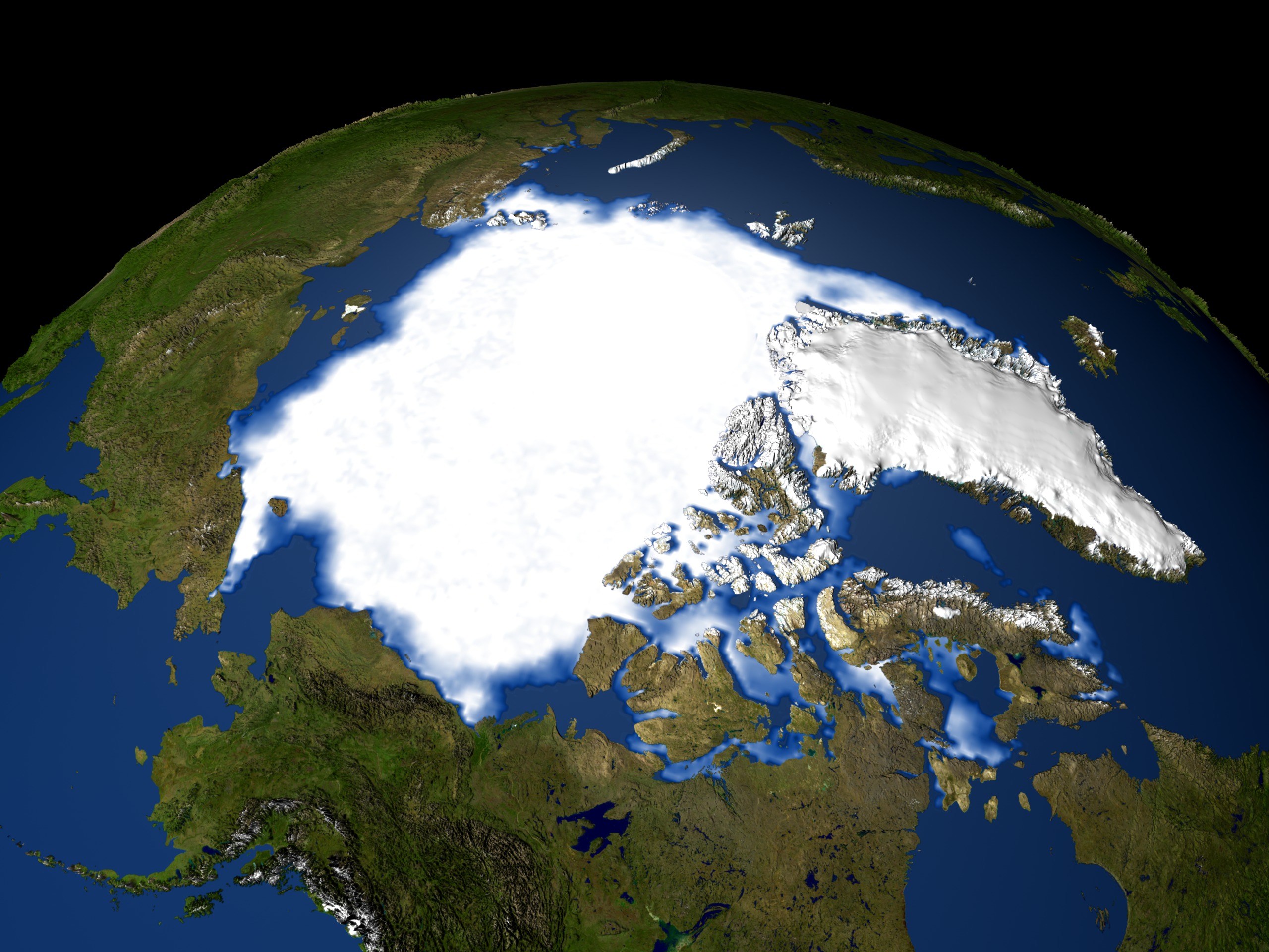

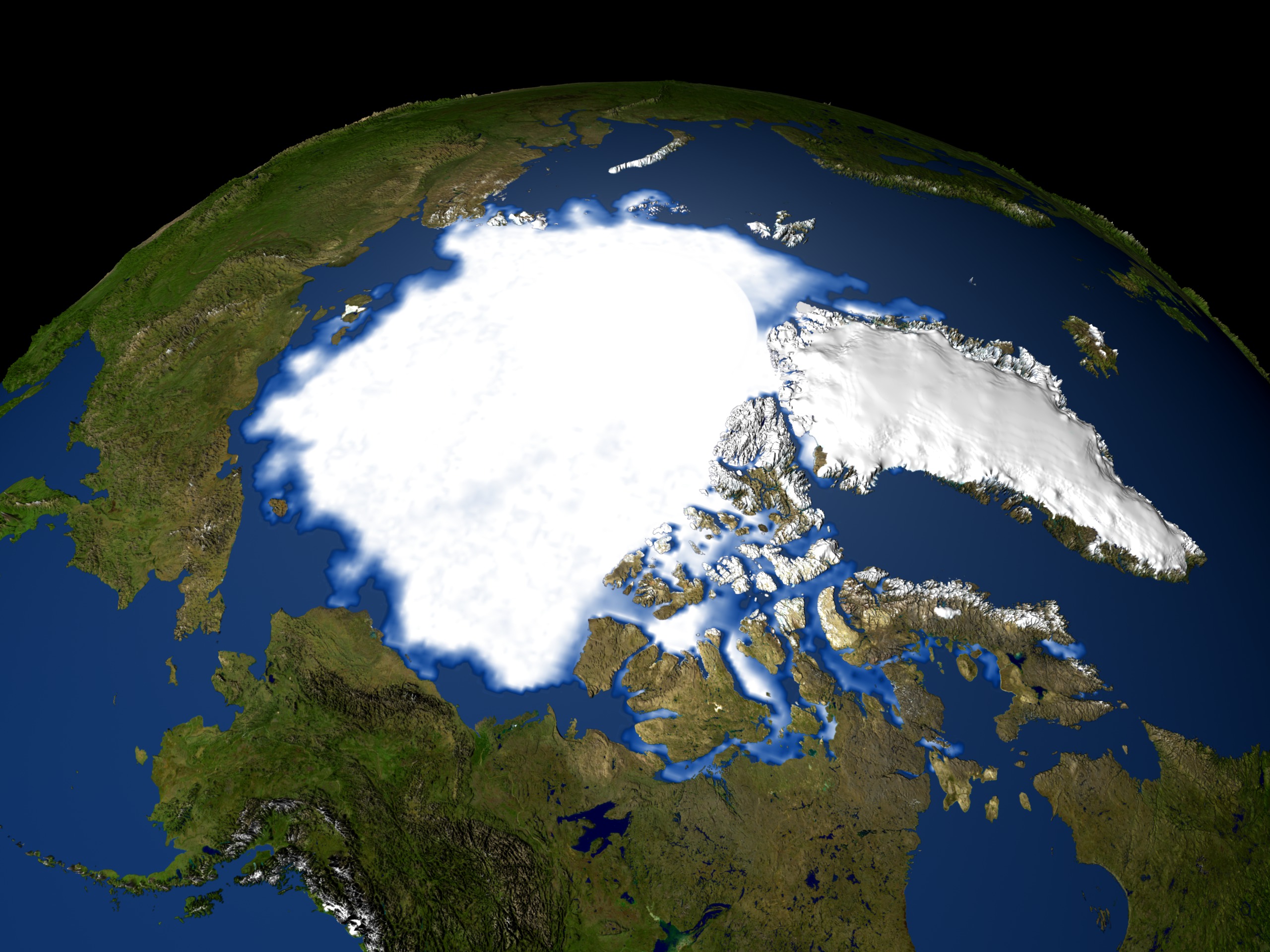
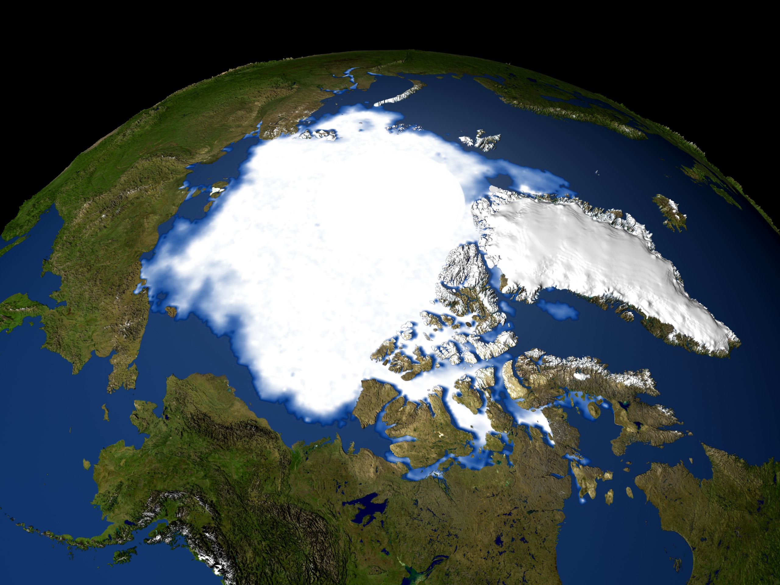
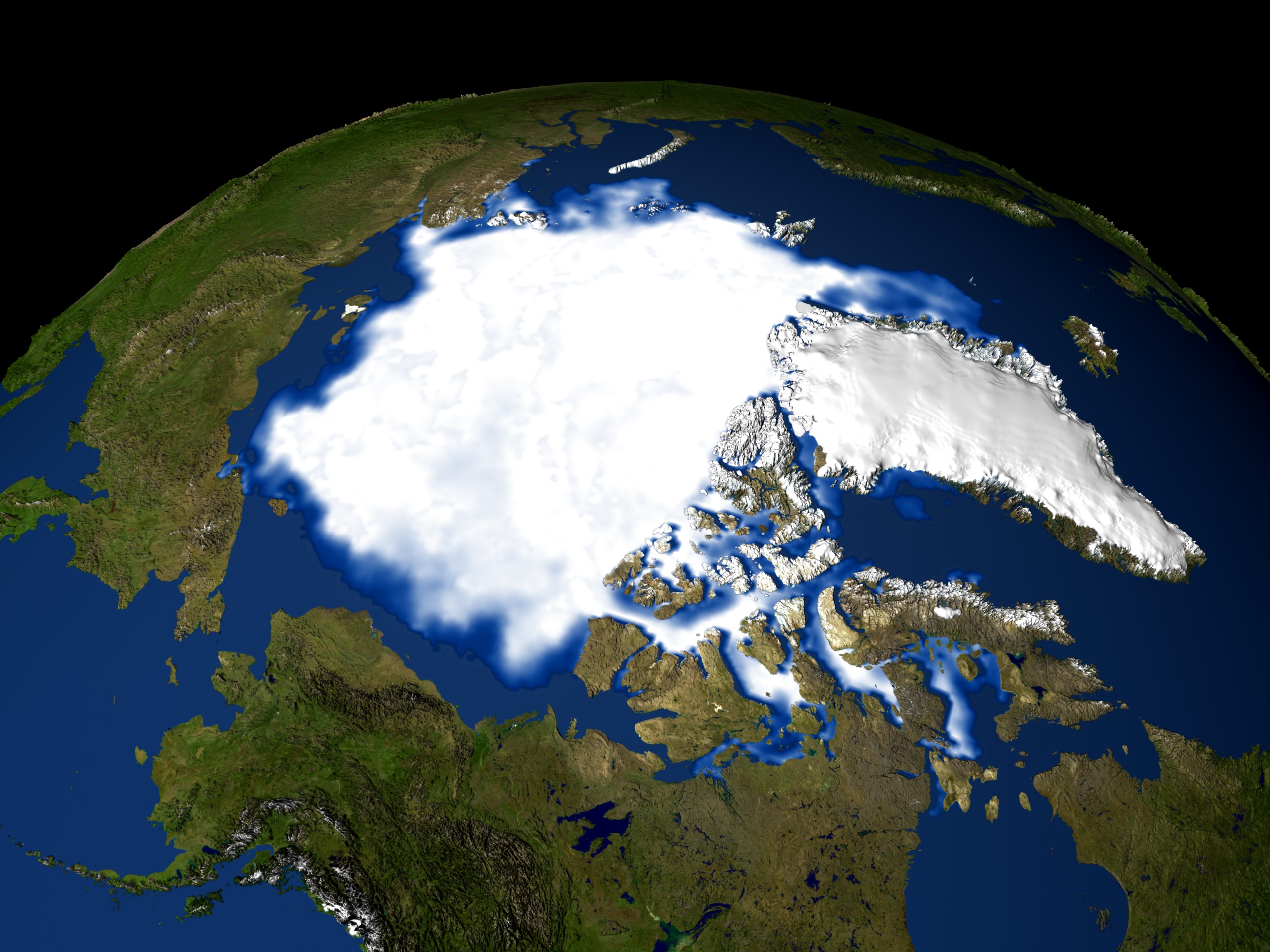
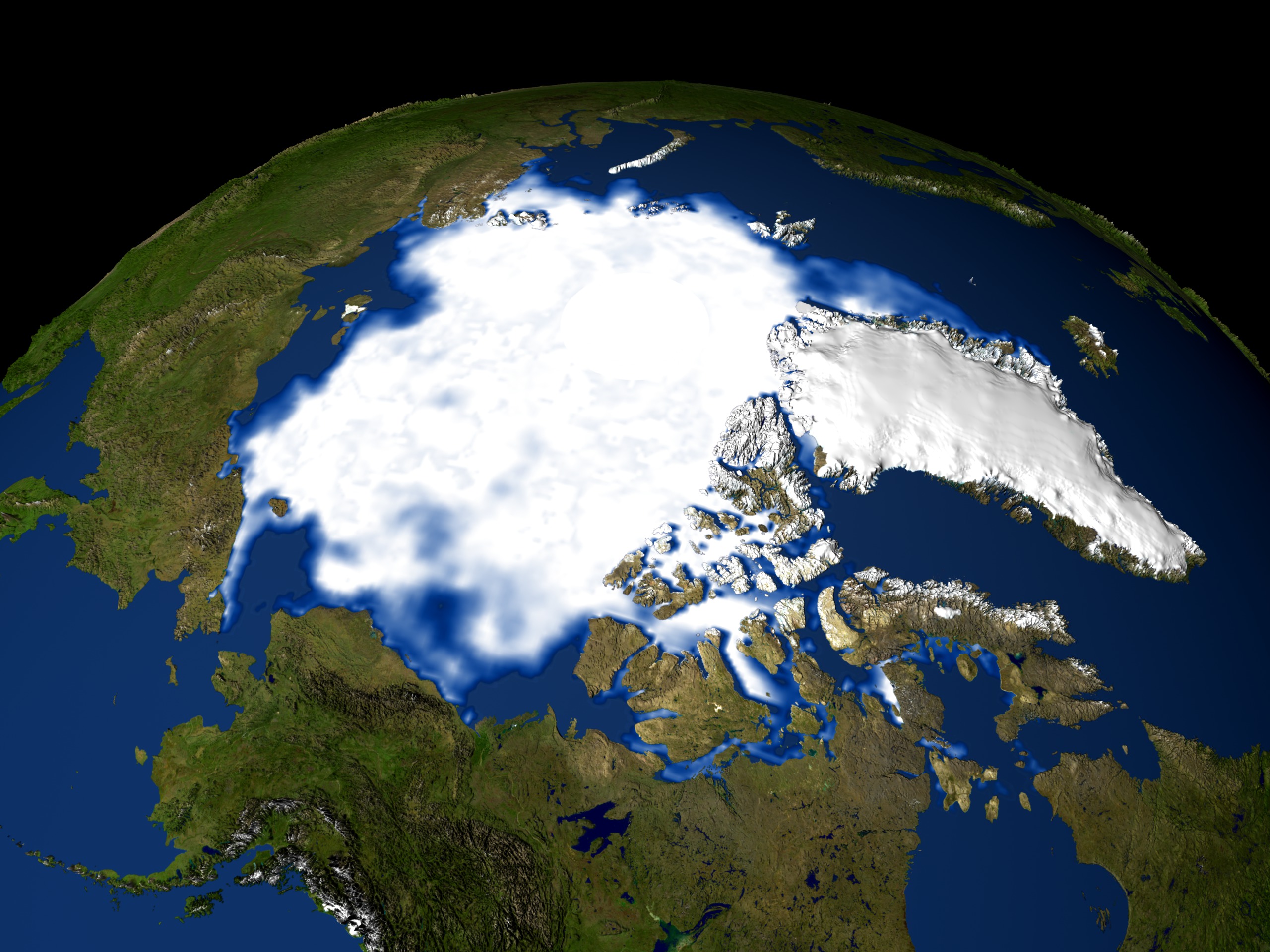
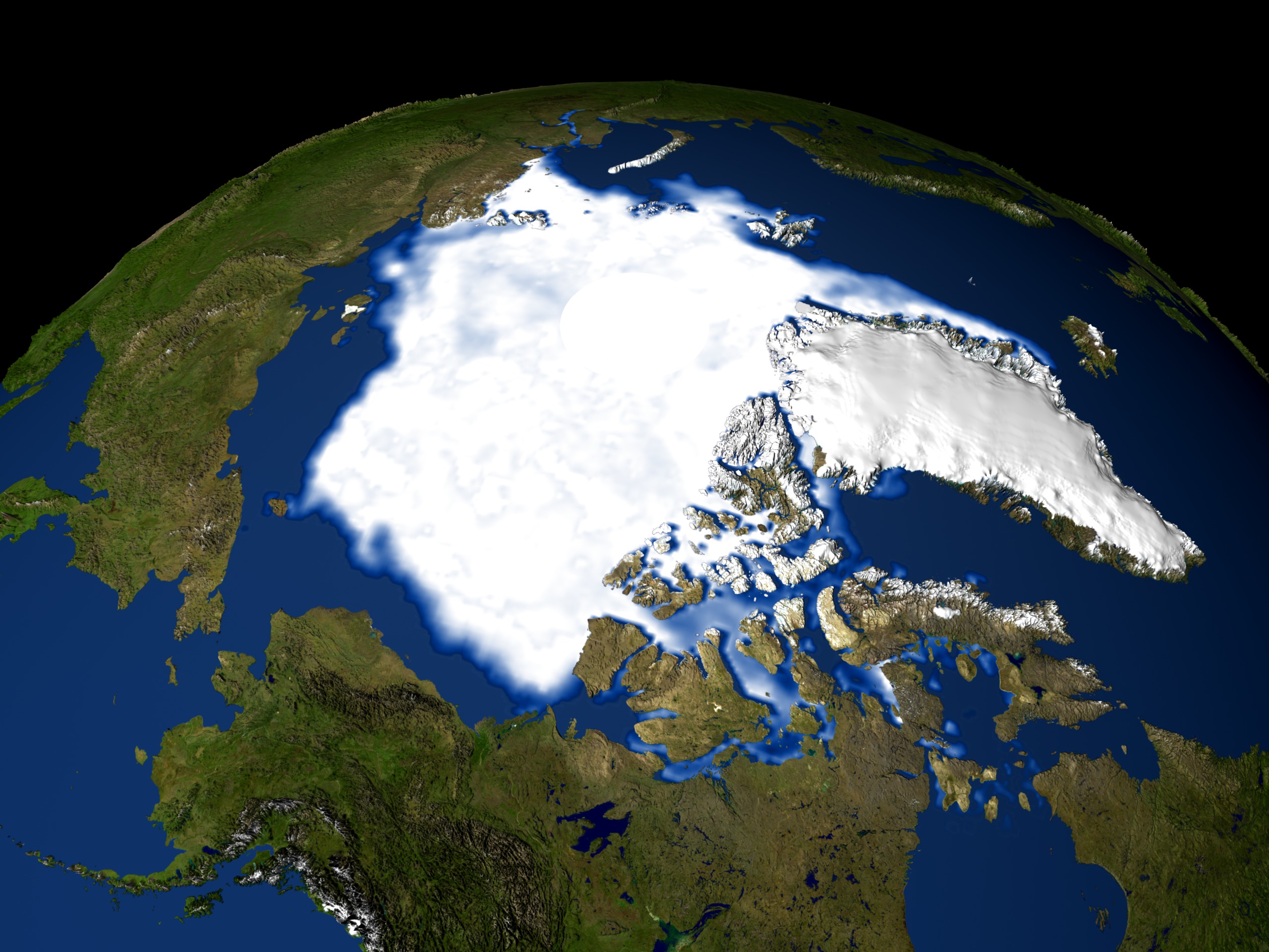
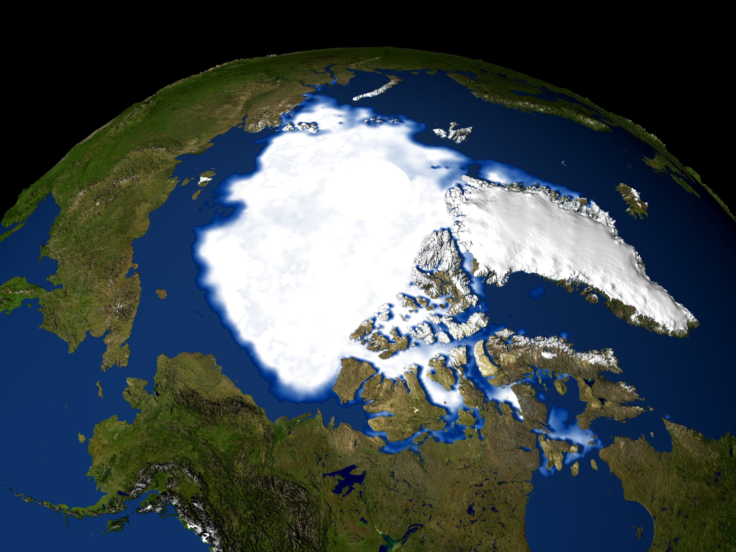

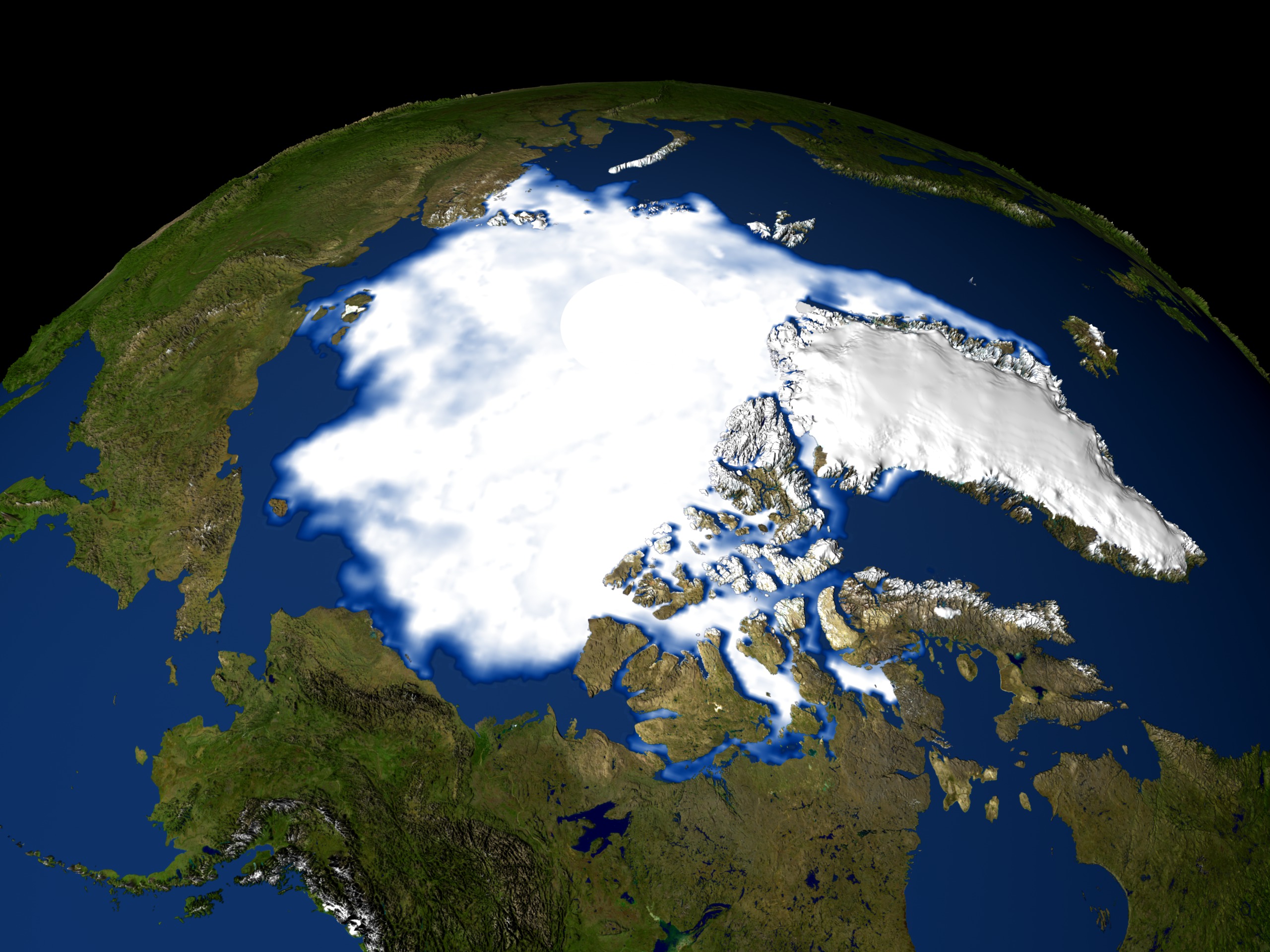
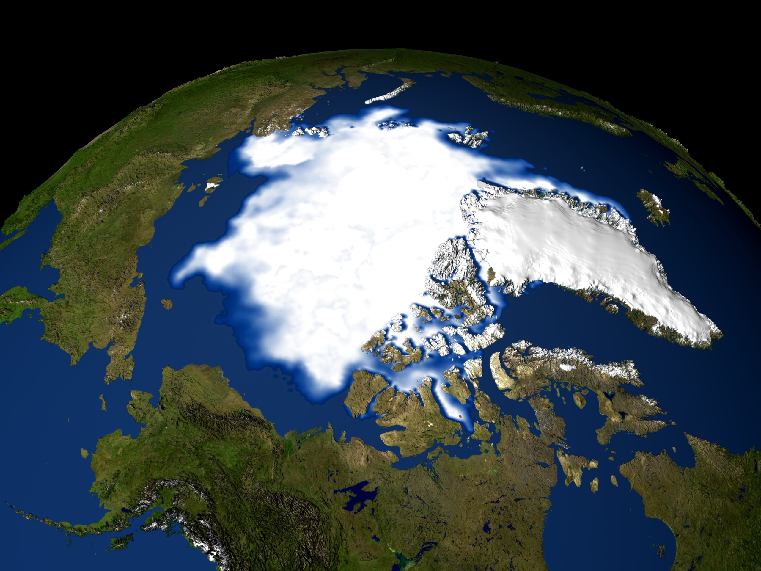
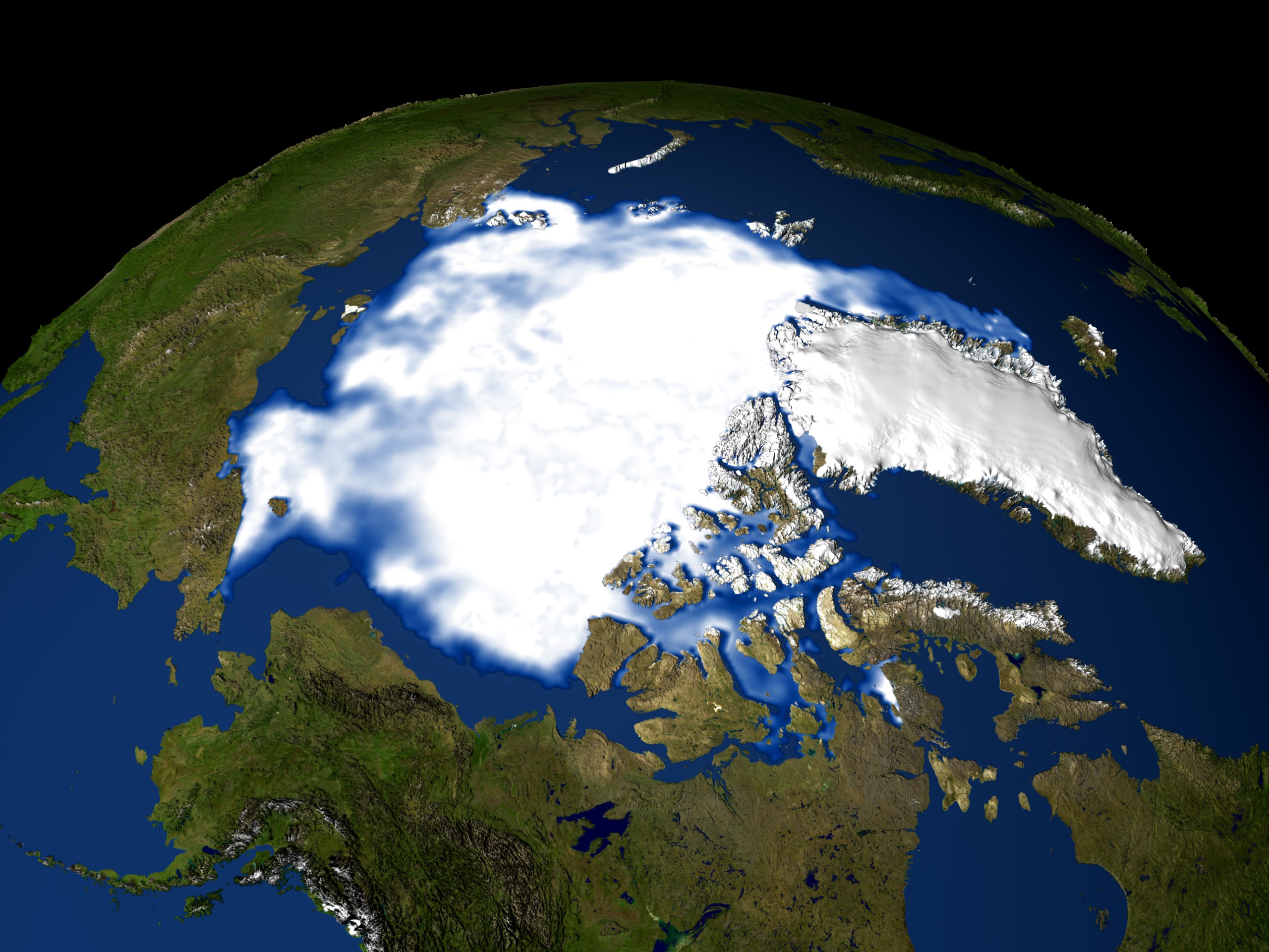

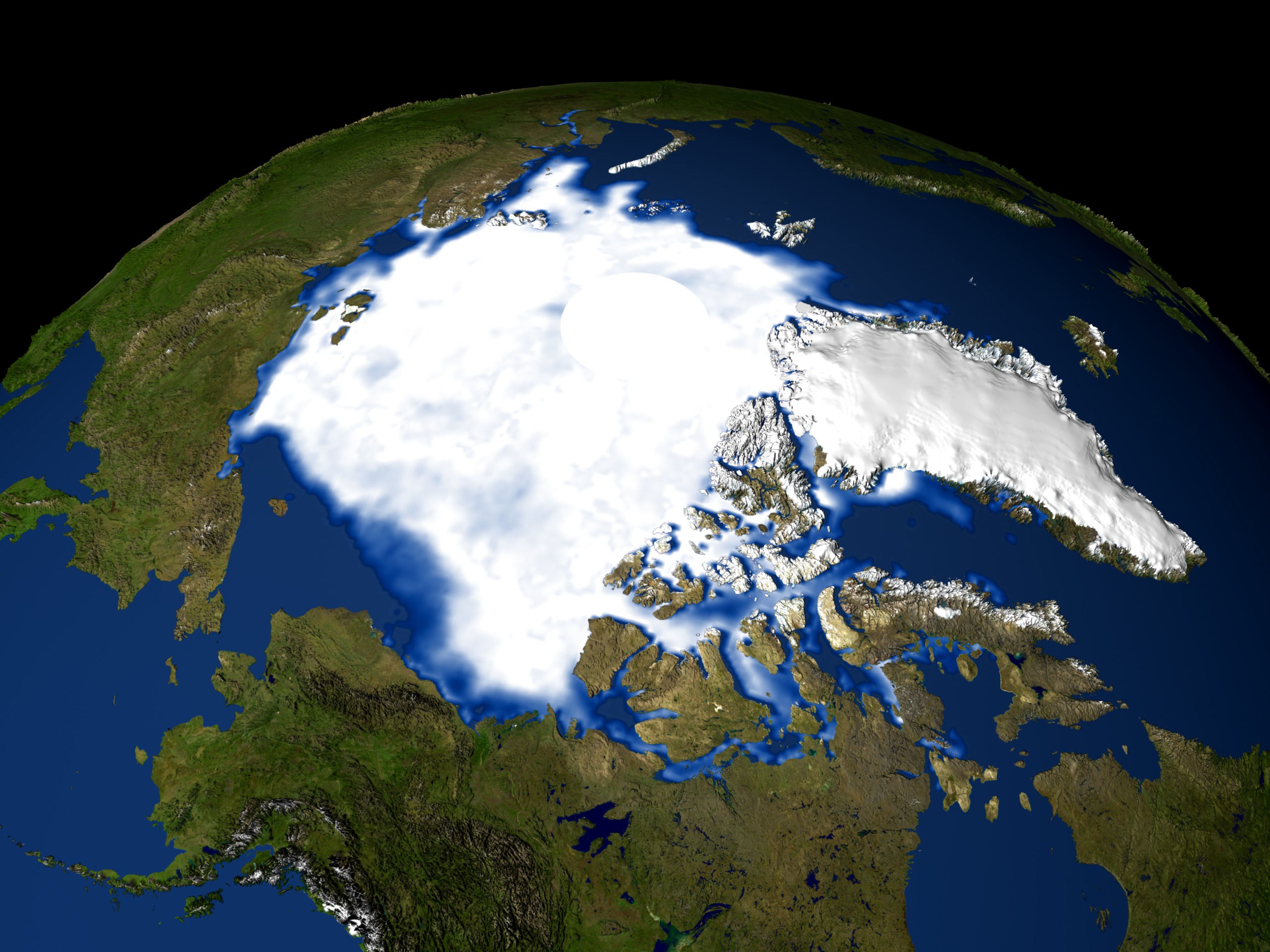
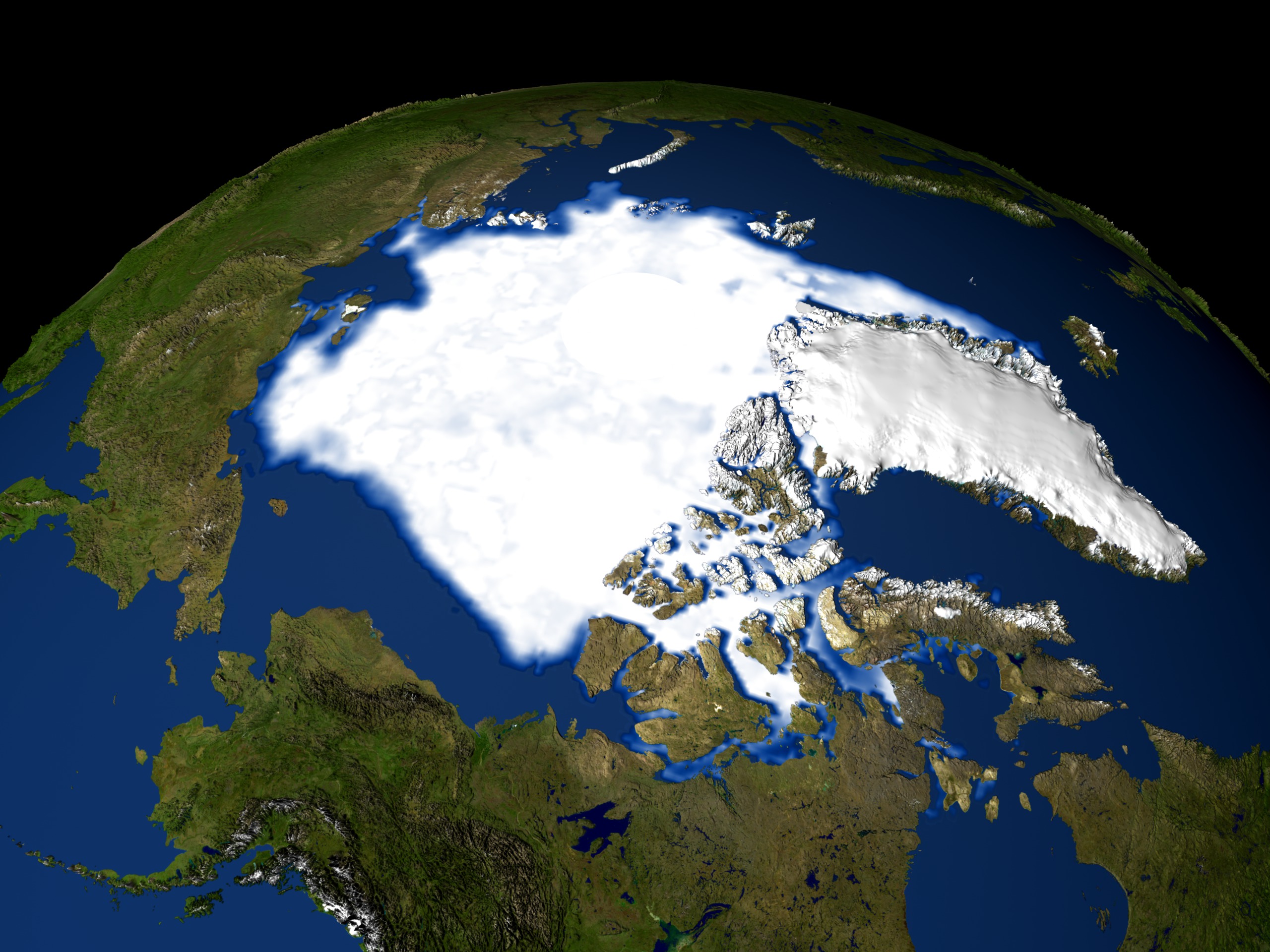
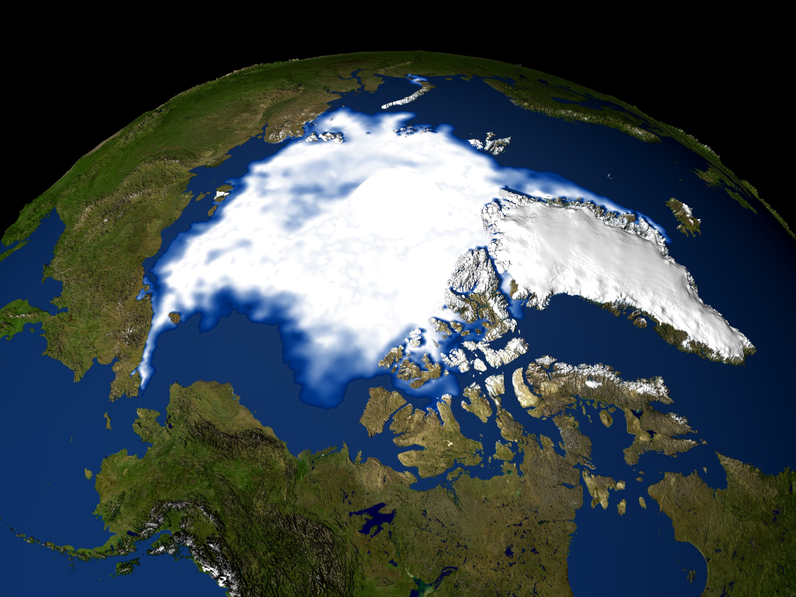
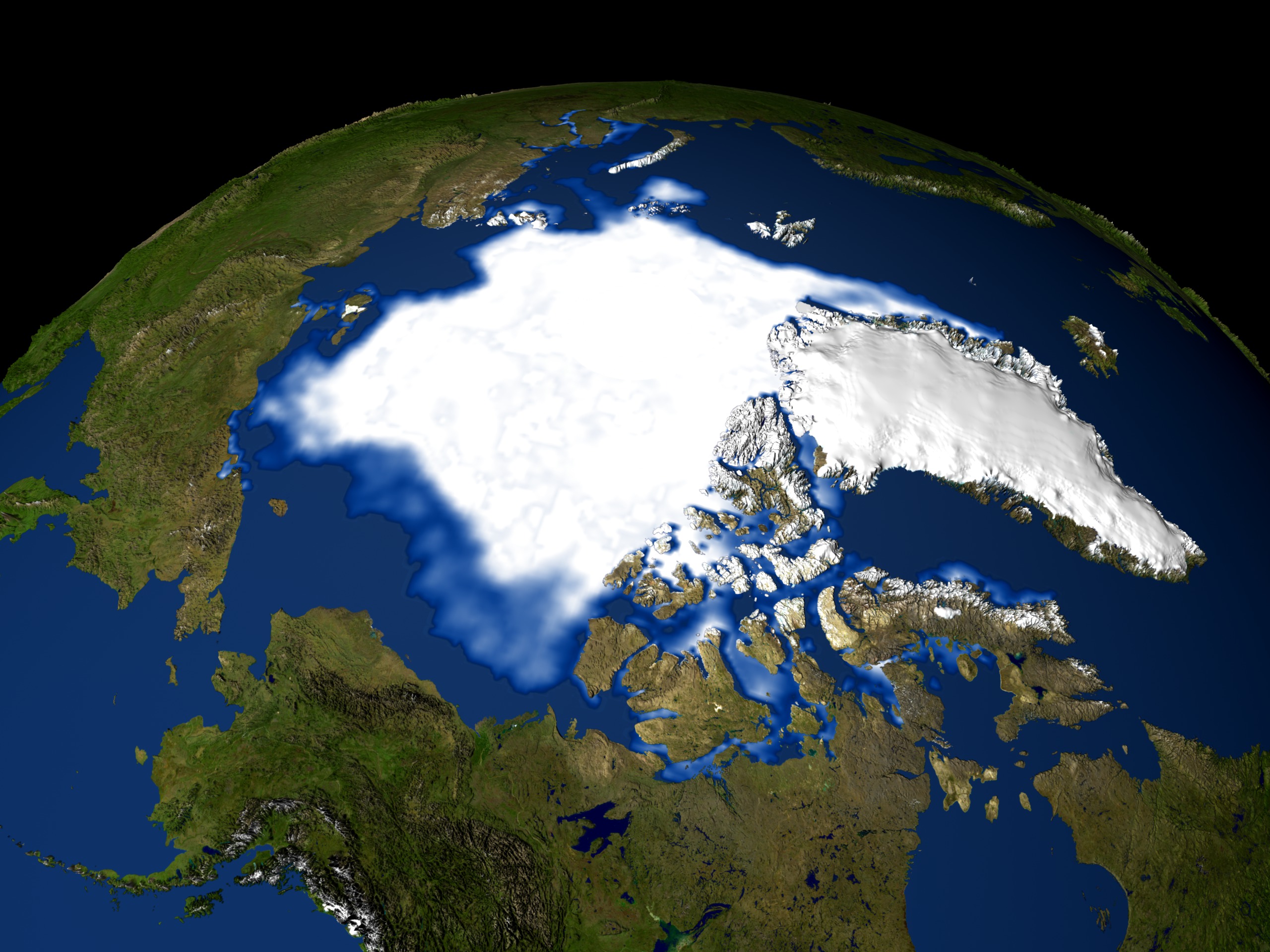
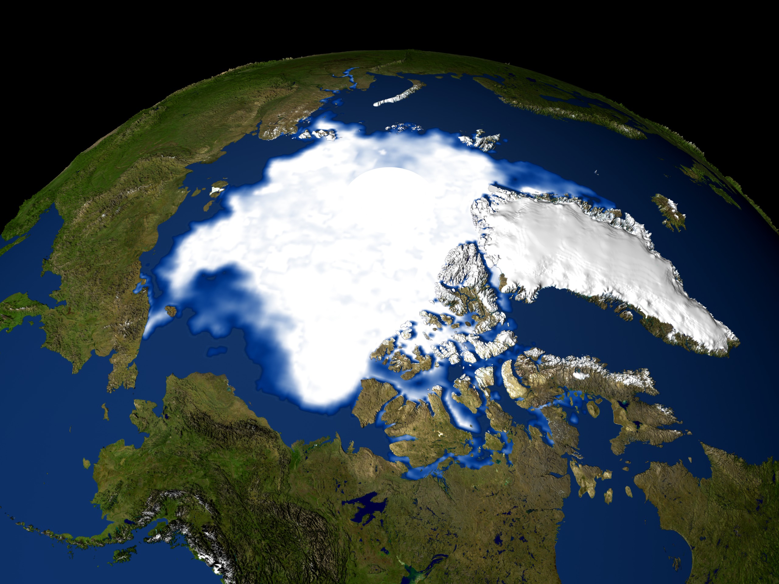

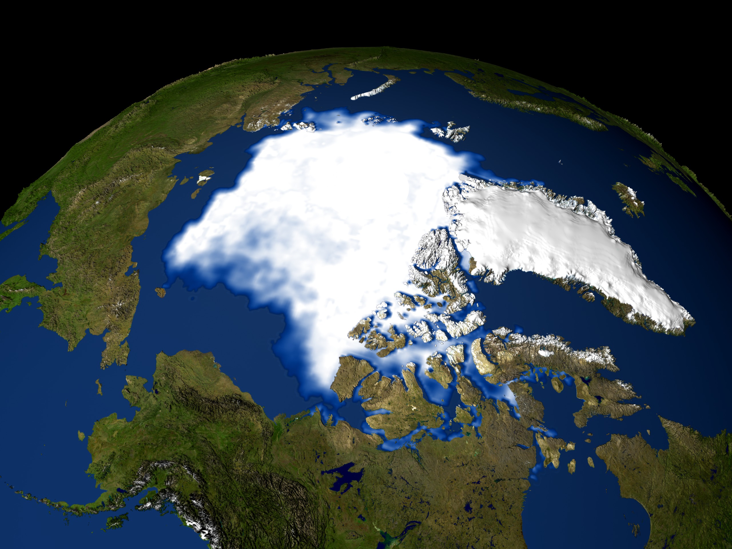
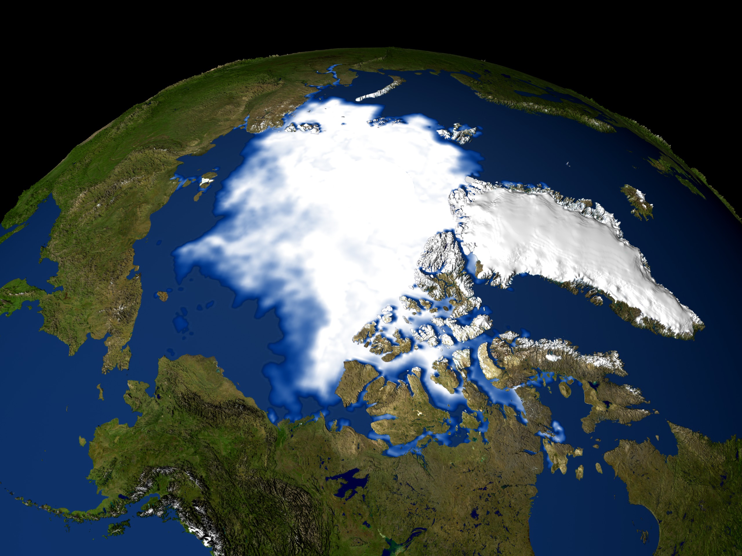
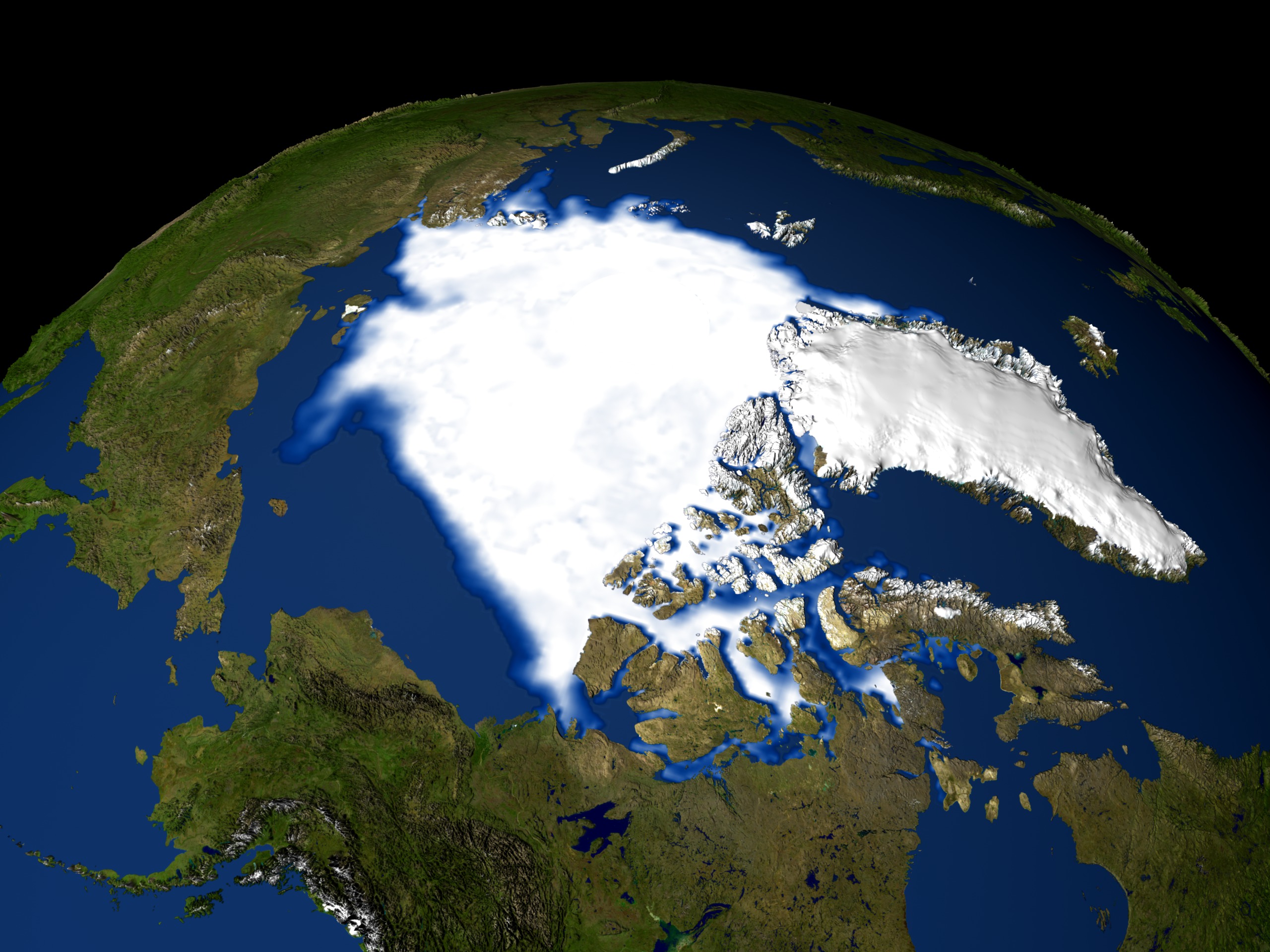
Sea Ice Minimum Extent for 1979-2004
There is a newer version of this story located here: https://svs.gsfc.nasa.gov/4435
Newer Version
Visualization Credits
Greg Shirah (NASA/GSFC): Lead Animator
James W. Williams (GST): Animator
Josefino Comiso (NASA/GSFC): Scientist
James W. Williams (GST): Animator
Josefino Comiso (NASA/GSFC): Scientist
Please give credit for this item to:
NASA/Goddard Space Flight Center Scientific Visualization Studio The Blue Marble Next Generation data is courtesy of Reto Stockli (NASA/GSFC) and NASA's Earth Observatory.
NASA/Goddard Space Flight Center Scientific Visualization Studio The Blue Marble Next Generation data is courtesy of Reto Stockli (NASA/GSFC) and NASA's Earth Observatory.
Short URL to share this page:
https://svs.gsfc.nasa.gov/3065
Mission:
Terra
Data Used:
Note: While we identify the data sets used in these visualizations, we do not store any further details nor the data sets themselves on our site.
Keywords:
SVS >> Ice
NASA Science >> Earth
https://svs.gsfc.nasa.gov/3065
Mission:
Terra
Data Used:
DMSP/SSM/I
1979-2004
Defense Meteorological Satellite Program Special Sensor Microwave Imager
GTOPO30
Model - USGSTerra and Aqua/MODIS/Blue Marble: Next Generation also referred to as: BMNG
1/1/2004 - 12/31/2004
Credit:
The Blue Marble data is courtesy of Reto Stockli (NASA/GSFC).
The Blue Marble data is courtesy of Reto Stockli (NASA/GSFC).
Comiso's September Minimum Sea Ice Concentration
Data Compilation - NASA/GSFC - 1979-2004Keywords:
SVS >> Ice
NASA Science >> Earth


