Earth
ID: 30019
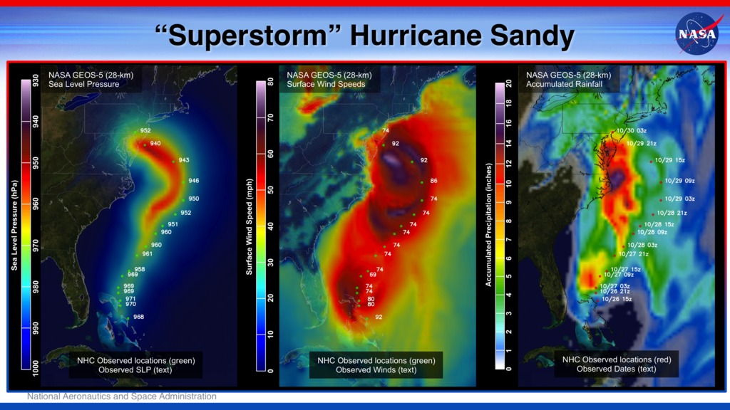
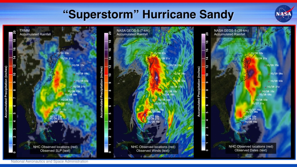
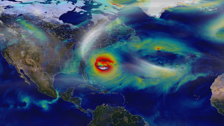
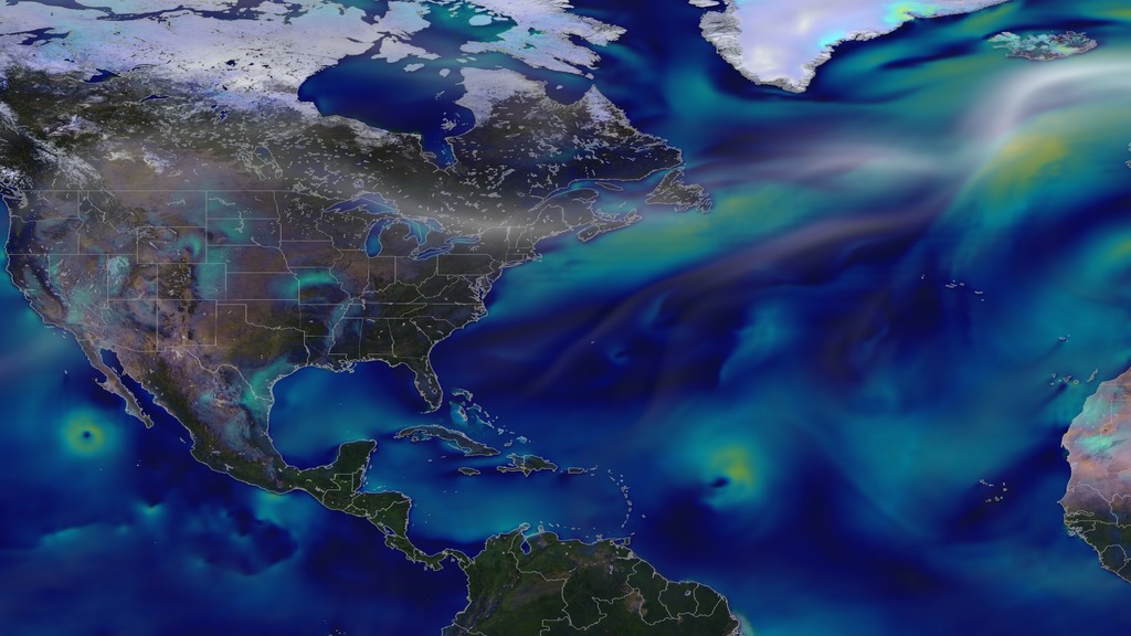
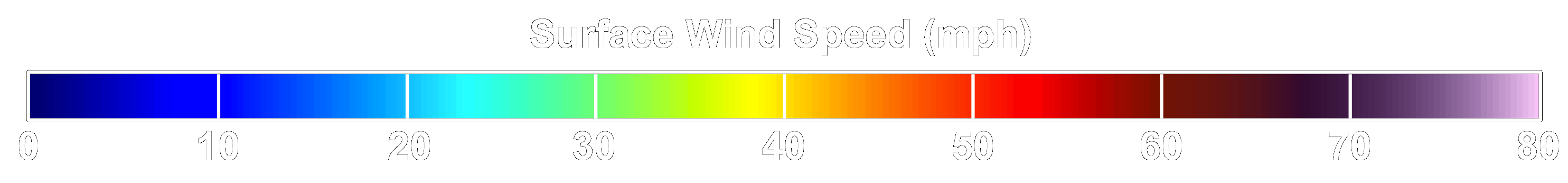
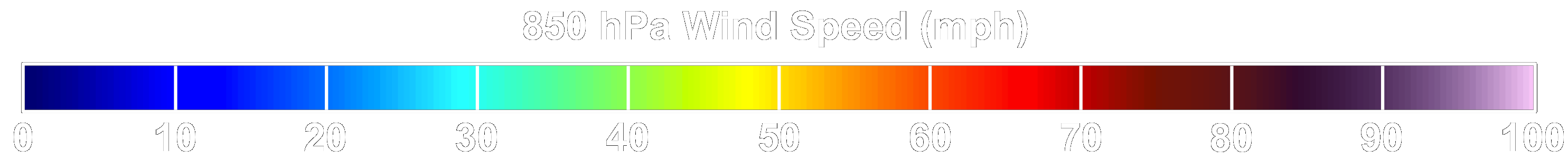
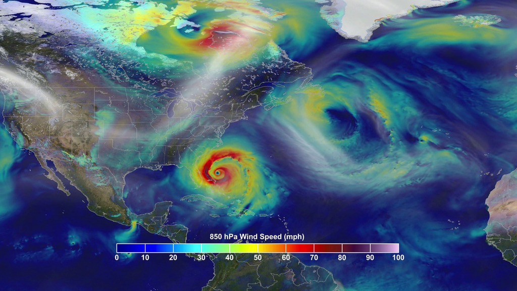
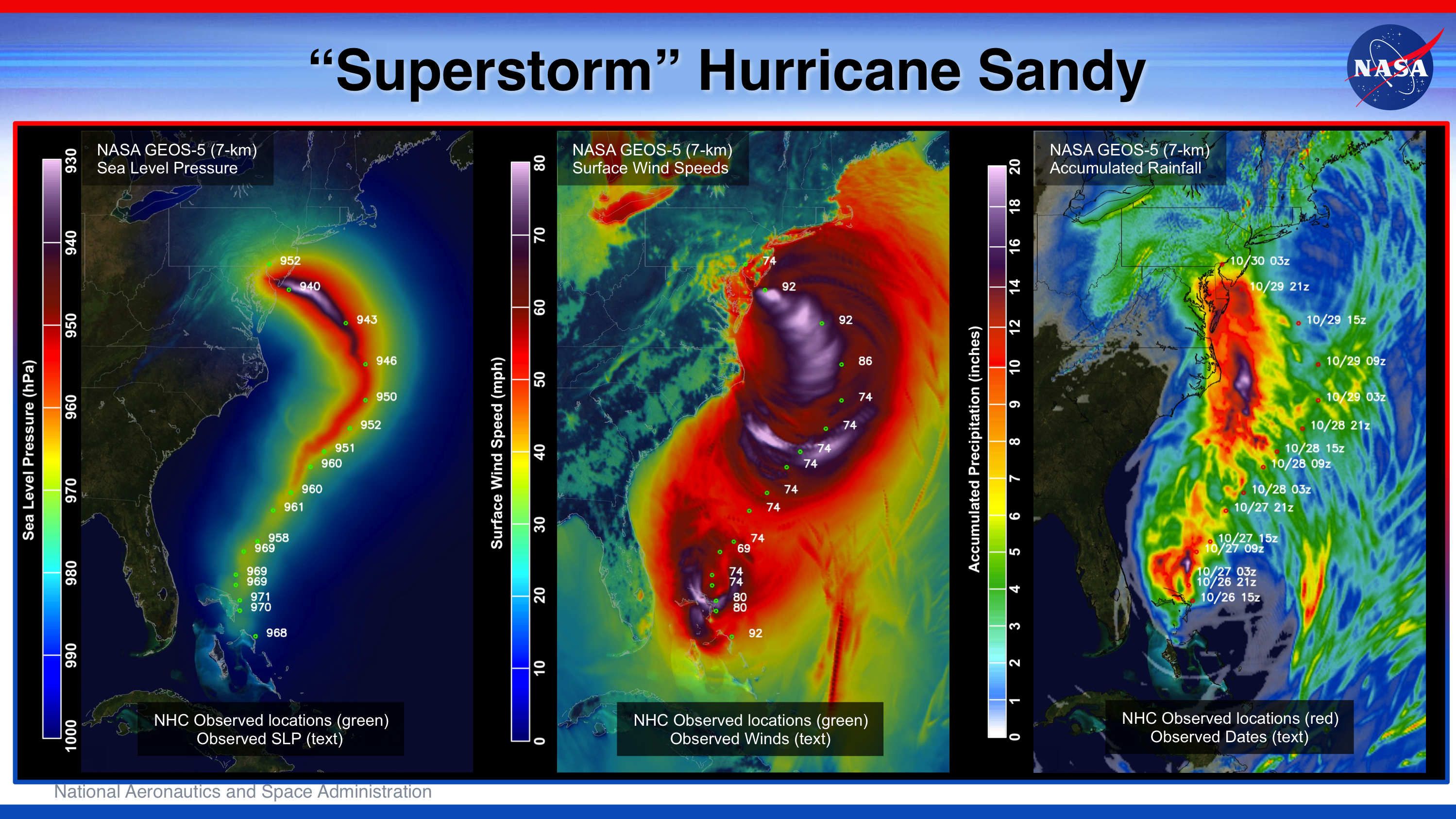
Surface and near-surface (850 hPa) wind speeds from the NASA Goddard Earth Observing System Model (GEOS-5) operational assimilation system (consisting of a 50-kilometer analysis coupled with a 25-kilometer model) beginning September 1, 2012 preceding a 7-kilometer global simulation with the GEOS-5 atmospheric model initialized at 09Z on October 26, 2012 reveal the massive size of Hurricane Sandy versus the other storms for this period, including the persistent Hurricane Nadine, as well as hurricanes Michael and Rafael. The 7-kilometer simulation depicts the strong onshore winds in New York and New Jersey even after landfall and the dramatic influence of the land surface slowing down Sandy's inland surface winds.


Hurricane Sandy
Used Elsewhere In
Related

For More Information
http://gmao.gsfc.nasa.gov/research/atmosphericassim/tracking_hurricanes/
http://gmao.gsfc.nasa.gov/research/atmosphericassim/tracking_hurricanes/
Credits
William Putman (NASA/GSFC): Lead Animator
William Putman (NASA/GSFC): Scientist
Eric Sokolowsky (Global Science and Technology, Inc.): Project Support
William Putman (NASA/GSFC): Scientist
Eric Sokolowsky (Global Science and Technology, Inc.): Project Support
Please give credit for this item to:
NASA/Goddard Space Flight Center
NASA/Goddard Space Flight Center
Short URL to share this page:
https://svs.gsfc.nasa.gov/30019
This item is part of this series:
Hyperwall
Keywords:
SVS >> HDTV
SVS >> Hyperwall
SVS >> GEOS
NASA Science >> Earth
SVS >> Presentation
https://svs.gsfc.nasa.gov/30019
This item is part of this series:
Hyperwall
Keywords:
SVS >> HDTV
SVS >> Hyperwall
SVS >> GEOS
NASA Science >> Earth
SVS >> Presentation


