Earth
ID: 2986
SeaWiFS tracks Hurricane Charley from August 9, 2004 to August 15, 2004. This animation zooms down to the Caribbean Sea where Hurricane Charley was first classified as a Tropical Depression. It ends in the Gulf of Maine where it lost its status as a Tropical Depression. It shows the SeaWiFS image from each day with the track of the eye of the storm overlaid on top of each image. Green denotes Tropical Depression status. Gold denotes Tropical Storm status. On the Saffir Simpson scale, red is hurricane category 1, orange is hurricane category 3, and purple is hurricane category 4.
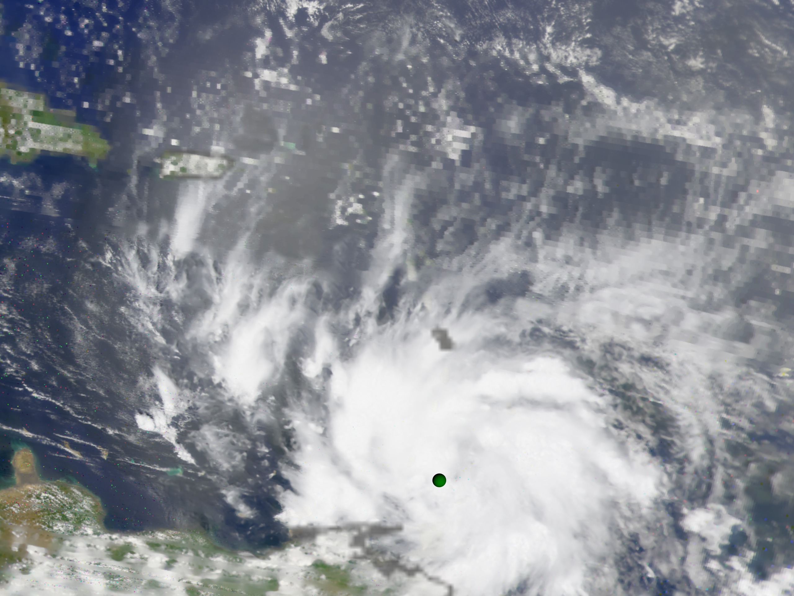
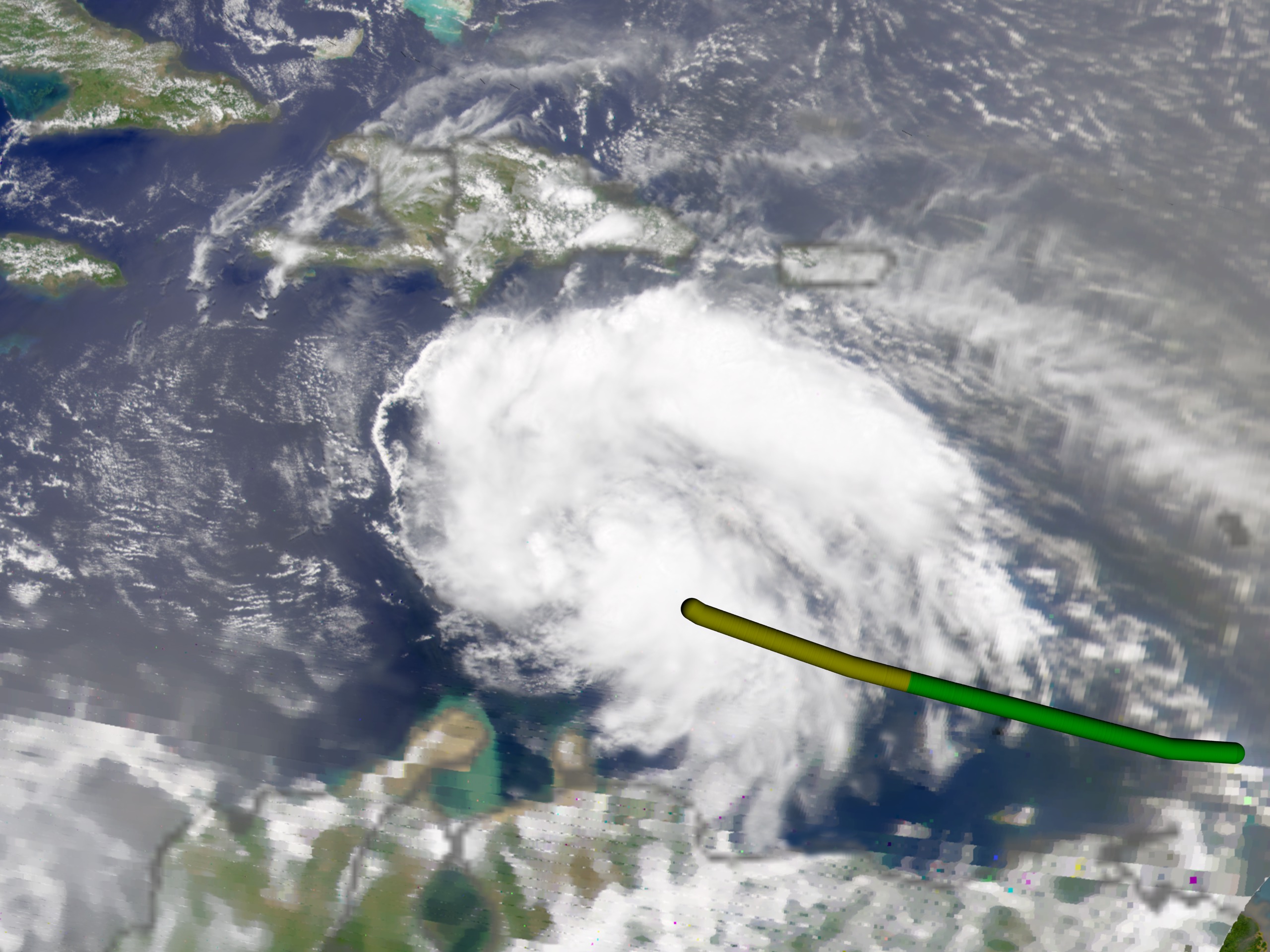
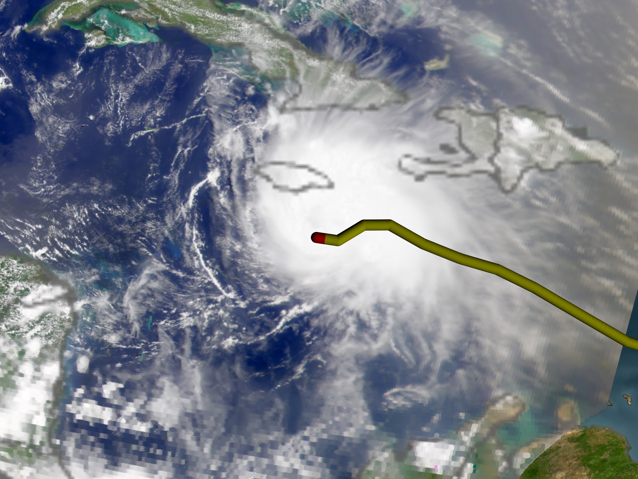
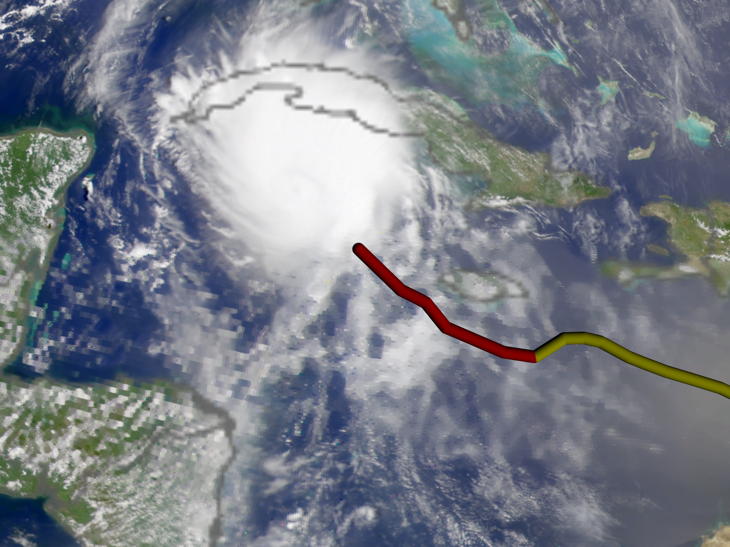
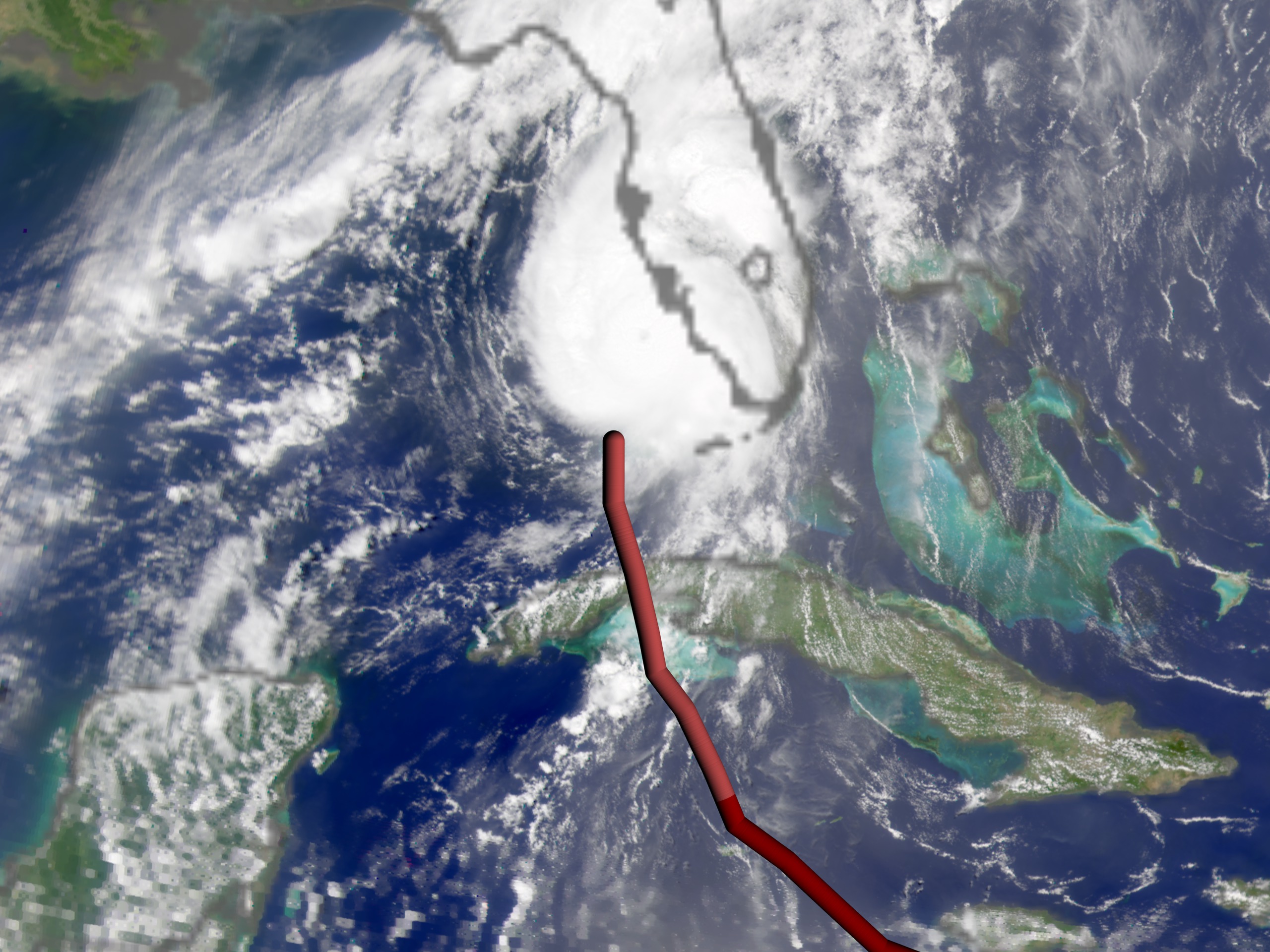
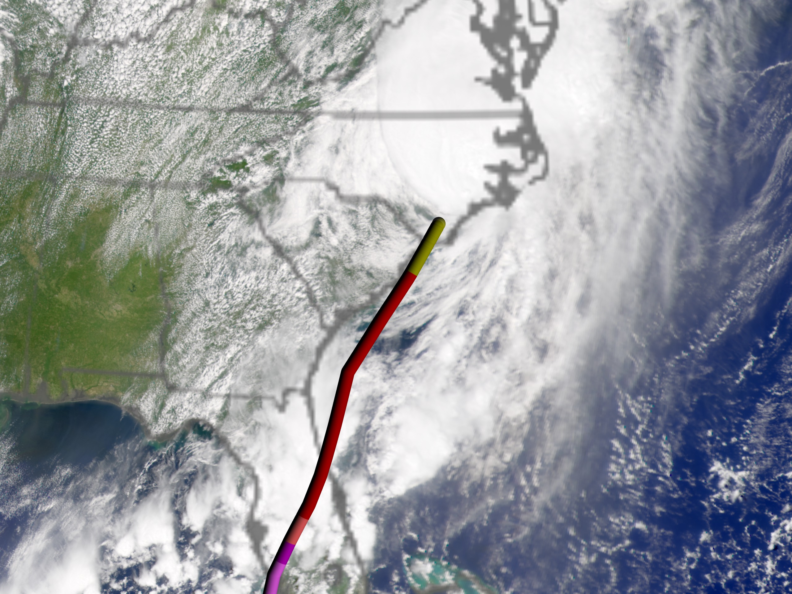
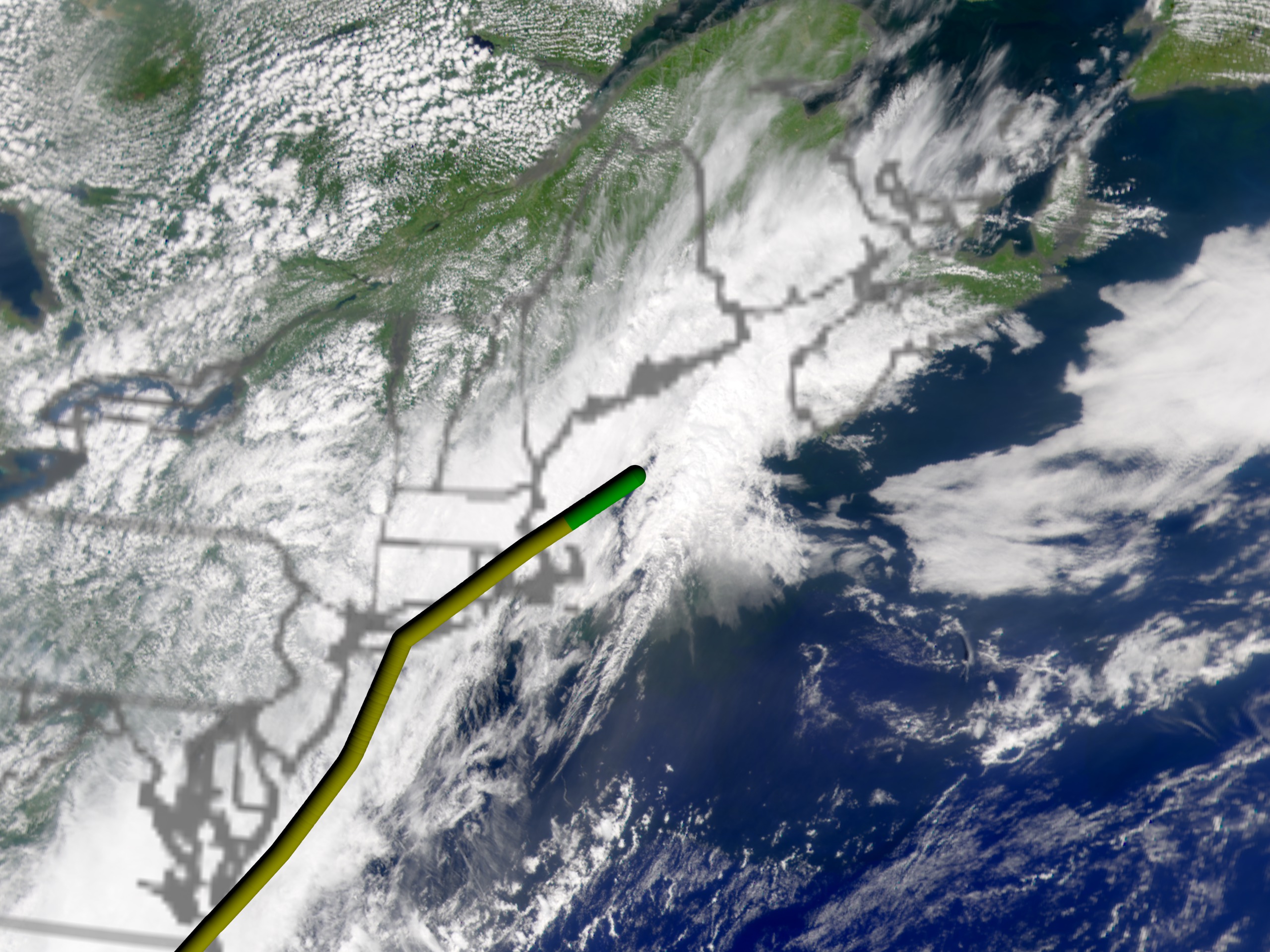
Hurricane Charley Progression
For More Information
Visualization Credits
Lori Perkins (NASA/GSFC): Lead Animator
Marte Newcombe (GST): Animator
Gene Feldman (NASA/GSFC): Scientist
Norman Kuring (NASA/GSFC): Scientist
Marte Newcombe (GST): Animator
Gene Feldman (NASA/GSFC): Scientist
Norman Kuring (NASA/GSFC): Scientist
Please give credit for this item to:
NASA/Goddard Space Flight Center, The SeaWiFS Project and GeoEye, Scientific Visualization Studio. NOTE: All SeaWiFS images and data presented on this web site are for research and educational use only. All commercial use of SeaWiFS data must be coordinated with GeoEye (NOTE: In January 2013, DigitalGlobe and GeoEye combined to become DigitalGlobe).
NASA/Goddard Space Flight Center, The SeaWiFS Project and GeoEye, Scientific Visualization Studio. NOTE: All SeaWiFS images and data presented on this web site are for research and educational use only. All commercial use of SeaWiFS data must be coordinated with GeoEye (NOTE: In January 2013, DigitalGlobe and GeoEye combined to become DigitalGlobe).
Short URL to share this page:
https://svs.gsfc.nasa.gov/2986
Data Used:
Note: While we identify the data sets used in these visualizations, we do not store any further details nor the data sets themselves on our site.
This item is part of these series:
Hurricanes
SeaWiFS Hurricanes
Keywords:
DLESE >> Atmospheric science
DLESE >> Natural hazards
GCMD >> Earth Science >> Atmosphere >> Atmospheric Phenomena
GCMD >> Earth Science >> Atmosphere >> Atmospheric Phenomena >> Hurricanes
GCMD >> Earth Science >> Human Dimensions >> Natural Hazards >> Fires
GCMD >> Earth Science >> Human Dimensions >> Natural Hazards >> Meteorological Hazards
GCMD >> Location >> Florida
SVS >> For Educators
SVS >> Atmospheric Circulation
SVS >> Wind Patterns
SVS >> Oceans >> Atlantic
SVS >> Meteorological Phenomenon
SVS >> Cloud Cover >> Type
SVS >> Cloud Cover >> Frequency
NASA Science >> Earth
GCMD keywords can be found on the Internet with the following citation: Olsen, L.M., G. Major, K. Shein, J. Scialdone, S. Ritz, T. Stevens, M. Morahan, A. Aleman, R. Vogel, S. Leicester, H. Weir, M. Meaux, S. Grebas, C.Solomon, M. Holland, T. Northcutt, R. A. Restrepo, R. Bilodeau, 2013. NASA/Global Change Master Directory (GCMD) Earth Science Keywords. Version 8.0.0.0.0
https://svs.gsfc.nasa.gov/2986
Data Used:
SeaStar/SeaWiFS
2004/08/09-15
NOTE: All SeaWiFS images and data presented on this web site are for research and educational use only. All commercial use of SeaWiFS data must be coordinated with GeoEye
Credit:
NASA/Goddard Space Flight Center, The SeaWiFS Project and GeoEye, Scientific Visualization Studio. NOTE: All SeaWiFS images and data presented on this web site are for research and educational use only. All commercial use of SeaWiFS data must be coordinated with GeoEye (NOTE: In January 2013, DigitalGlobe and GeoEye combined to become one DigitalGlobe.).
NASA/Goddard Space Flight Center, The SeaWiFS Project and GeoEye, Scientific Visualization Studio. NOTE: All SeaWiFS images and data presented on this web site are for research and educational use only. All commercial use of SeaWiFS data must be coordinated with GeoEye (NOTE: In January 2013, DigitalGlobe and GeoEye combined to become one DigitalGlobe.).
HURDAT
Database - NOAA - 2004/08/09-15This item is part of these series:
Hurricanes
SeaWiFS Hurricanes
Keywords:
DLESE >> Atmospheric science
DLESE >> Natural hazards
GCMD >> Earth Science >> Atmosphere >> Atmospheric Phenomena
GCMD >> Earth Science >> Atmosphere >> Atmospheric Phenomena >> Hurricanes
GCMD >> Earth Science >> Human Dimensions >> Natural Hazards >> Fires
GCMD >> Earth Science >> Human Dimensions >> Natural Hazards >> Meteorological Hazards
GCMD >> Location >> Florida
SVS >> For Educators
SVS >> Atmospheric Circulation
SVS >> Wind Patterns
SVS >> Oceans >> Atlantic
SVS >> Meteorological Phenomenon
SVS >> Cloud Cover >> Type
SVS >> Cloud Cover >> Frequency
NASA Science >> Earth
GCMD keywords can be found on the Internet with the following citation: Olsen, L.M., G. Major, K. Shein, J. Scialdone, S. Ritz, T. Stevens, M. Morahan, A. Aleman, R. Vogel, S. Leicester, H. Weir, M. Meaux, S. Grebas, C.Solomon, M. Holland, T. Northcutt, R. A. Restrepo, R. Bilodeau, 2013. NASA/Global Change Master Directory (GCMD) Earth Science Keywords. Version 8.0.0.0.0


