Earth
ID: 2746
Criss-crossing the world below at nearly 17,000 miles per hour, ICESat is measuring the Earth from space with unprecedented accuracy. ICESat measures the Earth by shining pulses of green and infrared light from one of its three onboard lasers. Although the major goal of ICESat's mission is to observe ice near the poles, the satellite takes measurements continuously around the entire globe, providing valuable information about our planet's clouds, oceans, mountains, forests, and fields.
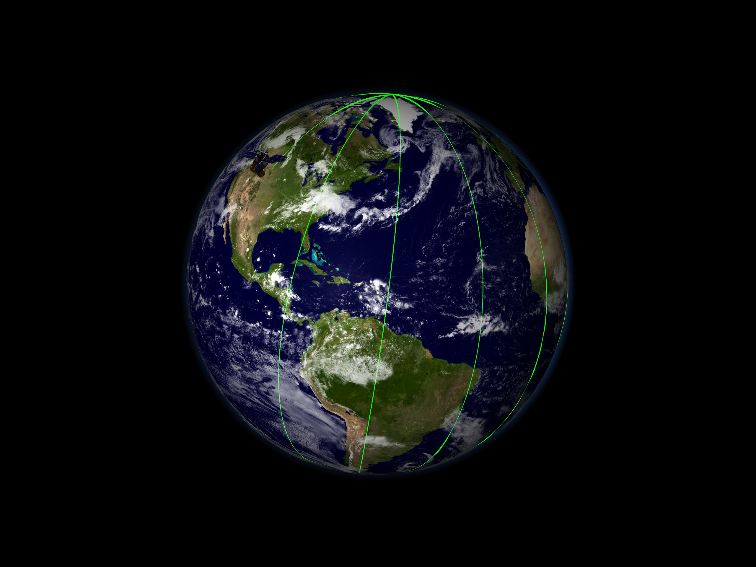

ICESat First Light Release: A Global Perspective
Visualization Credits
Greg Shirah (NASA/GSFC): Lead Animator
Alex Kekesi (Global Science and Technology, Inc.): Animator
Christopher Shuman (NASA/GSFC): Scientist
Jay Zwally (NASA/GSFC): Scientist
Alex Kekesi (Global Science and Technology, Inc.): Animator
Christopher Shuman (NASA/GSFC): Scientist
Jay Zwally (NASA/GSFC): Scientist
Please give credit for this item to:
NASA/Goddard Space Flight Center Scientific Visualization Studio The Blue Marble Next Generation data is courtesy of Reto Stockli (NASA/GSFC) and NASA's Earth Observatory.
NASA/Goddard Space Flight Center Scientific Visualization Studio The Blue Marble Next Generation data is courtesy of Reto Stockli (NASA/GSFC) and NASA's Earth Observatory.
Short URL to share this page:
https://svs.gsfc.nasa.gov/2746
Mission:
Terra
Data Used:
Note: While we identify the data sets used in these visualizations, we do not store any further details nor the data sets themselves on our site.
Dates of Data Used:
Simulated Data
Keywords:
SVS >> Satellite
DLESE >> Technology
NASA Science >> Earth
https://svs.gsfc.nasa.gov/2746
Mission:
Terra
Data Used:
RADARSAT-1/SAR
Credit:
Additional credit goes to Canadian Space Agency, RADARSAT International Inc.
Additional credit goes to Canadian Space Agency, RADARSAT International Inc.
Terra and Aqua/MODIS/Blue Marble: Next Generation also referred to as: BMNG
1/1/2004 - 12/31/2004
Credit:
The Blue Marble data is courtesy of Reto Stockli (NASA/GSFC).
The Blue Marble data is courtesy of Reto Stockli (NASA/GSFC).
Dates of Data Used:
Simulated Data
Keywords:
SVS >> Satellite
DLESE >> Technology
NASA Science >> Earth


