Earth
ID: 2565
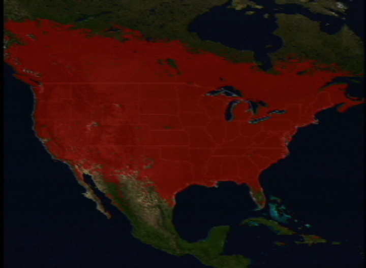
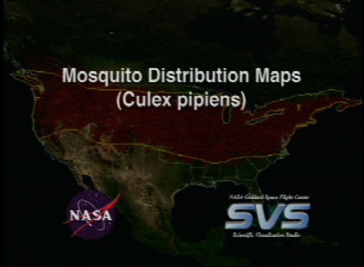
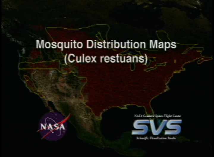
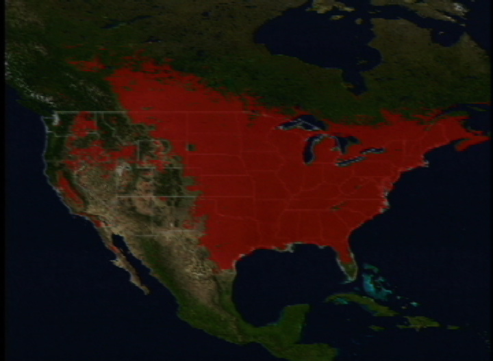
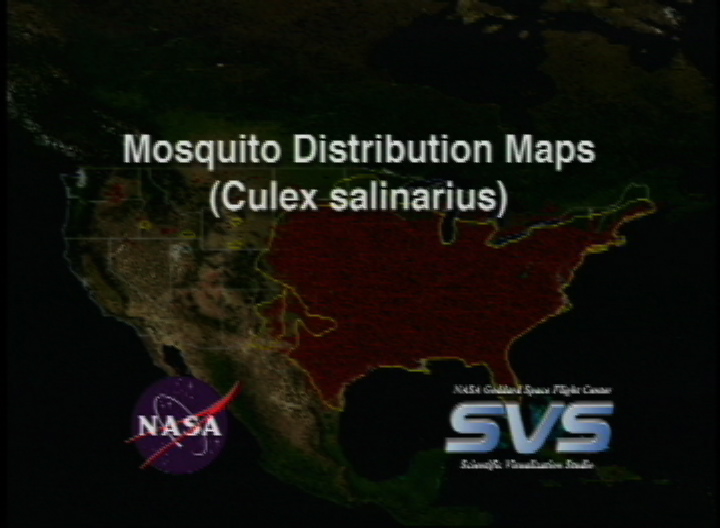
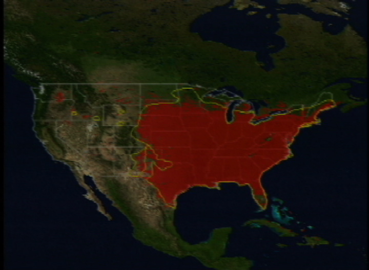
These maps show mosquito habitat distribution for four mosquito species. The red/black areas are results of satellite data analysis showing where particular species of mosquitos can be found. The yellow lines are the 'published' boundaries for where these species can be found. There is a strong correlation between the two. These images were created in support of a story describing how NASA is assisting the CDC and EPA in tracking the spread of West Nile Virus.
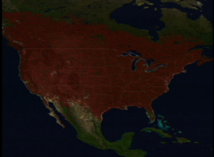
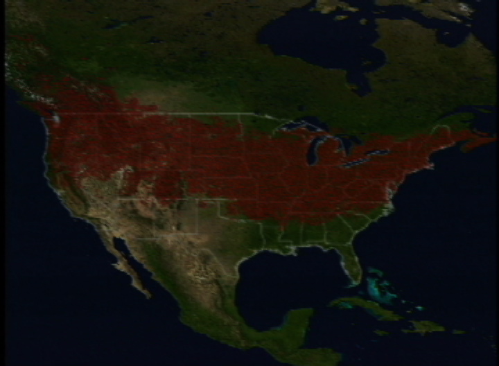
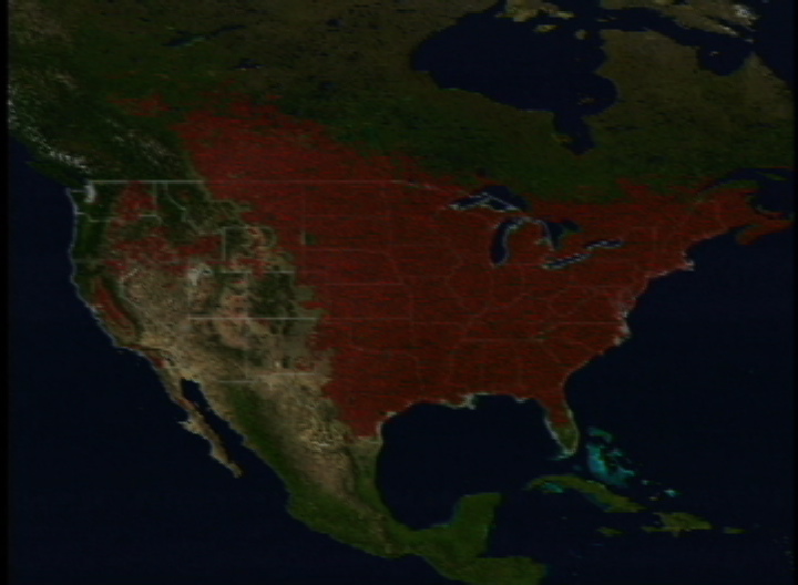
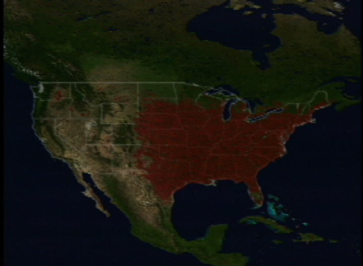
Mosquito Distribution Maps
Visualization Credits
Greg Shirah (NASA/GSFC): Lead Animator
Horace Mitchell (NASA/GSFC): Animator
David Rogers (Oxford University): Scientist
Bob Venezia (NASA/HQ): Scientist
Horace Mitchell (NASA/GSFC): Animator
David Rogers (Oxford University): Scientist
Bob Venezia (NASA/HQ): Scientist
Please give credit for this item to:
NASA/Goddard Space Flight Center Scientific Visualization Studio The Blue Marble Next Generation data is courtesy of Reto Stockli (NASA/GSFC) and NASA's Earth Observatory.
NASA/Goddard Space Flight Center Scientific Visualization Studio The Blue Marble Next Generation data is courtesy of Reto Stockli (NASA/GSFC) and NASA's Earth Observatory.
Short URL to share this page:
https://svs.gsfc.nasa.gov/2565
Mission:
Terra
Data Used:
Note: While we identify the data sets used in these visualizations, we do not store any further details nor the data sets themselves on our site.
Dates of Data Used:
Unknown
This item is part of this series:
West Nile Virus
Goddard TV Tape:
G2002-077
Keywords:
DLESE >> Biology
SVS >> Mosquitos
SVS >> West Nile Virus
NASA Science >> Earth
https://svs.gsfc.nasa.gov/2565
Mission:
Terra
Data Used:
Terra and Aqua/MODIS/Blue Marble: Next Generation also referred to as: BMNG
1/1/2004 - 12/31/2004
Credit:
The Blue Marble data is courtesy of Reto Stockli (NASA/GSFC).
The Blue Marble data is courtesy of Reto Stockli (NASA/GSFC).
Dates of Data Used:
Unknown
This item is part of this series:
West Nile Virus
Goddard TV Tape:
G2002-077
Keywords:
DLESE >> Biology
SVS >> Mosquitos
SVS >> West Nile Virus
NASA Science >> Earth


