Earth
ID: 2478
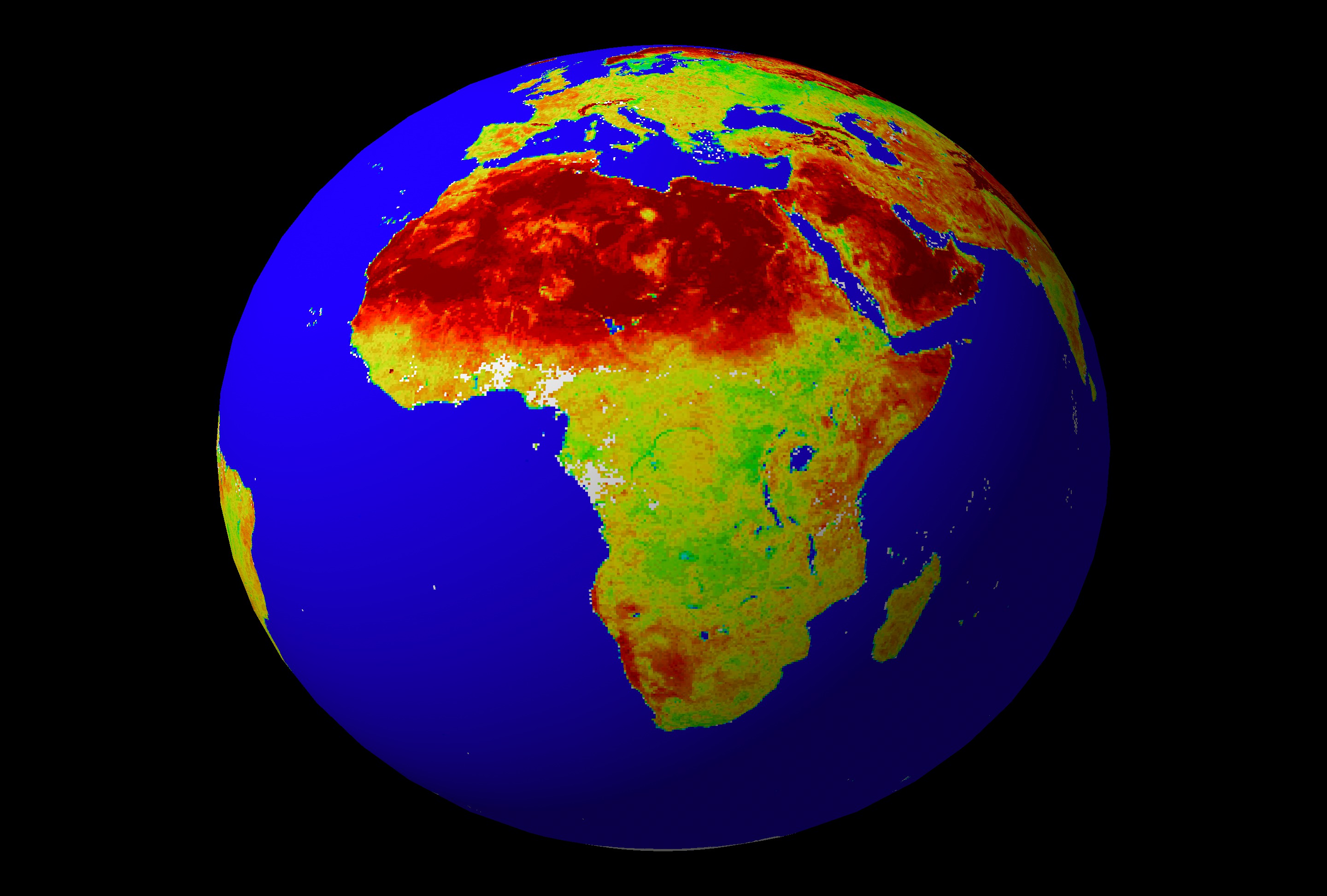
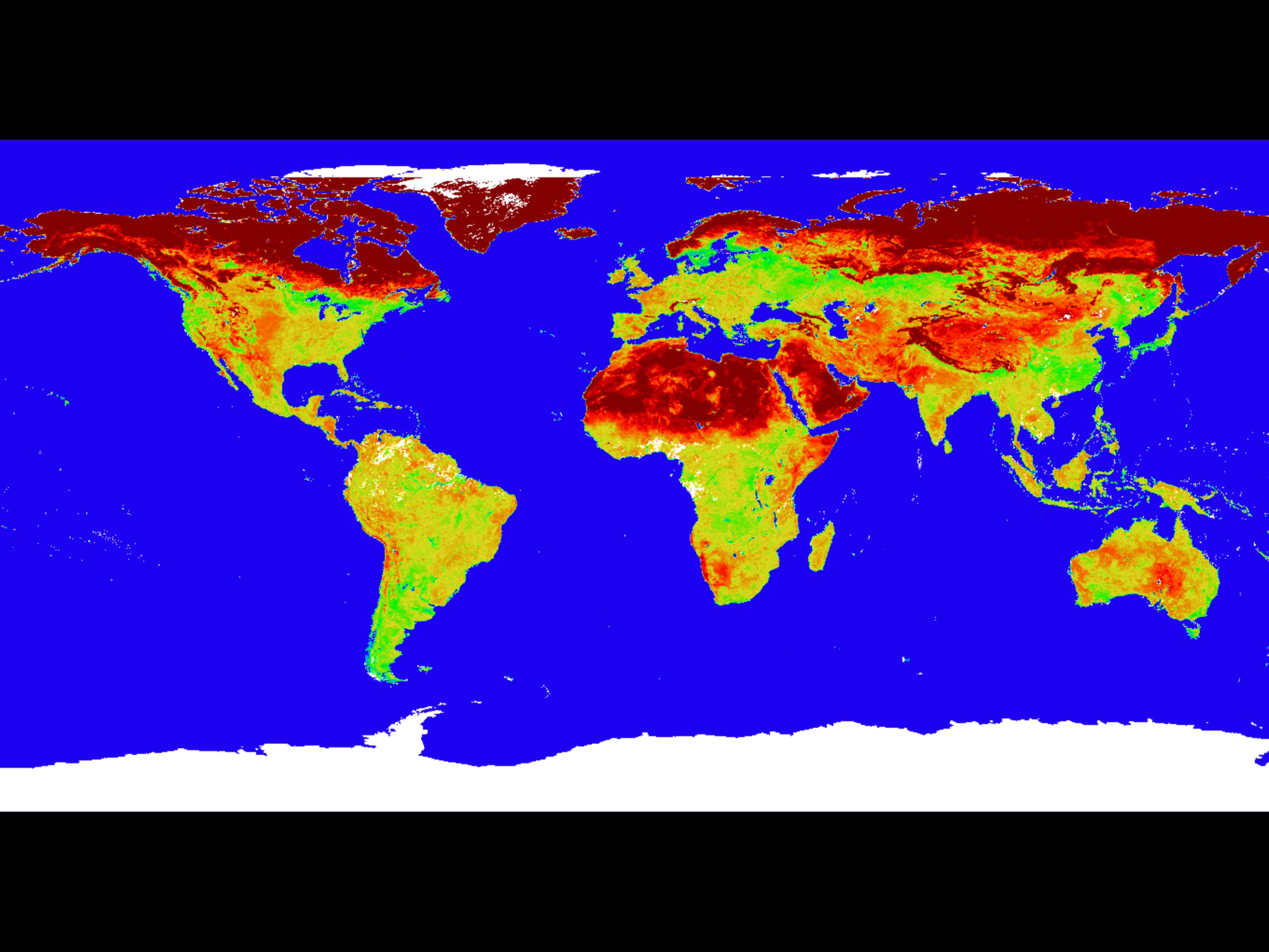
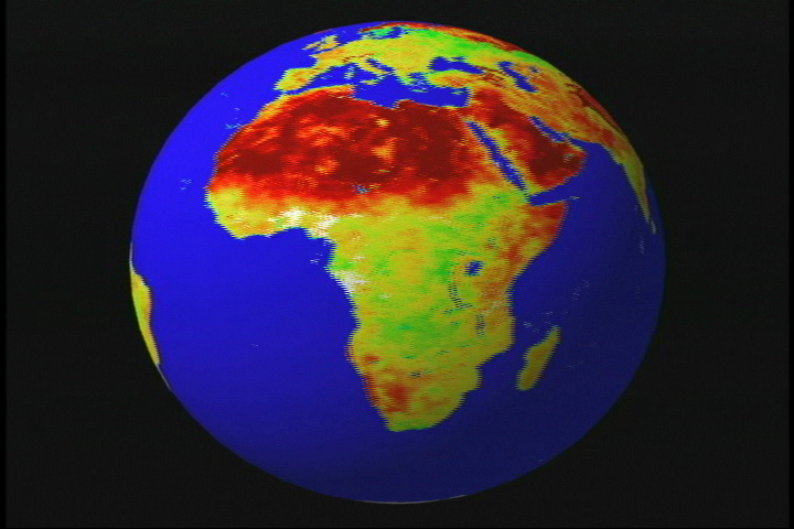
The MODIS instrument, flying aboard NASA's Terra and Aqua satellites, measures how much solar radiation is reflected by the Earth's surface almost every day over the entire planet. The colors in this image emphasize the albedos ranging from 0.0 to 0.4 over the Earth's land surfaces. Areas colored red show the brightest, most reflective regions; yellows and greens are intermediate values; and blues and violets show relatively dark surfaces. White indicates no data were available, and no albedo data are provided over the oceans. This image was produced using data composited over a 6-day period, from April 7-22, 2002.
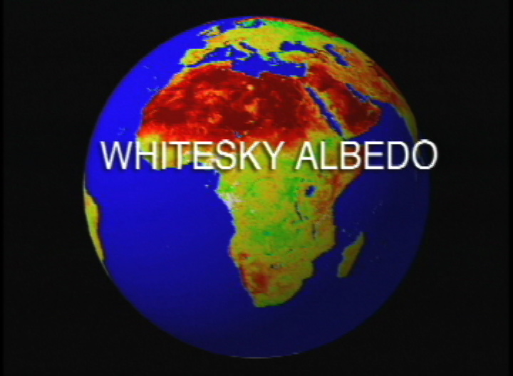
MODIS White Sky Albedo Image Improves Climate Modeling
For More Information
Visualization Credits
Lori Perkins (NASA/GSFC): Lead Animator
Crystal Schaaf (Boston University): Scientist
Elena Tsvetsinskaya (Boston University): Scientist
Crystal Schaaf (Boston University): Scientist
Elena Tsvetsinskaya (Boston University): Scientist
Please give credit for this item to:
NASA/Goddard Space Flight Center Scientific Visualization Studio
NASA/Goddard Space Flight Center Scientific Visualization Studio
Short URL to share this page:
https://svs.gsfc.nasa.gov/2478
Mission:
Terra
Data Used:
Note: While we identify the data sets used in these visualizations, we do not store any further details nor the data sets themselves on our site.
This item is part of this series:
MODIS Albedo
Keywords:
SVS >> Albedo
DLESE >> Climatology
SVS >> Forecast
DLESE >> Physical geography
NASA Science >> Earth
https://svs.gsfc.nasa.gov/2478
Mission:
Terra
Data Used:
Terra/MODIS
2002/04/07 - 2002/04/22This item is part of this series:
MODIS Albedo
Keywords:
SVS >> Albedo
DLESE >> Climatology
SVS >> Forecast
DLESE >> Physical geography
NASA Science >> Earth


