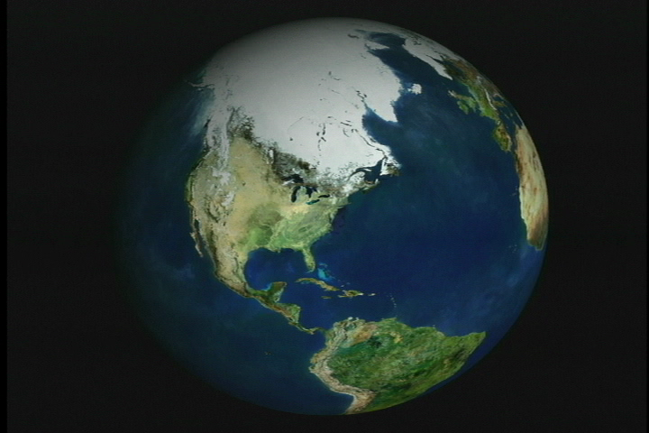
Earth
ID: 2107
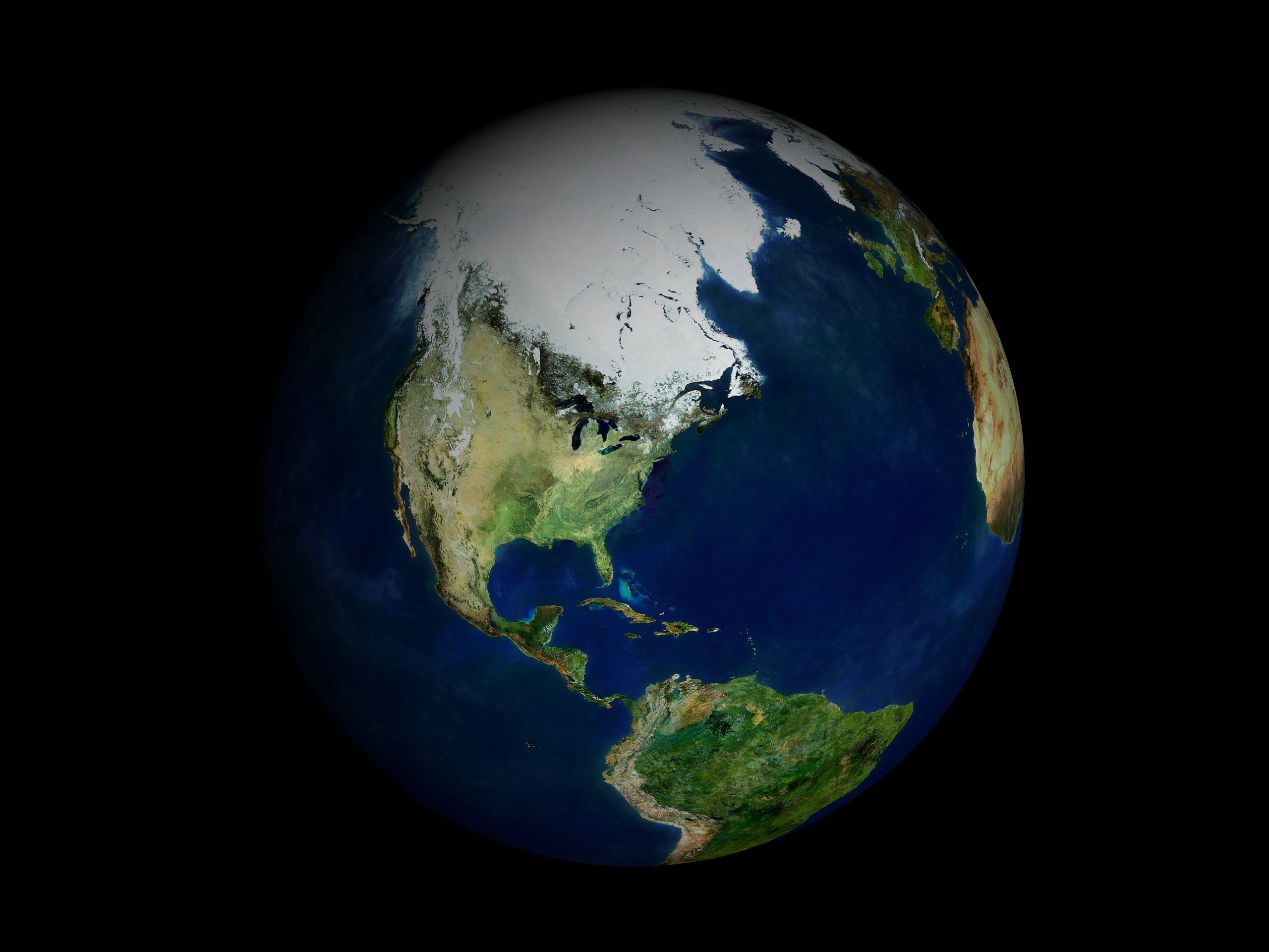
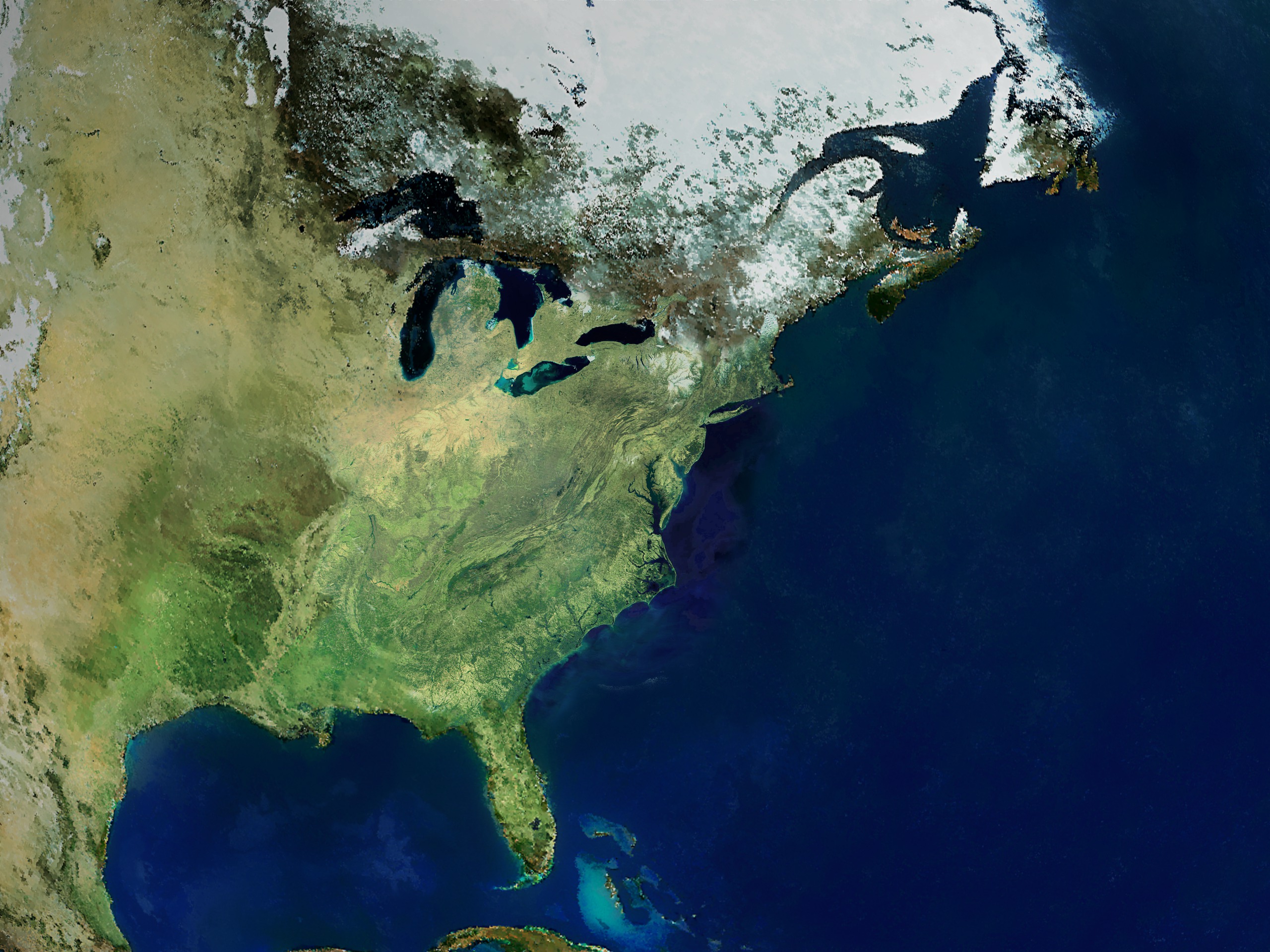
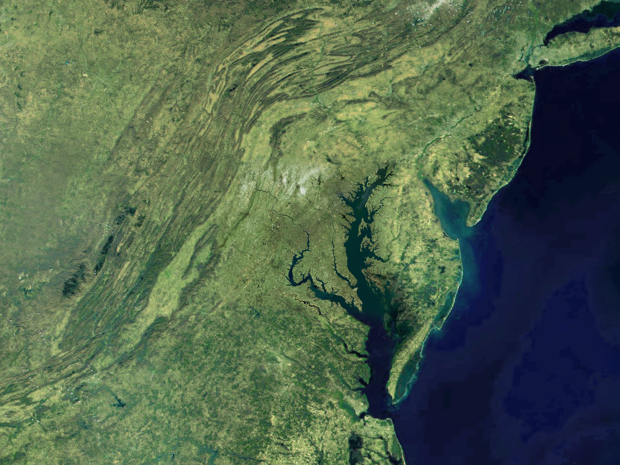
Using data from different spacecraft and some powerful computer technology, visualizers at the Goddard Space Flight Center present you with a collection of American cities in a way you have never seen them before. Starting with our camera high above the Earth, we rush in towards the surface at what would be an impossible speed for any known vehicle. Passing though layers of atmosphere, the colors of our destinations shimmer with their own unique characteristics, and suddenly we find ourselves floating in virtual space just above the ground.
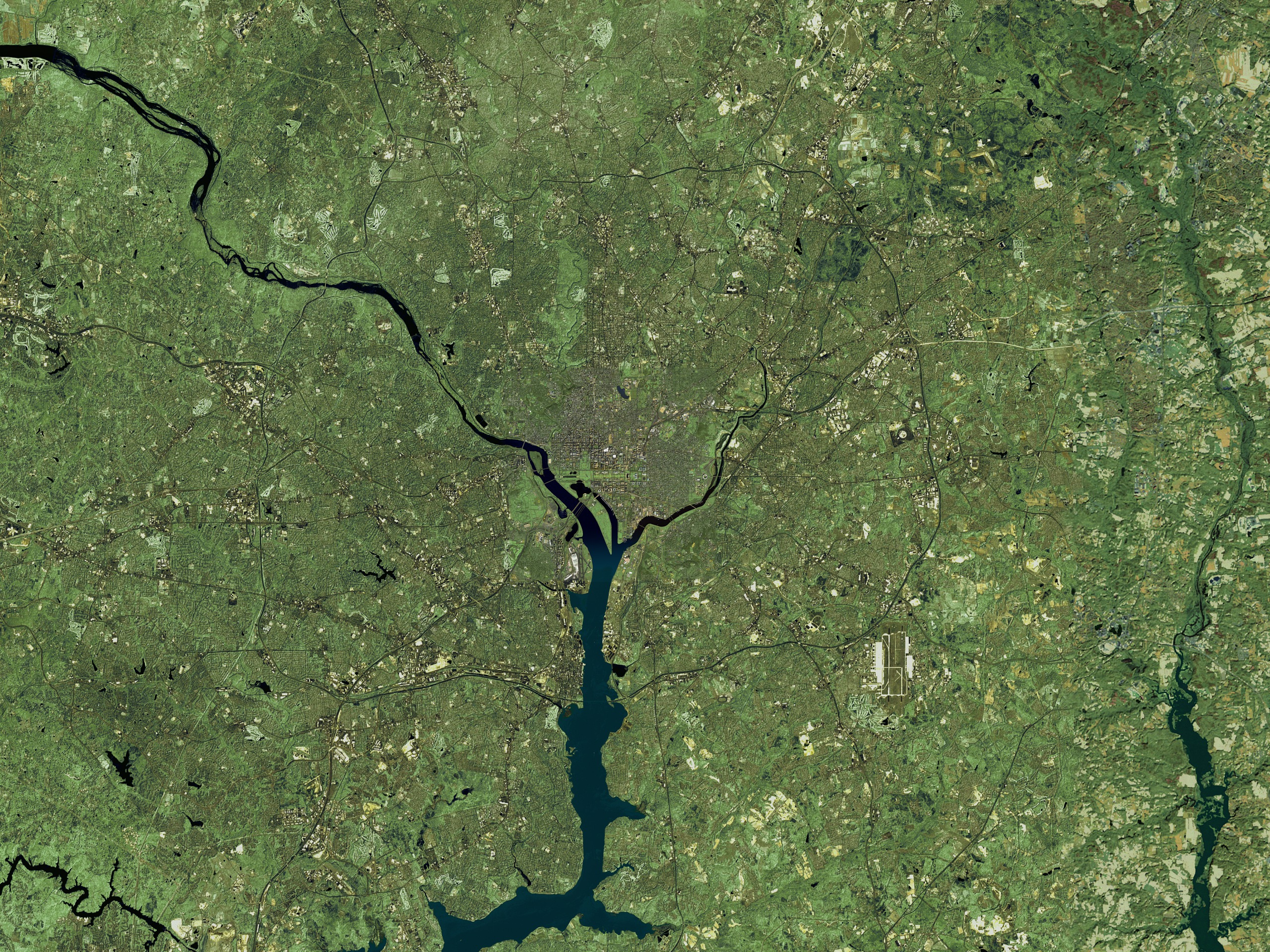
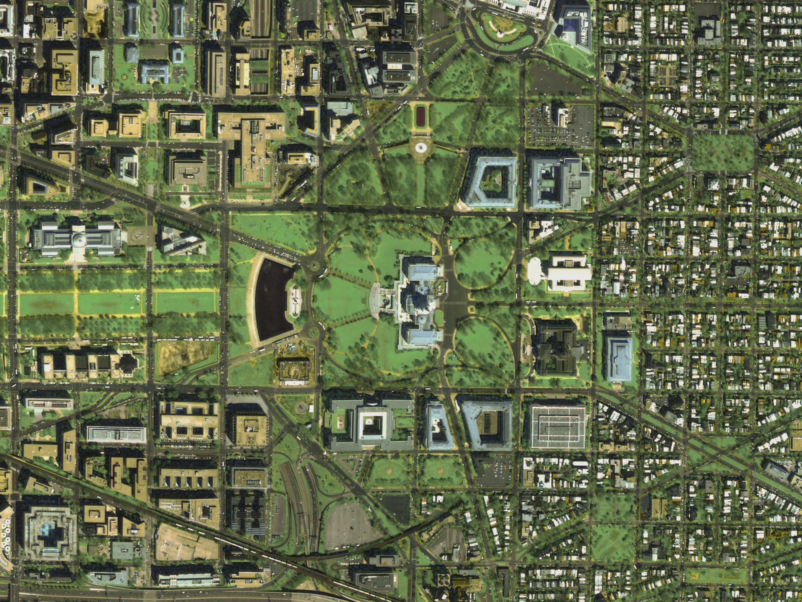
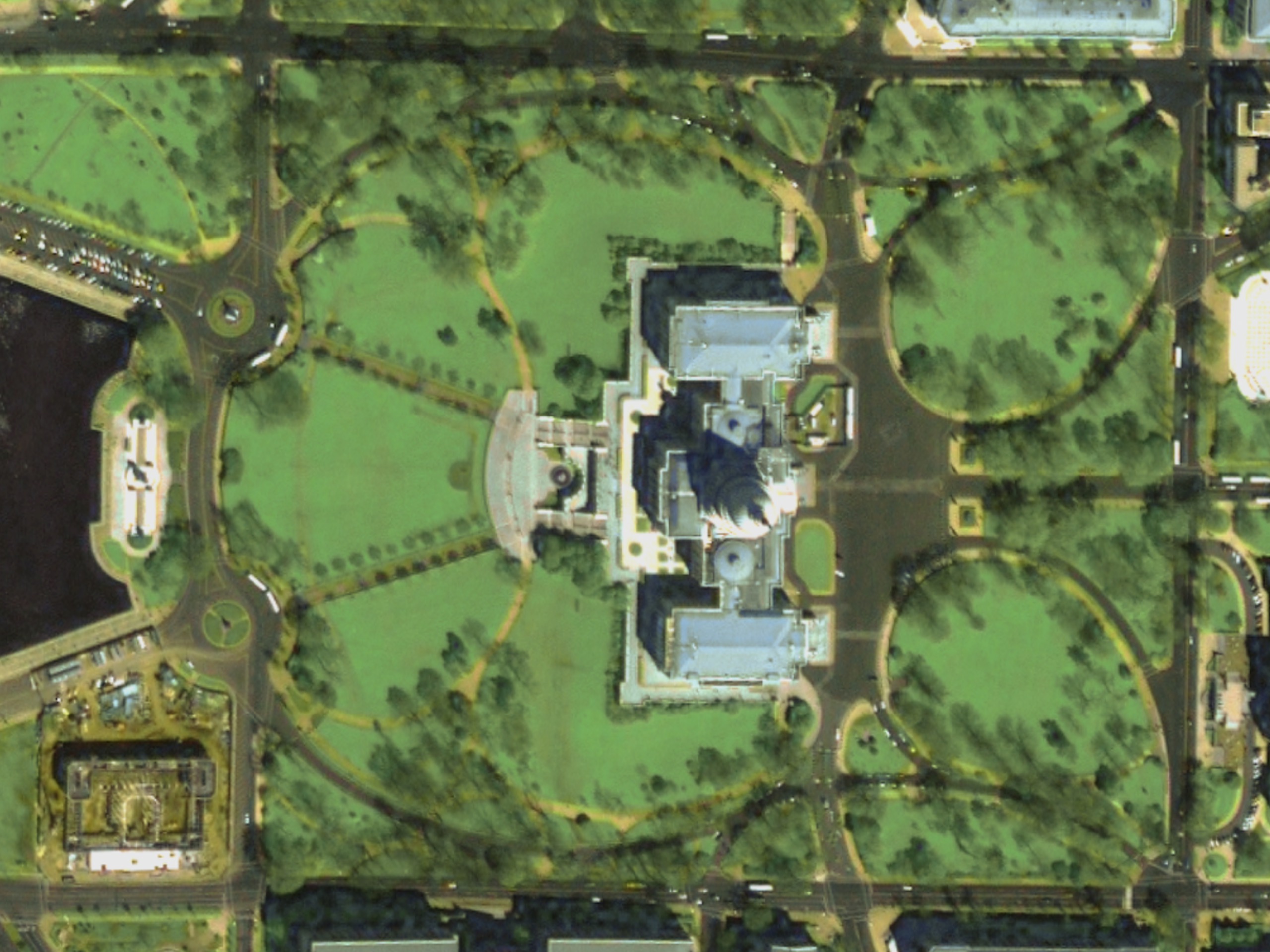
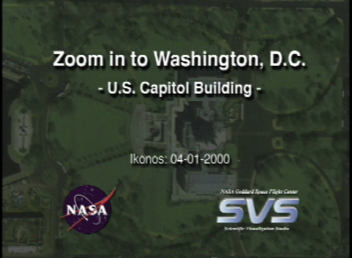
Great Zoom into Washington, DC: the U.S. Capitol
For More Information
Visualization Credits
Greg Shirah (NASA/GSFC): Lead Animator
Horace Mitchell (NASA/GSFC): Animator
Marte Newcombe (GST): Animator
Michael Mangos (GST): Animator
Darrel Williams (NASA/GSFC): Scientist
Horace Mitchell (NASA/GSFC): Animator
Marte Newcombe (GST): Animator
Michael Mangos (GST): Animator
Darrel Williams (NASA/GSFC): Scientist
Please give credit for this item to:
NASA/Goddard Space Flight Center Scientific Visualization Studio
NASA/Goddard Space Flight Center Scientific Visualization Studio
Short URL to share this page:
https://svs.gsfc.nasa.gov/2107
Missions:
Landsat
Terra
Data Used:
Note: While we identify the data sets used in these visualizations, we do not store any further details nor the data sets themselves on our site.
This item is part of this series:
Great Zooms
Goddard TV Tapes:
G2001-027
G2003-046
Keywords:
SVS >> HDTV
DLESE >> Human geography
DLESE >> Physical geography
SVS >> Washington DC
SVS >> Zoom
NASA Science >> Earth
https://svs.gsfc.nasa.gov/2107
Missions:
Landsat
Terra
Data Used:
IKONOS
2000/04/01Landsat-7/ETM+
1999/05/11Terra/MODIS
2000/03/06This item is part of this series:
Great Zooms
Goddard TV Tapes:
G2001-027
G2003-046
Keywords:
SVS >> HDTV
DLESE >> Human geography
DLESE >> Physical geography
SVS >> Washington DC
SVS >> Zoom
NASA Science >> Earth


