Earth
ID: 1324
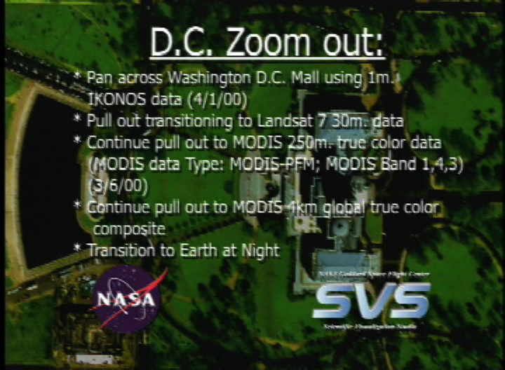
This spectacular image of the Mall area was acquired on Saturday, April 1, 2000 by Space Imaging's IKONOS sensor. Here we are moving across the Mall, from west to east and we will pause over the Capitol Building. Let's just sit back for a few seconds and enjoy the view. We will then gradually pull back from this highly localized view from space, to obtain a more regional perspective provided by Landsat 7. This regional view permits us to follow the entire length of the Potomac River, from its headwaters in the Shenandoahs, until it flows into the Chesapeake Bay. We can also see the full extent of the Chesapeake and Delaware Bays as they flow into the Atlantic. We will continue to pull back farther to obtain more continental and global views of the Earth as provided by a new instrument known as MODIS, or the Moderate Resolution Imaging Spectroradiometer, the primary instrument on the Terra spacecraft. Finally, we rotate the Earth so as to see a representation of the Earth's stable light sources, as derived from DMSP satellites. (Note: This animation is a precursor to the Great Zooms. It is based on the same concept and data sources, but is somewhat less polished, particularly in the area of color matching.)
DC Pan and Zoomout Animation
For More Information
Visualization Credits
Michael Mangos (GST): Lead Animator
Marte Newcombe (GST): Animator
Darrel Williams (NASA/GSFC): Scientist
Marte Newcombe (GST): Animator
Darrel Williams (NASA/GSFC): Scientist
Please give credit for this item to:
NASA/Goddard Space Flight Center Scientific Visualization Studio
NASA/Goddard Space Flight Center Scientific Visualization Studio
Short URL to share this page:
https://svs.gsfc.nasa.gov/1324
Missions:
Landsat
Terra
Data Used:
Note: While we identify the data sets used in these visualizations, we do not store any further details nor the data sets themselves on our site.
This item is part of this series:
Great Zooms
Keywords:
DLESE >> Human geography
DLESE >> Physical geography
NASA Science >> Earth
https://svs.gsfc.nasa.gov/1324
Missions:
Landsat
Terra
Data Used:
Terra/MODIS
2000/03/06IKONOS
2000/04/01Landsat-7/ETM+
1999/05/11DMSP/OLS
Defense Meteorological Satellite Program Operational Linescan System
This item is part of this series:
Great Zooms
Keywords:
DLESE >> Human geography
DLESE >> Physical geography
NASA Science >> Earth


