Earth
ID: 12359

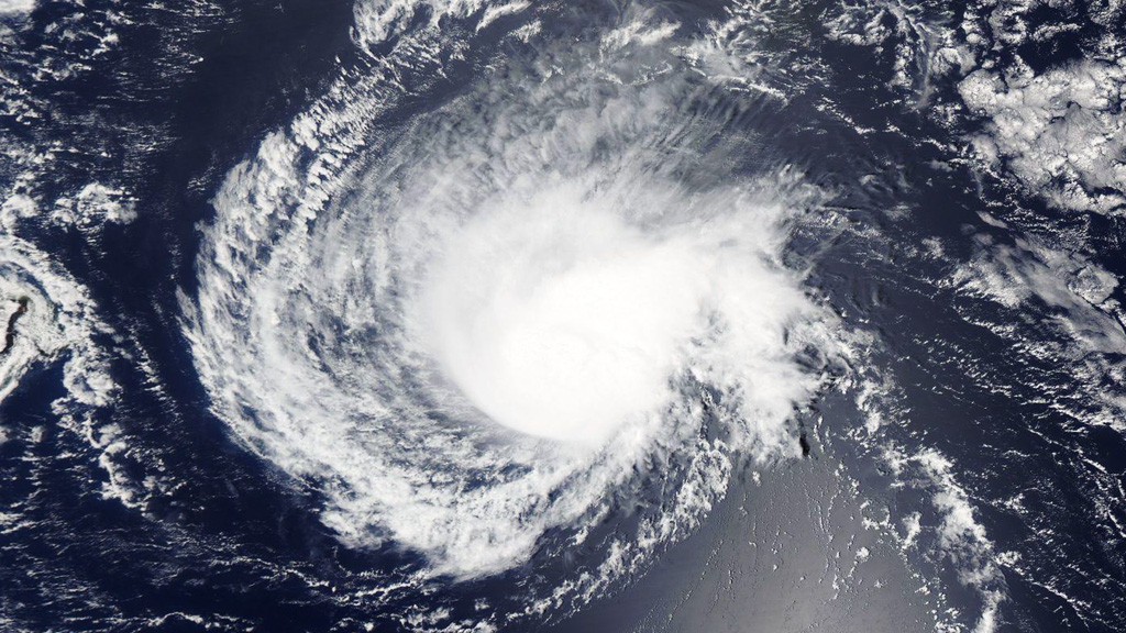
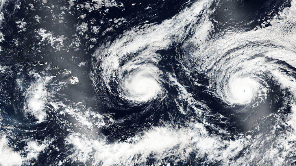
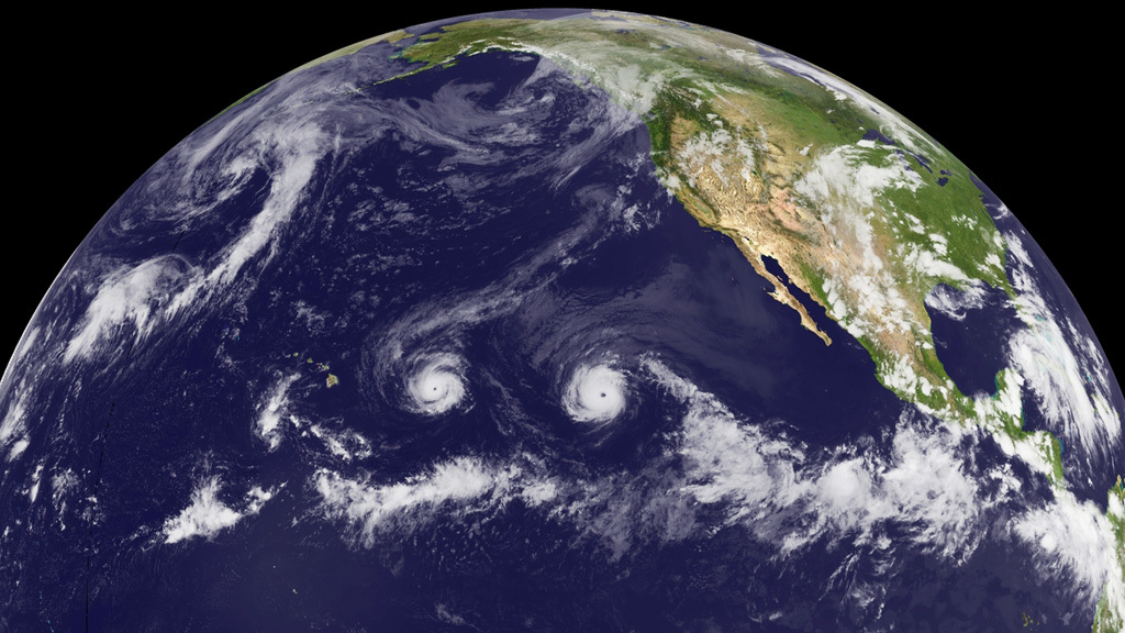
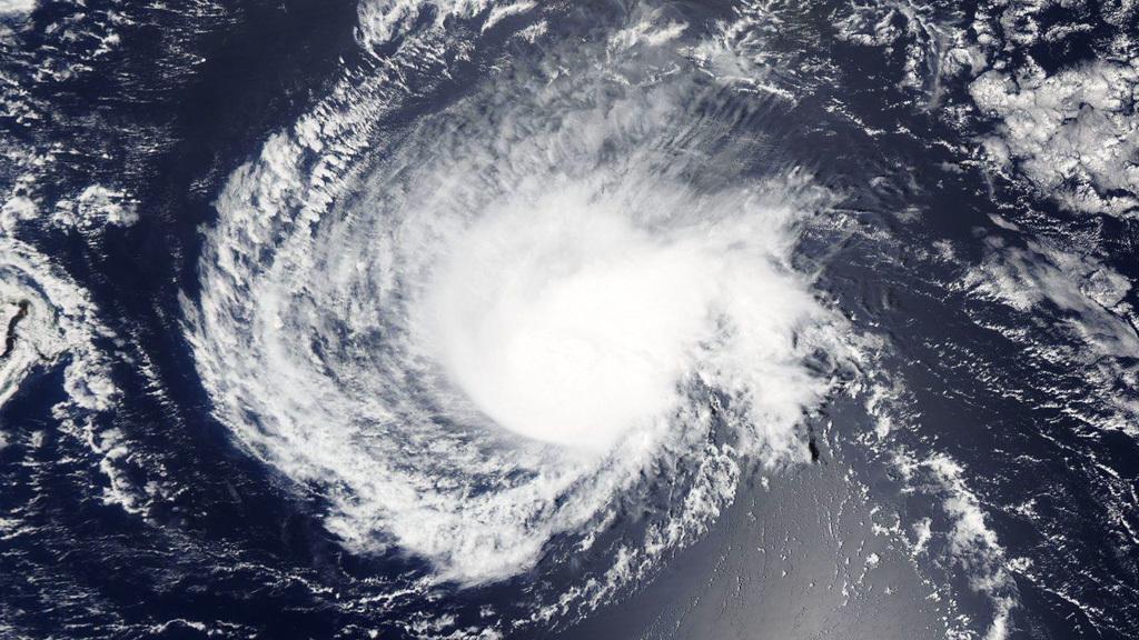
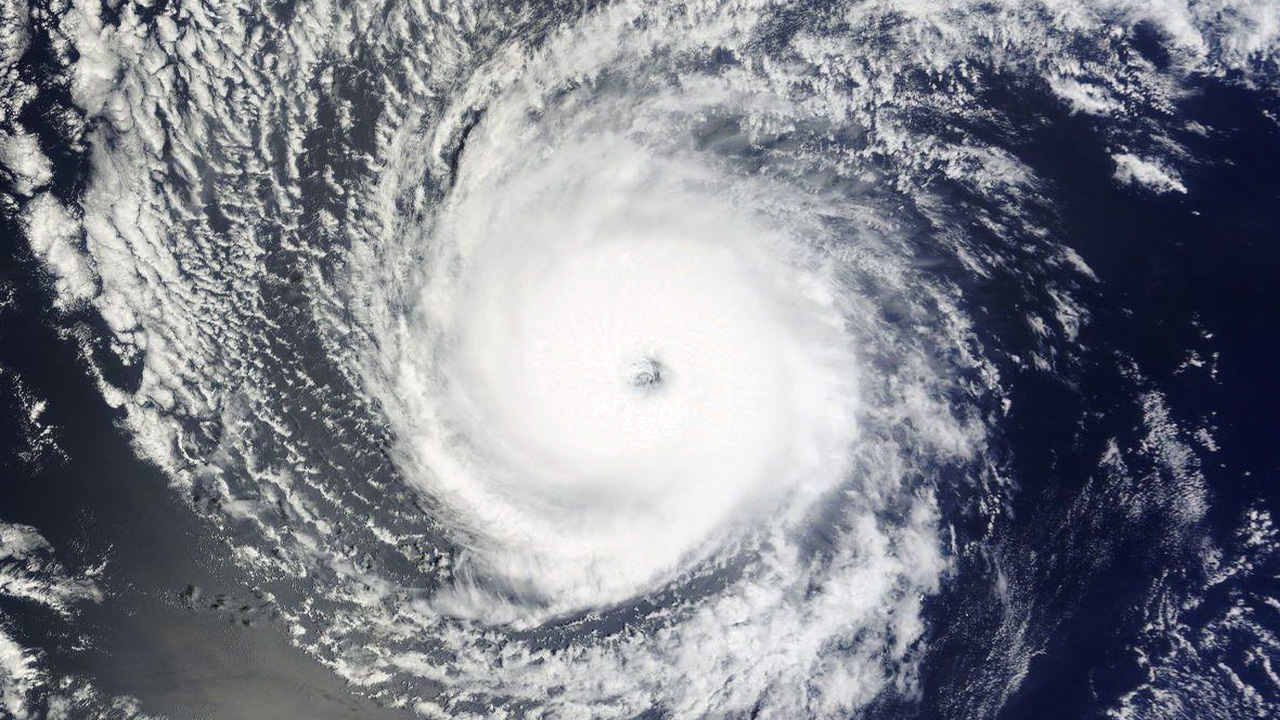
In late August 2015, NASA satellites observed three hurricanes simultaneously traveling west across the Pacific Ocean. Almost exactly one year later, two powerful storms were spotted whirling on a similar course. Hurricane Madeline and Lester began as tropical storms in the eastern Pacific Ocean. Within days of their formation, the storms intensified into Category 4 hurricanes, with maximum sustained winds near 130 mph. On August 29, 2016, satellite images showed both storms appeared to be headed toward Hawaii. On September 1, 2016, Madeline passed south of the Big Island of Hawaii and by that time had weakened significantly. Hurricane Lester continues to march west across the central Pacific Ocean. Explore the video and images for views of the storms captured from space.

Hurricane Watch
Story Credits
Please give credit for this item to:
NASA's Goddard Space Flight Center
Cover image and video courtesy of NASA/NOAA GOES Project
Satellite images courtesy of NASA/Worldview
NASA's Goddard Space Flight Center
Cover image and video courtesy of NASA/NOAA GOES Project
Satellite images courtesy of NASA/Worldview
Short URL to share this page:
https://svs.gsfc.nasa.gov/12359
Keywords:
SVS >> App
NASA Science >> Earth
https://svs.gsfc.nasa.gov/12359
Keywords:
SVS >> App
NASA Science >> Earth


